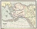
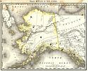
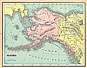
Viewing Options
Main Author:
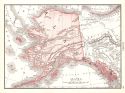
Cram, George F.
Title/Description:
Alaska
Publication Info:
Chicago: George F. Cram, 1887
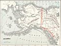
Viewing Options
Main Author:
Cram, George F
Title/Description:
Alaska
Publication Info:
Chicago: George F Cram, 1887, from Cram's Banker and Brokers Railroad Atlas
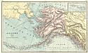
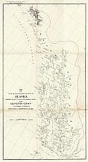
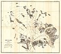
Viewing Options
Main Author:
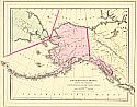
Allen, Henry T.
Title/Description:
Alaska, North of the 60th Parallel Showing the Exploration of the Party Commanded by Lieut. H.T. Allen
Publication Info:
Washington D.C.: Government Printing Office, 1887; from Report of an Expedition to the Copper, Tanana, and Koyukuk Rivers
Original Source:
Geological Survey of Alabama
Viewing Options
Main Author:
Allen, Henry T.
Title/Description:
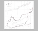
Copper and Chittyna Rivers, Alaska
Publication Info:
Washington D.C.: Government Printing Office, 1887; from Report of an Expedition to the Copper, Tanana, and Koyukuk Rivers
Original Source:
Geological Survey of Alabama
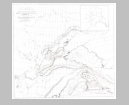
Viewing Options
Main Author:
Allen, Henry T.
Title/Description:
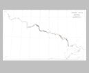
Tanana River, Alaska
Publication Info:
Washington D.C.: Government Printing Office, 1887; from Report of an Expedition to the Copper, Tanana, and Koyukuk Rivers
Original Source:
Geological Survey of Alabama
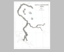
Viewing Options
Main Author:
Allen, Henry T.
Title/Description:
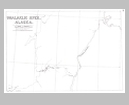
Koyukuk River, Alaska
Publication Info:
Washington D.C.: Government Printing Office, 1887; from Report of an Expedition to the Copper, Tanana, and Koyukuk Rivers
Original Source:
Geological Survey of Alabama
Viewing Options
Main Author:
Allen, Henry T.
Title/Description:
Unalaklik River, Alaska
Publication Info:
Washington D.C.: Government Printing Office, 1887; from Report of an Expedition to the Copper, Tanana, and Koyukuk Rivers
Original Source:
Geological Survey of Alabama
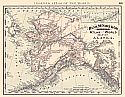
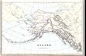
Viewing Options
Main Author:
Bradley, William M.
Title/Description:
Northwestern America Showing the Territory Ceded by Russia to the United States
Publication Info:
Boston: William M. Bradley, 1888
Viewing Options
Title/Description:
Alaska
Publication Info:
Chicago: Rand McNally and Co., 1889; from the Enlarged Business Atlas and Shippers Guide
Viewing Options
Main Author:
U.S. Coast and Geodetic Survey
Title/Description:
Map of the First or Southeastern District of Alaska
Publication Info:
New York: Sackett and Wilhelms Lith. Co., 1890; for the eleventh census of population.
Viewing Options
Main Author:
Fisk & Company
Title/Description:
Alaska
Publication Info:
New York: Hunt & Eaton, 1892
Viewing Options
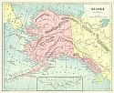
Main Author:
Rand McNally & Company
Title/Description:
Rand McNally & Co.'s Indexed Atlas of the World Map of Alaska
Publication Info:
Chicago: Rand McNally & Co., 1892
Viewing Options
Main Author:
Reid, Harry Fielding
Title/Description:
Muir Glacier, Alaska
Publication Info:
Washington: National Geographic Society, 1892
Viewing Options
Title/Description:
Alaska
Publication Info:
Chicago: John F. Waite, 1893
Viewing Options
Main Author:
Cram, George F.
Title/Description:
Alaska
Publication Info:
Chicago: John F. Waite, 1893; From International Office and Family Atlas of the World
Viewing Options
Main Author:
Bradley, William M.
Title/Description:
Alaska
Publication Info:
New York: John E. Potter and Company, 1894; from Potter - Bradley Atlas of the World
Viewing Options
Main Author:
Rand McNally and Company
Title/Description:
Alaska
Publication Info:
Chicago: Rand McNally and Company, 1894; Rand McNally and Company's Encyclopedia and Gazetteer

