Viewing Options
Main Author:
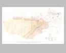
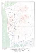
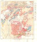
Waring, Gerlad A.
Title/Description:
Geologic Map of Part of Upper Matanuska Valley, Alaska
Publication Info:
Washington: Department of the Interior, US Geological Survey, 1936; Bulletin 861, Plate 1
Viewing Options
Main Author:
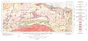
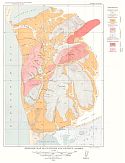
Richards, R.W. and Gerald A. Waring
Title/Description:
Geologic Map of the Western Part of the Anthracite Ridge District, Alaska
Publication Info:
Washington: Department of the Interior, US Geological Survey, 1936; Bulletin 861, Plate 2
Viewing Options
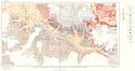
Title/Description:
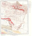
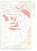
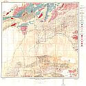
Geologic Map of the Eastern part of the Anthracite Ridge District, Alaska
Publication Info:
Washington: Department of the Interior, US Geological Survey, 1936; Bulletin 861, Plate 2
Viewing Options
Main Author:
Rand McNally and Company
Title/Description:
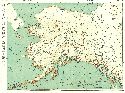
Standard Map of Alaska
Publication Info:
Chicago: Rand McNally and Company, 1936
Viewing Options
Main Author:
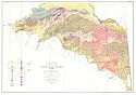
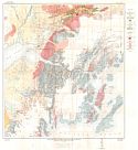
Mertie, J.B. Jr.
Title/Description:
Geologic Map of the Yukon-Tanana Region, Alaska
Publication Info:
Washington: Department of the Interior, U.S. Geological Survey, 1937; Bulletin 872, Plate 1
Viewing Options
Main Author:
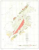
Capps, Stephen R.
Title/Description:
Geologic Reconnaissance Map of Kodiak and Adjacent Islands, Alaska
Publication Info:
Washington: Department of the Interior, U.S. Geological Survey, 1937; Bulletin 880, Plate 2
Viewing Options
Main Author:
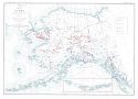
Smith, Philip S.
Title/Description:
Map of Alaska Showing areas differentiated in accordance with the dominate fineness of their placer gold
Publication Info:
Washington: Department of the Interior, US Geological Survey, 1938; Bulletin 910, Plate 3
Viewing Options
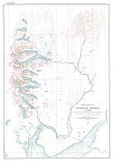
Title/Description:
Topographic Map of Nushagak District, Alaska
Publication Info:
Washington: Department of the Interior, US Geological Survey, 1938; Bulletin 903, Plate 1
Viewing Options
Main Author:
Moffit, Fred H.
Title/Description:
Geologic reconnaissance map of the chitna valley and adjacent areas, Alaska
Publication Info:
Washington: Department of the Interior, US Geological Survey, 1939; Bulletin 894, Plate 2
Viewing Options
Main Author:
U.S. Geological Survey
Title/Description:
The Alaska Railroad, Yanert Fork to Fairbanks
Publication Info:
Washington,: Department of the Interior, U.S. Geological Survey, 1940; Alaska Map 27
Viewing Options
Main Author:
U.S. Geological Survey
Title/Description:
The Alaska Railroad, Matanuska Coal Field to Yanert Fork
Publication Info:
Washington,: Department of the Interior, U.S. Geological Survey, 1940; Alaska Map 26
Viewing Options
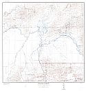
Title/Description:
Topographic map of Platinum and Vicinity, Alaska
Publication Info:
Washington: Department of the Interior, US Geological Survey, 1940; Bulletin 918, Plate 1
Viewing Options
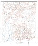
Title/Description:
Geologic Map of Platinum and Vicinity, Alaska
Publication Info:
Washington: Department of the Interior, US Geological Survey, 1940; Bulletin 918, Plate 2
Viewing Options
Title/Description:
Geologic Map of the Alaska Railroad Region, Yanert Fork to Fairbanks
Publication Info:
Washington: Department of the Interior, US Geological Survey, 1940; Bulletin 907, Plate 3
Viewing Options
Title/Description:
Geologic Map of the Alaska Railroad Region, Seward to Matanuska Coal Field
Publication Info:
Washington: Department of the Interior, US Geological Survey, 1940; Bulletin 907, Plate 1
Viewing Options
Title/Description:
Geologic Map of the Alaska Railroad Region, Matanuska Coal Field to Yanert Fork
Publication Info:
Washington: Department of the Interior, US Geological Survey, 1940; Bulletin 907, Plate 2