Viewing Options
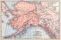
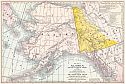
Main Author:
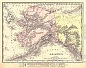
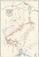
Rand McNally & Company
Title/Description:
Rand McNally & Co.'s New Map of Alaska
Publication Info:
Chicago: Rand McNally & Co., 1901; from Rand McNally's Atlas of the World
Viewing Options
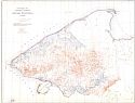
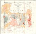
Main Author:
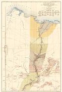
U.S. Geological Survey
Title/Description:
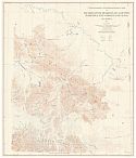
Geologic Reconnaissance Map of Northern Alaska
Publication Info:
Washington: U.S. Deparment of the Interior, Geological Survey
Viewing Options
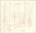
Main Author:
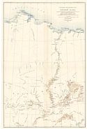
U.S. Geological Survey
Title/Description:
Topographic Reconnaissance Map of Northern Alaska
Publication Info:
Washington: U.S. Deparment of the Interior, Geological Survey
Viewing Options
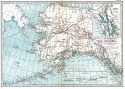
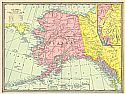
Main Author:
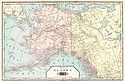
Tunison, Henry Cuthbert
Title/Description:
Alaska
Publication Info:
New York: H.C. Tunison, 1901; from Tunison's Atlas, Encyclopædia, Gazetteer, and Portfolio of Our Universe, Globe, and Nation
Viewing Options
Main Author:
Mast, Crowell and Kirkpatrick
Title/Description:
Alaska and Part of British America
Publication Info:
Chicago: Benedict and Co., 1902
Viewing Options
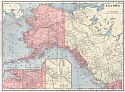
Main Author:
Century Company
Title/Description:
Alaska
Publication Info:
Buffalo: The Matthews-Northrup Co., 1902
Original Source:
From the personal collection of Dr. Robert Burckhalter
Viewing Options
Main Author:
U.S. Geological Survey
Title/Description:
Topographic Map of the Northern portions of Seward Peninsula, Alaska
Publication Info:
Washington: U.S. Deparment of the Interior, Geological Survey
Viewing Options
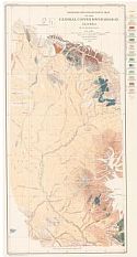
Main Author:
U.S. Geological Survey
Title/Description:
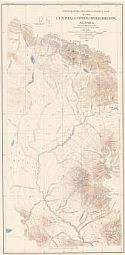
Geologic Reconnaissance Map of the Central Cooper River Region, Alaska
Publication Info:
Washington: U.S. Deparment of the Interior, Geological Survey
Viewing Options
Main Author:
U.S. Geological Survey
Title/Description:
Topographic Reconnaissance Map of Headwater Regions of Cooper, Nabesca, and Chisana Rivers, Alaska
Publication Info:
Washington: U.S. Deparment of the Interior, Geological Survey
Viewing Options
Main Author:
U.S. Geological Survey
Title/Description:
Topographic Reconnaissance Map of the Central Cooper River Region, Alaska
Publication Info:
Washington: U.S. Deparment of the Interior, Geological Survey
Viewing Options
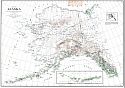
Main Author:
U.S. Department of the Interior, U.S. Geological Survey
Title/Description:
Map of Alaska
Publication Info:
Washington: U.S. Department of the Interior, U.S. Geological Survey, 1903
Viewing Options
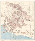
Main Author:
U.S. Geological Survey
Title/Description:
Map of Mount Wrangell District, Alaska
Publication Info:
Washington: U.S. Deparment of the Interior, Geological Survey
Viewing Options
Main Author:
Mast, Crowell and Kirkpatrick
Title/Description:
New Map of Alaska and Part of British America - The Yukon Gold Fields and Routes by Which They Are Reached
Publication Info:
Springfield, O.H.: The Crowell Publishing Co., 1904
Viewing Options
Main Author:
The Americana Company
Title/Description:
Alaska
Publication Info:
New York: The Americana Company, 1904
Viewing Options
Main Author:
Cram, George F.
Title/Description:
Alaska
Publication Info:
Chicago: George F. Cram, 1904; from Cram's Indexed County Map and Shipper's Guide of Alaska and Hawaii
Viewing Options
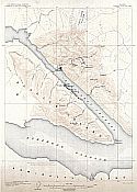
Main Author:
U.S. Geological Survey
Title/Description:
Juneau Special Map
Publication Info:
Washington: Department of the Interior, U.S. Geological Survey, 1904
Viewing Options
Main Author:
U.S. Geological Survey
Title/Description:
Reconnaissance Map of Mt. McKinley Region, Alaska
Publication Info:
Washington: U.S. Deparment of the Interior, Geological Survey
Viewing Options
Main Author:
Moffit, Fred H.
Title/Description:
Geological Reconnaissance Map of of Fairhaven Placer Field, Northeastern Portion of Seward Peninsula, Alaska
Publication Info:
Washington: Department of the Interior, U.S. Geological Survey, 1905; Bulletin 247, Plate 3
Viewing Options
Title/Description:
Reconnaissance Map of Northeastern Portion of Seward Peninsula, Alaska
Publication Info:
Washington: Department of the Interior, U.S. Geological Survey, 1905; Bulletin 247, Plate2

