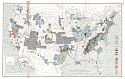
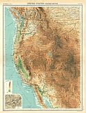
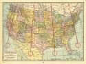
Viewing Options
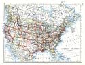
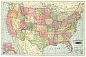
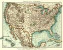
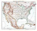
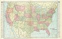
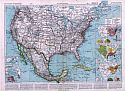
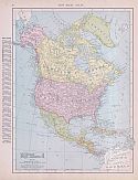
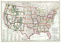
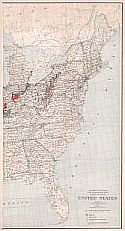
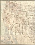
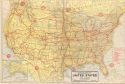
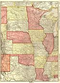
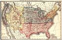
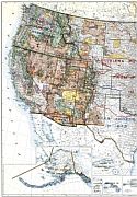
Main Author:
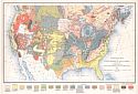
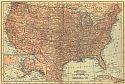
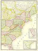
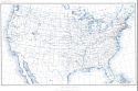
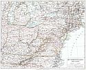
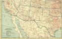
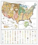
Johnston, William and Alexander Keith
Title/Description:
United States
Publication Info:
Edinburgh: W. and A.K. Johnston, 1901
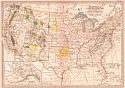
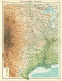
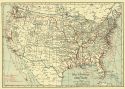
Viewing Options
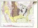
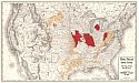
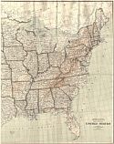
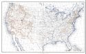
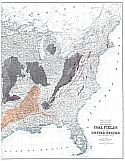
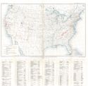
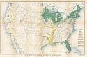
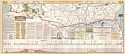
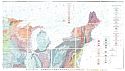
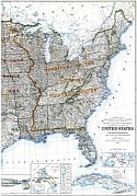
Title/Description:
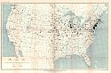
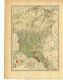
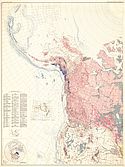
Coal Fields of the United States Showing areas of coal bearing formations
Publication Info:
Washington: Department of the Interior, US Geological Survey, 1901; 22nd Annual Report Part 3, Plate 1
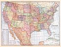
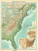
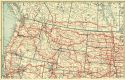
Viewing Options
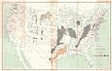
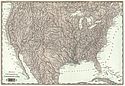
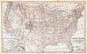
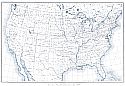
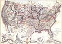
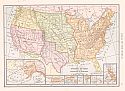
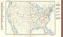
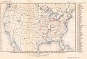
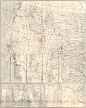
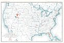
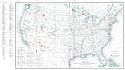
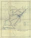
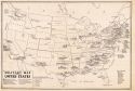
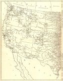
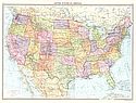
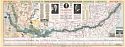
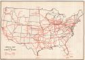
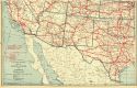
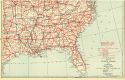
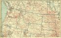
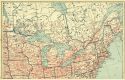
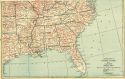
Title/Description:
Principal Routes of Transportation and Travel
Publication Info:
New York: University Publishing Company, 1901; from Maury's Manual of Geography
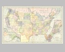
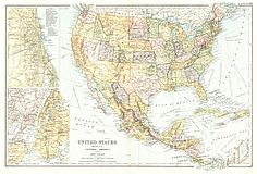
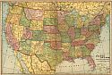
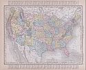
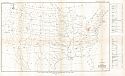
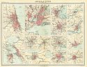
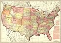
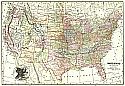
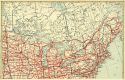
Viewing Options
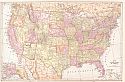
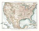
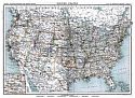
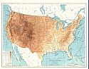
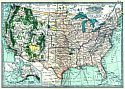
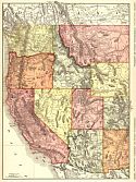
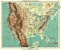
Main Author:
Cram, George F.
Title/Description:
United States of America
Publication Info:
Chicago: The Fort Dearborn Publishing Co., 1901; from The National Standard Family and Business Atlas of the World
Viewing Options
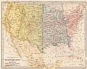
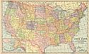
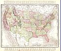
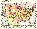
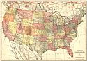
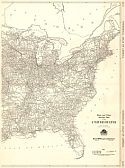
Main Author:
Tunison, Henry Cuthbert
Title/Description:
United States
Publication Info:
New York: H.C. Tunison, 1901; from Tunison's Atlas, Encyclopædia, Gazetteer, and Portfolio of Our Universe, Globe, and Nation
Viewing Options
Main Author:
Tunison, Henry Cuthbert
Title/Description:
Topographical United States
Publication Info:
New York: H.C. Tunison, 1901; from Tunison's Atlas, Encyclopædia, Gazetteer, and Portfolio of Our Universe, Globe, and Nation
Viewing Options
Title/Description:
Vereinigte Staaten von Nordamerika
Publication Info:
Leipzig: Velhagen and Klasing, 1901; from Andrees Allgemeiner Handatlas
Viewing Options
Main Author:
The Matthews-Northrup Co.
Title/Description:
Map of the United States
Publication Info:
Buffalo: Matthews-Northrup Co., 1902; 03257; New England 1902a on reverse
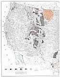
Viewing Options
Main Author:
U.S. Geological Survey
Title/Description:
Progress Map of Topographic and Geologic Surveys 1879-1900
Publication Info:
Washington: U.S. Department of the Interior, U.S. Geological Survey, 1902; Twenty-First Annual Report, Part I, Plate III
Viewing Options
Main Author:
The Century Company
Title/Description:
United States
Publication Info:
Buffalo: The Matthews-Northrup Co., 1902; from The Century Atlas of the World
Viewing Options
Main Author:
Miller, J. Martin
Title/Description:
United States and Adjacent Countries
Publication Info:
Buffalo: The Matthews-Northrup Company, 1902; from The Twentieth Century Atlas and Illustrated World
Viewing Options
Main Author:
Frye, Alexis Everett
Title/Description:
United States
Publication Info:
Boston: Ginn and Company, 1902; from Frye's Elements of Geography
Original Source:
Geological Survey of Alabama
Viewing Options
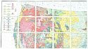
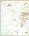
Main Author:
Willis, Bailey
Title/Description:
Geological Map of the United States and Part of Canada
Publication Info:
Baltimore: T. Chamberlin, 1903; compiled with the aid of geologists of the U.S. Geological Survey
Viewing Options
Main Author:
Oliphant, F.H.
Title/Description:
Known oil and gas fields of the United States
Publication Info:
Washington: Department of the Interior, U.S. Geological Survey, 1903
Viewing Options
Main Author:
The Crowell Publishing Company
Title/Description:
United States
Publication Info:
Springfield, Ohio: The Crowell Publishing Company, 1903; from The Twentieth Century Peerless Atlas and Pictorial Gazetteer
Viewing Options
Main Author:
Cram, George F.
Title/Description:
United States
Publication Info:
Philadelphia: The Philadelphia Inquirer,1903; from Pictorial Atlas of the Greater United States and the World
Viewing Options
Title/Description:
Vereinigte Staaten von Nordamerika
Publication Info:
Leipzig: Verlag von Velhagen and Klasing: from Andreas Allgemeiner Handatlas
Viewing Options
Title/Description:
United States, Mexico, Central America and the West Indies
Publication Info:
London: G.W. Bacon and Company, 1904; from New General Atlas of the World
Viewing Options
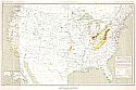
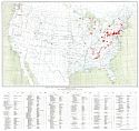
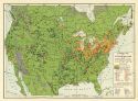
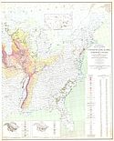
Main Author:
Daddow, Samuel Harries
Title/Description:
Coal Fields of the United States
Publication Info:
Washington: A. Petersen, [1905]
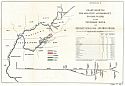
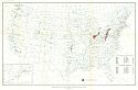
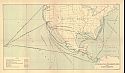
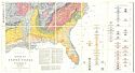
Viewing Options
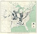
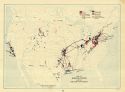
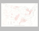
Title/Description:
Chart Showing the Relative Accessibility to Tide Water of the Tennessee River and Pennsylvania Coal and Iron Fields
Publication Info:
Washington,: United States Senate, 1905; Appendix E
Viewing Options
Main Author:
Habenicht, H. and H. Salzmann
Title/Description:
Vereinigte Staaten und Mexico
Publication Info:
Gotha: Justus Perthes, 1905; from Stielers Hand-Atlas
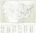
Viewing Options
Main Author:
Rand McNally & Co.
Title/Description:
Coal Fields of the United States
Publication Info:
Chicago: Rand McNally & Co., 1906
Viewing Options
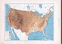
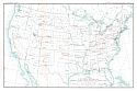
Main Author:
U.S. Geological Survey
Title/Description:
United States
Publication Info:
Washington: U.S. Geological Survey, 1906
Viewing Options
Title/Description:
United States
Publication Info:
New York: Student Volunteer Movement for Foreign Missions, 1906; Maps by John Bartholomew published in A Geography and Atlas of Protestant Missions
Viewing Options
Title/Description:
Map of the United States
Publication Info:
Chicago: George F. Cram for A. A. Grant, Toronto, Ont., 1906; from Grant's Bankers and Brokers Railroad System Atlas
Viewing Options
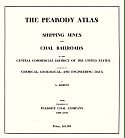
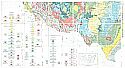
Main Author:
Bement, Alburto
Title/Description:
The Peabody Atlas: Shipping, Mines, and Coal Railroads in the Central Commercial District of the U.S.
Publication Info:
Chicago: Peabody Coal Company, 1906
Viewing Options
Main Author:
Cram, George F.
Title/Description:
Map of the United States
Publication Info:
Chicago: George F. Cram, 1907; from Cram's Standard American Atlas
Viewing Options
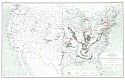
Main Author:
U.S. Department of the Interior, General Land Office
Title/Description:
United States, Showing Routes of Principal Exploreres and Early Roads and Highways
Publication Info:
Baltimore: The Lord Baltimore Press, 1908
Viewing Options
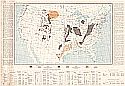
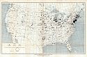
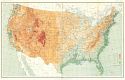
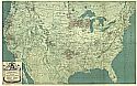
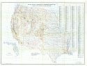
Main Author:
U.S. Department of Agriculture
Title/Description:
Departures from Normal Temperature for the Crop Season of 1908, from March 1 to September 30
Publication Info:
Washington,: U.S. Department of Agriculture, 1908; Plate L
Viewing Options
Main Author:
U.S. Department of Agriculture
Title/Description:
Departures from Normal Precipitation for the Crop Season of 1908, from March 1 to September 30
Publication Info:
Washington,: U.S. Department of Agriculture, 1908; Plate LI
Viewing Options
Main Author:
U.S. Department of Agriculture
Title/Description:
Total Precipitation for the Crop Season of 1908, from March 1 to September 30
Publication Info:
Washington: U.S. Department of Agriculture, 1908; Plate LII
Viewing Options
Title/Description:
Formation Politique de L'Amerique du Nord
Publication Info:
Paris: Librairie Armand Colin, 1908; from Atlas Classique Vidal-Lablache
Viewing Options
Title/Description:
Etats-Unis et Mexique
Publication Info:
Paris: Librairie Armand Colin, 1908; from Atlas Classique Vidal-Lablache
Viewing Options
Main Author:
Hammond, C.S.
Title/Description:
Map of the United States showing acquisition of Territory
Publication Info:
New York: C.S. Hammond & Co. 1908; from Hammond's Handy Atlas of the World
Viewing Options
Main Author:
Rand McNally and Company
Title/Description:
United States (Physical)
Publication Info:
Chicago: Rand McNally and Company, 1908; from The New Ideal State and County Survey and Atlas
Viewing Options
Main Author:
Rand McNally and Company
Title/Description:
United States
Publication Info:
Chicago: Rand McNally and Company, 1908; from The New Ideal State and County Survey and Atlas
Viewing Options
Main Author:
Patten, William and J.E. Homas
Title/Description:
Map of the United States
Publication Info:
New York: P.F. Collier and Son, 1909; from The New Encyclopedic Atlas and Gazetteer of the World
Viewing Options
Title/Description:
Map of the United States Showing Locations of blast furnaces in 1908
Publication Info:
Washington: Department of the Interior, U.S. Geological Survey, 1909; Mineral Resources, 1908, part 1, Plate 2
Viewing Options
Main Author:
Harder, E.C.
Title/Description:
Map Showing the Distribution of Iron Ore in the United States
Publication Info:
Washington: Department of the Interior, U.S. Geological Survey, 1909; Mineral Resources, 1908, part 1, Plate 1
Viewing Options
Main Author:
Day, David T.
Title/Description:
Known productive oil and gas fields of the United States in 1908
Publication Info:
Washington: Department of the Interior, US Geological Survey, 1909
Viewing Options
Main Author:
U.S. Geological Survey
Title/Description:
Map showing the Distribution of Manganese and Manganiferous Ore Deposits in the United States
Publication Info:
Washington: Department of the Interior, U.S. Geological Survey, 1922; Bulletin 708, Plate 1
Viewing Options
Main Author:
U.S. Geological Survey
Title/Description:
Geographic Distribution of Producer-Gas Power Plants (Based on Number of Installations in any Locality)
Publication Info:
Washington: Department of the Interior, U.S. Geological Survey, 1909; Bulletin 416 Plate I
Viewing Options
Main Author:
U.S. Geological Survey
Title/Description:
Geographic Distribution of Producer-Gas Power Plants (Based on Horsepower of Installations in any Locatlity)
Publication Info:
Washington: Department of the Interior, U.S. Geological Survey, 1909; Bulletin 416 Plate II
Viewing Options
Main Author:
Johnston, Alexander Keith
Title/Description:
United States of North America (Central Sheet)
Publication Info:
London: W. and A.K. Johnston, 1910
Viewing Options
Main Author:
Rand McNally and Company
Title/Description:
North America
Publication Info:
Chicago: Rand McNally and Company, 1910; from New Ideal State and County Survey
Viewing Options
Main Author:
Rand McNally and Company
Title/Description:
United States Physical
Publication Info:
Chicago: Rand McNally and Company, 1910; from New Ideal State and County Survey
Viewing Options
Main Author:
Rand McNally and Company
Title/Description:
United States
Publication Info:
Chicago: Rand McNally and Company, 1910; from New Ideal State and County Survey
Viewing Options
Main Author:
C.S. Hammond and Company
Title/Description:
United States
Publication Info:
New York: C.S. Hammond and Company,1910; from The New Reference Atlas of the World
Viewing Options
Main Author:
Rand McNally and Company
Title/Description:
Rand McNally & Co.'s New Commerical Map of the United States [East of Chicago]
Publication Info:
Chicago: Rand McNally & Co., 1911; from a Rand McNally Indexed Atlas
Viewing Options
Main Author:
Burchard, Ernest F.
Title/Description:
Map of the United States Showing Location of mills using local gypsum in 1910
Publication Info:
Washington: Department of the Interior, U.S. Geological Survey, 1911; Mineral Resources, 1910, part 2, Plate 26
Viewing Options
Main Author:
Burchard, Ernest F.
Title/Description:
Map Showing the Distribution of cement plants in the United States and principal limestone formations
Publication Info:
Washington: Department of the Interior, U.S. Geological Survey, 1911; Mineral Resources, 1910, part 2, Plate 15
Viewing Options
Title/Description:
Map of the United States Showing Location of copper producing dristricts and of reduction plants operated in 1908-1910
Publication Info:
Washington: Department of the Interior, U.S. Geological Survey, 1911; Mineral Resources, 1910, part 1, Plate 1
Viewing Options
Main Author:
Cram, George F.
Title/Description:
Forest Map of the United States showing The National Forest Reserves
Publication Info:
Chicago: George F. Cram, 1911; from Cram's Unrivaled Atlas of the World
Viewing Options
Main Author:
U.S. Geological Survey
Title/Description:
Map showing Distribution of Portland Cement Plants in the United States, 1911
Publication Info:
Washington: Department of the Interior, U.S. Geological Survey, 1912; Bulletin 522 Plate I
Viewing Options
Main Author:
Wansleben, Thomas O.
Title/Description:
Inter-Coastal Steamship Lines and Water Routes
Publication Info:
Washington: Office of Territories, 1912
Viewing Options
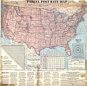
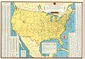
Title/Description:
Parcel Post Rate Map
Publication Info:
Indianapolis: The Scarborough Co., 1913
Viewing Options
Main Author:
U.S. Geological Survey
Title/Description:
Geologic Map of North America (Southeast Sheet)
Publication Info:
Washington: U.S. Department of the Interior, U.S. Geological Survey, 1913; to Accompany Professional Paper 71, Plate 1D
Viewing Options
Main Author:
U.S. Geological Survey
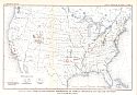
Title/Description:
United States, Oil and Gas Fields in 1913 (Western Half)
Publication Info:
Washington: Department of the Interior, U.S. Geological Survey 1913
Viewing Options
Title/Description:
United States
Publication Info:
New York: The Century Company, 1913; from The Century Atlas of the World
Viewing Options
Main Author:
U.S. Geological Survey
Title/Description:
Map Showing Principal Limestone Areas in the United States East of the Rocky Mountains
Publication Info:
Washington: U.S. Department of the Interior, U.S. Geological Survey, 1914; Mineral Resources 1913, Part II Plate VIII
West
Viewing Options
Main Author:
Smith, George Otis
Publication Info:
Washington: Department of the Interior, US Geological Survey, 1914
Viewing Options
Main Author:
U.S. Geological Survey
Title/Description:
Map of the United States showing location of phosphate deposits
Publication Info:
Washington: Department of the Interior, U.S. Geological Survey, 1915; from Mineral Resources of the United States, 1915 Part II Plate II
Viewing Options
Main Author:
U.S. Geological Survey
Title/Description:
Map of the United States showing distribution of Coke Ovens
Publication Info:
Washington: Department of the Interior, U.S. Geological Survey, 1915; from Mineral Resources of the United States, 1915 Part II Plate IV
Viewing Options
Main Author:
U.S. Department of the Interior, U.S. Geological Survey
Title/Description:
United States Base Map
Publication Info:
Washington: U.S. Department of the Interior, Geological Survey, 1916, reprinted 1962
Viewing Options
Main Author:
U.S. Department of the Interior, U.S. Geological Survey
Title/Description:
United States Base Map
Publication Info:
Washington: U.S. Department of the Interior, Geological Survey, 1916, reprinted 1939
Viewing Options
Title/Description:
Map of the United States Showing Location of copper producing districts and of reduction plants in 1915
Publication Info:
Washington: Department of the Interior, U.S. Geological Survey, 1916; Mineral Resources, 1915, part 1, Plate 1
Western Half
Eastern Half
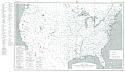
Main Author:
Campbell, Marius R.
Title/Description:
Map Showing Coal Fields of the United States
Publication Info:
Washington: Department of the Interior, U.S. Geological Survey, 1917: Professional Paper
100-A PL 1
Viewing Options
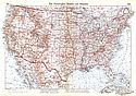
Title/Description:
Motor Vehicle Truck Routes Eastern United States
Publication Info:
Unknown
Viewing Options
Main Author:
U.S. Geological Survey
Title/Description:
Map of the United States showing distribution of asphalt, petroleum and related bitumens
Publication Info:
Washington: Department of the Interior, U.S. Geological Survey, 1918; from Mineral Resources of the United States, 1918 Part II Plate IV
Viewing Options
Main Author:
U.S. Geological Survey
Title/Description:
Map of the United States showing distribution of sources of mineral waters sold in 1918
Publication Info:
Washington: Department of the Interior, U.S. Geological Survey, 1918; from Mineral Resources of the United States, 1918 Part II Plate V
Viewing Options
Main Author:
U.S. Geological Survey
Title/Description:
Map of the United States showing location of manganese deposits
Publication Info:
Washington: Department of the Interior, U.S. Geological Survey, 1918; from Mineral Resources of the United States, 1918 Part II Plate V
Viewing Options
Main Author:
National Automobile Association
Title/Description:
The Red Road Book for New England States, Middle Atlantic States and Southern Seaboard States
Publication Info:
Boston: The Bullard Company, c. 1918
Viewing Options
Main Author:
Geographical Publishing Co., Chicago, IL
Title/Description:
Military Map of the United States
Publication Info:
Geographical Publishing Co., Chicago, Illinois, 1918; from World's Greatest War: Maps of Europe, Italy, and the Western Battle Front in detail with Descriptive Text fully illustrated
Viewing Options
Main Author:
U.S. Geological Survey
Title/Description:
Map of the United States showing distribution of portland, natural and puzzolan cement plants
Publication Info:
Washington: Department of the Interior, U.S. Geological Survey, 1920; from Mineral Resources of the United States, 1920 Part II Plate I
Viewing Options
Viewing Options
Viewing Options
Main Author:
Bartholomew, J.G.
Title/Description:
United States-Western Section
Publication Info:
London: The Times, 1920; from The Times Survey Atlas of the World
Viewing Options
Main Author:
Bartholomew, J.G.
Title/Description:
American Cities
Publication Info:
London: The Times, 1920; from The Times Survey Atlas of the World
Viewing Options
Main Author:
The Geographical Publishing Company
Title/Description:
Map of the United States and Alaska
Publication Info:
Chicago: The Geographical Publishing Company, 1920; from The North American Atlas of the World, issued by The North American (Philadelphia newspaper)
Viewing Options
Main Author:
Rand McNally and Company
Title/Description:
Group Boundaries and Percentage Bases for Freight Rate Increases under I.C.C. Opinion Ex-Parte 74, Issued July 29,1920, Effective August 26,1920
Publication Info:
Chicago: Rand McNally and Company, 1921; from the Commercial Atlas of America
Viewing Options
Main Author:
Rand McNally and Company
Title/Description:
United States
Publication Info:
Chicago: Rand McNally and Company, 1921; from the Commercial Atlas of America
Viewing Options
Main Author:
Rand McNally and Company
Title/Description:
United States- East of Chicago
Publication Info:
Chicago: Rand McNally and Company, 1921; from the Commercial Atlas of America
Viewing Options
Main Author:
Rand McNally and Company
Title/Description:
United States, Denver to Chicago
Publication Info:
Chicago: Rand McNally and Company, 1921; from the Commercial Atlas of America
Viewing Options
Main Author:
Rand McNally and Company
Title/Description:
United States, Denver to Pacific Coast
Publication Info:
Chicago: Rand McNally and Company, 1921; from the Commercial Atlas of America
Viewing Options
Main Author:
Rand McNally and Company
Title/Description:
United States Black and White Mileage Map, Western Sheet
Publication Info:
Chicago: Rand McNally and Company, 1921; from the Commercial Atlas of America
Viewing Options
Main Author:
Rand McNally and Company
Title/Description:
United States Black and White Mileage Map, Eastern Sheet
Publication Info:
Chicago: Rand McNally and Company, 1921; from the Commercial Atlas of America
Viewing Options
Main Author:
Rand McNally and Company
Title/Description:
Industrial Map of the United States
Publication Info:
Chicago: Rand McNally and Company, 1921; from the Commercial Atlas of America
Viewing Options
Main Author:
Philip, George
Title/Description:
United States of America
Publication Info:
London: George Philip and Son, 1921, from Philips New Handy General Atlas and Gazetteer
Viewing Options
Main Author:
The Geological Publishing Co.
Title/Description:
United States
Publication Info:
Chicago: The Geographical Publishing Co., 1922; from New International Atlas of the World
Viewing Options
Main Author:
U.S. Geological Survey
Title/Description:
Map of the United States Showing Distribution of Peat Deposits and Approximate Location of Plants that Produce Peat in 1918
Publication Info:
Washington: Department of the Interior, U.S. Geological Survey, 1922; Bulletin 728 Plate 1
Viewing Options
Main Author:
National Highway Association
Title/Description:
Map of the Lee Highway
Publication Info:
Washington: National Highway Association, 1923
Viewing Options
Main Author:
National Highway Association
Title/Description:
Map of the Old Spanish Trail, Florida to California
Publication Info:
Washington: National Highway Association, 1923
Viewing Options
Main Author:
Bibliographisches Institut
Title/Description:
Vereinigte Staaten Ostliches Blatt
Publication Info:
Leipzig: Bibliographisches Institut, 1924; from Meyers Geographischer Hadatlas, map no. 78
Viewing Options
Main Author:
Bibliographisches Institut
Title/Description:
Vereinigte Staaten Westliches Blatt
Publication Info:
Leipzig: Bibliographisches Institut, 1924; from Meyers Geographischer Hadatlas, map no. 78
Viewing Options
Main Author:
Bibliographisches Institut
Title/Description:
Die Nordoststaaten Der Union
Publication Info:
Leipzig: Bibliographisches Institut, 1924; from Meyers Geographischer Hadatlas, map no. 80
Viewing Options
Main Author:
Malford, John C.
Title/Description:
United States Touring Map
Publication Info:
Washington: National Highways Association, 1924
Viewing Options
Main Author:
Campbell, Marius R.
Title/Description:
Coal Fields of the United States (from the Proceedings of the International Conference on Bituminous Coal)
Publication Info:
Baltimore: A Hoen and Company, [1926]
Viewing Options
Main Author:
Langwith Publishing Company
Title/Description:
Langwith's Folding Road Map Atlas of the United States and Canada
Publication Info:
Minneapolis: Langwith Publishing Company, 1928
Viewing Options
Main Author:
Gannett, Henry
Title/Description:
United States Relief Map
Publication Info:
Washington: U.S. Department of the Interior, Geological Survey, 1916, reprinted in 1929
Viewing Options
Main Author:
U.S. Department of Agriculture
Title/Description:
National Forests, State Forests, National Parks, National Monuments and Indian Reservations
Publication Info:
Washington: U.S. Department of Agriculture, Forest Service, 1930
Viewing Options
Main Author:
Byllesby Engineering and Management Corporation
Title/Description:
Map of the United States Showing Territories served by Operated and Affiliated Public Utility Companies of Standard Gas and Electric Company
Publication Info:
New York: The Whitney-Graham Co., Inc., c.1930
Viewing Options
Main Author:
C.S. Hammond and Company
Title/Description:
Physical Map of North America
Publication Info:
New York: C.S. Hammond and Company, c. 1930; from The New World Loose Leaf Atlas, Sixth Edition
Viewing Options
Main Author:
C.S. Hammond and Company
Title/Description:
Airways Map of the United States
Publication Info:
New York: C.S. Hammond and Company, c. 1930; from The New World Loose Leaf Atlas, Sixth Edition
Viewing Options
Main Author:
C.S. Hammond and Company
Title/Description:
Population Map of the United States and Dominion of Canada
Publication Info:
New York: C.S. Hammond and Company, c. 1930; from The New World Loose Leaf Atlas, Sixth Edition
Viewing Options
Main Author:
C.S. Hammond and Company
Title/Description:
Economic Map of the United States and the Dominion of Canada
Publication Info:
New York: C.S. Hammond and Company, c. 1930; from The New World Loose Leaf Atlas, Sixth Edition
Viewing Options
Main Author:
C.S. Hammond and Company
Title/Description:
Map of the United States Showing Oil and Gas Areas
Publication Info:
New York: C.S. Hammond and Company, c. 1930; from The New World Loose Leaf Atlas, Sixth Edition
Viewing Options
Main Author:
C.S. Hammond and Company
Title/Description:
Standard Time Map of the United States
Publication Info:
New York: C.S. Hammond and Company, c. 1930; from The New World Loose Leaf Atlas, Sixth Edition
Viewing Options
Main Author:
C.S. Hammond and Company
Title/Description:
Inland Waterways Map of the United States
Publication Info:
New York: C.S. Hammond and Company, c. 1930; from The New World Loose Leaf Atlas, Sixth Edition
Viewing Options
Viewing Options
Viewing Options
Viewing Options
Main Author:
C.S. Hammond and Company
Title/Description:
Auto Route Distance Map of the United States and Canada
Publication Info:
New York: C.S. Hammond and Company, c. 1930
Viewing Options
Viewing Options
Viewing Options
Viewing Options
Main Author:
C.S. Hammond and Company
Title/Description:
Railroad Map of United States and Canada
Publication Info:
New York: C.S. Hammond and Company, c. 1930
Viewing Options
Title/Description:
Vereinigte Staaten und Kanada
Publication Info:
Braunschweig: George Westermann, c.1931; from Diercke Schulatlas Fur Hohere Lehranstalten
Viewing Options
Viewing Options
Viewing Options
Viewing Options
Main Author:
U.S. Geological Survey
Title/Description:
Geologic Map of North America
Publication Info:
Washington: U.S. Department of the Interior, U.S. Geological Survey, 1932

Viewing Options
Main Author:
Gallup Map and Supply Company
Title/Description:
Western Auto's Highway Atlas of the United States and Canada
Publication Info:
Kansas City: Gallup Map and Supply Company, 1933
Viewing Options
Title/Description:
RCA Radio Tours (Map of the United States)
Publication Info:
RCA Radiotron Company, 1934
Viewing Options
Main Author:
Continental Oil Company
Title/Description:
Official Road Map, United States
Publication Info:
Chicago: H.M. Gousha Company, c. 1934
Original Source:
Murray Hudson
Viewing Options
Main Author:
Rand McNally and Company
Title/Description:
Standard Map of United States (East Sheet)
Publication Info:
Chicago: Rand McNally and Company, 1936
Viewing Options
Main Author:
Rand McNally and Company
Title/Description:
Standard map of United States (West Sheet)
Publication Info:
Chicago: Rand McNally and Company, 1936
Viewing Options
Main Author:
Rand McNally and Company
Title/Description:
Desk Map of United States, Showing Scheduled Air Lines
Publication Info:
Chicago: Rand McNally and Company, 1936
Viewing Options
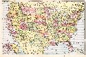
Main Author:
Rand McNally and Company
Title/Description:
Distribution of Retail Sales in the United States by Counties
Publication Info:
Chicago: Rand McNally and Company, 1936
Viewing Options
Main Author:
Rand McNally and Company
Title/Description:
Distribution of Manufacturing Plants in the United States by Counties
Publication Info:
Chicago: Rand McNally and Company, 1936
Viewing Options
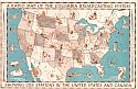
Title/Description:
A Radio Map of the Columbia Broadcasting System showing C.B.S. Stations in the United States and Canada
Publication Info:
Unknown
Viewing Options
Main Author:
Frenzel, Konrad
Title/Description:
Die Vereinigten Staaten von Amerika
Publication Info:
Leipzig: Velhagen and Klasing, 1937; from Grosser Volks-Atlas
Viewing Options
Main Author:
U.S. Department of Agriculture
Title/Description:
Soil Associations of the United States
Publication Info:
Washington: Soil Survey Division, Bureau of Chemistry and Soils, U.S. Department of Agriculture
Viewing Options
Main Author:
U.S. Army Corps of Engineers
Title/Description:
Army Map Service 1:500,000
Publication Info:
Washington: U.S. War Department
Viewing Options
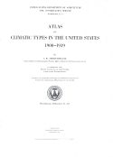
Main Author:
Thornthwaite, C.W.
Title/Description:
Atlas of Climatic Types in the United States, 1900-1939, Miscellaneous Publication No. 421
Publication Info:
Washington: U.S. Department of Agriculture, Soil Conservation Service, 1941
Viewing Options
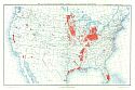
Main Author:
Bureau of the Census
Title/Description:
Map of the United States showing location of lands in drainage enterprises
Publication Info:
Washington: U.S. Government Printing Office, 1942
Viewing Options
Main Author:
Bureau of the Census
Title/Description:
United States Irrigation of Drainage Basins, 1939
Publication Info:
Washington: U.S. Government Printing Office, 1942
Viewing Options
Main Author:
Geographical Publishing Company
Title/Description:
United States
Publication Info:
Chicago: Geographical Publishing Company, 1942; from The New International Atlas of the World, War Edition
Viewing Options
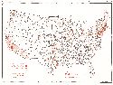
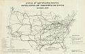
Title/Description:
Status of Certified Routes, United States Air Transportation System, October 1, 1944
Publication Info:
Washington: Civil Aeronautics Board, 1944
Viewing Options
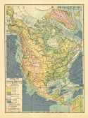
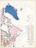
Main Author:
The Geological Society of America
Title/Description:
Glacial Map of North America - Eastern Half
Publication Info:
New York: The Geological Society of America, 1945; from Special Papers Number 60
Viewing Options
Main Author:
The Geological Society of America
Title/Description:
Glacial Map of North America - Western Half
Publication Info:
New York: The Geological Society of America, 1945; from Special Papers Number 60
Viewing Options
Main Author:
Fenneman, Nevin M.
Title/Description:
Physical Divisions of the United States
Publication Info:
Washington: Department of the Interior, U.S. Geological Survey, 1946
Viewing Options
Main Author:
U.S. Coast and Geodetic Survey
Title/Description:
U.S. Army Air Forces Aeronautical Planning Chart: United States (9W)
Publication Info:
Washington: U.S. Coast and Geodetic Survey, 1947
Viewing Options
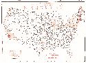
Main Author:
Subcommittee on Hydrology, Federal Inter-Agency River Basin Maps
Title/Description:
River Basin Maps Showing Hydrological Stations
Publication Info:
Washington: Subcommittee on Hydrology, 1949
Viewing Options
Main Author:
The Geological Society of America
Title/Description:
Pleistocene Eolian Deposits of the United States, Alaska and Parts of Canada
Publication Info:
New York: The Geological Society of America, 1952
Viewing Options
Main Author:
The Geological Society of America
Title/Description:
Pleistocene Eolian Deposits of the United States, Alaska and Parts of Canada
Publication Info:
New York: The Geological Society of America, 1952
Viewing Options
Viewing Options
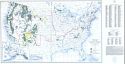
Main Author:
Bureau of Land Management
Title/Description:
United States Including Territories and Insular Possessions Showing the Extent of Public Surveys, National Parks, National Forests, Indian Reservations, National Wildlife Refuges, and Reclamation Projects
Publication Info:
Washington: U.S. Department of the Interior, Bureau of Land Management, 1953
Viewing Options
Main Author:
U.S. Geological Survey
Title/Description:
Index Map of Salt Occurrences in the United States
Publication Info:
Washington: Department of the Interior, U.S. Geological Survey, 1957; Bulletin 1019-J Plate 4
Viewing Options
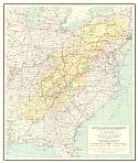
Main Author:
U.S. Geological Survey
Title/Description:
Appalachain Region
Publication Info:
Washington: Department of the Interior, U.S. Geological Survey, 1965

