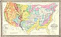
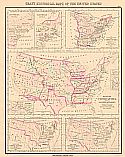
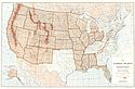
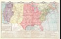
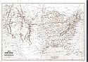
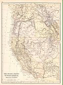
Viewing Options
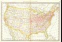
Main Author:
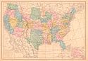
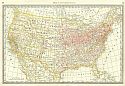
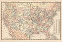
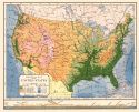
Hitchcock, Charles H.
Title/Description:
Gray's Geological Map of the United States
Publication Info:
Philadelphia: O.W. Gray & Son, c.1876
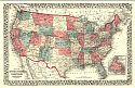
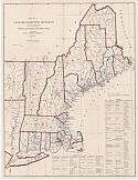
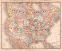
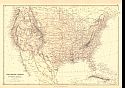
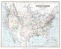
Viewing Options
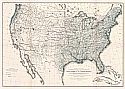
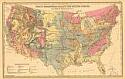
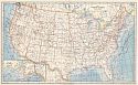
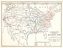
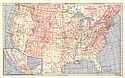
Title/Description:
Map of the United States and territories together with Canada
Publication Info:
Pomeroy, Whitman & Co. 1876; Atlas of York Co. Pennsylvania
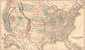
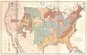
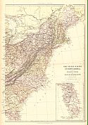
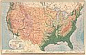
Viewing Options
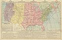
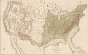
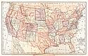
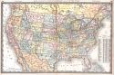
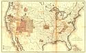
Main Author:
Gray, Ormando W.
Title/Description:
United States of America
Publication Info:
Philadelphia: O.W. Gray and Son, 1876; from Gray's National Atlas with Descriptions
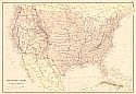
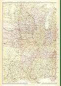
Viewing Options
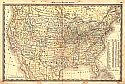
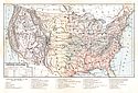
Main Author:
W.G. Blackie & Son
Title/Description:
The United States of North America (General Map)
Publication Info:
London: W.G. Blackie & Son, 1877; from the Imperial Atlas of Modern Geography
Viewing Options
Main Author:
Drioux, M.M and Ch. Leroy
Title/Description:
Carte Physique et Politique des Etats-Unis Canada et Partie du Mexique
Publication Info:
Paris: Eugene Bellin, c1878; from Atlas Universel et Classique de Geographie Ancienne, Romaine du Moyen Age, Moderne et Contemporaine
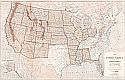
Viewing Options
Main Author:
U.S. Geographical and Geological Survey of the Rocky Mountain Region
Title/Description:
Rain Chart of the United States Showing by Isohyetal Lines the Distribution of the Mean Annual Precipitation in Rain and Melted Snow
Publication Info:
Washington: U.S. Dept. of the Interior, U.S. Geographical and Geological Survey of the Rocky Mountain Region, 1878; to accompany report on the Lands of the Arid Region of the U.S.; This is a copy of the chart constructed for the Smithsonian Institute
Viewing Options
Title/Description:
Carte Militaire des Ètat-sUnis (Partie Occidentale)
Publication Info:
Paris: Furne, Jouvet et Compagnie, 1878; from Atlas de Geographie Militaire
Viewing Options
Title/Description:
Carte Militaire des Ètats-Unis (Partie Occidentale)
Publication Info:
Paris: Furne, Jouvet et Compagnie, 1878; from Atlas de Geographie Militaire
Viewing Options
Main Author:
Gray, Frank A.
Title/Description:
Gray's New Map of the United States
Publication Info:
Philadelphia: O.W. Gray & Son, 1879
Viewing Options
Main Author:
Johnston, William and Alexander Keith
Title/Description:
United States of North America North Eastern Sheet
Publication Info:
Edinburgh: W. and A.K. Johnston, c.1880
Viewing Options
Main Author:
Andree, Richard
Title/Description:
Die Nordost - Staaten der Union
Publication Info:
Leipzig: Velhagen & Klasing, 1881; from Andree's Allgemeiner Handatlas
Viewing Options
Main Author:
von Steinwehr, A.
Title/Description:
Physical and Political map of the United States
Publication Info:
Cincinnati: Von Antwerp, Bragg and Company, 1881; from Eclectic Series, School Geography No. 3
Viewing Options
Main Author:
Rand McNally and Company
Title/Description:
United States
Publication Info:
Chicago: Rand McNally and Company, 1881; from New Indexed Business Atlas and Shippers Guide
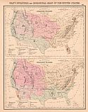
Viewing Options
Main Author:
Hitchcock, Charles Henry
Title/Description:
Gray's Geological Map of the United States
Publication Info:
Philadelphia: O.W. Gray & Son, 1882
Orginal Source:
Personal Collection of Robert M. Baker
Viewing Options
Main Author:
McNally, Francis
Title/Description:
Commercial Map of the United States
Publication Info:
Chicago: A.S. Barnes and Company, 1882; from McNally's System of Geography
Viewing Options
Main Author:
Hardesty, H.H.
Title/Description:
Map of the United States
Publication Info:
New York: H.H. Hardesty and Company, 1883. From Hardesty's Historical and Geographical Encyclopedia
Viewing Options
Main Author:
Gray, Frank A.
Title/Description:
Gray's Historical Maps of the United States
Publication Info:
Philadelphia: O.W. Gray & Son, 1883
Viewing Options
Main Author:
U.S. Department of the Treasury
Title/Description:
Map No. 1 Customs Collection Districts with their Respective Ports of Entry and Delivery
Publication Info:
Washington, D.C.: U.S. Department of the Treasury, 1883
Viewing Options
Main Author:
U.S. Department of the Treasury
Title/Description:
Map No. 2 Customs Collection Districts with their Respective Ports of Entry and Delivery
Publication Info:
Washington, D.C.: U.S. Department of the Treasury, 1883
Viewing Options
Main Author:
U.S. Department of the Treasury
Title/Description:
Map No. 3 Customs Collection Districts with their Respective Ports of Entry and Delivery
Publication Info:
Washington, D.C.: U.S. Department of the Treasury, 1883
Viewing Options
Main Author:
Hardesty, H.H.
Title/Description:
Map of the United States
Publication Info:
Chicago: H.H. Hardesty & Company, 1883; from Hardesty's Historical & Geographical Encyclopedia, Illustrated
Viewing Options
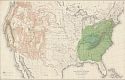
Main Author:
Gannett, Henry / Harry King
Title/Description:
Map showing the Distribution of the Genus Juglans (The Walnuts) in North America exclusive of Mexico
Publication Info:
Washington: Department of the Interior, 10th Census, 1883
Viewing Options
Main Author:
Gannett, Henry / Harry King
Title/Description:
Map showing the Distribution of Liriodendron Tulipdera and Pinus Lambertiana in North America exclusive of Mexico
Publication Info:
Washington: Department of the Interior, 10th Census
Viewing Options
Title/Description:
The United States
Publication Info:
Cincinnati: Von Antwerp, Bragg and Company, 1883; from The Eclectic Complete Geography
Viewing Options
Main Author:
Watson, Gaylord
Title/Description:
United States
Publication Info:
Boston: Perry and Spaulding, 1883; from New Indexed Family Atlas of the United States with Maps of the World
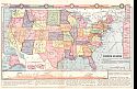
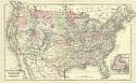
Viewing Options
Main Author:
Ivison, Blakeman, Taylor and Company
Title/Description:
United States Standard Railway Time
Publication Info:
New York: Ivison, Blakeman, Taylor and Company,1883; from Handy Atlas of the World
Viewing Options
Main Author:
Ivison, Blakeman, Taylor and Company
Title/Description:
The United States of America
Publication Info:
New York: Ivison, Blakeman, Taylor and Company,1883; from Handy Atlas of the World
Viewing Options
Main Author:
Ivison, Blakeman, Taylor and Company
Title/Description:
United States Commercial Map
Publication Info:
New York: Ivison, Blakeman, Taylor and Company,1883; from Handy Atlas of the World
Viewing Options
Main Author:
Van Antwerp, Bragg and Company
Title/Description:
Commercial Map of the United States
Publication Info:
New York: American Book Company, 1883; from The Eclectic Complete Geography
Viewing Options
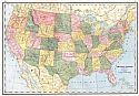
Main Author:
Rand McNally & Company
Title/Description:
United States
Publication Info:
Chicago: Rand McNally & Co., 1884; from Rand McNally's Indexed Atlas of the World
Orginal Source:
From the personal collection of Dr. Gerald Webster
Viewing Options
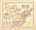
Main Author:
Mitchell, Samuel Augustus
Title/Description:
1776. Map of the Original Thirteen Colonies
Publication Info:
Philadelphia: S.A. Mitchell, 1884; copied from John Mitchell's "Map of the British & French Dominion"
Viewing Options
Title/Description:
Commercial Map of the United States
Publication Info:
Philadelphia: Cowperthwait and Company, 1884; from Warren's Common-School Geography
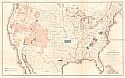
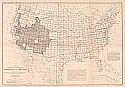
Viewing Options
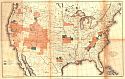
Main Author:
McFarland, N.C.
Title/Description:
Map of the United States and Territories- Public Land States and Territories
Publication Info:
Washington: Department of the Interior, General Land Office, 1884
Viewing Options
Main Author:
Rand McNally and Company
Title/Description:
United States of America
Publication Info:
Chicago: Rand McNally and Company, 1884; from The New Household Atlas of the World
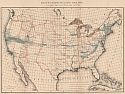
Viewing Options
Main Author:
Gannett, Henry, Chief Geographer
Title/Description:
Map of the United States Exhibiting the Progress Made in the Geographic Survey During the Fiscal Year 1884-5
Publication Info:
Washington: Department of the Interior, U.S. Geological Survey, c.1885; Plate 1, Sixth Annual Report
Viewing Options
Main Author:
U.S. Geological Survey
Title/Description:
Map of the United States Exhibiting the Present Status of Knowledge Relating to the Areal Distribution of Geologic Groups
Publication Info:
Washington: U.S. Department of the Interior, U.S. Geological Survey, 1885; Fifth Annual Report, Plate II; compiled by W.J. McGee, 1884
Viewing Options
Title/Description:
Map of the United States and Territories
Publication Info:
Washington: US Department of the Interior, General Land Office, 1885; To accompany Annual Report of Hon. N.C. McFarland
Viewing Options
Main Author:
Wheeler, George M.
Title/Description:
Sketch Showing Proposed Disposition of Sheets for a General Atlas of the United States
Publication Info:
Washington: US Department of the Interior, General Land Office, 1885; Plate IV from Report on 3rd Geographic Congress and Expedition 1881, Revised to August 1885
Viewing Options
Main Author:
Schott, C.A.
Title/Description:
Scheme for a Geodetic Survey of the United States
Publication Info:
Washington: U.S. Coast and Geodetic Survey, c.1885
Viewing Options
Main Author:
Monteith, James
Title/Description:
United States
Publication Info:
New York: A.S. Barnes and Company, 1885; from Monteith's Independent Course Comprehensive Geography
Viewing Options
Main Author:
Monteith, James
Title/Description:
Commercial Map of the United States
Publication Info:
New York: A.S. Barnes and Company, 1885; from Monteith's Independent Course Comprehensive Geography
Viewing Options
Main Author:
Porter, Thomas C. and Edward D. Cope
Title/Description:
Gray's Botanical and Zoological Maps of the United States
Publication Info:
Philadelphia: O.W. Gray & Son, 1886
Viewing Options
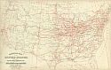
Main Author:
Mitchell, S. Augustus
Title/Description:
Railroad Map of the United States showing the through lines of communication from the Atlantic to the Pacific
Publication Info:
Philadelphia: Wm. M. Bradley and Bro., 1886
Viewing Options
Main Author:
Mitchell, S. Augustus
Title/Description:
Map of the United States and Territories, together with Canada, etc.
Publication Info:
Philadelphia: Wm. M. Bradley and Bro., 1886
Viewing Options
Main Author:
Butler, George
Title/Description:
The United States
Publication Info:
London: Longmans, Green, and Company, 1886; from the Public Schools Atlas of Modern Geography
Viewing Options
Main Author:
Blackie, Walter Graham
Title/Description:
The United States, of North America (General Map)
Publication Info:
London: Blackie and Son, 1886; from The Comprehensive Atlas & Geography of the World
Viewing Options
Main Author:
Blackie, Walter Graham
Title/Description:
The United States of North America. Atlantic States
Publication Info:
London: Blackie and Son, 1886; from The Comprehensive Atlas & Geography of the World
Viewing Options
Main Author:
Blackie, Walter Graham
Title/Description:
United States - Valley of the Mississippi
Publication Info:
London: Blackie and Son, 1886; from The Comprehensive Atlas & Geography of the World
Viewing Options
Main Author:
Blackie, Walter Graham
Title/Description:
The United States of North America, Pacific States
Publication Info:
London: Blackie and Son, 1886; from The Comprehensive Atlas & Geography of the World
Viewing Options
Main Author:
Philip, George and Son
Title/Description:
The United States of North America
Publication Info:
London: George Philip and Son, 1886; from Philips' Elementary Atlas and Geography
Viewing Options
Title/Description:
Physical Map of the United States
Publication Info:
Unknown: 1887
Viewing Options
Title/Description:
United States
Publication Info:
New York: A. A. Grant, 1887; from Grant's Standard American Atlas of the World
Viewing Options
Main Author:
Redway, Jacques W.
Title/Description:
Physical Map of the United States
Publication Info:
Philadelphia: E.H. Butler and Company, 1891; from Butler's Physical Geography
Viewing Options
Main Author:
United States Gelogical Survey
Title/Description:
Map of the United States Showing Progress in Preparation and Engraving of Topographic Maps
Publication Info:
Washington: Department of the Interior, U.S. Geological Survey, 1887; 7th Annual Report Plate 1
Viewing Options
Main Author:
United States Geological Survey
Title/Description:
Map of the U.S. Showing Progress of the Topographic Survey during the Fiscal Year 1887-88
Publication Info:
Washington: Department of the Interior, U.S. Geological Survey, 1888; 8th Annual Report Plate 1
Viewing Options
Main Author:
United States Deep Waterways Commission
Title/Description:
General Route Map (Navigable Waters of the Great Lakes System)
Publication Info:
Washington: Government Printing Office, 1897; Report to 54th Congress, 2nd Session, Document No. 192

