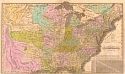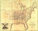
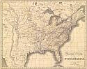
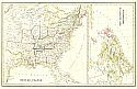
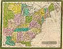
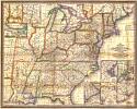
Viewing Options
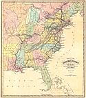
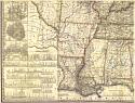
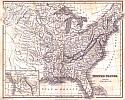
Main Author:
Schoyer, Solomon
Title/Description:
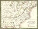
Map of the United States
Publication Info:
New York: Solomon Schoyer, 1826
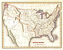
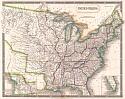
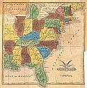
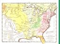
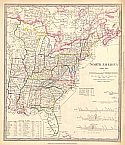
Viewing Options
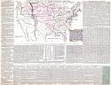
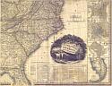
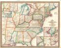
Main Author:
Melish, John
Title/Description:
Map of the United States Drawn from the Most Approved Surveys
Publication Info:
New York: I. Starr & Co., 1826
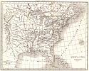
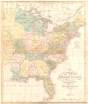
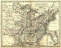
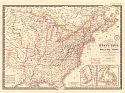
Viewing Options
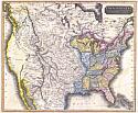
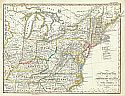
Main Author:
Thomson, John
Title/Description:
United States and Additions, 1820
Publication Info:
[Edinburgh: J. Thomas & Co., 1827]
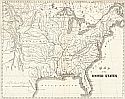
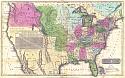
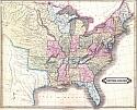
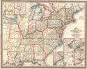
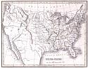
Viewing Options
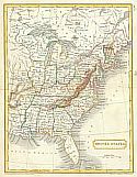
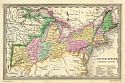
Main Author:
Finley, Anthony
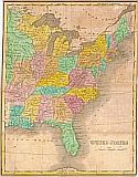
Title/Description:
Map of the United States
Publication Info:
Philadelphia: Anthony Finley, 1827
Viewing Options
Title/Description:
Vereinigte Staaten von Nord America
Publication Info:
Weimar: W. Hoffman, 1828
Viewing Options
Main Author:
Hall, Sidney
Title/Description:
United States
Publication Info:
London: Longman, Reas, Orme, Brown & Green, 1828
Viewing Options
Main Author:
Olney, Jesse
Title/Description:
United States
Publication Info:
[Hartford]: D.F. Robinson, 1828
Viewing Options
Main Author:
Hart, Joseph C.
Title/Description:
Map of the United States
Publication Info:
New York: R. Lockwood, 1828 from A Modern Atlas of Fourteen Maps, 7th edition
Viewing Options
Title/Description:
Map of the United States and Canada
Publication Info:
[London: Simpkin & Marshall, 1829]; from Hall's Travels in North America in the Years 1827 and 1828, Vol. 1
Viewing Options
Main Author:
Las Cases, Emanuel
Title/Description:
Historisch Geographische Carte der Nordamerikanischen Freistaaten
Publication Info:
Carlsruhe: J. Velton, 1829
Viewing Options
Main Author:
Hall, Sidney
Title/Description:
United States
Publication Info:
London: Longman and Company, c1830
Viewing Options
Main Author:
Malte-Brun, Conrad
Title/Description:
United States
Publication Info:
Philadelphia: John Grigg, 1830; from Malte-Brun's A New General Atlas, Exhibiting the Five Great Divisions of the Globe; 22352
Viewing Options
Title/Description:
United States. - New Brunswick, Nova Scotia &c.
Publication Info:
London: C. Smith & Son, 1830
Viewing Options
Title/Description:
United States
Publication Info:
unknown, c1830; 02196; B6
Viewing Options
Main Author:
Butler, Samuel
Title/Description:
United States
Publication Info:
London: Longman, Rees, Orme, Brown, Green and Longman, C.1830; from An Atlas of Modern Geography
Viewing Options
Main Author:
Lizars, Daniel
Title/Description:
United States
Publication Info:
Edinburgh: [J. Hamilton, 1831?]
Viewing Options
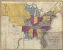
Main Author:
Fenner, Sears and Company
Title/Description:
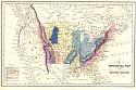
A Geological Map of the United States
Publication Info:
London: I.T. Hinton, Simpkin and Marshall, 1832; from An Atlas of the United States of North America
Viewing Options
Main Author:
Fenner, Sears and Company
Title/Description:
Map of the United States of America
Publication Info:
London: I.T. Hinton, Simpkin and Marshall, 1832; from the History and Topography of the United States, 1830-1832, J.H. Hinton, ed.
Viewing Options
Viewing Options
Viewing Options
Viewing Options
Main Author:
Tanner, Henry Schenck
Title/Description:
United States of America
Publication Info:
Philadelphia: H.S. Tanner, 1832
Viewing Options
Main Author:
Stieler, Adolf
Title/Description:
Der Nordliche Theil der Vereinigten Staten von Nord America
Publication Info:
Gotha: Justus Perthes, 1832; from Stieler's Hand Atlas (No. 47a)
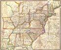
Viewing Options
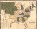
Main Author:
Drayton, J. and J.H. Young
Title/Description:
United States Northern Section
Publication Info:
Philadelphia: Carey & Lea, 1832
Viewing Options
Main Author:
Davenport, Bishop
Title/Description:
United States
Publication Info:
Providence: Hutchens & Shepare, c1832
Viewing Options
Title/Description:
Stati-Uniti Dell' America Settentrionale Dalle Piú Recenti Mappe
Publication Info:
Venice: 1832
Viewing Options
Main Author:
Brue, Adrien Hubert
Title/Description:
Carte Generale des Etats-Unis, des Haut et Bas-Canada
Publication Info:
Paris: 1832; from Atlas Universel de Geographie Physique, Politique et Historique
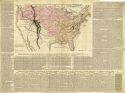
Viewing Options
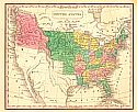
Main Author:
Mitchell, Samuel Augustus
Title/Description:
Mitchell's Travelers' Guide Through the United States
Publication Info:
Philadelphia: S.A. Mitchell, 1832
Viewing Options
Title/Description:
United States
Publication Info:
Glasgow: Archibald Fullarton & Co., 1833
Viewing Options
Main Author:
Mitchell, Samuel Augustus
Title/Description:
Mitchell's Travelers' Guide Through the United States
Publication Info:
Philadelphia: S.A. Mitchell, 1833
Viewing Options
Title/Description:
CARTE Spéciale. Historique et Géographique De La République Des États-Unis De L'Amérique DU NORD.
Publication Info:
Paris: Leclere, 1833; from Atlas Historique, Généalogique, Chronologique et Géographique
Viewing Options
Main Author:
Tanner, Henry Schenck
Title/Description:
Map of the Roads, Canals and Rail Roads of the United States
Publication Info:
Philadelphia: H.S. Tanner, 1834
Viewing Options
Main Author:
Mitchell, Samuel Augustus
Title/Description:
Mitchell's Traveler's Guide through the United States
Publication Info:
Philadelphia: S.A. Mitchell, 1834
Viewing Options
Main Author:
Walker, J. & C.
Title/Description:
North America Indexed Map to Canada and the United States
Publication Info:
London: Baldwin & Cradock, 1834
Viewing Options
Main Author:
Bradford, Thomas Gamaliel
Title/Description:
United States
Publication Info:
Unknown publisher, c1835
Viewing Options
Main Author:
Barber, B.B. and Willard
Title/Description:
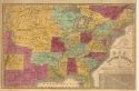
Map of the United States of America
Publication Info:
Hartford: B.B. Barber A. Willard, 1835; Eastern section
Viewing Options
Main Author:
Barber, B.B. and Willard
Title/Description:
Map of the United States of America
Publication Info:
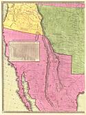
Hartford: B.B. Barber A. Willard, 1835; Western section
Viewing Options
Main Author:
Bradford, Thomas Gamaliel
Title/Description:
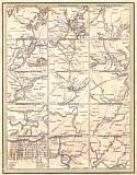
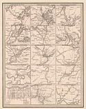
[Maps of the Principal Cities of the United States]
Publication Info:
Boston: American Stationer's Co., 1835
Viewing Options
Main Author:
Young & Delleker
Title/Description:
United States
Publication Info:
Philadelphia: Anthony Finley, c1835; small travel guide map
Viewing Options
Main Author:
Bradford, Thomas Gamaliel
Title/Description:
United States, Exhibiting the Railroads and Canals
Publication Info:
Boston: T.G. Bradford, 1835
Viewing Options
Main Author:
Bradford, Thomas Gamaliel
Title/Description:
[Maps of Various U.S. Cities]
Publication Info:
New York: Wiley & Long, 1835; from Bradford's A Comprehensive Atlas Geographical, Historical & Commercial
Viewing Options
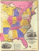
Main Author:
Strong, Ezra
Title/Description:
Map of the United States Corrected from the most Authentic Sources
Publication Info:
New York: Ezra Strong, 1835