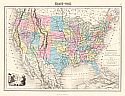
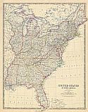
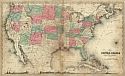
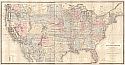
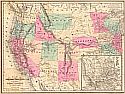
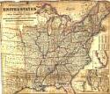
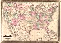
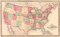
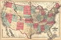
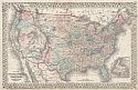
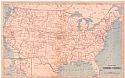
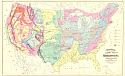
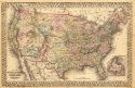
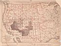
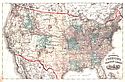
Viewing Options
Main Author:
Colton, G.W. and C.B.
Title/Description:
Coltons New Rail Road and County map of the United States
Publication Info:
New York: G.W. and C.B. Colton, 1864
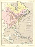
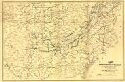
Viewing Options
Main Author:
Perigot, Charles
Title/Description:
Carte de la Partie Orientale de L'Amerique du Nord et des Antilles Apres la Paix de Versailles 1783
Publication Info:
Paris: Charles DeLagrave, 1865; Plate 88 from "Atlas General"; to illustrate the "Histoire de colonies Francaises et Anglaises en Amerique, et a l'historie de la fondation des Ètats-Unis
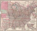
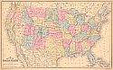
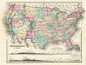
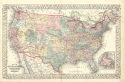
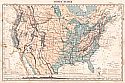
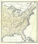
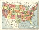
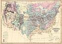
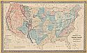
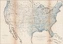
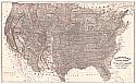
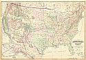
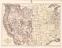
Viewing Options
Main Author:
Johnson, Alvin J.
Title/Description:
Johnson's United States
Publication Info:
New York: A.J. Johnson, c.1865
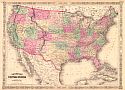
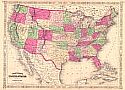
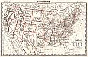
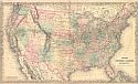
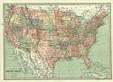
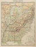
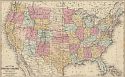
Viewing Options
Main Author:
Johnston, Alexander Keith
Title/Description:
United States of North America (Eastern States)
Publication Info:
Edinburgh: W. and A.K. Johnston, c.1865; from Keith Johnston's General Atlas
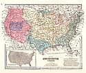
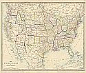
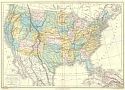
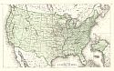
Viewing Options
Main Author:
Cornell, Sarah Sophia
Title/Description:
Map of the United States (VII)
Publication Info:
New York: D. Appleton & Co., c.1865;
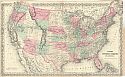
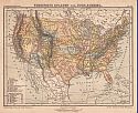
Viewing Options
Main Author:
Young, James H.
Title/Description:
Map of the United States
Publication Info:
Philadelphia: S.A. Mitchell, 1865; Engraved to illustrate Mitchell's New Intermediate Geography
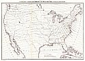
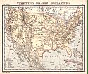
Viewing Options
Main Author:
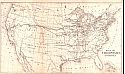
U.S. Coast Survey
Title/Description:
Magnetic Declination - Isogonic Lines for the Year 1870
Publication Info:
Washington D.C: U.S. Coast Survey, 1865
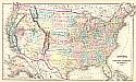
Viewing Options
Main Author:
McNally, Francis
Title/Description:
United States
Publication Info:
New York: A.S. Barnes and Burr, 1865; from An Improved System of Geography
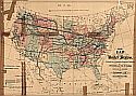
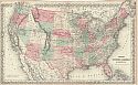
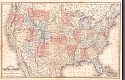
Viewing Options
Main Author:
Bien, Julius
Title/Description:
Map of the United States Military Rail Roads
Publication Info:
New York: Lithography of J. Bien, 1866
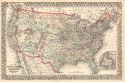
Viewing Options
Main Author:
Colton, G.W. & C.B. Colton
Title/Description:
United States of America
Publication Info:
New York: G.W. & C.B. Colton, c.1866
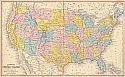
Viewing Options
Main Author:
Johnson, Alvin J.
Title/Description:
Johnson's United States
Publication Info:
New York: A.J. Johnson, 1867
Viewing Options
Main Author:
Wilson, Joseph S.
Title/Description:
Map of the United States and Territories
Publication Info:
Washington: Department of the Interior Land Grant Office, 1867
Viewing Options
Main Author:
Mitchell, Samuel Augustus, Jr.
Title/Description:
Map of the United States and Territories Together with Canada
Publication Info:
Philadelphia: Samuel Augustus Mitchell, Jr., 1867
Viewing Options
Main Author:
Colton, G.W. & C.B.
Title/Description:
Colton's United States of America
Publication Info:
New York: G.W. & C.B. Colton, 1867
Viewing Options
Main Author:
Fitch, George W.
Title/Description:
United States of America (Physical)
Publication Info:
New York: Sheldon and Company, 1867; from Colton's Outlines of Physical Geography
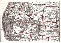
Viewing Options
Main Author:
Colton, G.W. & C.B. Colton
Title/Description:
Map of the Territories and Pacific States
Publication Info:
New York: Hurd & Houghton, 1868; to accompany "Across the Continent" by Samuel Bowles;
Viewing Options
Title/Description:
United States
Publication Info:
New York: Charles Scribner & Co., 1868; from Guyot's Common-School Geography
Viewing Options
Title/Description:
United States
Publication Info:
New York: Charles Scribner & Co., 1868; from Guyot's Common-School Geography
Viewing Options
Main Author:
Waddell, J.H.
Title/Description:
Map of the United States, Constructed on the Rectangular Tangential Projection
Publication Info:
Office of Physical Survey of Virginia, Virginia Military Institute, 1868; prepared under the instructions of M.F. Maury, L.L.D.
Viewing Options
Title/Description:
Section of a Correct Map of the United States showing the Great National Post Routes
Publication Info:
New York: G.W. & C.B. Colton & Co., 1869
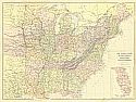
Viewing Options
Main Author:
Chambers, William and Robert
Title/Description:
United States (Sheet 2)
Publication Info:
Philadelphia: J.B. Lipponcott & Co, 1869; from Chambers' Atlas to accompany Chambers' Encyclopaedia
Viewing Options
Main Author:
Chambers, William and Robert
Title/Description:
United States (Sheet 1)
Publication Info:
Philadelphia: J.B. Lipponcott & Co, 1869; from Chambers' Atlas to accompany Chambers' Encyclopaedia
Viewing Options
Title/Description:
North America
Publication Info:
Philadelphia: J.B. Lippincott and Co., 1869; from Atlas to accompany Chamber's Encyclopaedia
Viewing Options
Main Author:
Goddard, Fredrick B.
Title/Description:
[United States]
Publication Info:
Philadelphia: The Peoples Publishing Company, 1869; from Where to Emigrate and Why - Homes and Fortunes in the Boundless West and Sunny South
Viewing Options
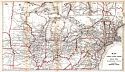
Main Author:
Colton, C.B. and G.W.
Title/Description:
United States of America
Publication Info:
New York: C.B. and G.W. Colton, 1869
Viewing Options
Main Author:
Blackie, W.G.
Title/Description:
The United States of North America. Atlantic States and the Valley of the Mississippi
Publication Info:
Glasgow: Blackie & Son, c.1870
Viewing Options
Main Author:
Johnson, Alvin J.
Title/Description:
Johnson's United States
Publication Info:
New York: A.J. Johnson, 1870
Viewing Options
Main Author:
H.H. Lloyd and Company
Title/Description:
Railroad Map of the United States
Publication Info:
New York: H.H. Lloyd & Co., c.1870
Viewing Options
Main Author:
Bartholomew, John
Title/Description:
United States
Publication Info:
Edinburgh: William Collins, Sons and Co., 1870; from The Advanced Atlas
Viewing Options
Main Author:
Amthor, Ed. & Wilhelm Issleib
Title/Description:
Vereinigte Staaten von Nordamerica
Publication Info:
Fort Wayne: Siemon Bro & Co., 1870; from Volks-Atlast über alle Theile der Erde für Schule und Haus
Viewing Options
Main Author:
S. Augustus Mitchell
Title/Description:
Map of the United States
Publication Info:
Philadelphia: E.H. Butler and Company, 1870; from Mitchell's New School Atlas
Viewing Options
Main Author:
Walling, H.F. and O.W. Gray
Title/Description:
Map of the United States and Territories
Publication Info:
Boston: Stedman, Brown and Lynn, 1871; from Official Topographical Atlas of Massachusetts
Viewing Options
Main Author:
Hitchcock, Charles Henry
Title/Description:
Asher and Adams' Geological Map: United States and Territories
Publication Info:
New York: Asher & Adams, 1872; from and Adam's New Commercial, Topographical and Statistical Atlas of 1872
Viewing Options
Main Author:
Colton, G.W. & C.B. Colton
Title/Description:
Colton's United States of America
Publication Info:
New York: G.W. & C.B. Colton, 1872
Viewing Options
Title/Description:
The United States of North America
Publication Info:
London: Edward Stanford, 1872
Viewing Options
Main Author:
Mitchell, Samuel Augustus
Title/Description:
Map of the United States and Territories Together With Canada
Publication Info:
Philadelphia: S.A. Mitchell, 1872
Viewing Options
Main Author:
Hitchcock, Charles H.
Title/Description:
Gray's Geological Map of the United States
Publication Info:
Philadelphia: O.W. Gray & Son, 1872
Viewing Options
Main Author:
Appleton, D.
Title/Description:
Map of States & Territories, West of Missouri
Publication Info:
New York: D. Appleton and Co., 1872; to accompany Appletons' Hand Book of American Travel, Western Tour
Viewing Options
Main Author:
Appleton, D.
Title/Description:
Map to Accompany Appleton's Hand-Book of American Travel. Western Tour. Section East of Missouri River
Publication Info:
New York: D. Appleton and Co., 1872
Viewing Options
Main Author:
Hall, Mary L.
Title/Description:
Map of the United States
Publication Info:
Boston: Ginn Brothers, 1872; from Our World No. 2 or Second Series of Lessons in Geography
Viewing Options
Main Author:
Schott, Charles A.
Title/Description:
Rain Chart of the United States
Publication Info:
Washington: Department of the Interior, 1872; to accompany the report on the Lands of the Arid Region of the U.S.
Viewing Options
Title/Description:
Vereinigte Staaten von Nord-Amerika
Publication Info:
Braunschweig: Druck und Verlag von George Westermann, 1872; from Dr. H. Lange's Neuer Volksschul - Atlas uber alle Theile der Erde
Viewing Options
Main Author:
Gray, Frank A.
Title/Description:
Gray's Atlas Map of the United States of America
Publication Info:
Philadelphia: Frank A. Gray, 1873
Viewing Options
Main Author:
Hitchcock, Charles H.
Title/Description:
Gray's Atlas Map of the United States Showing Principal Geological Formations
Publication Info:
Philadelphia: O.W. Gray & Son, 1873
Viewing Options
Main Author:
Blodget, Lorin
Title/Description:
Climatological Map of the United States Showing Average Temperature, Amount of Rain Fall, etc.
Publication Info:
Philadelphia: O.W. Gray, 1873; published for a Gray Atlas
Viewing Options
Main Author:
Bartholomew, John
Title/Description:
General Map of the United States
Publication Info:
Philidelphia: T. Ellwood Zell, 1873; from A Descriptive Hand Atlas of the World
Viewing Options
Main Author:
Drioux and Leroy
Title/Description:
Carte Physique et Politique des Etats-Unis, Canada, et partie du Mexique
Publication Info:
Paris: Librarie Classique d'Eugene Belin, 1873; from Atlas Universel et Classique de Geographie
Viewing Options
Main Author:
Mitchell, S. Augustus
Title/Description:
Map of the United States and Territories Together with Canada
Publication Info:
Philadelphia: S. A. Mitchell, 1873; from Mitchell's New General Atlas
Viewing Options
Main Author:
Asher & Adams
Title/Description:
United States and Territories
Publication Info:
New York: Asher & Adams, 1874
Viewing Options
Title/Description:
United States
Publication Info:
New York: Scribner, Armstrong and Company, c.1874; from Guyot's Intermediate Geography
Viewing Options
Main Author:
Mitchell, S. Augustus
Title/Description:
Map of the United States and Territories Together with Cananda, etc.
Publication Info:
Philadelphia: S. Augustus Mitchell, 1874
Viewing Options
Main Author:
Mitchell, S. Augustus
Title/Description:
Statistical Atlas of the United States Based on the Results of the Ninth Census 1870
Publication Info:
Philadelphia: J.H. Butler and Company, 1875; from A System of Modern Geography
Viewing Options
Main Author:
Porter, Thomas C.
Title/Description:
Map of the United States Showing the Principal Botanical Divisions
Publication Info:
Philadelphia: O.W. Gray & Son, 1875
Viewing Options
Main Author:
Cope, Edward D.
Title/Description:
Map of the United States Showing the Principal Zoological Divisions
Publication Info:
Philadelphia: O.W. Gray & Son, 1875
Viewing Options
Main Author:
Wheeler, George M.
Title/Description:
Map of the Areas of Drainage to the Atlantic and Pacific Oceans and of the Interior Basins of the Territory of the United States West of the Mississippi River
Publication Info:
Washington, D.C.: U.S. Department of War, 1875; from Wheeler's Topographical Atlas Projected to Illustrate Geographical Explorations & Surveys West of the 100th Meridian of Longitude, Expeditions of 1869, 1871, 1872, 1873, & 1874
Viewing Options
Main Author:
Wheeler, George M.
Title/Description:
Progress Map of Lines and Areas of Explorations and Surveys Conducted Under the Auspices of the War Department Giving the Area of Public Domain Lying West of the 100th Meridian
Publication Info:
Washington D.C.: U.S. Department of War,1875; from Wheeler's Topographical Atlas Projected to Illustrate Geographical Explorations & Surveys West of the 100th Meridian of Longtitude, Seasons of 1869, 1871, 1872, 1873, & 1874
Viewing Options
Main Author:
Wheeler, George M.
Title/Description:
Map Showing the General Topographical Features of The Territory of the United States West of the Mississippi River
Publication Info:
Washington, D.C.: U.S. Department of War, 1875; from Wheeler's Topographical Atlas Projected to Illustrate Geographical Explorations & Surveys west of the 100th Meridian of Longitude, Seasons of 1869, 1871, 1872, 1873
Viewing Options
Main Author:
Mitchell, S. Augustus
Title/Description:
Map of the United States
Publication Info:
Philadelphia: J.H. Butler and Company, 1875; from A System of Modern Geography
Viewing Options
Title/Description:
Map of the United States
Publication Info:
New York: F.W. Beers and Company, 1875; from the County Atlas of Tioga, Pennsylvania
Viewing Options
Main Author:
Hardesty, H.H.
Title/Description:
New Railroad Map of the United States and Dominion of Canada/
Publication Info:
Chicago: H.H. Hardesty and Company, 1875; from Historical Atlas of the World Illustrated