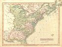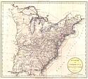
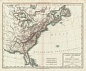
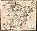
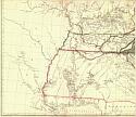
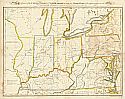
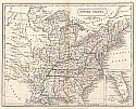
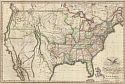
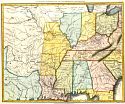
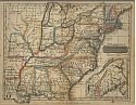
Viewing Options
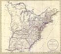
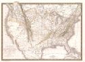
Main Author:
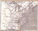
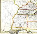
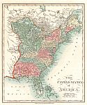
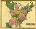
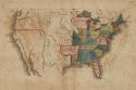
Russell, John C.
Title/Description:
States of America
Publication Info:
London: G.G.J. and J. Robinson and J. Mawman, 1801; for Guthrie's New System of Geography
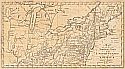
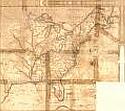
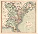
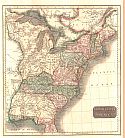
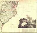
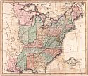
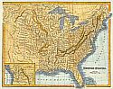
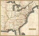
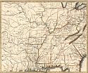
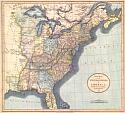
Viewing Options
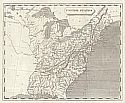
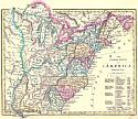
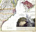
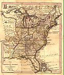
Main Author:
Bradley, Abraham
Title/Description:
Map of the Northern Parts of the United States of America
Publication Info:
Boston: Isaiah Thomas and Ebenezer Andrews, 1802
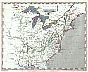
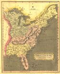
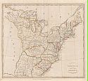
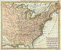
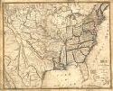
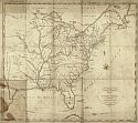
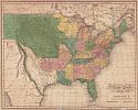
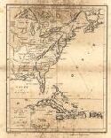
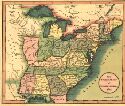
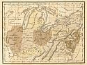
Viewing Options
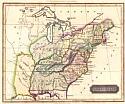
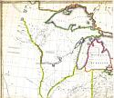
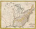
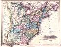
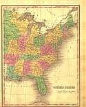
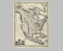
Main Author:
Arrowsmith, Aaron
Title/Description:
United States of North America
Publication Info:
London: Cadell & Davies, Longman and Rees, 1802; from Arrowsmith's large map
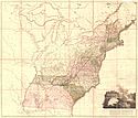
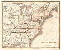
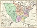
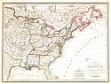
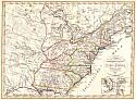
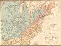
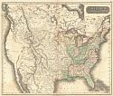
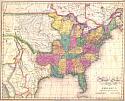
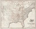
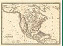
Viewing Options
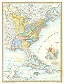
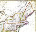
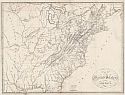
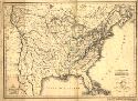
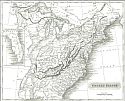
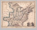
Main Author:
Arrowsmith, Aaron
Title/Description:
Map of the United States of North America
Publication Info:
London: Aaron Arrowsmith, 1802
Viewing Options
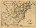
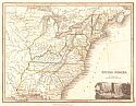
Main Author:
Arrowsmith, Aaron
Title/Description:
United States
Publication Info:
London: Longman, Hurst, Rees & Orme, 1805
Viewing Options
Main Author:
Lewis, Samuel
Title/Description:
United States
Publication Info:
Philadelphia: H.S. Tanner, c.1805
Viewing Options
Main Author:
Lizars, Daniel
Title/Description:
United States
Publication Info:
Edinburgh: Oliver & Boyd, [1806]; for Ewing's General Atlas
Viewing Options
Main Author:
Chamouin, Jean Baptiste Marie
Title/Description:
Etats Unis et Grande Antilles
Publication Info:
Paris: 1806; 18369
Viewing Options
Main Author:
Mentelle, E & PG Chanlaire
Title/Description:
Carte Generale des Ètats-Unis
Publication Info:
Paris: 1806
Viewing Options
Title/Description:
A New Map for the United States of America
Publication Info:
London: John Cary, 1806
Viewing Options
Main Author:
Longman and Company
Title/Description:
United States of America
Publication Info:
London: Longman and Company, 1808
Viewing Options
Main Author:
Djurberg, Daniel
Title/Description:
Karta över Vingandacoa eller Forenta Staterne i Nordamerica
Publication Info:
Stockholm: 1810
Viewing Options
Main Author:
Russell, John C.
Title/Description:
States of America
Publication Info:
London: Wilkie and Robinson, J. Mawman, 1811; from the 7th edition of Guthrie's A System of Modern Geography
Viewing Options
Main Author:
Wilkinson, Robert
Title/Description:
The United States of America
Publication Info:
London: R. Wilkinson, 1812; from his A General Atlas
Viewing Options
Viewing Options
Viewing Options
Viewing Options
Main Author:
Tardieu, Antoine Francois
Title/Description:
Carte des Etats-Unis de L'Amèrique Septentrionale
Publication Info:
Paris: 1812
Viewing Options
Title/Description:
A Map of the United States and Part of Louisiana
Publication Info:
Philadelphia: Johnson and Warner, 1812; from Brook's General Gazetter
Viewing Options
Main Author:
Melish, John
Title/Description:
Map of the United States of America
Publication Info:
Philadelphia: T. and G. Palmer, 1812; from the book Travels in the United States of America
Viewing Options
Main Author:
Darton, William
Title/Description:
The United States of America
Publication Info:
London: William Darton, 1812
Viewing Options
Main Author:
Neele, Samuel John
Title/Description:
United States
Publication Info:
London: S. & G. Neele, 1813
Viewing Options
Main Author:
Lapie, Pierre
Title/Description:
Carte des Ètats-Unis, dressèe par P. Lapie, geographe, directeur du cabinet topographique du roi, 1814
Publication Info:
[S.1: s.n.; 1814]
Viewing Options
Main Author:
Carey, Mathew
Title/Description:
Map of the United States of America
Publication Info:
Philadelphia: Mathew Carey, 1814
Viewing Options
Main Author:
Carey, Mathew
Title/Description:
United States
Publication Info:
Philadelphia: Mathew Carey, 1814; from Carey's American Pocket Atlas
Viewing Options
Main Author:
Thomson, John
Title/Description:
United States of America
Publication Info:
Edinburgh: John Thomson, 1814
Viewing Options
Main Author:
Herisson, Eustache
Title/Description:
Les Etats Unis de L'Amerique
Publication Info:
Paris: Pierre Claude Boiste, c1816; p. 48 from a French atlas
Viewing Options
Title/Description:
Etats-Unis de L'Amèrique Septentrionale
Publication Info:
Paris: 1816
Viewing Options
Main Author:
Lucas, Fielding
Title/Description:
United States
Publication Info:
Baltimore: Fielding Lucas, Jr., 1817?
Viewing Options
Main Author:
Walch, Johannes
Title/Description:
Karte Der Vereinigten Staaten Von Nord America
Publication Info:
Augsburg: Joh Walch [c1817]
Viewing Options
Viewing Options
Viewing Options
Viewing Options
Main Author:
Melish, John
Title/Description:
Map of the United States of America
Publication Info:
Philadelphia: John Melish, [1817]

Viewing Options
Main Author:
Arrowsmith, Aaron
Title/Description:
United States
Publication Info:
Edinburgh: Archibald Constable & Co., 1817; 01335
Viewing Options
Main Author:
Darby, William
Title/Description:
A Map of the United States including Louisiana
Publication Info:
New York: Kirk & Marcein, 1818
Viewing Options
Main Author:
Gussefeld, F.L.
Title/Description:
Charte von den Vereinigten Staaten von Nord America mit Luisana
Publication Info:
Prag: 1818
Viewing Options
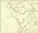
Main Author:
Taylor, John
Title/Description:
Map of Part of the United States of North America with the Territory of Illinois on the Ohio Porticularly Designed to Illustrate Birkbeck's Journey
Publication Info:
Dublin: Thomas Larkin, 1818
Viewing Options
Main Author:
Lizars, W. & D.
Title/Description:
United States of America
Publication Info:
Edinburgh: W.& D. Lizars, 1818; Drawn & Engraved for Wardens Statistical Account
Orginal Source:
Courtesy of Whitney Telle, Northport, Alabama
Viewing Options
Main Author:
Darby, William
Title/Description:
Map of the United States including Louisiana
Publication Info:
New York: 1818; from The Emigrant's Guide
Viewing Options
Main Author:
Melish, John
Title/Description:
Map of the United States of America Designed to Illustrate the Geological Memoir of Wm. McClure, Esqur.
Publication Info:
Philadelphia: A. Small, 1818
Orginal Source:
Courtesy of Tom McMillan; Brewton, Alabama
Viewing Options
Main Author:
Butler, Samuel
Title/Description:
United States
Publication Info:
London: Longman and Company, 1820; from an Atlas of Modern Geography
Viewing Options
Title/Description:
United States
Publication Info:
Glasgow: Blackie, Fullarton & Co., 1820
Viewing Options
Main Author:
Melish, John
Title/Description:
United States of America Compiled from the Latest & Best Authorities
Publication Info:
Philadelphia: Mathew Carey & Son, 1820
Orginal Source:
Courtesy of Whitney Telle, Northport, Alabama
Viewing Options
Main Author:
Thomson, John
Title/Description:
United States and Additions
Publication Info:
Edinburgh: John Thomson, Jr. & Co., 1820; from Thomas's New General Atlas
Viewing Options
Title/Description:
United States of America
Publication Info:
Philadelphia: B. Warner, 1820
Viewing Options
Title/Description:
United States
Publication Info:
unknown
Orginal Source:
Courtesy of Tom McMillan; Brewton, Alabama
Viewing Options
Main Author:
unknown author
Title/Description:
Carte de Ètats-Unis et des Fles du Golfe du Mexique
Publication Info:
unknown publication
Viewing Options
Main Author:
Melish, John
Title/Description:
United States of America
Publication Info:
Philadelphia: Mathew Carey & Son, 1821; from Lavoisne's A Complete Geneological, Historical, and Geographical Atlas of 1821
Viewing Options
Main Author:
Neele and Son
Title/Description:
Countries Bordering on the Mississippi and Missouri
Publication Info:
London: Sir Richard Phillips and Co., 1821
Viewing Options
Main Author:
Phillips, Richard
Title/Description:
Countries Bordering on the Mississippi and Missouri
Publication Info:
London: Sir Richard Phillips and Co., 1821; Vol III No. V
Orginal Source:
Courtesy of Tom McMillan, Brewton, Alabama
Viewing Options
Main Author:
Laurie, R.H.
Title/Description:
The United States of North America, 1822
Publication Info:
London: R.H. Laurie, 1822
Viewing Options
Main Author:
Melish, John
Title/Description:
United States of America
Publication Info:
Philadelphia: John Melish, c.1822
Viewing Options
Title/Description:
[United States]
Publication Info:
Providence: Miller and Hutchins, 1822; Plate II of Geography for Schools Atlas of Forty Luminous and Consise Maps
Viewing Options
Main Author:
Young and Delleker
Title/Description:
United States
Publication Info:
Philadelphia: Anthony Finley, [c1823]
Viewing Options
Main Author:
Arrowsmith, Aaron
Title/Description:
United States
Publication Info:
Edinburgh: A. Constable and Co., 1823
Viewing Options
Title/Description:
United States
Publication Info:
Edinburgh: John Thomson, c1824; from A General Atlas
Viewing Options
Main Author:
Woodbridge, William C.
Title/Description:
The United States of America
Publication Info:
Hartford: Oliver D. Cook and Sons, 1824
Viewing Options
Title/Description:
A New Map of the United States of America
Publication Info:
London: John Cary, 1825; from his New Universal Atlas of 1824
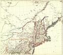
Viewing Options
Title/Description:
(East Central United States)
Publication Info:
Boston: Russell, Odiorne & Co., 1825
Viewing Options
Main Author:
Bruè, Adrien Hubert
Title/Description:
Carte de L'Amerique Septentrionale
Publication Info:
Paris: 1825
Viewing Options
Main Author:
Bue, Adrien Hubert
Title/Description:
Carte Generale des Etats Unis du Canada
Publication Info:
Paris: 1825
Viewing Options
Main Author:
Hewitt, N.R.
Title/Description:
North America
Publication Info:
Edinburgh: John Thomason and Company, c.1825; from the Edinburgh School Atlas
Original Source:
Univeristy of Alabama Map Library
Viewing Options
Main Author:
Hewitt, N.R.
Title/Description:
United States of America
Publication Info:
Edinburgh: John Thomason and Company, c.1825; from the Edinburgh School Atlas
Original Source:
Univeristy of Alabama Map Library