Viewing Options
Main Author:
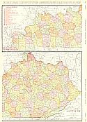
Rand McNally & Company
Title/Description:
Kentucky
Publication Info:
Chicago: Rand McNally & Co., 1911; from Rand McNally and Co.'s Indexed Atlas
Viewing Options
Main Author:
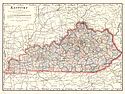
Cram, George F.
Title/Description:
Kentucky
Publication Info:
Chicago: George F. Cram, 1911; from Cram's Unrivaled Atlas of the World
Viewing Options
Main Author:
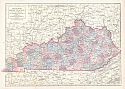
Ravenstein, E.G.
Title/Description:
Kentucky
Publication Info:
Chicago: The Reilly and Britton Company, 1911; from The New Census Atlas of the World
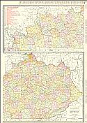
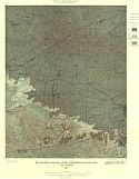
Viewing Options
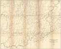
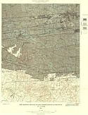
Main Author:
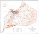
U.S. Department of the Interior, U.S. Geological Survey
Title/Description:
Topography of Jefferson County, Kentucky
Publication Info:
Washington: U.S. Department of the Interior, Geological Survey, 1912
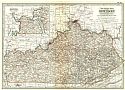
Viewing Options
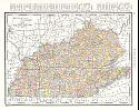
Main Author:
Rand McNally & Company
Title/Description:
Rand McNally and Co.'s New Commercial Atlas of Kentucky
Publication Info:
Chicago: Rand McNally & Co., 1912; from Rand McNally and Co.'s Library Atlas of the World
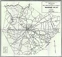
Viewing Options
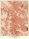
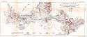
Main Author:
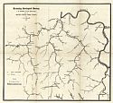
Jillson, Willard R.
Title/Description:
Sketch Map Showing Oil and Gas Development in Warren, KY
Publication Info:
Frankfort: Department of Geology and Forestry, 1912
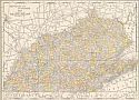
Viewing Options
Main Author:
Rand McNally and Company
Title/Description:
Kentucky and Tennessee
Publication Info:
Chicago: Rand McNally and Company, 1912; from The Rand McNally Imperial Atlas of the World
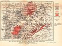
Viewing Options
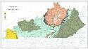
Main Author:
U.S. Geological Survey
Title/Description:
Map of Kentucky and Tennessee Showing Limestone Formations
Publication Info:
Washington: Department of the Interior, U.S. Geological Survey, 1912; Bulletin 522 Plate VIII

Viewing Options
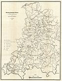
Main Author:
U.S. Geological Survey
Title/Description:
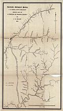
Sketch Map of Knox County, Kentucky showing Location of Oil and Gas Pools
Publication Info:
Washington: Department of the Interior, U.S. Geological Survey, 1912; Bulletin 471 Plate IV
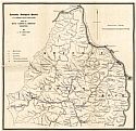
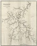
Viewing Options
Main Author:
Sellier, L.M.
Title/Description:
Map of Upper Big Sandy Valley (Sheet 2)
Publication Info:
Frankfort: Kentucky Geological Survey, 1913
Viewing Options
Main Author:
Sellier, L.M.
Title/Description:
Sketch Map of a Portion of Rowan County
Publication Info:
Frankfort: Kentucky Geological Survey, 1913
Viewing Options
Main Author:
Sellier, L.M.
Title/Description:
Map of Pond & Blackberry Creeks
Publication Info:
Frankfort: Kentucky Geological Survey, 1913
Viewing Options
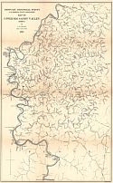
Main Author:
Sellier, L.M.
Title/Description:
Map of Upper Licking Valley
Publication Info:
Frankfort: Kentucky Geological Survey, 1913
Viewing Options
Main Author:
Sellier, L.M.
Title/Description:
Map of Upper Big Sandy Valley (Sheet 1)
Publication Info:
Frankfort: Kentucky Geological Survey, 1913
Viewing Options
Main Author:
Sellier, L.M.
Title/Description:
Map of Boyd, Carter, & Greenup Counties
Publication Info:
Frankfort: Kentucky Geological Survey
Viewing Options
Main Author:
Sellier, L.M.
Title/Description:
Map of Upper Big Sandy Valley (Sheet 3)
Publication Info:
Frankfort: Kentucky Geological Survey, 1913
Viewing Options
Main Author:
Sellier, L.M.
Title/Description:
Map of Upper Big Sandy Valley (Sheet 4)
Publication Info:
Frankfort: Kentucky Geological Survey, 1913
Viewing Options
Main Author:
Sellier, L.M.
Title/Description:
Map of Georgetown Quadrangle
Publication Info:
Frankfort: Kentucky Geological Survey, 1913
Viewing Options
Main Author:
The Century Company
Title/Description:
Kentucky
Publication Info:
New York: The Century Company, 1913; from The Century Atlas of the World
Viewing Options
Main Author:
Sellier, L.M.
Title/Description:
Map of Leatherwood Creek, Perry County
Publication Info:
Frankfort: Kentucky Geological Survey, 1913; Series 4, Vol. 2, Part 2
Viewing Options
Main Author:
Rand McNally & Company
Title/Description:
Rand McNally and Co.'s New Map of Kentucky and Tennessee
Publication Info:
Chicago: Rand McNally & Co., 1914; from Rand McNally and Co.'s Atlas of the World
Viewing Options
Main Author:
Sellier, L.M.
Title/Description:
Map of Macies Creek, Perry County
Publication Info:
Frankfort: Kentucky Geological Survey, 1914; Series 4, Vol. 2, Part 2
Viewing Options
Main Author:
Sellier, L.M.
Title/Description:
Map of Nolin River District
Publication Info:
Frankfort: Kentucky Geological Survey, 1914; Series 4, Vol. 2, Part 1
Viewing Options
Main Author:
Sellier, L.M.
Title/Description:
Goose Creek and Tributaries
Publication Info:
Frankfort: Kentucky Geological Survey, 1914; Series 4, Vol. 2, Part 2
Viewing Options
Main Author:
Sellier, L.M.
Title/Description:
Map Showing Geology of the Earlington Quadrangle
Publication Info:
Frankfort: Kentucky Geological Survey, 1914
Viewing Options
Main Author:
Sellier, L.M.
Title/Description:
Map Showing Geology of the Dawson Springs Quadrangle
Publication Info:
Frankfort: Geological Survey of Kentucky, 1914
Viewing Options
Main Author:
Reynolds, Francis J.
Title/Description:
Kentucky and Tennessee
Publication Info:
New York: P.F. Collier and Son, 1914; from The New Encyclopedic Atlas and Gazetteer of the World
Viewing Options
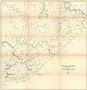
Main Author:
U.S. Geological Survey
Title/Description:
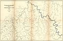
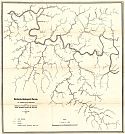
Sketch Map of a Portion of Little South Fork Oil District, Wayne County, Kentucky
Publication Info:
Washington: Department of the Interior, U.S. Geological Survey, 1914; Bulletin 579 Plate VI

Viewing Options
Main Author:
U.S. Geological Survey
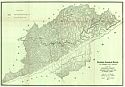
Title/Description:
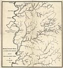
Farm Line Map of the Southern Part of Wayne and McCreary Counties, Kentucky
Publication Info:
Washington: Department of the Interior, U.S. Geological Survey, 1914; Bulletin 579 Plate V
Viewing Options
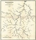
Main Author:
Sellier, L.M.
Title/Description:
Preliminary Map of Kentucky
Publication Info:
Baltimore: A. Hoen and Company, 1915
Viewing Options
Main Author:
Sellier, L.M.
Title/Description:
Map of Drainage of North Fork of Kentucky River, Between Hazard and Krypton
Publication Info:
Frankfort: Kentucky Geological Survey, 1915; Series 4, Vol. 2, Part 2
Viewing Options
Main Author:
Sellier, L.M.
Title/Description:
Map of Letcher County Showing Fire-Clay and Elkhorn Coals
Publication Info:
Frankfort: Geological Survey of Kentucky, 1915; series 4, Vol. 4, Part 1
Viewing Options
Main Author:
Sellier, L.M.
Title/Description:
Map of Letcher County
Publication Info:
Frankfort: Geological Survey of Kentucky, 1915; series 4, Vol. 4, Part 1
Viewing Options
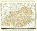
Main Author:
Rand McNally and Company
Title/Description:
Kentucky and Tennessee
Publication Info:
Chicago: Rand McNally and Company, 1915; from the International Atlas of the World