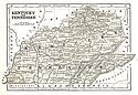
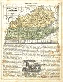
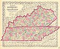
Viewing Options
Main Author:
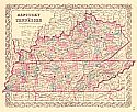
Morse, Sidney E.
Title/Description:
Kentucky and Tennessee
Publication Info:
New York: Harper and Brothers 1851; from Morse's School Geography
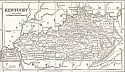
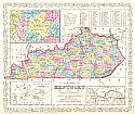
Viewing Options
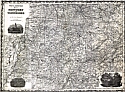
Main Author:
Phelps, Fanning and Company
Title/Description:
Kentucky
Publication Info:
New York: Phelps, Fanning and Company, 1853; from Fanning's Illustrated Gazetteer of the United States
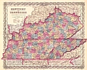
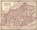
Viewing Options
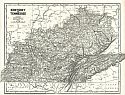
Main Author:
Colton, Joseph Hutchins
Title/Description:
Tennessee and Kentucky
Publication Info:
New York: J.H. Colton & Co., 1853
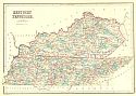
Viewing Options
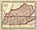
Main Author:
Black, Adam and Charles
Title/Description:
Kentucky and Tennessee
Publication Info:
Edinburgh: A and C Adams, 1854; from the General Atlas of the World by Hall and Hughes
Viewing Options
Main Author:
Mitchell, Samuel Augustus
Title/Description:
Kentucky and Tennessee
Publication Info:
Philadelphia: Samuel Augustus Mitchell, 1854; from Descriptive Geography
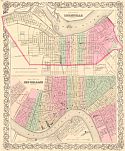
Viewing Options
Main Author:
Colton, Joseph Hutchins
Title/Description:
The City of Louisville, Kentucky [and] The City of New Orleans, Louisiana
Publication Info:
New York: J.H. Colton, 1855;
Viewing Options
Main Author:
Colton, Joseph Hutchins
Title/Description:
Kentucky and Tennessee
Publication Info:
New York: J.H. Colton & Co, [1855]. From Colton's Atlas of the World
Viewing Options
Main Author:
Desilver, Charles
Title/Description:
A New Map of Kentucky with Roads and Distances
Publication Info:
Philadelphia: Charles Desilver, [1857]
Viewing Options
Main Author:
Colton, Joseph Hutchins
Title/Description:
Kentucky and Tennessee
Publication Info:
New York: J.H. Colton & Co., 1856
Viewing Options
Main Author:
Desilver, Charles
Title/Description:
A New Map of Kentucky with Its Roads and Distances from Place to Place Along the Stage and Steamboat Routes
Publication Info:
Philadelphia: Charles Desilver, 1857
Viewing Options
Main Author:
Geological Survey of Kentucky
Title/Description:
Hopkins County
Publication Info:
Frankfort: Geological Survey of Kentucky, 1857
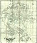
Viewing Options
Title/Description:
Map No. 1 Exhibiting The Topographical and Geological Features of Union and Part of Crittenden Counties
Publication Info:
Frankfort: Geological Survey of Kentucky, 1857
Viewing Options
Main Author:
Colton, Joseph Hutchins
Title/Description:
Kentucky and Tennessee
Publication Info:
New York: J.H. Colton, 1859
Viewing Options
Main Author:
West and Johnson
Title/Description:
West and Johnston's Map of Kentucky and Tennessee
Publication Info:
Richmond: West and Johnston [c. 1860]
Viewing Options
Main Author:
Morse, Sidney E.
Title/Description:
Kentucky and Tennessee
Publication Info:
New York: Morse and Breese, c. 1860
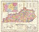
Viewing Options
Main Author:
Mitchell, Samuel Augustus
Title/Description:
County Map of Kentucky and Tennessee
Publication Info:
Philadelphia: S.A. Mitchell, 1860