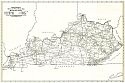
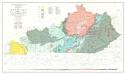
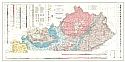
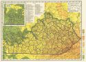
Viewing Options
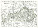
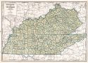
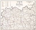
Main Author:
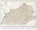
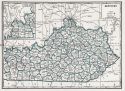
Rand McNally and Company
Title/Description:
Kentucky
Publication Info:
Chicago: Rand McNally and Company, 1921; from the Commercial Atlas of America
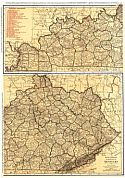
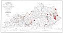
Viewing Options
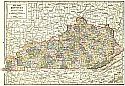
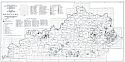
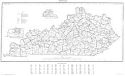
Main Author:
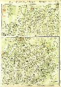
Rand McNally and Company
Title/Description:
Kentucky- Black and White Mileage Chart
Publication Info:
Chicago: Rand McNally and Company, 1921; from the Commercial Atlas of America
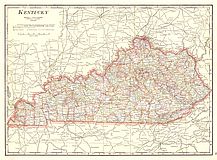
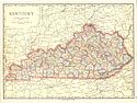
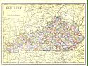
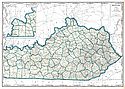
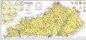
Viewing Options
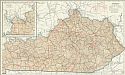
Main Author:
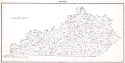
Cram, George F.
Title/Description:
Kentucky
Publication Info:
Chicago: George F. Cram Company, 1921; from Cram's Unrivaled Atlas of the World
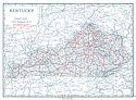
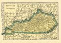
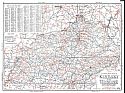
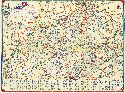
Viewing Options
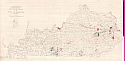
Main Author:
National Map Company
Title/Description:
Kentucky
Publication Info:
Indianapolis: National Map Company, 1921; from Auto Trails and Commercial Survey of the United States
Viewing Options
Main Author:
National Map Company
Title/Description:
Kentucky
Publication Info:
Indianapolis: National Map Company, 1921; from Auto Trails and Commercial Survey of the United States
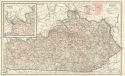
Viewing Options
Main Author:
The Geographical Publishing Co.
Title/Description:
Kentucky
Publication Info:
Chicago: The Geographical Publishing Co., 1922; from New International Atlas of the World
Viewing Options
Main Author:
C.S. Hammond and Company
Title/Description:
Kentucky
Publication Info:
New York: C.S. Hammond and Company, 1922; from the New World Loose-leaf Atlas
Viewing Options
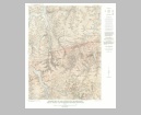
Main Author:
U.S. Geological Survey
Title/Description:
Oil and Gas Fields of the State of Kentucky
Publication Info:
Washington: Department of the Interior, U.S. Geological Survey, 1922
Viewing Options
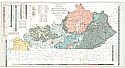
Main Author:
Jillson, Willard Rouse
Title/Description:
Geologic Map of Kentucky Showing Oil and Gas Pools and Pipelines and the Eastern and Western Coalfields
Publication Info:
Kentucky Geological Survey, 1923
Viewing Options
Main Author:
Cram, George F.
Title/Description:
Kentucky
Publication Info:
Chicago: George F. Cram Company, 1923; from Cram's Unrivaled Atlas of the World
Viewing Options
Main Author:
Funk and Wagnalls Company
Title/Description:
Kentucky
Publication Info:
New York: Funk and Wagnalls Company, 1923; from Atlas of the World and Gazetteer
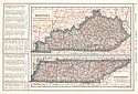
Viewing Options
Main Author:
Reynolds, Francis J.
Title/Description:
Kentucky, Tennessee
Publication Info:
New York: P.F. Collier and Son Company, 1924; from The New World Atlas and Gazetteer
Viewing Options
Main Author:
Rand McNally and Company
Title/Description:
Kentucky and Tennessee
Publication Info:
Chicago: Rand McNally and Company, 1925; from Premier Atlas of the World
Viewing Options
Main Author:
Jillson, Willard Rouse
Title/Description:
Geologic Map of Kentucky Showing Oil and Gas Pools and Pipelines, Fluorspar and Rock Asphalt Deposits, and the Eastern and Western Coal Fields
Publication Info:
Lexington: Kentucky Geological Survey, 1927
Viewing Options
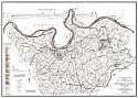
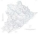
Title/Description:
Structural Geological Map of Henderson County, Kentucky
Publication Info:
Frankfort: Kentucky Geological Survey, 1927
Viewing Options
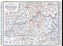
Main Author:
Clason Map Company
Title/Description:
Best Roads of Kentucky
Publication Info:
Chicago: Clason Map Company, c. 1927; from Clason's Touring Atlas
Viewing Options
Main Author:
Jillson, Willard Rouse
Title/Description:
Geological Map of Kentucky
Publication Info:
Kentucky Geological Survey, 1929
Viewing Options
Main Author:
National Map Company
Title/Description:
Kentucky
Publication Info:
Indianapolis: National Map Company, 1930; from Official Paved Road and Commercial Survey of the United States
Viewing Options
Main Author:
Clason Map Company
Title/Description:
Clason's Road Map of Kentucky and Tennessee
Publication Info:
Denver: The Clason Map Company, 1930; from Clason's Touring Atlas of the United States and Canada
Viewing Options
Main Author:
C.S. Hammond and Company
Title/Description:
Kentucky
Publication Info:
New York: C.S. Hammond and Company, c. 1930; from The New World Loose Leaf Atlas, Sixth Edition
Viewing Options
Main Author:
C.S. Hammond and Company
Title/Description:
Kentucky
Publication Info:
New York: C.S. Hammond and Company, c. 1930; from The New World Loose Leaf Atlas, Sixth Edition
Viewing Options
Main Author:
Jillson, Willard Rouse
Title/Description:
Structural Geologic Map of Kentucky
Publication Info:
Lexington: Kentucky Geological Survey, 1931
Viewing Options
Main Author:
Geographical Publishing Company
Title/Description:
Kentucky
Publication Info:
Chicago: Geographical Publishing Company1931; from Commercial Atlas of the World
Viewing Options
Main Author:
Gulf Refining Company
Title/Description:
1935 Official Road Map, Kentucky and Tennessee
Publication Info:
Chicago: Rand McNally and Company, 1935
Original Source:
Murray Hudson
Viewing Options
Main Author:
Branom, Frederick K. and Lloyd Edwin Smith
Title/Description:
Kentucky
Publication Info:
Chicago: Geographical Publishing Company, 1936; from Capper's 1936 Atlas of the World
Viewing Options
Main Author:
Rand McNally and Company
Title/Description:
Standard Map of Kentucky
Publication Info:
Chicago: Rand McNally and Company, 1936
Viewing Options
Main Author:
U.S. Geological Survey
Title/Description:
Map Showing Known coal localities and outcrops of coal beds in Pike County, Kentucky
Publication Info:
Washington, D.C: Department of the Interior, US Geological Survey, 1937; Bulletin 876, Plate 48
Viewing Options
Main Author:
U.S. Department of Commerce, Bureau of the Census
Title/Description:
Kentucky, Minor Civil Divisions for the 1930 Census
Publication Info:
Washington: U.S. Government Printing Office, 1938
Viewing Options
Main Author:
Geographical Publishing Company
Title/Description:
Kentucky and Tennessee
Publication Info:
Chicago: Geographical Publishing Company, 1942; from The New International Atlas of the World, War Edition
Viewing Options
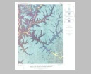
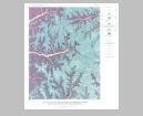
Title/Description:
Preliminary Oil and Gas Map of Kentucky
Publication Info:
Lexington: Kentucky Geological Survey, 1949
Viewing Options
Main Author:
The Department of Highways
Title/Description:
Official Kentucky Road Map
Publication Info:
Frankfort: Kentucky Department of Highways, 1950
Viewing Options
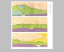
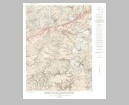
Main Author:
U.S. Geological Survey
Title/Description:
Geologic Map and Sections of the Senator-Schwenck Area, Tabb Fault System, Caldwell County, Kentucky
Publication Info:
Washington: Department of the Interior, U.S. Geological Survey, 1954; Bulletin 1012 Plate 18
Viewing Options
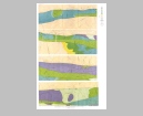
Main Author:
U.S. Geological Survey
Title/Description:
Geologic Map of the Northeastern Part of the Moore Hill Fault System, Crittenden and Livingston Counties, Kentucky
Publication Info:
Washington: Department of the Interior, U.S. Geological Survey, 1954; Bulletin 1012 Plate 12
Viewing Options
Main Author:
U.S. Geological Survey
Title/Description:
Geologic Map and Sections of the Mineral Ridge Area, Crittenden and Livingston Counties, Kentucky
Publication Info:
Washington: Department of the Interior, U.S. Geological Survey, 1954; Bulletin 1012 Plate 7
Viewing Options
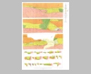
Main Author:
U.S. Geological Survey
Title/Description:
Geologic Map and Sections of the Central Part of the Commodore Fault System, Crittenden County, Kentucky
Publication Info:
Washington: Department of the Interior, U.S. Geological Survey, 1954; Bulletin 1012 Plate 6
Viewing Options
Main Author:
U.S. Geological Survey
Title/Description:
Geologic Map of the Southwestern Part of the Moore Hill Fault System, Crittenden and Livingston Counties, Kentucky
Publication Info:
Washington: Department of the Interior, U.S. Geological Survey, 1954; Bulletin 1012 Plate 11
Viewing Options
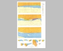
Main Author:
U.S. Geological Survey
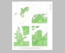
Title/Description:
Maps Showing Thickness of Fire Clay, Cannel City, Little Caney, and Grassy Coal Beds in the Cannel City Quadrangle, Morgan, Wolfe, and Magoffin Counties, Kentucky
Publication Info:
Washington: Department of the Interior, U.S. Geological Survey, 1955; Bulletin 1020-A Plate 4
Viewing Options
Main Author:
U.S. Geological Survey
Title/Description:
Geologic Map of the Cannel City Quadrangle, Morgan, Wolfe, and Magoffin Counties, Kentucky
Publication Info:
Washington: Department of the Interior, U.S. Geological Survey, 1955; Bulletin 1020-A Plate 1
Viewing Options
Main Author:
U.S. Geological Survey
Title/Description:
Geologic Map of the White Oak Quadrangle, McGoffin and Morgan Counties, Kentucky
Publication Info:
Washington: Department of the Interior, U.S. Geological Survey, 1957; Bulletin 1047-A Plate 1

Viewing Options
Main Author:
U.S. Geological Survey
Title/Description:
Geologic Map of the Big Four Fault System, Crittenden County, Kentucky
Publication Info:
Washington: Department of the Interior, U.S. Geological Survey, 1958; Bulletin 1042-P Plate 61
Viewing Options
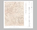
Main Author:
U.S. Geological Survey
Title/Description:
Geologic Map of the TipTop Quadrangle, Kentucky
Publication Info:
Washington: Department of the Interior, U.S. Geological Survey, 1958; Bulletin 1042-P Plate 51
Viewing Options
Main Author:
Rose, William D.
Title/Description:
Coal Mine Map of Western Kentucky
Publication Info:
Lexington: Kentucky Geological Survey, 1959
Viewing Options
Main Author:
U.S. Department of Commerce, Bureau of the Census
Title/Description:
Kentucky, Census County Divisions
Publication Info:
Washington: U.S. Government Printing Office, 1961
Viewing Options
Main Author:
U.S. Geological Survey
Title/Description:
Geologic Map of the Wrigley Quadrangle, Rowan, Morgan, and Elliott Counties, Kentucky
Publication Info:
Washington: Department of the Interior, U.S. Geological Survey, 1962; Bulletin 1122-F Plate 3
Viewing Options
Main Author:
U.S. Geological Survey
Title/Description:
Geologic Map of the Haldeman Quadrangle, Carter, Rowan, and Elliott Counties, Kentucky
Publication Info:
Washington: Department of the Interior, U.S. Geological Survey, 1962; Bulletin 1122-F Plate 2
Viewing Options
Main Author:
U.S. Geological Survey
Title/Description:
Geologic Map of the Salyersville North Quadrangle, Magoffin, Morgan, and Johnson Counties, Kentucky
Publication Info:
Washington: Department of the Interior, U.S. Geological Survey, 1963; Bulletin 1047-B Plate 5
Viewing Options
Main Author:
U.S. Geological Survey
Title/Description:
Geologic Map and Section of the Ewing Quadrangle, Kentucky and Virginia
Publication Info:
Washington: Department of the Interior, U.S. Geological Survey, 1963; Bulletin 1142-B Plate 1