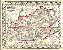
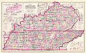
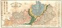
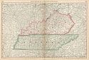
Viewing Options
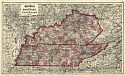
Main Author:
Mitchell, Samuel Augustus
Title/Description:
County Map of Kentucky and Tennessee
Publication Info:
Philadelphia: S.A. Mitchell, 1871
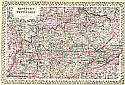
Viewing Options
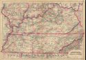
Main Author:
Asher & Adams
Title/Description:
Asher and Adams Kentucky and Tennessee
Publication Info:
New York: Asher & Adams, 1872
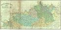
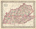
Viewing Options
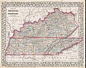
Main Author:
Gray, Ormando W.
Title/Description:
Gray's Atlas Map of Kentucky and Tennessee
Publication Info:
Philadelphia: O.W. Gray & Son, 1873
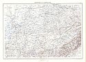
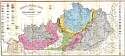
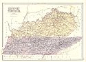
Viewing Options
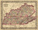
Title/Description:
Kentucky and Tennessee
Publication Info:
Philadelphia: Stedman, Brown and Lyon, 1873; from Gray's Atlas of the World, Accompanied by Descriptions Geographical, Historical, Scientific and Statistical
Viewing Options
Main Author:
Asher & Adams
Title/Description:
Asher and Adams' Kentucky and Tennessee
Publication Info:
New York: Asher and Adams, 1873
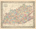
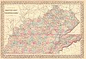
Viewing Options
Main Author:
Mitchell, S. Augustus
Title/Description:
County Map of Kentucky and Tennessee
Publication Info:
Philadelphia: S. Augustus Mitchell, 1873; from Mitchell's New General Atlas
Viewing Options
Main Author:
Mitchell, S. Augustus
Title/Description:
County Map of Kentucky and Tennessee
Publication Info:
Philadelphia: S. A. Mitchell,1873; from Mitchell's New General Atlas
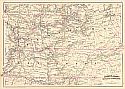
Viewing Options
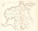
Main Author:
Norwood, Charles J.
Title/Description:
Map Embracing the Lead Region of South West Kentucky
Publication Info:
Frankfort: Geological Survey of Kentucky, 1874
Viewing Options
Main Author:
Kentucky Geological Survey
Title/Description:
Kentucky Geological Survey Preliminary Map
Publication Info:
Boston: A. Meisel, 1875
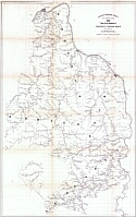
Viewing Options
Main Author:
Kentucky Geological Survey
Title/Description:
Map of the Counties of Greenup, Carter, Boyd, and a part of Lawrence
Publication Info:
Boston: A. Meisel, 1876
Viewing Options
Main Author:
Gray, Frank A.
Title/Description:
Gray's New Map of Kentucky and Tennessee
Publication Info:
Philadelphia: O.W. Gray & Son, 1876
Viewing Options
Main Author:
Gray, Frank A.
Title/Description:
Gray's New Map of Kentucky and Tennessee
Publication Info:
Philadelphia: O.W. Gray & Son, 1876
Viewing Options
Main Author:
Mitchell, Samuel Augustus
Title/Description:
Kentucky and Tennessee
Publication Info:
Philadelphia: S.A. Mitchell, Jr., 1876
Viewing Options
Main Author:
Trourelot, L.
Title/Description:
Preliminary Map to Illustrate the Drainage Basins of the Commonwealth
Publication Info:
Frankfort: Geological Survey of Kentucky, 1877
Viewing Options
Main Author:
Leslie, Joseph
Title/Description:
Reconnaissance of a baseline for the Eastern Kentucky Coal Field
Publication Info:
Frankfort: Geological Survey of Kentucky, 1877
Viewing Options
Main Author:
Shaler, N.S.
Title/Description:
Preliminary Map [of Kentucky]
Publication Info:
Frankfort: Geological Survey of Kentucky, 1877
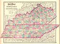
Viewing Options
Main Author:
Mitchell, Samuel Augustus
Title/Description:
County Map of Kentucky and Tennessee
Publication Info:
Philadelphia: Samuel Augustus Mitchelle,1877
Viewing Options
Main Author:
Mitchell, Samuel Augustus
Title/Description:
County Map of Kentucky and Tennessee
Publication Info:
Philadelphia: Samuel Augustus Mitchell, 1878
Viewing Options
Main Author:
Black, A. and C.
Title/Description:
Kentucky and Tennessee
Publication Info:
Edinburgh: A. and C. Black, 1879
Viewing Options
Main Author:
Rand McNally and Company
Title/Description:
Kentucky and Tennessee
Publication Info:
Chicago: Rand McNally and Company, 1879
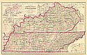
Viewing Options
Main Author:
Gamble, W.H.
Title/Description:
County Map of Kentucky and Tennessee
Publication Info:
Philadelphia: Samuel Augustus Mitchell, 1880