Viewing Options
Main Author:
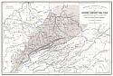
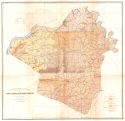
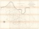
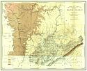
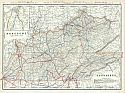
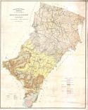
Hoeing, J.B.
Title/Description:
Map Showing Relation of Eastern Kentucky Coal Field to the Transportation Routes and Iron Ores of the South Appalachian Region
Publication Info:
Kentucky Geological Survey, 1886
Viewing Options
Main Author:
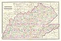
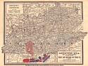
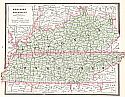
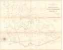
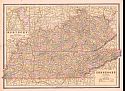
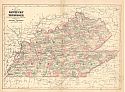
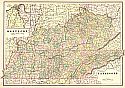
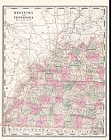
Mitchell, Samuel Augustus
Title/Description:
Kentucky and Tennessee
Publication Info:
Philadelphia: William M. Bradley & Brother, c.1886
Viewing Options
Main Author:
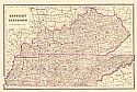
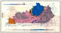
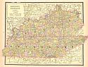
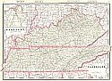
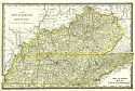
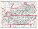
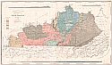
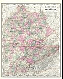
Mitchell, Samuel Augustus
Title/Description:
County Map of Kentucky and Tennessee
Publication Info:
Philadelphia: William M. Bradley, 1886; from a First Edition Bradley Atlas
Viewing Options
Title/Description:
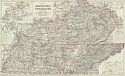
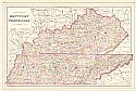
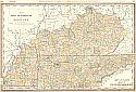
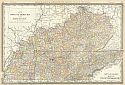
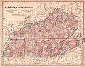
Gray's New Map of Kentucky and Tennessee
Publication Info:
Philadelphia: Stedman and Brown, 1886; from The National Atlas
Viewing Options
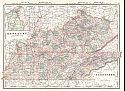
Main Author:
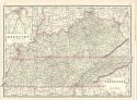
Cram, George F.
Title/Description:
Kentucky and Tennessee
Publication Info:
Chicago: George F. Cram, 1886; from Cram's Unrivaled Family Atlas of the World
Viewing Options
Main Author:
Geological Survey of Kentucky
Title/Description:
Washington and Marion Counties
Publication Info:
Frankfort: Geological Survey of Kentucky, c.1886
Viewing Options
Main Author:
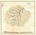
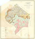
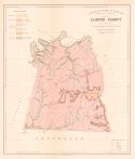
Geological Survey of Kentucky
Title/Description:
Garrard County
Publication Info:
Frankfort: Geological Survey of Kentucky, c.1886
Viewing Options
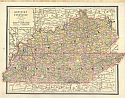
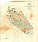
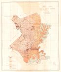
Main Author:
Geological Survey of Kentucky
Title/Description:
Map of Montgomery and Clark Counties
Publication Info:
Frankfort: Geological Survey of Kentucky, c.1886
Viewing Options
Main Author:
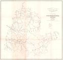
Geological Survey of Kentucky
Title/Description:
Elliot County
Publication Info:
Frankfort: Geological Survey of Kentucky, c.1886
Viewing Options
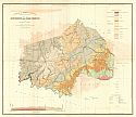
Main Author:
Geological Survey of Kentucky
Title/Description:
Lincoln County
Publication Info:
Frankfort: Geological Survey of Kentucky, c.1886
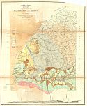
Viewing Options
Main Author:
Linney, W.M.
Title/Description:
Map of Bath and Fleming Counties
Publication Info:
Frankfort: Geological Survey of Kentucky, c.1886
Viewing Options
Title/Description:
Plan of Part of Bath, Menifee, Montgomery, Powell, Wolfe, Morgan, and Estill Counties
Publication Info:
Frankfort: Geological Survey of Kentucky, c.1886
Viewing Options
Main Author:
Linney, W.M.
Title/Description:
Map of Henry, Shelby and Oldham Counties
Publication Info:
Frankfort: Geological Survey of Kentucky, c.1886
Viewing Options
Title/Description:
Kentucky and Tennessee
Publication Info:
Chicago: Henry S. Stebbins, 1887. Issued by the Decatur Land Improvement and Furnace Company
Viewing Options
Main Author:
Hoeing, J.B.
Title/Description:
Preliminary Map of Kentucky
Publication Info:
New York: Julius Bien and Co., 1887; for the Kentucky Geological Survey
Viewing Options
Main Author:
Mitchell, Samuel Augustus
Title/Description:
County Map of Kentucky and Tennessee
Publication Info:
Philadelphia: William M. Bradley, 1887
Viewing Options
Main Author:
Cram, George F.
Title/Description:
Kentucky and Tennessee
Publication Info:
Chicago: Peoples Publishing Co., 1887
Viewing Options
Main Author:
Cram, George F.
Title/Description:
Kentucky and Tennessee
Publication Info:
Chicago: George F. Cram, 1887
Viewing Options
Main Author:
Rand McNally & Company
Title/Description:
New County and Railroad Map of Kentucky
Publication Info:
Chicago: Rand McNally & Co., 1887; from Rand McNally and Co.'s New Indexed Atlas of the World
Viewing Options
Main Author:
Cram, George F.
Title/Description:
Kentucky and Tennessee
Publication Info:
Chicago: George F. Cram, 1887; from Grant's Business and Railroad Atlas
Viewing Options
Main Author:
Moore, P.N. and W.B. Page
Title/Description:
Map of Hancock County and parts of Ohio, Grayson and Breckinridge, showing Eastern Outline of the Western Coal Field (Sheet I)
Publication Info:
Frankfort: Geological Survey of Kentucky, 1887
Viewing Options
Main Author:
Moore, P.N. and W.B. Page
Title/Description:
Map of Hancock County and parts of Ohio, Grayson and Breckinridge, showing Eastern Outline of the Western Coal Field (Sheet 2)
Publication Info:
Frankfort: Geological Survey of Kentucky, 1887
Viewing Options
Main Author:
Cram, George F.
Title/Description:
Kentucky and Tennessee
Publication Info:
Chicago: George F. Cram, 1888; from Cram's American Standard Atlas

Viewing Options
Main Author:
Cram, George F.
Title/Description:
Kentucky and Tennessee
Publication Info:
Chicago: The People's Publishing Company, 1888
Viewing Options
Main Author:
Rand McNally and Company
Title/Description:
New County and Railroad Map of Kentucky and Tennessee
Publication Info:
Chicago: Rand McNally and Company, 1888; from the New Indexed Atlas of the World
Viewing Options
Main Author:
Cram, George F.
Title/Description:
Kentucky, Tennessee
Publication Info:
Chicago: Henry S. Stebbins, c.1888; from Cram's Unrivaled Atlas of the World
Viewing Options
Main Author:
Rand McNally and Company
Title/Description:
Kentucky and Tennessee
Publication Info:
Chicago: Rand McNally and Co., 1889; from the Enlarged Business Atlas and Shippers Guide
Viewing Options
Main Author:
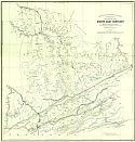
Hoeing, J.R.
Title/Description:
Map of Whitley County
Publication Info:
Frankfort: Geological Survey of Kentucky, 1889
Viewing Options
Main Author:
Hoeing, J.R.
Title/Description:
Preliminary Map of South East Kentucky
Publication Info:
Frankfort: Geological Survey of Kentucky, 1889
Viewing Options
Main Author:
Cram, George F.
Title/Description:
Kentucky and Tennessee
Publication Info:
Chicago: George F. Cram, 1889
Viewing Options
Main Author:
Johnson, Alvin Jewitt
Title/Description:
Map of Kentucky and Tennessee
Publication Info:
New York: A.J. Johnson and Company, 1889; from Johnson's Cyclopedia
Viewing Options
Main Author:
Cram, George F.
Title/Description:
Railroad and County Map of Kentucky and Tennessee
Publication Info:
Chicago: Henry S. Stebbins, c. 1889; from Cram's Unrivaled Atlas of the World
Viewing Options
Main Author:
Mast, Crowell and Kirkpatrick
Title/Description:
Map of Kentucky and Tennessee
Publication Info:
Springfield, Ohio: Mast, Crowell and Kirkpatrick, 1889; from Peerless Atlas of the World
Viewing Options
Main Author:
Hoeing, J.B.
Title/Description:
Spencer and Nelson Counties
Publication Info:
Geological Survey of Kentucky, c.1890
Viewing Options
Main Author:
Cram, George F.
Title/Description:
Kentucky and Tennessee
Publication Info:
Chicago: George F. Cram, 1890
Viewing Options
Main Author:
Hoeing, J.B.
Title/Description:
Preliminary Map of Kentucky
Publication Info:
Kentucky Geological Survey, 1890
Viewing Options
Main Author:
Loughridge, R.H.
Title/Description:
Map of Clinton County
Publication Info:
Frankfort: Geological Survey of Kentucky, c. 1890
Viewing Options
Main Author:
Walker, Henry B.
Title/Description:
Kentucky and Tennessee - Eastern Part
Publication Info:
Philadelphia: H.B. Walker, 1890; from Walker's International Atlas
Viewing Options
Main Author:
Walker, Henry B.
Title/Description:
Kentucky and Tennessee - Western Part
Publication Info:
Philadelphia: H.B. Walker, 1890; from Walker's International Atlas
Viewing Options
Main Author:
Walker, Henry B.
Title/Description:
Kentucky and Tennessee
Publication Info:
Philadelphia: H.B. Walker, 1890; from Walker's International Atlas