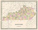
Viewing Options
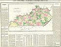
Title/Description:
Carte Géographique, Statistique, et Historique du Kentucky
Publication Info:
Paris: J. Carez, 1825
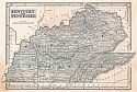
Viewing Options
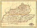
Title/Description:
Kentucky and Tennessee
Publication Info:
New Haven: N. and S.S. Jocelyn, [1825]. From S.E. Morse's A New and Universal Atlas of the World
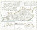
Viewing Options
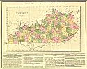
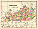
Main Author:
Lucas, Fielding
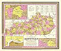
Title/Description:
Geographical, Statistical, and Historical Map of Kentucky
Publication Info:
Philadelphia: Carey & Lea, 1827
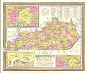
Viewing Options
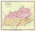
Main Author:
Darby, William / J. Knight
Title/Description:
Kentucky and Tennessee
Publication Info:
[Philadelphia: Henry S. Tanner, 1828]
Viewing Options
Main Author:
Finley, Anthony
Title/Description:
Kentucky
Publication Info:
Philadelphia: Anthony Finley, 1829
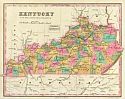
Viewing Options
Title/Description:
Kentucky with the Latest Improvements
Publication Info:
Philadelphia: S.C. Atkinson, 1836
Viewing Options
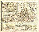
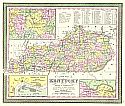
Main Author:
Tanner, Henry Schenck
Title/Description:
A New Map of Kentucky with Its Distances from Place to Place Along the Stage and Steamboat Routes
Publication Info:
Philadelphia: H.S. Tanner, 1836
Viewing Options
Main Author:
Illman, Thomas
Title/Description:
Kentucky and Tennessee
Publication Info:
[New York]: Thomas Illman, 1836
Viewing Options
Main Author:
Bradford, T.G. and S.G. Goodrich
Title/Description:
Kentucky
Publication Info:
Boston: Charles D. Strong, 1841
Viewing Options
Main Author:
Morse, Sidney E.
Title/Description:
Kentucky and Tennessee
Publication Info:
New York: Harper and Brothers, 1844; from the System of Geography for the Use of Schools
Viewing Options
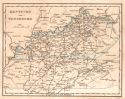
Main Author:
Meyer, Joseph
Title/Description:
Neueste Karte von Kentucky
Publication Info:
Hildburghausen: Bibliographschen Instituts, 1845 from Meyer's Handatlas
Viewing Options
Main Author:
Mitchell, Samuel Augustus
Title/Description:
A New Map of Kentucky with Its Roads and Distances from Place to Place Along the Stage and Steamboat Routes
Publication Info:
Philadelphia: S.A. Mitchell, 1846
Viewing Options
Main Author:
Mitchell, Samuel Augustus
Title/Description:
A New Map of Kentucky with Its Roads and Distances from Place to Place Along the Stage and Steamboat Routes
Publication Info:
Philadelphia: S.A. Mitchell, 1847
Viewing Options
Main Author:
Thomas, Cowperthwait and Co.
Title/Description:
A New Map of Kentucky with Its Roads and Distances from Place to Place Along the Stage and Steamboat Routes
Publication Info:
Philadelphia: Thomas Cowperthwait, & Co., 1850
Viewing Options
Main Author:
Goodrich, S.G.
Title/Description:
Kentucky
Publication Info:
New York: George Savage, 1850; from A Comprehensive Geography and History Ancient and Modern