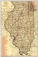
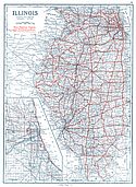
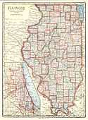
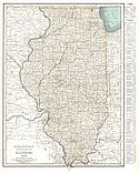
Viewing Options
Main Author:
Rand McNally and Company
Title/Description:
Illinois
Publication Info:
Chicago: Rand McNally and Company, 1921; from the Commercial Atlas of America
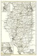
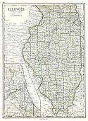
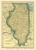
Viewing Options
Main Author:
Rand McNally and Company
Title/Description:
Illinois- Black and White Mileage Map
Publication Info:
Chicago: Rand McNally and Company, 1921; from the Commercial Atlas of America
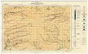
Viewing Options
Main Author:
Illinois State Geological Survey
Title/Description:
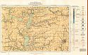
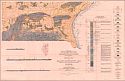
Geologic map of the La Harpe and Good Hope quadrangles
Publication Info:
Urbana: Illinois State Geological Survey, 1921; Bulletin 43, Plate 1
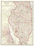
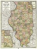
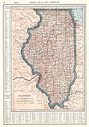
Viewing Options
Main Author:
Cram, George F.
Title/Description:
Illinois
Publication Info:
Chicago: George F. Cram Company, 1921; from Cram's Unrivaled Atlas of the World
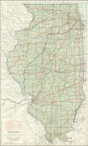
Viewing Options
Main Author:
National Map Company
Title/Description:
Illinois
Publication Info:
Indianapolis: National Map Company, 1921; from Auto Trails and Commercial Survey of the United States
Viewing Options
Main Author:
National Map Company
Title/Description:
Illinois
Publication Info:
Indianapolis: National Map Company, 1921; from Auto Trails and Commercial Survey of the United States
Viewing Options
Main Author:
The Geographical Publishing Co.
Title/Description:
Illinois
Publication Info:
Chicago: The Geographical Publishing Co., 1922; from New International Atlas of the World
Viewing Options
Main Author:
C.S. Hammond and Company
Title/Description:
Illinois
Publication Info:
New York: C.S. Hammond and Company, 1922; from the New World Looseleaf Atlas
Viewing Options
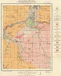
Main Author:
Illinois State Geological Survey
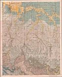
Title/Description:
Geologic Map of the Avon and Canton Quadrangles
Publication Info:
Urbana: Illinois State Geological Survey, 1922; Bulletin 38, Plate 1
Viewing Options
Main Author:
Illinois State Geological Survey
Title/Description:
Geology of the Kings quadrangle
Publication Info:
Urbana: Illinois State Geological Survey, 1923; Bulletin 43, Plate 4
Viewing Options
Main Author:
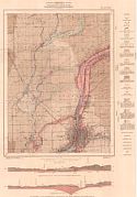
Illinois State Geological Survey
Title/Description:
Economic, structural and areal geology of the Morris quadrangle
Publication Info:
Urbana: Illinois State Geological Survey, 1923; Bulletin 43, Plate 3
Viewing Options
Main Author:
Illinois State Geological Survey
Title/Description:
Surficial geology and rock outcrops of the Morris quadrangle
Publication Info:
Urbana: Illinois State Geological Survey, 1923; Bulletin 43, Plate 2
Viewing Options
Main Author:
Cram, George F.
Title/Description:
Illinois
Publication Info:
Chicago: George F. Cram Company, 1923; from Cram's Unrivaled Atlas of the World
Viewing Options
Main Author:
Funk and Wagnalls Company
Title/Description:
Illinois
Publication Info:
New York: Funk and Wagnalls Company, 1923; from Atlas of the World and Gazetteer
Viewing Options
Main Author:
Reynolds, Francis J.
Title/Description:
Illinois
Publication Info:
New York: P.F. Collier and Son Company, 1924; from The New World Atlas and Gazetteer
Viewing Options
Main Author:
Illinois State Geological Survey
Title/Description:
Topographic map of Equality - Shawneetown area, Illinois
Publication Info:
Urbana: Illinois State Geological Survey, 1925; Bulletin 47, Plate 4
Viewing Options
Main Author:
Butts, Charles
Title/Description:
Geologic Map of Equality - Shawneetown Area, Illinois
Publication Info:
Urbana: Illinois State Geological Survey, 1925; Bulletin 47, Plate 1
Viewing Options
Main Author:
Illinois State Geological Survey
Title/Description:
Areal and Economic Geology of the Carbondale quadrangle
Publication Info:
Urbana: Illinois State Geological Survey, 1925; Bulletin 48, Plate 1
Viewing Options
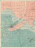
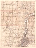
Main Author:
Illinois State Geological Survey
Title/Description:
Economic and surficial Geology of the Joliet quadrangle
Publication Info:
Urbana: Illinois State Geological Survey, 1925; Bulletin 51, Plate 1
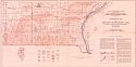
Viewing Options
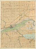
Main Author:
Illinois State Geological Survey
Title/Description:
Topographic map of the Joliet quadrangle showing contours on the bed rock surface and location of wells
Publication Info:
Urbana: Illinois State Geological Survey, 1925; Bulletin 51, Plate 2
Viewing Options
Main Author:
Rand McNally and Company
Title/Description:
Illinois
Publication Info:
Chicago: Rand McNally and Company, 1925; from Premier Atlas of the World

