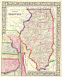
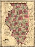
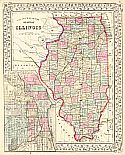
Viewing Options
Main Author:
Mitchell, Samuel Augustus
Title/Description:
County Map of the State of Illinois
Publication Info:
Philadelphia: S.A. Mitchell, Jr., c.1861
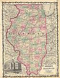
Viewing Options
Main Author:
Johnson, Alvin J.
Title/Description:
Johnson's Illinois
Publication Info:
New York: Johnson and Browning, 1861
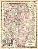
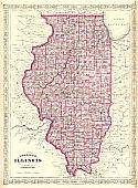
Viewing Options
Main Author:
Johnson, Alvin J.
Title/Description:
Johnson's Illinois
Publication Info:
New York: Johnson and Ward, 1862
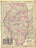
Viewing Options
Main Author:
Johnson, Alvin J.
Title/Description:
Johnson's Illinois
Publication Info:
New York: Johnson and Ward, 1863
Viewing Options
Main Author:
Johnson and Ward
Title/Description:
Johnson's Illinois
Publication Info:
New York: Johnson and Ward, 1864; from Johnson's New Illustrated Family Atlas
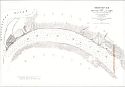
Viewing Options
Title/Description:
Ohio River between Mound City and Cairo
Publication Info:
Washington: U.S. Coast Survey, 1864
Viewing Options
Main Author:
Johnson, Alvin J.
Title/Description:
Johnson's Illinois
Publication Info:
New York: A.J. Johnson, 1866
Viewing Options
Main Author:
Colton, George W.
Title/Description:
Illinois
Publication Info:
New York: G.W. & C.B. Colton, c.1867
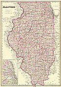
Viewing Options
Main Author:
Mitchell, Samuel Augustus
Title/Description:
County Map of the State of Illinois
Publication Info:
Philadelphia: S.A. Mitchell, 1867

