

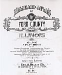
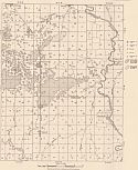
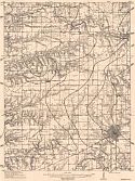
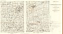
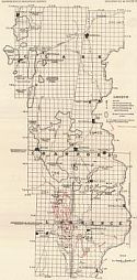
Main Author:
George A. Ogle and Company
Title/Description:
Standard Atlas of Ford County, Illinois
Publication Info:
Chicago: George A. Ogle and Company, 1916: from The Standard Atlas of Ford County, Illinois
Date:
1916
Scale:
Various Scales
Original Source
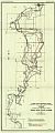
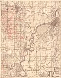
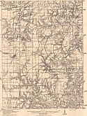
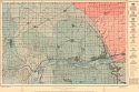
Main Author:
Harmon, Jacob A.
Title/Description:
Plans for Reclamation of Lands Subject to Overflow in the Spoon River Valley, Illinois - Sheet 1
Publication Info:
Urbana: Illinois State Geological Survey, 1916; from Bulletin 32, Sheet 1
Date:
1916
Scale:
1:31,680
Original Source:
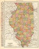
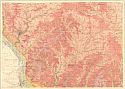
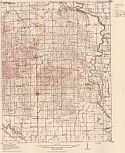
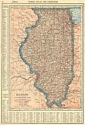
Main Author:
Rand McNally and Company
Title/Description:
Illinois
Publication Info:
Chicago: Rand McNally and Co., 1916; from the Ideal Atlas of the World
Date:
1916
Scale:
1:2,027,520
Original Source:
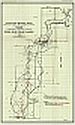
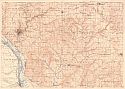
Main Author:
Illinois State Geological Survey
Title/Description:
Map Showing Drill Holes to Robinson Sand in Birds Quadrangle
Publication Info:
Urbana: Illinois State Geological Survey, 1916; Bulletin 33, Plate 7
Date:
1916
Scale:
1:62,500
Original Source:
Main Author:
Illinois State Geological Survey
Title/Description:
Map Showing the Oil Fields of the Vincennes Quadrangle
Publication Info:
Urbana: Illinois State Geological Survey, 1916
Date:
1916
Scale:
1:62,500
Original Source:
Main Author:
Illinois State Geological Survey
Title/Description:
Geologic map of the Galana and Elizabeth quadrangles, Illinois
Publication Info:
Urbana: Illinois State Geological Survey, 1916; Bulletin 26, Plate 4
Date:
1916
Scale:
1:62,500
Original Source:
Main Author:
Illinois State Geological Survey
Title/Description:
Topographic in map of Galena and Elizabeth quadrangles, Illinois
Publication Info:
Urbana: Illinois State Geological Survey, 1916; Bulletin 26, Plate 1
Date:
1916
Scale:
1:62,500
Original Source:
Main Author:
Illinois State Geological Survey
Title/Description:
Map Showing structure of Canton quadrangle
Publication Info:
Urbana: Illinois State Geological Survey, 1916; Bulletin 33, Plate 2
Date:
1916
Scale:
1:62,500
Original Source:
Main Author:
Illinois State Geological Survey
Title/Description:
Map Showing structure of Avon quadrangle
Publication Info:
Urbana: Illinois State Geological Survey, 1916; Bulletin 33, Plate 3
Date:
1916
Scale:
1:62,500
Original Source:
Main Author:
Illinois State Geological Survey
Title/Description:
Map showing oil field in Birds quadrangle
Publication Info:
Urbana: Illinois State Geological Survey, 1916; Bulletin 33, Plate 4
Date:
1916
Scale:
1:62,500
Original Source:
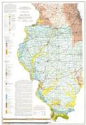
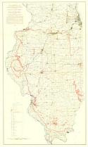
Main Author:
Illinois State Geological Survey
Title/Description:
Geologic Map of Illinois
Publication Info:
(Illinois) State Geological Survey, 1917
Date:
1917
Scale:
1:500,000
Original Source:
Main Author:
Illinois State Geological Survey
Title/Description:
Map Showing Geology of Colchester and Macomb Quadrangles
Publication Info:
Urbana: Illinois State Geological Survey, 1917; Bulletin 30, Plate 2
Date:
1917
Scale:
1:100,000
Original Source:
Main Author:
Illinois State Geological Survey
Title/Description:
Economic structural and Areal geology of Hennepin and LaSalle quadrangles
Publication Info:
Urbana: Illinois State Geological Survey, 1919; Bulletin 37, Plate 2
Date:
1919
Scale:
1:62,500
Original Source:
Main Author:
Illinois State Geological Survey
Title/Description:
Surficial geology and rock outercrops of Hennepin and LaSalle quadrangles
Publication Info:
Urbana: Illinois State Geological Survey, 1919; Bulletin 37, Plate 1
Date:
1919
Scale:
1:62,500
Original Source:
Main Author:
Christensen, H.P. for the Illinois State Geological Survey
Title/Description:
Mineral Industries of Illinois
Publication Info:
(Illiniois) State Geological Survey, 1920
Date:
1920
Scale:
1:500,000
Original Source:
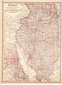
Main Author:
Reynolds, Francis J.
Title/Description:
Illinois
Publication Info:
New York: P.F. Collier and Son Company, 1920; from The New World Atlas and Gazetteer
Date:
1920
Scale:
1:2,661,120
Original Source:
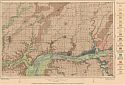
Main Author:
Illinois State Geological Survey
Title/Description:
Map of Clark, Crawford and Lawrence counties, showing oil pools, drill holes, depths to the Mississippian "Big Lime" and No. 2 and No. 6 coals, and structure contours on the Kirkwood sand
Publication Info:
Urbana: Illinois State Geological Survey, 1920; Bulletin 36, Plate 3
Date:
1920
Scale:
1:221,760
Original Source:
Main Author:
Cram, George F.
Title/Description:
Illinois
Publication Info:
Chicago: George F. Cram, 1920; from Descriptive Review Showing Development of the State of Pennsylvania
Date:
1920
Scale:
1:1,900,800
Original Source:
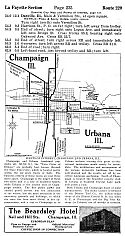
Main Author:
Title/Description:
Official Automobile Bluebook, Vol. 4, 1920, Ohio, Indiana, Kentucky and Lower Michigan
Publication Info:
New York: Automobile Blue Book Publishing Co., 1920
Date:
1920
Scale:
Various
Original Source: