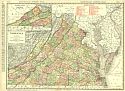
Viewing Options
Main Author:
Rand McNally and Company
Title/Description:
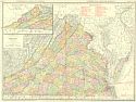
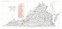
Virginia
Publication Info:
Chicago: Rand McNally and Co., 1911; from The Commercial Atlas of America
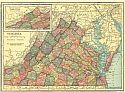
Viewing Options
Main Author:
C.S. Hammond and Company
Title/Description:
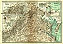
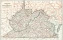
Virginia
Publication Info:
New York: C.S. Hammond and Company, 1911; from Hammond's Modern Atlas of the World
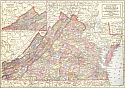
Viewing Options
Main Author:
The Geographical Publishing Company
Title/Description:
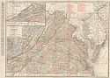
Virginia
Publication Info:
Chicago: Geographical Publishing Company, 1911
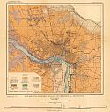
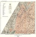
Viewing Options
Main Author:
U.S. Geological Survey
Title/Description:
Map Showing Economic Geology of Richmond, VA and Vicinity
Publication Info:
Washington: Department of the Interior, U.S. Geological Survey, 1911; Bulletin 483 Plate I
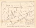
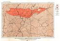
Viewing Options
Main Author:
U.S. Geological Survey
Title/Description:
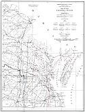
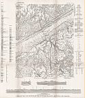
Sketch Map of the Powell Mountain Coalfield, Virginia
Publication Info:
Washington: Department of the Interior, U.S. Geological Survey, 1911; Bulletin 431
Viewing Options
Main Author:
Cram, George F.
Title/Description:
Virginia
Publication Info:
Chicago: George F. Cram, 1911; from Cram's Unrivaled Atlas of the World
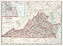
Viewing Options
Main Author:
Rand McNally and Company
Title/Description:
Virginia and West Virginia
Publication Info:
Chicago: Rand McNally and Company, 1912; from The Rand McNally Imperial Atlas of the World
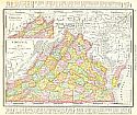
Viewing Options
Main Author:
Rand McNally & Company
Title/Description:
Rand McNally's New Map of Virginia
Publication Info:
Chicago: Rand McNally & Co., 1912; from Rand McNally and Co.'s Atlas of the World
Viewing Options
Main Author:
Virginia Geological Survey
Title/Description:
Topographic and Geologic Map of the Gold Belt in the James River Basin, Virginia
Publication Info:
Charlottesville: Virginia Geological Survey, 1912; Bulletin VII, Plate I
Viewing Options
Main Author:
Virginia Geological Survey
Title/Description:
Detailed Geologic Map of Gold Belt in North Side of James River, in Goochland and Fluvanna Counties
Publication Info:
Charlottesville: Virginia Geological Survey, 1912; Bulletin VII, Plate II
Viewing Options
Main Author:
Virginia Geological Survey
Title/Description:
Map of Rutile Area in Amherst and Nelson Counties, Virginia
Publication Info:
Charlottesville: Virginia Geological Survey, 1912; Bulletin III-A, Plate I
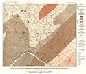
Viewing Options
Main Author:
Clark, William Bullock and Miller, Benjamin Leroy
Title/Description:
A Geological Map of the Coastal Plain of Virginia
Publication Info:
Charlottesville: Virginia Geological Survey, 1912; Bulletin IV, Plate I
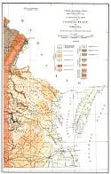
Viewing Options
Main Author:
Virginia Geological Survey
Title/Description:
Map of the Coastal Plain of Virginia
Publication Info:
Charlottesville: Virginia Geological Survey, 1912; Bulletin V, Plate I
Viewing Options
Main Author:
Rand McNally and Company
Title/Description:
Virginia
Publication Info:
Chicago: Rand McNally and Company, 1912; from The Commerial Atlas of America
Viewing Options
Main Author:
The Century Company
Title/Description:
Virginia
Publication Info:
New York: The Century Company, 1913; from The Century Atlas of the World
Viewing Options
Main Author:
United States Geological Survey
Title/Description:
State of Virginia
Publication Info:
Washington, D.C.: U.S. Geological Survey, 1914; Bulletin X, Plate V
Viewing Options
Main Author:
Rand McNally and Company
Title/Description:
New Commerical Atlas Map of Virginia
Publication Info:
Chicago: Rand McNally & Co., 1914
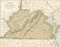
Viewing Options
Main Author:
Reynolds, Francis J.
Title/Description:
Virginia and West Virginia
Publication Info:
New York: P.F. Collier and Son, 1914; from The New Encyclopedic Atlas and Gazatteer of the World
Viewing Options
Main Author:
U.S. Geological Survey
Title/Description:
Geologic Map and Sections of the Pound Quadrangle, Kentucky and Virginia
Publication Info:
Washington: Department of the Interior, U.S. Geological Survey, 1922; Bulletin 708, Plate 1