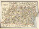
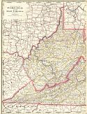
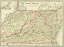
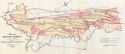
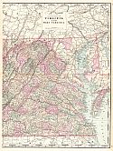
Viewing Options
Main Author:
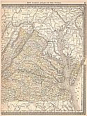
Cram, George F.
Title/Description:
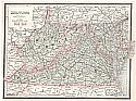
Virginia, West Virginia, Maryland, and Delaware
Publication Info:
Chicago: George F. Cram, 1886; from Cram's Unrivaled Family Atlas of the World
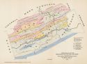
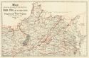
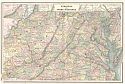
Viewing Options
Main Author:
Stevenson, J.J.
Title/Description:
Geological Map of Giles, Bland and Wythe Counties with parts of Pulaski and Montgomery Cos. Virginia
Publication Info:
Philadelphia: Proceedings of the American Philosophical Society, Vol XXIV, No 125
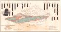
Viewing Options
Main Author:
D'Invilliers, Edward V.
Title/Description:
A Geological Map of Portions of Tazewell, Russell, Wise, Lee and Scott Counties, Virginia
Publication Info:
Philadelphia: Dando Printing and Publishing Company, 1886
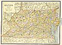
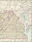
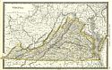
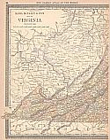
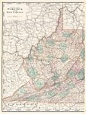
Viewing Options
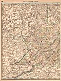
Main Author:
Cram, George F.
Title/Description:
Virginia, West Virginina, Maryland, and Delaware
Publication Info:
Chicago: George F. Cram, 1887
Viewing Options
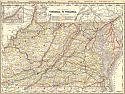
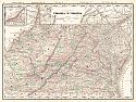
Viewing Options
Main Author:
Cram, George F
Title/Description:
Western and Eastern Half of Virginia and West Virginia
Publication Info:
Chicago: George F Cram, 1887, from Cram's Banker and Brokers Railroad Atlas
Viewing Options
Main Author:
Cram, George F
Title/Description:
Railroad and County Map of Virginia, West Virginia
Publication Info:
Chicago: George F Cram, 1887, from Cram's Banker and Brokers Railroad Atlas
Viewing Options
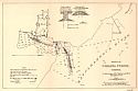
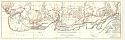
Main Author:
U.S. Army Corps of Engineers
Title/Description:
Sketch of Richmond, Va. Showing approaches to National Cemetary
Publication Info:
Washington: U.S Senate, 49th Congress, 2nd session, Doc. No. 1807
Viewing Options
Title/Description:
Map of the Arlington Estate, VA. January 1888 Showing all buildings occupied by citizens outside of Fort Meyer and the National Cemetery
Publication Info:
unknown
Viewing Options
Main Author:
People's Publishing Co.
Title/Description:
Virginia, West Virginia, Maryland & Delaware
Publication Info:
Rochester: W.H. Stewart & Co., 1888; from the Peoples' Illustrated & Descriptive Family Atlas of the World
Viewing Options
Viewing Options
Main Author:
Rand McNally and Company
Title/Description:
Virginia and West Virginia
Publication Info:
Chicago: Rand McNally & Co., 1888; from Rand McNally's Standard Atlas of the World
Viewing Options
Main Author:
Cram, George F.
Title/Description:
Virginia, West Virginia
Publication Info:
Chicago: George F. Cram, 1888; from Cram's Standard American Atlas
Viewing Options
Main Author:
Hotchkiss, Jed
Title/Description:
Map Showing Location of and Railways to Buena Vista, and the Coking Coal-field of Virginia and West Virginia
Publication Info:
Staunton: Jed Hotchkiss, 1888; from a report by W.H. Ruffner titled Report on the Landed Property of the Buena Vista Company
Viewing Options
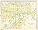
Main Author:
Cram, George F.
Title/Description:
Richmond and Manchester, Virginia
Publication Info:
Chicago: George F. Cram, 1889
Viewing Options
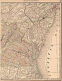
Main Author:
Rand McNally and Company
Title/Description:
Virginia
Publication Info:
Chicago: Rand McNally and Co., 1889; from The Enlarged Business Atlas and Shippers Guide
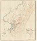
Viewing Options
Title/Description:
Map of the Douthat Survey containing 102,000 Acres situated in Bath and Allegheny Counties, Va.
Publication Info:
Philadelphia: J.L. Smith, 1889
Viewing Options
Main Author:
Hurlbul, W.J.
Title/Description:
The Buena Vista Property, Rockbridge County, Virginia
Publication Info:
Philadelphia: Dando Printing and Publishing Company, 1889; from a report by W.H. Ruffner titled Report on the Landed Property of the Buena Vista Company
Viewing Options
Main Author:
Mast, Crowell and Kirkpatrick
Title/Description:
Virginia and West Virginia
Publication Info:
Springfield, Ohio: Mast, Crowell and Kirkpatrick, 1889; from Peerless Atlas of the World
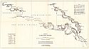
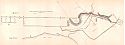
Viewing Options
Title/Description:
Index Map, Pamunky River
Publication Info:
Washington: (U.S. Army Corp of Engineers), 1890; to accompany the annual report of 1890
Viewing Options
Main Author:
Rand McNally and Company
Title/Description:
Map of Virginia
Publication Info:
Chicago: Rand McNally & Co., 1890; from Rand McNally & Co.'s Family Atlas of the World
Viewing Options
Main Author:
Rand McNally and Company
Title/Description:
Map of Virginia
Publication Info:
Chicago: Rand McNally & Co., 1890; from Rand McNally & Co.'s Family Atlas of the World
Viewing Options
Title/Description:
Mouth of Urbana Creek, Virginia
Publication Info:
Washington: Government Printing Office, 1890; from the Annual Report of the Secretary of War to 51st Congress, 2nd Session, Ex. Doc. 1, Part 2
Viewing Options
Main Author:
Cram, George F.
Title/Description:
Virginia and West Virginia
Publication Info:
Rochester: W.H. Stewart, c. 1890; from Cram's Unrivaled Atlas of the World
Viewing Options
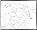
Title/Description:
Portions of Alexandria and Fairfax Counties, Virginia, Showing the Routes Surveyed for a National Road from Washington, D.C. to Mount Vernon, Va.
Publication Info:
Washington: Government Printing Office, 1890; from the Annual Report of the Chief of Engineers, U.S. Army to the Secretary of War for the year 1890
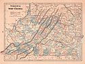
Viewing Options
Main Author:
Walker, Henry B.
Title/Description:
Eastern Half of Virginia and West Virginia
Publication Info:
Philadelphia: H.B. Walker, 1890; from Walker's International Atlas
Viewing Options
Main Author:
Walker, Henry B.
Title/Description:
Western Half of Virginia and West Virginia
Publication Info:
Philadelphia: H.B. Walker, 1890; from Walker's International Atlas
Viewing Options
Main Author:
Walker, Henry B.
Title/Description:
Virginia and West Virginia
Publication Info:
Philadelphia: H.B. Walker, 1890; from Walker's International Atlas