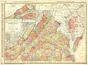
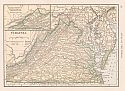
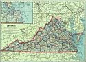
Viewing Options
Main Author:
Rand McNally and Company
Title/Description:
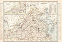
Virginia
Publication Info:
Chicago: Rand McNally and Company from The Business Atlas and Shippers Guide
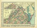
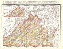
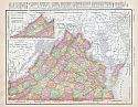
Viewing Options
Main Author:
Hammond, C.S.
Title/Description:
Virginia
Publication Info:
New York: C.S. Hammond and Company, 1906; from The Pictorial Atlas of the World
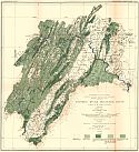
Viewing Options
Main Author:
U.S. Geological Survey
Title/Description:
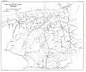
Potomac River Drainage Basin Above Washingtion Showing Forest Area And Cleared Land
Publication Info:
Washington: Department of the Interior, U.S. Geological Survey, 1906; Water Supply Paper No. 1910 Plate 10
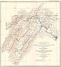
Viewing Options
Main Author:
U.S. Geological Survey
Title/Description:
Potomac River Drainage Basin Above Washington Showing Mean Annual Precipitation For The Decade 1895-1905
Publication Info:
Washington: Department of the Interior, U.S. Geological Survey, 1906; Water Supply Paper No. 192 Plate 1
Viewing Options
Main Author:
Cram, George F.
Title/Description:
Virginia
Publication Info:
Chicago: George F. Cram for A. A. Grant, Toronto, Ont., 1906; from Grant's Bankers and Brokers Railroad System Atlas
Viewing Options
Main Author:
Rand McNally and Company
Title/Description:
Virginia
Publication Info:
Chicago: Rand McNally and Company, 1906; from The World and its Peoples
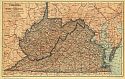
Viewing Options
Main Author:
The Crowell Publishing Company
Title/Description:
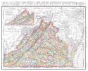
Virginia and West Virginia
Publication Info:
New York: The Crowell Publishing Co., 1908; from The Peerless Atlas of the World
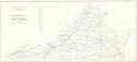
Viewing Options
Main Author:
U.S. Geological Survey
Title/Description:
Map of Russell Fork Coal Field, Virginia
Publication Info:
Washington: Department of the Interior, U.S. Geological Survey, 1908; Bulletin 348 Plate V
Viewing Options
Main Author:
Hammond, C.S.
Title/Description:
Virginia
Publication Info:
New York: C.S. Hammond & Co. 1908; from Hammond's Handy Atlas of the World
Viewing Options
Main Author:
Rand McNally and Company
Title/Description:
Virginia
Publication Info:
Chicago: Rand McNally and Company, 1908; from The New Ideal State and County Survey and Atlas
Viewing Options
Main Author:
Rand McNally and Company
Title/Description:
Virginia
Publication Info:
Chicago: Rand McNally and Company, 1908; from The New Ideal State and County Survey and Atlas
Viewing Options
Main Author:
Watkins, J.H.
Title/Description:
Map of Virginia Showing Location of Mines and Quarries
Publication Info:
Charlottesville: Virginia Geological Survey, 1909
Viewing Options
Main Author:
Patten, William and J.E. Homas
Title/Description:
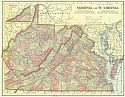
Virginia and West Virginia
Publication Info:
New York: P.F. Collier and Son, 1909; from The New Encyclopedic Atlas and Gazetteer of the World
Viewing Options
Main Author:
Cram, George F.
Title/Description:
Virginia
Publication Info:
Chicago: George F. Cram, c.1909; from The Heart of our Country
Viewing Options
Main Author:
Rand McNally and Company
Title/Description:
Virginia
Publication Info:
Chicago: Rand McNally and Company 1910; from New Ideal State and County Survey