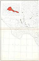
Viewing Options
Main Author:
Branom, Frederick K. and Lloyd Edwin Smith
Publication Info:
Chicago: Geographical Publishing Company, 1936; from Capper's 1936 Atlas of the World

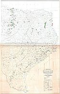
Viewing Options
Main Author:
U.S. Geological Survey
Title/Description:
Map of the Vicinity of Uvalde, Texas Showing Wells for Which Data Were Obtained, Areas Irrigated by Well Water, and Piezometric Surface of the Water in the Edwards Limestone
Publication Info:
Washington: Department of the Interior, U.S. Geological Survey, 1936; Water Supply Paper No. 678 Plate 2

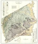
Viewing Options
Main Author:
U.S. Geological Survey
Title/Description:
Geologic Hydrologic Map of Uvalde and Medina Countries, Texas
Publication Info:
Washington: Department of the Interior, U.S. Geological Survey, 1936; Water Supply Paper No. 678 Plate 1

Viewing Options
Main Author:
Continental Oil Company
Title/Description:
Map of Texas Centennial Central Exposition; Dallas, Texas
Publication Info:
Chicago: H.M. Gousha Company, 1936
Original Source:
Murray Hudson

Viewing Options
Main Author:
Continental Oil Company
Publication Info:
Chicago: H.M. Gousha Company, 1936
Original Source:
Murray Hudson

Viewing Options
Main Author:
Rand McNally and Company
Title/Description:
Northern Texas
Publication Info:
Chicago: Rand McNally and Company, 1936

Viewing Options
Main Author:
Rand McNally and Company
Title/Description:
Southern Texas
Publication Info:
Chicago: Rand McNally and Company, 1936
Viewing Options
Viewing Options
Main Author:
Richardson, G.B.
Title/Description:
Oil and Gas Fields of the State of Texas
Publication Info:
Washington: U.S. Department of the Interior, U.S. Geological Survey, 1938
Viewing Options
Main Author:
Stenzel, H.B.
Title/Description:
Geologic Map of Leon County, Texas,
Publication Info:
Austin: University of Texas, Bureau of Economic Geology; Plate 1, Bulletin No.3818

Viewing Options
Main Author:
U.S. Geological Survey
Title/Description:
Geologic map Showing Iron-Bearing Formations in East Texas
Publication Info:
Washington: Department of the Interior, US Geological Survey, 1938; Bulletin 902, Plate 1

Viewing Options
Main Author:
U.S. Geological Survey
Title/Description:
Map Showing Geology and Distribution of Iron-Ore Deposits in Part of the North Basin in Parts of Cass, Marion, and Morris Counties, Texas
Publication Info:
Washington: Department of the Interior, US Geological Survey, 1938; Bulletin 902, Plate 2

Viewing Options
Main Author:
U.S. Geological Survey
Title/Description:
Geologic Map of Duval County, Texas, Showing Location of Wells
Publication Info:
Washington: Department of the Interior, U.S. Geological Survey, 1938; Water Supply Paper No. 776 Plate 1

Viewing Options
Main Author:
Continental Oil Company
Title/Description:
Highway Map of Texas (East Half)
Publication Info:
Chicago: H.M. Gousha Company, 1940
Original Source:
Murray Hudson

Viewing Options
Main Author:
Continental Oil Company
Title/Description:
Highway Map of Texas (West Half)
Publication Info:
Chicago: H.M. Gousha Company, 1940
Original Source:
Murray Hudson

Viewing Options

Viewing Options
Main Author:
Bureau of the Census
Title/Description:
Texas Irrigation by Drainage Basins, 1939
Publication Info:
Washington: U.S. Government Printing Office, 1942

Viewing Options
Main Author:
Geographical Publishing Company
Publication Info:
Chicago: Geographical Publishing Company, 1942; from The New International Atlas of the World, War Edition

Viewing Options
Main Author:
U.S. Coast and Geodetic Survey
Title/Description:
Del Rio Sectional Aeronautical Chart
Publication Info:
Washington: U.S. Coast and Geodetic Survey, 1943

Viewing Options
Main Author:
U.S. Coast and Geodetic Survey
Title/Description:
Corpus Christi Sectional Aeronautical Chart
Publication Info:
Washington: U.S. Coast and Geodetic Survey, 1943

Viewing Options
Main Author:
Phillips Petroleum Company
Title/Description:
1946 Official Road Map, Texas
Publication Info:
Chicago: H.M. Gousha Company, 1946
Original Source:
Murray Hudson

Viewing Options
Main Author:
Texas Highway Department
Title/Description:
Texas Highway Department Official Map
Publication Info:
Austin: Texas Highway Department, 1948
Original Source:
Murray Hudson

Viewing Options
Main Author:
Ashburn, J. Foster
Title/Description:
Dallas City Map
Publication Info:
Dallas: J. Foster Ashburn, 1949
Original Source:
Murray Hudson

Viewing Options
Main Author:
Texas Highway Commission
Title/Description:
Texas Official Highway Map
Publication Info:
Austin: Texas Highway Department, 1950

Viewing Options
Main Author:
Texas Highway Department
Title/Description:
Texas Highway Department Official Map
Publication Info:
Austin: Texas Highway Department, 1950
Original Source:
Murray Hudson

Viewing Options
Main Author:
Texas Highway Department
Title/Description:
Texas Guide
Publication Info:
Austin: Texas Highway Department, 1950
Original Source:
Murray Hudson

Viewing Options
Main Author:
U.S. Geological Survey
Title/Description:
Geologic Map of Part of Eagle Mountains, Hudspeth County, Texas
Publication Info:
Washington: Department of the Interior, U.S. Geological Survey, 1953; Bulletin no.987

Viewing Options
Main Author:
U.S. Geological Survey
Title/Description:
Geologic Map of the Cross Plains Quadrangle, Brown, Callahan, Coleman, and Eastland Counties, Texas
Publication Info:
Washington: Department of the Interior, U.S. Geological Survey, 1960; Bulletin 1096-B Plate 4

Viewing Options
Main Author:
U.S. Geological Survey
Title/Description:
Reconnaissance Geologic Map of Part of the Brazos River Valley, North Texas
Publication Info:
Washington: Department of the Interior, U.S. Geological Survey, 1960; Bulletin 1081-G Plate 11
Viewing Options
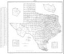
Main Author:
U.S. Department of Commerce, Bureau of the Census
Title/Description:
Texas Census County Divisions (1960 census)
Publication Info:
Washington: U.S. Government Printing Office, 1961