Viewing Options
Viewing Options
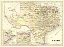
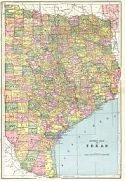
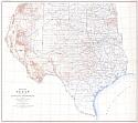
Main Author:
Cram, George F.
Publication Info:
Chicago: George F. Cram, 1896; from Cram's Universal Atlas, Geographical, Astronomical, and Historical

Viewing Options
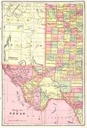
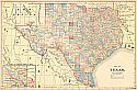
Main Author:
Rand McNally and Company
Publication Info:
Chicago: Rand McNally and Company, 1896; from Enlarged Business Atlas

Viewing Options
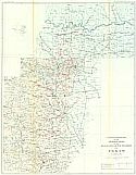
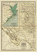
Main Author:
Rand McNally and Company
Publication Info:
Chicago: Rand McNally and Company,1896; from Indexed Atlas of the World
Viewing Options
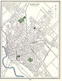
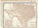
Main Author:
Cram, George F.
Title/Description:
Dallas
Publication Info:
Chicago: George F. Cram, 1898 from Cram's Universal Atlas, Geographical, Astronomical and Historical
Viewing Options
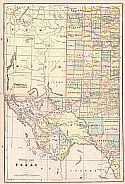
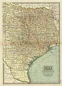
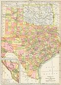
Main Author:
Cram, George F.
Title/Description:
Eastern Half of Texas
Publication Info:
Chicago: George F. Cram, 1898 from Cram's Universal Atlas, Geographical, Astronomical and Historical
Viewing Options
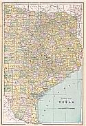
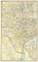
Main Author:
Cram, George F.
Title/Description:
Western Half of Texas
Publication Info:
Chicago: George F. Cram, 1898 from Cram's Universal Atlas, Geographical, Astronomical and Historical
Viewing Options
Main Author:
Hill, Robert T.
Title/Description:
Locations and Depths of the Artesian Wells of the Black and Grand Prairies of Texas
Publication Info:
Washington: U.S. Department of the Interior, U.S. Geological Survey, 1898; 21st Annual Report Part VII Plate XLVIII
Viewing Options
Main Author:
Funk & Wagnalls Company
Publication Info:
New York: Funk & Wagnalls Co., 1898; from A Standard Atlas of the World

Viewing Options
Main Author:
Rand McNally and Company
Publication Info:
Chicago: Rand McNally and Company, c.1898

Viewing Options
Main Author:
Mast, Crowell and Kirkpatrick
Publication Info:
Springfield, Ohio: Mast, Crowell and Kirkpatrick, 1898; from The New Peerless Atlas of the World
Viewing Options
Main Author:
Hill, Robert T.
Title/Description:
Map of Texas
Publication Info:
[Washington]: U.S. Deparment of the Interior, Geological Survey, 1899
Viewing Options
Main Author:
Mast, Crowell and Kirkpatrick
Title/Description:
Map of Texas
Publication Info:
Springfield, OH: Mast, Crowell, & Kirkpatrick, 1899
Viewing Options
Viewing Options
Main Author:
Smith, Benjamin E.
Publication Info:
New York: The Century Company, 1899; from The Century Atlas of the World

Viewing Options
Main Author:
The Bradstreet Company
Publication Info:
New York: The Bradstreet Company, 1899; from Bradstreet's Pocket Atlas of the United States
Viewing Options
Main Author:
Servoss, R.D.
Title/Description:
Texas and Indian Territory
Publication Info:
New York: The Snow-Church Surety Co., 1900; from The Snow-Church Co.'s Legal and Banking Year Book for Bankers, Lawyers, and the Business Public
Viewing Options
Main Author:
Matthews - Northrup Company
Publication Info:
New York: P.F. Collier, 1900

Viewing Options
Main Author:
Hill, Robert T.
Title/Description:
Map of the Paluxy Artesian Reservoirs of the Black and Grand Prairies of Texas
Publication Info:
Washington: Department of the Interior, U.S. Geological Survey, 1900; 21st Annual Report Part 7 Plate 70

Viewing Options
Main Author:
Hill, Robert T.
Title/Description:
Map of the Trinity Artesian Reservoirs of the Black and Grand Prairies of Texas
Publication Info:
Washington: Department of the Interior, U.S. Geological Survey, 1900; 21st Annual Report Part 7 Plate 69

Viewing Options
Main Author:
Hill, Robert T.
Title/Description:
Map of the Black and Grand Prairies of Texas
Publication Info:
Washington: Department of the Interior, U.S. Geological Survey, 1900; 21st Annual Report Part 7 Plate 65

Viewing Options
Main Author:
Hill, Robert T.
Title/Description:
Location of and depths of the artesian wells of the Black and Grand Prairies of Texas
Publication Info:
Washington: Department of the Interior, U.S. Geological Survey, 1900; 21st Annual Report Part 7 Plate 68

Viewing Options
Main Author:
Hill, Robert T.
Title/Description:
Map of the Woodbine Artesian Reservoirs of the Black and Grand Prairies of Texas
Publication Info:
Washington: Department of the Interior, U.S. Geological Survey, 1900; 21st Annual Report Part 7 Plate 71

Viewing Options
Main Author:
Hill, Robert T.
Title/Description:
Geology of the Black and Grand Prairies of Texas
Publication Info:
Washington: Department of the Interior, U.S. Geological Survey, 1900; 21st Annual Report Part 7 Plate 66

Viewing Options
Main Author:
Rand McNally and Company
Publication Info:
Philadelphia: The Gebbie Publishing Company, 1900; from Spofford's Cabinet Cyclopedia Atlas of the World