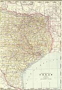
Viewing Options
Main Author:
Rand McNally & Company
Publication Info:
Chicago: The Encyclopedia Britannica Co., c.1895
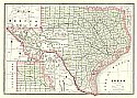
Viewing Options
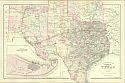
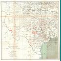
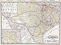
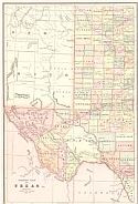
Main Author:
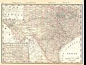
Mitchell, S. Augustus
Title/Description:
County Map of the State of Texas
Publication Info:
Philadelphia: Wm. M. Bradley and Bro., 1886
Viewing Options
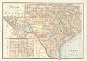
Main Author:
Cram, George F.
Publication Info:
Chicago: George F. Cram, 1886; from Cram's Unrivaled Family Atlas of the World
Viewing Options
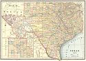
Main Author:
Cram, George F.
Publication Info:
Chicago: Henry S. Stebbins, 1887; from Cram's Universal Atlas of the World
Viewing Options
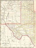
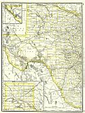
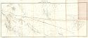
Main Author:
Cram, George F
Title/Description:
Western Half of Texas
Publication Info:
Chicago: George F Cram, 1887, from Cram's Banker and Brokers Railroad Atlas
Viewing Options
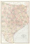
Main Author:
Cram, George F
Title/Description:
Eastern Half of Texas
Publication Info:
Chicago: George F Cram, 1887, from Cram's Banker and Brokers Railroad Atlas

Viewing Options
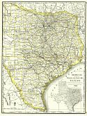
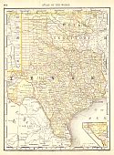
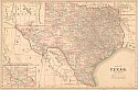
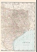
Main Author:
Cram, George F.
Title/Description:
Railroad and County Map of Texas
Publication Info:
Chicago: George F. Cram, 1888
Viewing Options

Viewing Options
Main Author:
Cram, George F.
Publication Info:
Chicago: George F. Cram, 1888; from Cram's Standard American Atlas of the World

Viewing Options
Main Author:
Cram, George F.
Publication Info:
Kansas City: Edwin Williamson, 1888; from Cram's Unrivaled Atlas of the World
Viewing Options
Main Author:
Cram, George F.
Publication Info:
Chicago: Peoples Publishing Co., c1889
Viewing Options
Main Author:
Rand McNally and Compnay
Title/Description:
Texas (No. 1)
Publication Info:
Chicago: Rand McNally and Co., 1889; from The Enlarged Business Atlas and Shippers Guide
Viewing Options
Main Author:
Rand McNally and Compnay
Title/Description:
Texas (No. 2)
Publication Info:
Chicago: Rand McNally and Co., 1889; from The Enlarged Business Atlas and Shippers Guide
Viewing Options
Main Author:
Geological Survey of Texas
Title/Description:
Progress Map, 1889
Publication Info:
Austin: Geological Survey of Texas, 1889
Viewing Options
Main Author:
Rand McNally and Company
Publication Info:
Chicago: The Continental Publishing Company, 1889; from The Standard Atlas of the World
Viewing Options
Main Author:
Mast, Crowell and Kirkpatrick
Title/Description:
Map of Eastern Half of Texas, Map of Indian Territory
Publication Info:
Springfield, Ohio: Mast, Crowell and Kirkpatrick, 1889; from Peerless Atlas of the World
Viewing Options
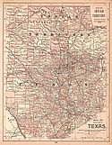
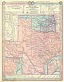
Main Author:
Monteith, James
Title/Description:
Texas, Indian Territory, and Oklahoma
Publication Info:
New York: American Book Co., c1890; from Monteith's Independent Course Comprehensive Geography
Viewing Options
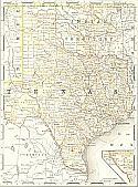
Main Author:
Cram, George F.
Title/Description:
Railroad and County Map of Texas
Publication Info:
Chicago: George F. Cram, c.1890
Viewing Options
Main Author:
Mast, Crowell and Kirkpatrick
Title/Description:
Map of Texas
Publication Info:
Chicago: Mast, Crowell and Kirkpatrick, c.1890
Viewing Options
Main Author:
Alden, John B
Title/Description:
Texas, Indian Territory
Publication Info:
New York: John B. Alden, 1890
Viewing Options
Viewing Options
Main Author:
Cram, George F.
Title/Description:
Eastern Half of Texas
Publication Info:
Rochester: W.H. Stewart, c. 1890; from Cram's Unrivaled Atlas of the World
Viewing Options
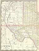
Main Author:
Geological Survey of Texas
Title/Description:
Topographic Map of Trans Pecos Texas
Publication Info:
Austin: Geological Survey of Texas, 1890; Second Annual Report
Viewing Options
Main Author:
Walker, Henry B.
Title/Description:
Eastern Half of Texas
Publication Info:
Philadelphia: H.B. Walker, 1890; from Walker's International Atlas

Viewing Options
Main Author:
Walker, Henry B.
Title/Description:
Western Half of Texas
Publication Info:
Philadelphia: H.B. Walker, 1890; from Walker's International Atlas
Viewing Options
Main Author:
Walker, Henry B.
Publication Info:
Philadelphia: H.B. Walker, 1890; from Walker's International Atlas