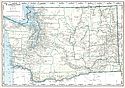
Viewing Options
Main Author:
Geographical Publishing Company
Title/Description:
Washington
Publication Info:
Chicago: Geographical Publishing Company1931; from Commercial Atlas of the World
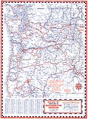
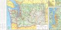
Viewing Options
Main Author:
H.M. Gousha Company
Title/Description:
Guide "A" Index Map of Washington, Oregon
Publication Info:
Chicago: H.M. Gousha Company, 1935; from Gousha Guide, Guide A
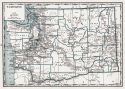
Viewing Options
Main Author:
Branom, Frederick K. and Lloyd Edwin Smith
Title/Description:
Washington
Publication Info:
Chicago: Geographical Publishing Company, 1936; from Capper's 1936 Atlas of the World
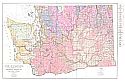
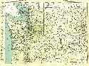
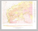
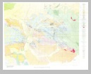
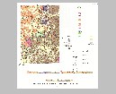
Viewing Options
Main Author:
State of Washington, Division of Geology
Title/Description:
State of Washington, Preliminary Geologic Map
Publication Info:
Olympia: State of Washington, Division of Geology, 1936
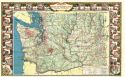
Viewing Options
Main Author:
Rand McNally and Company
Title/Description:
Standard Map of Washington
Publication Info:
Chicago: Rand McNally and Company, 1936
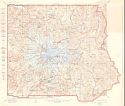
Viewing Options
Main Author:
U.S. Geological Survey
Title/Description:
Mount Rainier National Park, Washington
Publication Info:
Washington: U.S. Department of the Interior, U.S. Geological Survey, 1938
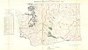
Viewing Options
Main Author:
Department of Highways
Title/Description:
Highways of the State of Washington
Publication Info:
[Olympia]: Department of Highways, 1939

Viewing Options
Main Author:
U.S. Coast and Geodetic Survey
Title/Description:
Seattle Sectional Aeronautical Chart
Publication Info:
Washington: U.S. Coast and Geodetic Survey, 1941

Viewing Options
Main Author:
U.S. Coast and Geodetic Survey
Title/Description:
Bellingham Sectional Aeronautical Chart
Publication Info:
Washington: U.S. Coast and Geodetic Survey, 1942
Viewing Options
Main Author:
Bureau of the Census
Title/Description:
Washington Irrigation by Drainage Basin, 1939
Publication Info:
Washington: U.S. Governmet Printing Office, 1942
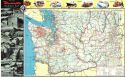
Viewing Options
Main Author:
Department of Highways
Title/Description:
State of Washington Highway Map
Publication Info:
[Olympia]: Department of Highways, 1950
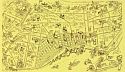
Viewing Options
Title/Description:
(Seattle)
Publication Info:
Unknown, c.1950; promotional map
Viewing Options
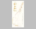
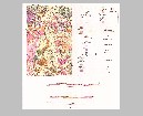
Main Author:
U.S. Geological Survey
Title/Description:
Geologic Map and Sections of the Cle Elum River Nickelferous Iron Deposits, Kittias County, Washington
Publication Info:
Washington: Department of the Interior, U.S. Geological Survey, 1952; Bulletin 978-B Plate 9
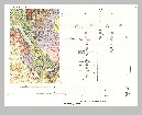
Viewing Options
Main Author:
U.S. Geological Survey
Title/Description:
Geologic Map and Structure Sections of the Toledo and Castle Rock District, Lewis and Cowlitz Counties, Washington
Publication Info:
Washington: Department of the Interior, U.S. Geological Survey, 1958; Bulletin 1062 Plate 1
Viewing Options
Main Author:
U.S. Geological Survey
Title/Description:
Geologic Map of the Centralia-Chehalis District, Washington
Publication Info:
Washington: Department of the Interior, U.S. Geological Survey, 1958; Bulletin 1053 Plate 1
Viewing Options
Main Author:
Washington State Highway Commission
Title/Description:
Washington State Highways
Publication Info:
[Olympia]: Washington State Highway Commission, 1963
Viewing Options
Main Author:
U.S. Geological Survey
Title/Description:
Geologic Map and Sections of the Turtle Lake Quadrangle, Lincoln and Steven's Counties, Washington
Publication Info:
Washington: Department of the Interior, U.S. Geological Survey, 1963; Bulletin 1131 Plate 1
Viewing Options
Main Author:
U.S. Geological Survey
Title/Description:
Geologic Map and Sections of the Curlew Quadrangle, Ferry County, Washington
Publication Info:
Washington: Department of the Interior, U.S. Geological Survey, 1964; Bulletin 1169 Plate 1
Viewing Options
Main Author:
U.S. Geological Survey
Title/Description:
Geologic Map and Sections of the Bald Knob Quadrangle, Ferry and Okanogan Counties, Washington
Publication Info:
Washington: Department of the Interior, U.S. Geological Survey, 1964; Bulletin 1161-F Plate 1

