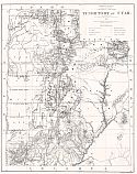
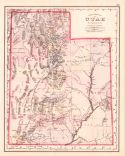
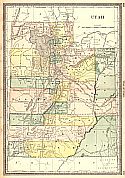
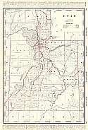
Viewing Options
Title/Description:
Territory of Utah
Publication Info:
Washington: Department of the Interior, General Land Office, 1876
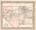
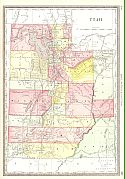
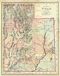
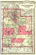
Viewing Options
Main Author:
Mitchell, Samuel Augustus
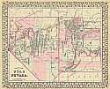
Title/Description:
County Map of Utah and Nevada
Publication Info:
Philadelphia: S.A. Mitchell, 1877
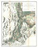
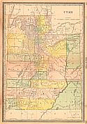
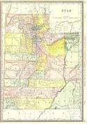
Viewing Options
Main Author:
U.S. Geological Survey
Title/Description:
Map of Utah Territory
Publication Info:
Washington: Department of the Interior, U.S. Geological Survey, 1878
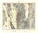
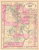
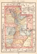
Viewing Options
Main Author:
Wheeler, George M.
Title/Description:
U.S. Geographical Surveys West of the 100th Meridian, Land Classification Map of North Eastern Utah and South Eastern Idaho
Publication Info:
Washington: U.S. Army Corps of Engineers, 1878
Viewing Options
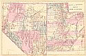
Main Author:
Gamble, William H.
Title/Description:
County Map of Utah and Nevada
Publication Info:
Philadelphia: S.A. Mitchell, 1879
Viewing Options
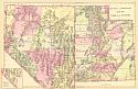
Main Author:
Mitchell, Samuel Augustus
Title/Description:
County and Township Map of Utah and Nevada
Publication Info:
Philadelphia: S.A. Mitchell, 1880
Viewing Options
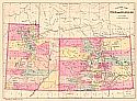
Main Author:
Bradley, William M.
Title/Description:
County Map of Utah and Colorado
Publication Info:
Philadelphia: William M. Bradley, c.1881
Viewing Options
Main Author:
Mitchell, Samuel Augustus
Title/Description:
County and Township Map of Utah and Nevada
Publication Info:
Philadelphia: S.A. Mitchell, 1881
Viewing Options
Main Author:
Gray, Frank A.
Publication Info:
Philadelphia: O.W. Gray and Son, c.1881
Viewing Options
Main Author:
Rand McNally and Company
Publication Info:
Chicago: Rand McNally and Company, 1881; from New Indexed Business Atlas and Shippers Guide
Viewing Options
Main Author:
Hardesty, H.H.
Title/Description:
Map of Utah
Publication Info:
Chicago: H.H. Hardesty & Co., 1882
Viewing Options
Main Author:
Cram, George F.
Title/Description:
New Railroad and County Map of Utah
Publication Info:
Chicago: George F. Cram, 1883
Viewing Options
Main Author:
Hardesty, H.H.
Title/Description:
Map of Utah
Publication Info:
New York: H.H. Hardesty & Co., 1883; from Hardesty's Historical and Geographical Encyclopedia
Viewing Options
Main Author:
Gray, Frank A.
Publication Info:
Philadelphia: O.W. Gray and Son, 1883; from The National Atlas
Viewing Options
Main Author:
Rand McNally and Company
Publication Info:
Chicago: Rand McNally & Co., 1884; from Rand McNally and Company's Indexed Atlas of the World
Viewing Options
Main Author:
Rand McNally and Company
Publication Info:
Chicago: Rand McNally and Company, 1884; from The New Household Atlas of the World
Viewing Options
Main Author:
Cram, George F.
Publication Info:
Chicago: George F. Cram, 1885
Viewing Options
Main Author:
Tunison, Henry Cuthbert
Title/Description:
Utah Territory
Publication Info:
Jacksonville, IL: H.C. Tunison, 1885

