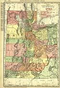
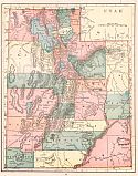
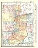
Viewing Options
Main Author:
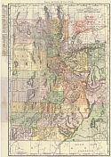
Rand McNally and Company
Publication Info:
Chicago: Rand McNally and Company, 1906; from The Business Atlas and Shippers Guide

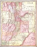
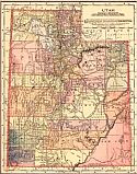
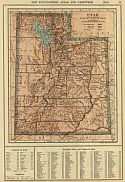
Viewing Options
Main Author:
C.S. Hammond and Company
Publication Info:
New York: C.S. Hammond and Company, 1906; from The Pictorial Atlas of the World

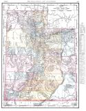
Viewing Options
Main Author:
Cram, George F.
Publication Info:
Chicago: George F. Cram for A. A. Grant, Toronto, Ont., 1906; from Grant's Bankers and Brokers Railroad System Atlas
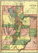
Viewing Options
Main Author:
Cram, George F.
Publication Info:
Chicago: George F. Cram, 1906; from Cram's Superior Reference Atlas
Viewing Options
Main Author:
Rand McNally and Company
Publication Info:
Chicago: Rand McNally and Company, 1906; from The World and its Peoples
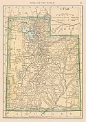
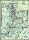
Viewing Options
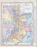
Main Author:
Cram, George F.
Title/Description:
Map of Utah
Publication Info:
Chicago: George F. Cram, 1907; from Cram's Standard American Atlas

Viewing Options
Main Author:
P.F. Collier and Son
Publication Info:
New York: P.F. Collier and Son, 1907; from The New Encyclopedic Atlas and Gazetteer of the World
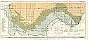
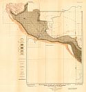
Viewing Options
Main Author:
U.S. Geological Survey
Title/Description:
Topographic Map of the Western Portion of the Uinta Mountains, Utah
Publication Info:
Washington: Deparment of the Interior, U.S. Geological Survey, 1907
Viewing Options
Main Author:
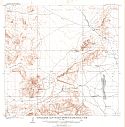
U.S. Geological Survey
Title/Description:
Topographic Map of Iron Springs Quadrangle, Utah
Publication Info:
Washington: Department of the Interior, U.S. Geological Survey, 1907; Bulletin 338 Plate I
Viewing Options
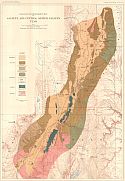
Main Author:
U.S. Geological Survey
Title/Description:
Geologic Map and Sections of Iron Springs Quadrangle, Utah
Publication Info:
Washington: Department of the Interior, U.S. Geological Survey, 1907 Bulletin 338 Plate II
Viewing Options
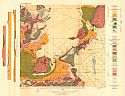
Main Author:
U.S. Geological Survey
Title/Description:
Geologic Reconnaissance map of Sanpete and Central Sevier Valleys Utah
Publication Info:
Washington: Department of the Interior, U.S. Geological Survey, 1907; Water Supply Paper No. 199 Plate 2
Viewing Options
Main Author:
Cram, George F.
Publication Info:
Chicago: George F. Cram, 1907; from Cram's Ideal Reference Atlas of the World
Viewing Options
Main Author:
The Crowell Publishing Company
Publication Info:
New York: The Crowell Publishing Co., 1908; from The Twentieth Century Peerless Atlas
Viewing Options
Main Author:
U.S. Geological Survey
Title/Description:
Reconnaissance Map and Cross Section of Part of the Rock Cliffs Coal Field, Colorado and Utah
Publication Info:
Washington: Department of the Interior, U.S. Geological Survey, 1908; Bulletin 371 Plate I
Viewing Options
Main Author:
Hammond, C.S.
Publication Info:
New York: C.S. Hammond & Co. 1908; from Hammond's Handy Atlas of the World
Viewing Options
Main Author:
Rand McNally and Company
Publication Info:
Chicago: Rand McNally and Company, 1908; from The New Ideal State and County Survey and Atlas
Viewing Options
Main Author:
Patten, William and J.E. Homas
Publication Info:
New York: P.F. Collier and Son, 1909; from The New Encyclopedic Atlas and Gazetteer of the World
Viewing Options
Main Author:
Cram, George F.
Publication Info:
Chicago: George F. Cram, c.1909; from The Heart of Our Country
Viewing Options
Main Author:
U.S. Geological Survey
Title/Description:
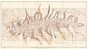
Reconnaissance Geologic and Topographic Map of part of Jensen Quadrangle, Utah and Colorado
Publication Info:
Washington: Department of the Interior, U.S. Geological Survey, 1909; Bulletin 415 Plate XXI
Viewing Options
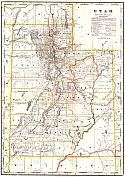
Main Author:
Rand McNally & Co.
Title/Description:
Rand McNally & Co.'s Utah
Publication Info:
Chicago: Rand McNally & Co., 1910
Viewing Options
Main Author:
Cram, George F.
Publication Info:
Berkeley: Ellis A. Davis, 1910; from Davis' Commercial Encyclopedia-California, Nevada, Utah, and Arizona
Viewing Options
Main Author:
Rand McNally and Company
Publication Info:
Chicago: Rand McNally and Company, 1910; from New Ideal State and County Survey

