Viewing Options
Publication Info:
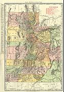
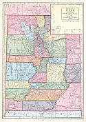
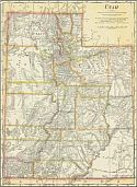
New York: C.S. Hammond and Company, 1911; from Hammond's Modern Atlas of the World
Viewing Options
Main Author:
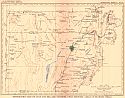
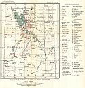
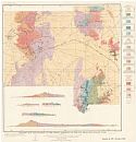
U.S. Geological Survey
Title/Description:
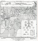
Topographic Map of Juab and Mill and Counties, Utah, Showing Areas of Flowing Wells
Publication Info:
Washington: Department of the Interior, U.S. Geological Survey, 1911; Water Supply Paper No. 277 Plate 1
Viewing Options
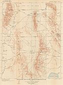
Main Author:
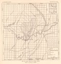
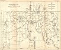
U.S. Geological Survey
Title/Description:
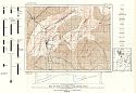
Topographic Map of Fish Springs Quadrangle, Utah
Publication Info:
Washington: Department of the Interior, U.S. Geological Survey, 1911; Water Supply Paper No. 277 Plate 4
Viewing Options
Main Author:
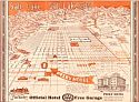
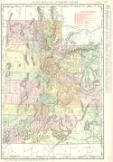
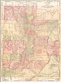
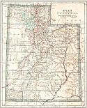
Rand McNally
Publication Info:
Chicago: Rand McNally and Company, 1911
Viewing Options
Main Author:
U.S. Geological Survey
Title/Description:
Map of San Juan Oil Field, Utah
Publication Info:
Washington: Department of the Interior, U.S. Geological Survey, 1911; Bulletin 431
Viewing Options
Main Author:
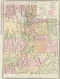
Rand McNally and Company
Publication Info:
Chicago: Rand McNally and Company, 1911
Viewing Options
Main Author:
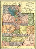
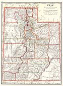
Cram, George F.
Publication Info:
Chicago: George F. Cram, 1911; from Cram's Unrivaled Atlas of the World
Viewing Options
Main Author:
Ravenstein, E.G.
Publication Info:
Chicago: The Reilly and Britton Company, 1911; from The New Census Atlas of the World
Viewing Options
Main Author:
Rand McNally and Company
Publication Info:
Chicago: Rand McNally and Company, 1912; from The Rand McNally Imperial Atlas of the World
Viewing Options
Main Author:
U.S. Geological Survey
Title/Description:
Map of Utah, Showing Location of Mining Districts
Publication Info:
Washington: Department of the Interior, U.S. Geological Survey, 1912; Bulletin 507 Plate XIV
Viewing Options
Main Author:
Rand McNally & Co.
Title/Description:
New Commercial Atlas Map of Utah
Publication Info:
Chicago: Rand McNally & Co., 1913
Viewing Options
Main Author:
Cram, George F.
Publication Info:
Chicago: George F. Cram, 1913; from Cram's Unrivaled Atlas of the World
Viewing Options
Main Author:
U.S. Geological Survey
Title/Description:
Geologic Map and Sections of the Mining Districts of the San Francisco Region, Utah
Publication Info:
Washington: U.S. Deparment of the Interior, Geological Survey, 1913
Viewing Options
Main Author:
U.S. Geological Survey
Title/Description:
Map of Boxelder County, Utah showing location of wells and springs
Publication Info:
Washington: Department of the Interior, U.S. Geological Survey, 1913; Water Supply Paper No. 333 Plate 1
Viewing Options
Main Author:
Reynolds, Francis J.
Publication Info:
New York: P.F. Collier and Son, 1914; from The New Encyclopededic Atlas and Gazatteer of the World
Viewing Options
Main Author:
U.S. Geological Survey
Title/Description:
Map of the Coalville Coal Field, Utah
Publication Info:
Washington: Department of the Interior, U.S. Geological Survey, 1915; Bulletin 581 Plate XI
Viewing Options
Main Author:
U.S. Geological Survey
Title/Description:
Geologic Reconnaissance Map of the Cottonwood - American Fork Mining Region, Utah
Publication Info:
Washington: Department of the Interior, U.S. Geological Survey, 1915; Bulletin 620 Plate VI