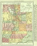
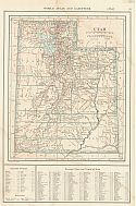
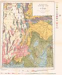
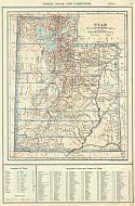
Viewing Options
Main Author:
Rand McNally and Company
Publication Info:
Chicago: Rand McNally and Co., 1916; from The Ideal Atlas of the World
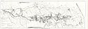
Viewing Options
Main Author:
U.S. Geological Survey
Title/Description:
Map of Emery Coal Field, Emory and Sevier Counties, Utah
Publication Info:
Washington: Department of the Interior, U.S. Geological Survey, 1916; Bulletin 628 Plate X
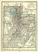
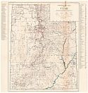
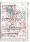
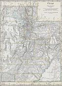
Viewing Options
Main Author:
C.S. Hammond and Company
Publication Info:
New York: C.S. Hammond and Company, 1917; from The Universal Atlas of the World
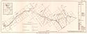
Viewing Options
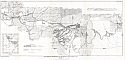
Main Author:
U.S. Geological Survey
Title/Description:
Map of Ozokerite Field in Central Utah
Publication Info:
Washington: Department of the Interior, U.S. Geological Survey, 1917; Bulletin 641 Plate 1
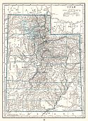
Viewing Options
Main Author:
Reynolds, Francis J.
Publication Info:
New York: P.F. Collier and Son, 1917; from The New Encyclopedia Atlas and Gazateer of the World
Viewing Options
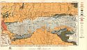
Main Author:
U.S. Geological Survey
Title/Description:
Topographic Map of Utah showing water-powered plants, transmission lines, undeveloped power possibilities and mining districts
Publication Info:
Washington: U.S. Deparment of the Interior, Geological Survey, 1918; from Professional Paper No. 111 Plate 1
Viewing Options
Main Author:
U.S. Geological Survey
Title/Description:
Geologic Map and Sections of the Bingham Mining District, Utah
Publication Info:
Washington: U.S. Deparment of the Interior, Geological Survey, 1918; from Professional Paper No. 38 Plate XXXIII
Viewing Options
Main Author:
U.S. Geological Survey
Title/Description:
Geologic Map of the Cottonwood and Park City Mining Districts, Utah
Publication Info:
Washington: U.S. Deparment of the Interior, Geological Survey, 1918; from Professional Paper No. 111 Plate XXVII
Viewing Options
Main Author:
U.S. Geological Survey
Title/Description:
Reconnaissance Geologic Map of Utah
Publication Info:
Washington: U.S. Deparment of the Interior, Geological Survey, 1918; from Professional Paper No. 111 Plate IV
Viewing Options
Main Author:
U.S. Geological Survey
Title/Description:
Map Showing Distribution of Oil Shale in Uinta Basin, Utah
Publication Info:
Washington: Department of the Interior, U.S. Geological Survey, 1918; Bulletin 691 Plate XII
Viewing Options
Main Author:
U.S. Geological Survey
Title/Description:
Map Showing the Distribution of Phosphate Deposits Along the North and South Slopes of the Uinta Mountains, in Northeastern Utah
Publication Info:
Washington: Department of the Interior, U.S. Geological Survey, 1918; Bulletin 690 Plate V
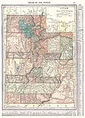
Viewing Options
Main Author:
C.S. Hammond and Company
Publication Info:
New York: C.S. Hammond and Company, 1918; from Hammonds Pictorial Atlas of the World
Viewing Options
Main Author:
Reynolds, Francis J.
Publication Info:
New York: P.F. Collier and Son Company, 1920; from The New World Atlas and Gazetteer
Viewing Options
Main Author:
Cram, George F.
Publication Info:
Chicago: James R. Gray and Company, 1920; from Cram's Unrivaled Atlas of the World
Viewing Options
Main Author:
C.S. Hammond and Company
Publication Info:
New York: C.S. Hammond and Company, 1920; from The New Reference Atlas of the World
Original Source:
Courtesy of Shawn Carter
Viewing Options
Main Author:
Leslie-Judge Company
Publication Info:
New York: Leslie-Judge Company1920; from Leslie's New World Atlas

