Viewing Options
Main Author:
Gray, Ormando W.
Title/Description:
Pennsylvania
Publication Info:
Philadelphia: O.W. Gray, 1876
Viewing Options
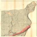
Main Author:
Second Geological Survey of Pennsylvania
Title/Description:
Geological and Topological Map Showing the Limestone of Lehigh County (North West Sheet)
Publication Info:
Harrisburg: Second Geological Survey of Pennsylvania, 1876
Original Source:
Geological Survey of Alabama
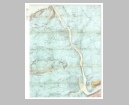
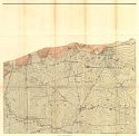
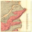
Viewing Options
Main Author:
Second Geological Survey of Pennsylvania
Title/Description:
Geological and Topological Map Showing the Limestone of Lehigh County (North East Sheet)
Publication Info:
Harrisburg: Second Geological Survey of Pennsylvania, 1876
Original Source:
Geological Survey of Alabama
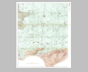
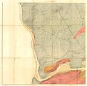
Viewing Options
Main Author:
Second Geological Survey of Pennsylvania
Title/Description:
Geological and Topological Map Showing the Limestone of Lehigh County (South West Sheet)
Publication Info:
Harrisburg: Second Geological Survey of Pennsylvania, 1876
Original Source:
Geological Survey of Alabama
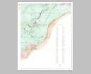
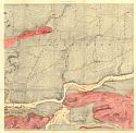
Viewing Options
Main Author:
Second Geological Survey of Pennsylvania
Title/Description:
Geological and Topological Map Showing the Limestone of Lehigh County (South East Sheet)
Publication Info:
Harrisburg: Second Geological Survey of Pennsylvania, 1876
Original Source:
Geological Survey of Alabama
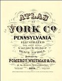
Main Author:
Nichols, Beach and O.W. Gray and Son
Title/Description:
Atlas of York Co., Pennsylvania
Publication Info:
Philadelphia: Pomeroy, Whitman and Company, 1876
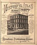
Main Author:
Reading Publishing House
Title/Description:
Illustrated Historical Atlas of Berks County, Penna.
Publication Info:
Reading: Reading Publishing House, 1876
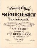
Title/Description:
County Atlas of Somerset Co., Pennsylvania
Publication Info:
New York: F.W. Beers and Company, 1876
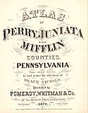
Main Author:
Nichols, Beach
Title/Description:
The Atlas of Perry, Juniata, and Mifflin Counties, Pennsylvania
Publication Info:
Philadelphia: Pomeroy, Whitman and Company, 1877
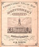
Title/Description:
Combination Atlas Map of Montgomery County, Pennsylvania
Publication Info:
Philadelphia: Pomeroy, Whitman and Company, 1877
Viewing Options
Viewing Options
Viewing Options
Viewing Options
Viewing Options
Viewing Options
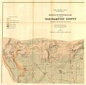
Main Author:
The Second Geological Survey of Pennsylvania
Title/Description:
Geological and Topographical Map of a part of Northampton County, Sheet 1
Publication Info:
Harrisburg: Second Geological Survey of Pennsylvania, 1878
Viewing Options
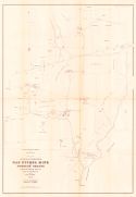
Main Author:
Cooper, W.M.
Title/Description:
Plan of Joseph Wharton's Gap Nickel Mine and Furnace Tracts in Lancaster Co. Pa.
Publication Info:
Harrisburg: Second Geological Survey of Pennsylvania, 1878
Viewing Options
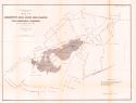
Title/Description:
Map of the Chestnut Hill Iron Ore Banks in West Hempfield Township, Lancaster County
Publication Info:
Harrisburg: Second Geological Survey of Pennsylvania, 1878
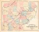
Main Author:
Caldwell, J.A.
Title/Description:
Historical Atlas of Clearfield Co. Pennsylvania
Publication Info:
Condit, Ohio: J.A. Caldwell, 1878
Viewing Options
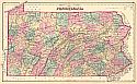
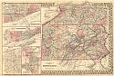
Main Author:
Mitchell, S. Augustus
Title/Description:
County Map of the State of Pennsylvania
Publication Info:
Philadelphia: S. Augustus Mitchell, 1880; from Mitchell's New General Atlas