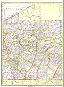
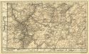
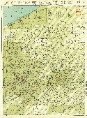
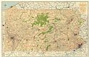
Viewing Options
Main Author:
Clason Map Company
Title/Description:
Best Roads of Pennsylvania
Publication Info:
Chicago: Clason Map Company, c. 1927; from Clason's Touring Atlas

Viewing Options
Main Author:
Sisler, James D.
Title/Description:
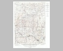
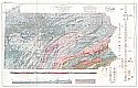
Map of the Coal Fields of Pennsylvania
Publication Info:
[Harrisburg]: Commonwealth of Pennsylvania, Topographic and Geological Survey, 1929; Bulletin M-6 Part II Plate I
Viewing Options
Main Author:
U.S. Geological Survey
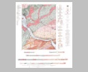
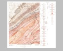
Title/Description:
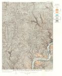
Geologic Map and Sections of the McCalls Ferry and Quarryville Quadrangles, Pennsylvania
Publication Info:
Washington: Department of the Interior, U.S. Geological Survey, 1929; Bulletin 799 Plate 1
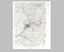
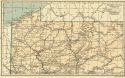
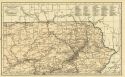
Viewing Options
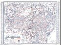
Main Author:
National Map Company
Title/Description:
Pennsylvania - West
Publication Info:
Indianapolis: National Map Company, 1930; from Official Paved Road and Commercial Survey of the United States
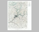
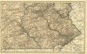
Viewing Options
Main Author:
National Map Company
Title/Description:
Pennsylvania - East
Publication Info:
Indianapolis: National Map Company, 1930; from Official Paved Road and Commercial Survey of the United States
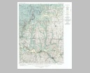
Viewing Options
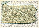
Main Author:
Clason Map Company
Title/Description:
Clason's Road Map of Pennsylvania
Publication Info:
Denver: The Clason Map Company, 1930; from Clason's Touring Atlas of the United States and Canada
Viewing Options
Main Author:
C.S. Hammond and Company
Title/Description:
Pennsylvania (Northwestern Part)
Publication Info:
New York: C.S. Hammond and Company, c. 1930; from The New World Loose Leaf Atlas, Sixth Edition
Viewing Options
Main Author:
C.S. Hammond and Company
Title/Description:
Pennsylvania (Southwestern Part)
Publication Info:
New York: C.S. Hammond and Company, c. 1930; from The New World Loose Leaf Atlas, Sixth Edition
Viewing Options
Main Author:
C.S. Hammond and Company
Title/Description:
Pennsylvania (Northeastern Part)
Publication Info:
New York: C.S. Hammond and Company, c. 1930; from The New World Loose Leaf Atlas, Sixth Edition
Viewing Options
Main Author:
C.S. Hammond and Company
Title/Description:
Pennsylvania (Southeastern Part)
Publication Info:
New York: C.S. Hammond and Company, c. 1930; from The New World Loose Leaf Atlas, Sixth Edition
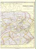
Viewing Options
Main Author:
C.S. Hammond and Company
Title/Description:
Pennsylvania
Publication Info:
New York: C.S. Hammond and Company, c. 1930; from The New World Loose Leaf Atlas, Sixth Edition
Viewing Options
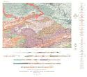
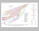
Main Author:
Stose, George W. and O.J. Ljungstedt
Title/Description:
Geologic Map of Pennsylvania
Publication Info:
Harrisburg: Commonwealth of Pennsylvania, Topographic and Geologic Survey, 1931
Viewing Options
Main Author:
U.S. Geological Survey
Title/Description:
Geologic Map and Sections of the Quakertown and Doylestown Quadrangles, Pennsylvania-New Jersey
Publication Info:
Washington: Department of the Interior, U.S. Geological Survey, 1931; Bulletin 828 Plate 1
Viewing Options
Main Author:
Geographical Publishing Company
Title/Description:
Pennsylvania
Publication Info:
Chicago: Geographical Publishing Company1931; from Commercial Atlas of the World
Viewing Options
Main Author:
U.S. Geological Survey
Title/Description:
Geological Map of the New Kensington Quadrangle, Pennsylvania
Publication Info:
Washington: Department of the Interior, U.S. Geological Survey, 1932; Bulletin 829, Plate I
Viewing Options
Main Author:
U.S. Geological Survey
Title/Description:
Map Showing Structure and Economic Geology of the New Kensington Quadrangle, Pennsylvania
Publication Info:
Washington: Department of the Interior, U.S. Geological Survey, 1932; Bulletin 829, Plate 2
Viewing Options
Main Author:
Vacuum Oil Company
Title/Description:
Mobilgas Road Map of Pennsylvania
Publication Info:
New York: General Drafting Company, 1934
Original Source:
Murray Hudson
Viewing Options
Main Author:
Branom, Frederick K. and Lloyd Edwin Smith
Title/Description:
Pennsylvania
Publication Info:
Chicago: Geographical Publishing Company, 1936; from Capper's 1936 Atlas of the World
Viewing Options
Main Author:
Rand McNally and Company
Title/Description:
Eastern Pennsylvania
Publication Info:
Chicago: Rand McNally and Company, 1936
Viewing Options
Main Author:
Rand McNally and Company
Title/Description:
Western Pennsylvania
Publication Info:
Chicago: Rand McNally and Company, 1936
Viewing Options
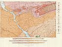
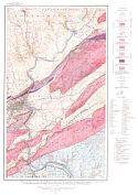
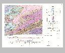
Main Author:
Bascom, F. and G.W. Stose
Title/Description:
Geologic Map and Structure Sections of the Honeybrook and Phoenixville Quadrangles, Pennsylvania
Publication Info:
Washington: Department of the Interior, US Geological Survey, 1938; Bulletin 891. Plate 1
Viewing Options
Main Author:
Esso (Standard Oil of New Jersey)
Title/Description:
Happy Motoring in Pennsylvania
Publication Info:
New York: General Drafting Company, 1938
Original Source:
Murray Hudson
Viewing Options
Main Author:
U.S. Geological Survey
Title/Description:
Geologic Map of the Pre-Cambrian and Lower Cambrian (Hardyston) Areas in the Delaware Water Gap and Easton Quadrangles, Pennsylvania
Publication Info:
Washington: Department of the Interior, US Geological Survey, 1940; Bulletin 920. Plate 5
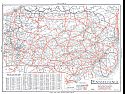
Viewing Options
Main Author:
Department of Commerce
Title/Description:
Map of Pennsylvania Showing the State Highway System and Main Connecting Roads
Publication Info:
Harrisburg: Pennsylvania Department of Commerce, 1940
Viewing Options
Main Author:
Geographical Publishing Company
Title/Description:
Pennsylvania
Publication Info:
Chicago: Geographical Publishing Company, 1942; from The New International Atlas of the World, War Edition
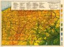
Viewing Options
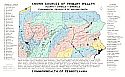
Main Author:
The Pennsylvania State College
Title/Description:
Known Sources of Primary Wealth
Publication Info:
State College: School of Mineral industries, The Pennsylvania State College, 1948
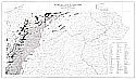
Viewing Options
Main Author:
Jones, Thomas and Lillian Heeren
Title/Description:
Oil and Gas Fields of Pennsylvania
Publication Info:
Harrisburg: Pennsylvania Geological Survey, 1953
Viewing Options
Main Author:
U.S. Geological Survey
Title/Description:
Mineral Deposits in the Northern Serpentine Districts of Pennsylvania-Delaware Piedmont Upland
Publication Info:
Washington: Department of the Interior, U.S. Geological Survey, 1960; Bulletin 1082-K Plate 42
Viewing Options
Main Author:
U.S. Geological Survey
Title/Description:
Geology of Rocks of Pennsylvanian Age in the Southern Half of the Tremont Quadrangle, Schuylkill County, Pennsylvania
Publication Info:
Washington: Department of the Interior, U.S. Geological Survey, 1962; Bulletin 1112-F Plate 13
Viewing Options
Main Author:
U.S. Geological Survey
Title/Description:
Geologic Map Showing Uranium Occurrences in the Northern Half of the Lehighton Quadrangle and Some Adjoining Areas
Publication Info:
Washington: Department of the Interior, U.S. Geological Survey, 1963; Bulletin 1138 Plate 1