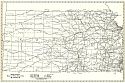
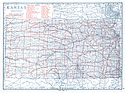
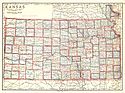
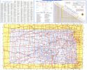
Viewing Options
Main Author:
Rand McNally and Company
Title/Description:
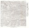
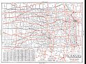
Kansas: Black and White Mileage Chart
Publication Info:
Chicago: Rand McNally and Company, 1921
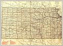
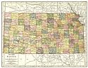
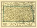
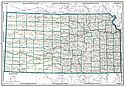
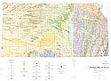
Viewing Options
Main Author:
Rand McNally and Company
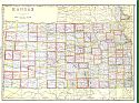
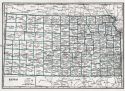
Title/Description:
Kansas
Publication Info:
Chicago: Rand McNally and Company, 1921; from the Commercial Atlas of America
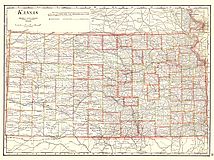
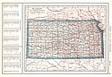
Viewing Options
Main Author:
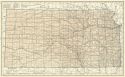
Cram, George F.
Title/Description:
Kansas
Publication Info:
Chicago: George F. Cram Company, 1921; from Cram's Unrivaled Atlas of the World
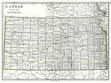
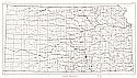
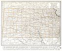
Viewing Options
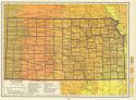
Main Author:
National Map Company
Title/Description:
Kansas
Publication Info:
Indianapolis: National Map Company, 1921; from Auto Trails and Commercial Survey of the United States
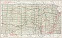
Viewing Options
Main Author:
National Map Company
Title/Description:
Kansas
Publication Info:
Indianapolis: National Map Company, 1921; from Auto Trails and Commercial Survey of the United States
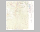
Viewing Options
Main Author:
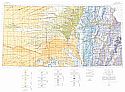
U.S. Geological Survey
Title/Description:
State of Kansas
Publication Info:
Washington: Department of the Interior, U.S. Geological Survey, 1922; compiled 1921, reprinted 1944
Viewing Options
Main Author:
The Geographical Publishing Co.
Title/Description:
Kansas
Publication Info:
Chicago: The Geographical Publishing Co., 1922; from New International Atlas of the World
Viewing Options
Main Author:
C.S. Hammond and Company
Title/Description:
Kansas
Publication Info:
New York: C.S. Hammond and Company, 1922; from the New World Loose-leaf Atlas
Viewing Options
Main Author:
Cram, George F.
Title/Description:
Kansas
Publication Info:
Chicago: George F. Cram Company, 1923; from Cram's Unrivaled Atlas of the World
Viewing Options
Main Author:
Funk and Wagnalls Company
Title/Description:
Kansas
Publication Info:
New York: Funk and Wagnalls Company, 1923; from Atlas of the World and Gazetteer
Viewing Options
Main Author:
Reynolds, Francis J.
Title/Description:
Kansas
Publication Info:
New York: P.F. Collier and Son Company, 1924; from The New World Atlas and Gazetteer
Viewing Options
Main Author:
Rand McNally and Company
Title/Description:
Kansas
Publication Info:
Chicago: Rand McNally and Company, 1925; from Premier Atlas of the World
Viewing Options
Main Author:
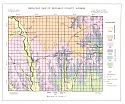
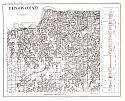
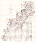
State Geological Survey of Kansas
Title/Description:
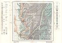
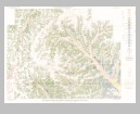
Reconnaissance Geologic Map of Russell County, Kansas
Publication Info:
Lawrence: State Geological Survey of Kansas, 1926; Bulletin 10
Viewing Options
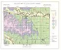
Main Author:
State Geological Survey of Kansas
Title/Description:
Reconnaissance Geologic Map of Cowley County, Kansas
Publication Info:
Lawrence: State Geological Survey of Kansas, 1927; Bulletin 12
Viewing Options
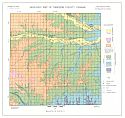
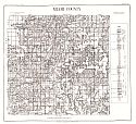
Main Author:
State Geological Survey of Kansas
Title/Description:
Reconnaissance Geologic Map of Ellis County, Kansas
Publication Info:
Lawrence: State Geological Survey of Kansas, 1927; Bulletin 11
Viewing Options
Main Author:
Clason Map Company
Title/Description:
Best Roads of Kansas
Publication Info:
Chicago: Clason Map Company, c. 1927; from Clason's Touring Atlas
Viewing Options
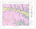
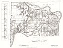
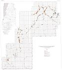
Main Author:
State Geological Survey of Kansas
Title/Description:
Geologic Map of Republic County, Kansas
Publication Info:
Lawrence: State Geological Survey of Kansas, 1930; Bulletin 15
Viewing Options
Main Author:
State Geological Survey of Kansas
Title/Description:
Geologic Map of Cloud County, Kansas
Publication Info:
Lawrence: State Geological Survey of Kansas, 1930; Bulletin 15
Viewing Options
Main Author:
State Geological Survey of Kansas
Title/Description:
Geologic Map of Osborne County, Kansas
Publication Info:
Lawrence: State Geological Survey of Kansas, 1930; Bulletin 16
Viewing Options
Main Author:
State Geological Survey of Kansas
Title/Description:
Geologic Map of Mitchell County, Kansas
Publication Info:
Lawrence: State Geological Survey of Kansas, 1930; Bulletin 16
Viewing Options
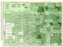
Main Author:
National Map Company
Title/Description:
Kansas
Publication Info:
Indianapolis: National Map Company, 1930; from Official Paved Road and Commercial Survey of the United States
Viewing Options
Main Author:
Clason Map Company
Title/Description:
Clason's Road Map of Kansas
Publication Info:
Denver: The Clason Map Company, 1930; from Clason's Touring Atlas of the United States and Canada
Viewing Options
Main Author:
C.S. Hammond and Company
Title/Description:
Kansas
Publication Info:
New York: C.S. Hammond and Company, c. 1930; from The New World Loose Leaf Atlas, Sixth Edition
Viewing Options
Main Author:
C.S. Hammond and Company
Title/Description:
Kansas
Publication Info:
New York: C.S. Hammond and Company, c. 1930; from The New World Loose Leaf Atlas, Sixth Edition
Viewing Options
Main Author:
State Geological Survey of Kansas
Title/Description:
Geologic Map of Geologic Sections of Wallace County
Publication Info:
Lawrence: State Geological Survey of Kansas, 1931; Bulletin 18
Viewing Options
Main Author:
Geographical Publishing Company
Title/Description:
Kansas
Publication Info:
Chicago: Geographical Publishing Company1931; from Commercial Atlas of the World
Viewing Options
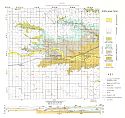
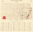
Main Author:
Landes, Kenneth K.
Title/Description:
Oil and Gas Fields of Kansas
Publication Info:
Lawrence: State Geological Survey of Kansas, 1932

Viewing Options
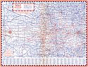
Main Author:
Highway Map Company
Title/Description:
Highway Map of Kansas
Publication Info:
Topeka: Highway Map Company, c. 1933
Original Source:
Murray Hudson
Viewing Options
Main Author:
Barnsdall Refining Company
Title/Description:
1933 Road Map, Kansas
Publication Info:
Chicago: H.M. Gousha Company, 1933
Original Source:
Murray Hudson
Viewing Options
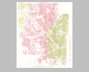
Main Author:
State Geological Survey of Kansas
Title/Description:
Areal Geologic Map of Johnson County
Publication Info:
Lawrence: State Geological Survey of Kansas, 1934; Bulletin 21
Viewing Options
Main Author:
State Geological Survey of Kansas
Title/Description:
Areal Geologic Map of Miami County
Publication Info:
Lawrence: State Geological Survey of Kansas, 1934; Bulletin 21
Viewing Options
Main Author:
State Geological Survey of Kansas
Title/Description:
Areal Geologic Map of Wyandotte County
Publication Info:
Lawrence: State Geological Survey of Kansas, 1934; Bulletin 21
Viewing Options
Main Author:
H.M. Gousha Company
Title/Description:
Guide "G" Index Map of Kansas and Missouri
Publication Info:
Chicago: H.M. Gousha Company, 1935
Viewing Options
Main Author:
Branom, Frederick K. and Lloyd Edwin Smith
Title/Description:
Kansas
Publication Info:
Chicago: Geographical Publishing Company, 1936; from Capper's 1936 Atlas of the World
Viewing Options
Main Author:
State Geological Survey of Kansas
Title/Description:
Geological Map of the Southeastern Kansas Coal Field
Publication Info:
Lawrence: State Geological Survey of Kansas, 1936; Bulletin 24
Viewing Options
Main Author:
State Geological Survey of Kansas
Title/Description:
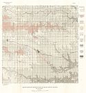
Map of part of Kansas showing wells, oil fields and distribution of Shoestring Sands in the Lower Part of Cherokee Shale
Publication Info:
Lawrence: State Geological Survey of Kansas, 1936; Bulletin 23
Viewing Options
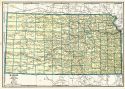
Main Author:
Rand McNally and Company
Title/Description:
Standard Map of Kansas
Publication Info:
Chicago: Rand McNally and Company, 1936
Viewing Options
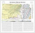
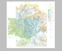
Main Author:
State Geological Survey of Kansas
Title/Description:
Geological Map of Kansas
Publication Info:
State Geological Survey of Kansas, 1937
Viewing Options
Main Author:
Rand McNally & Company
Title/Description:
Rand McNally Standard Map of Kansas
Publication Info:
Chicago: Rand McNally & Co., 1938
Viewing Options
Main Author:
Moore, Raymond G.
Title/Description:
Geologic Map of Kansas
Publication Info:
Lawrence: State Geological Survey, c.1940
Viewing Options
Main Author:
Geographical Publishing Company
Title/Description:
Kansas
Publication Info:
Chicago: Geographical Publishing Company, 1942; from The New International Atlas of the World, War Edition
Viewing Options
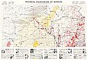
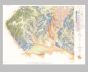
Main Author:
Moore, Raymond C. and John C. Frye
Title/Description:
Mineral Resources of Kansas
Publication Info:
Lawrence: State Geological Survey, 1942
Viewing Options
Main Author:
Bureau of the Census
Title/Description:
Kansas Irrigation by Drainage Basins, 1939
Publication Info:
Washington: U.S. Government Printing Office, 1942
Viewing Options
Main Author:
Geological Survey of Kansas
Title/Description:
Kansas Pits and Quarries
Publication Info:
Lawrence: State Geological Survey, 1951
Viewing Options
Main Author:
State Highway Commission of Kansas
Title/Description:
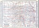
Official 1957-58 Kansas Highway Map
Publication Info:
State Highway Commission of Kansas, 1958
Viewing Options
Main Author:
U.S. Geological Survey
Title/Description:
Map Showing the Construction Materials and Geology of Morris County, Kansas
Publication Info:
Washington: Department of the Interior, U.S. Geological Survey, 1958; Bulletin 1060-A Plate 1
Viewing Options
Main Author:
U.S. Geological Survey
Title/Description:
Map Showing the Construction Materials and Geology of Wabaunsee County, Kansas
Publication Info:
Washington: Department of the Interior, U.S. Geological Survey, 1959; Bulletin 1068 Plate 2
Viewing Options
Main Author:
U.S. Geological Survey
Title/Description:
Map Showing the Construction Materials and Geology of Pottawatomie County, Kansas
Publication Info:
Washington: Department of the Interior, U.S. Geological Survey, 1959; Bulletin 1060-C Plate 5
Viewing Options
Main Author:
U.S. Geological Survey
Title/Description:
Map Showing the Construction Materials and Geology of Marion County, Kansas
Publication Info:
Washington: Department of the Interior, U.S. Geological Survey, 1959; Bulletin 1060-B Plate 3
Viewing Options
Main Author:
U.S. Geological Survey
Title/Description:
Map Showing the Construction Materials and Geology of Nemaha County, Kansas
Publication Info:
Washington: Department of the Interior, U.S. Geological Survey, 1959; Bulletin 1060-D Plate 6
Viewing Options
Main Author:
State Highway Commission of Kansas
Title/Description:
Official
Publication Info:
[Topeka]: State Highway Commission of Kansas, 1962
Viewing Options
Main Author:
Geological Survey of Kansas
Title/Description:
Geologic Map of Kansas
Publication Info:
Lawrence: State Geological Survey, 1964

