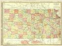
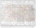
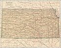
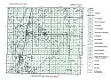
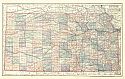
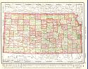
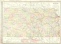
Viewing Options
Main Author:
Rand McNally and Company
Title/Description:
Kansas
Publication Info:
Chicago: Rand McNally and Company, 1906; from the Business Atlas and Shippers Guide
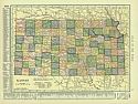
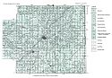
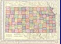
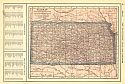
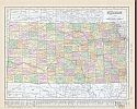
Viewing Options
Main Author:
C.S. Hammond and Company
Title/Description:
Kansas
Publication Info:
New York: C.S. Hammond and Company, 1906; from The Pictorial Atlas of the World
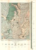
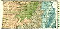
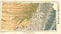
Viewing Options
Main Author:
U.S. Geological Survey
Title/Description:
Geologic and Topographic Map and Sections of Independence Quadrangle, Kansas showing Location of Oil and Gas Wells in October, 1904
Publication Info:
Washington: Department of the Interior, U.S. Geological Survey, 1906; Bulletin 296 Plate I
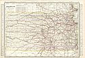
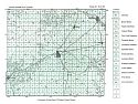
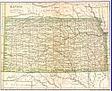
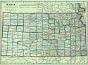
Viewing Options
Title/Description:
Kansas
Publication Info:
Chicago: George F. Cram for A. A. Grant, Toronto, Ont., 1906; from Grant's Bankers and Brokers Railroad System Atlas
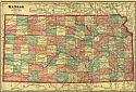
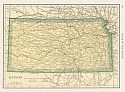
Viewing Options
Main Author:
Rand McNally and Company
Title/Description:
Kansas
Publication Info:
Chicago: Rand McNally and Company, 1906; from The World and its Peoples
Viewing Options
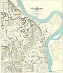
Main Author:
Army Service Schools
Title/Description:
Map of Fort Leavenworth, Kansas and Vicinity
Publication Info:
Fort Leavenworth: Army Service Schools, 1907
Viewing Options
Main Author:
Poates, L.L.
Title/Description:
Kansas
Publication Info:
Boston: Dodd, Mead & Co., c. 1907; from Patton & Homans New Encyclopedic Atlas and Gazetteer
Viewing Options
Main Author:
Cram, George F.
Title/Description:
Kansas
Publication Info:
Chicago: George F. Cram, 1907; from the Standard American Atlas
Viewing Options
Main Author:
P.F. Collier and Son
Title/Description:
Kansas
Publication Info:
New York: P.F. Collier and Son, 1907; from The New Encyclopedic Atlas and Gazetteer of the World
Viewing Options
Main Author:
University Geological Survey of Kansas
Title/Description:
Geological Map of Kansas
Publication Info:
Topeka: State Printing Office, 1908; from Volume 9, Special Report on Oil and Gas
Viewing Options
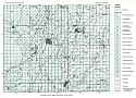
Main Author:
University Geological Survey of Kansas
Title/Description:
A Geological Surface Map of Montgomery Co., Kansas
Publication Info:
Topeka: State Printing Office, 1908; from Volume 9, Special Report on Oil and Gas
Viewing Options
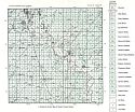
Main Author:
University Geological Survey of Kansas
Title/Description:
A Geological Surface Map of Neosho County, Kansas
Publication Info:
Topeka: State Printing Office, 1908; from Volume 9, Special Report on Oil and Gas
Viewing Options
Main Author:
University Geological Survey of Kansas
Title/Description:
A Geological Surface Map of Allen County, Kansas
Publication Info:
Topeka: State Printing Office, 1908; from Volume 9, Special Report on Oil and Gas
Viewing Options
Main Author:
University Geological Survey of Kansas
Title/Description:
A Geological Surface Map of Miami County, Kansas
Publication Info:
Topeka: State Printing Office, 1908; from Volume 9, Special Report on Oil and Gas
Viewing Options
Main Author:
University Geological Survey of Kansas
Title/Description:
A Geological Surface Map of Chautauqua County, Kansas
Publication Info:
Topeka: State Printing Office, 1908; from Volume 9, Special Report on Oil and Gas

Viewing Options
Main Author:
University Geological Survey of Kansas
Title/Description:
A Geological Surface Map of Wilson County, Kansas
Publication Info:
Topeka: State Printing Office, 1908; from Volume 9, Special Report on Oil and Gas
Viewing Options
Main Author:
University Geological Survey of Kansas
Title/Description:
A Geological Surface Map of Woodson County, Kansas
Publication Info:
Topeka: State Printing Office, 1908; from Volume 9, Special Report on Oil and Gas
Viewing Options
Main Author:
Hammond, C.S.
Title/Description:
Kansas
Publication Info:
New York: The Crowell Publishing Company, 1908; from The Twentieth Century Peerless Atlas
Viewing Options
Main Author:
Hammond, C.S.
Title/Description:
Kansas
Publication Info:
New York: C.S. Hammond and Company, 1908
Viewing Options
Title/Description:
Kansas
Publication Info:
New York: Dodd, Mead and Company, 1908
Viewing Options
Main Author:
Hammond, C.S.
Title/Description:
Kansas
Publication Info:
New York: C.S. Hammond & Co. 1908; from Hammond's Handy Atlas of the World
Viewing Options
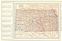
Main Author:
Rand McNally and Company
Title/Description:
Kansas
Publication Info:
Chicago: Rand McNally and Company, 1908; from The New Ideal State and County Survey and Atlas
Viewing Options
Main Author:
Patten, William and J.E. Homas
Title/Description:
Kansas
Publication Info:
New York: P.F. Collier and Son, 1909; from The New Encyclopedic Atlas and Gazetteer of the World
Viewing Options
Main Author:
Cram, George F.
Title/Description:
Kansas
Publication Info:
Chicago: George F. Cram, c. 1909; from the Heart of our Country
Viewing Options
Main Author:
U.S. Geological Survey
Title/Description:
Geologic Map of Kansas
Publication Info:
Washington: Department of the Interior, U.S. Geological Survey, 1909; Water Supply Paper No. 273 Plate 1
Viewing Options
Main Author:
Rand McNally and Company
Title/Description:
Kansas
Publication Info:
Chicago: Rand McNally and Company, 1910; from Enlarged Business Atlas and Shippers Guide
Viewing Options
Main Author:
Rand McNally and Company
Title/Description:
Kansas
Publication Info:
Chicago: Rand McNally and Company, 1910; from New Ideal State and County Survey

