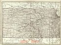
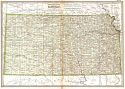
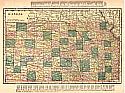
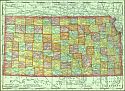
Viewing Options
Main Author:
Rand McNally and Company
Title/Description:
Kansas
Publication Info:
Chicago: Rand McNally and Co., 1901; from the Enlarged Business and Shippers Guide
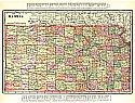
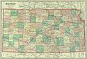
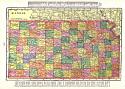
Viewing Options
Main Author:
Rand McNally and Company
Title/Description:
Kansas
Publication Info:
Chicago: Rand McNally and Company, 1901; from The Enlarged Business Atlas and Shippers Guide
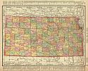
Viewing Options
Main Author:
Rand McNally and Co.
Title/Description:
Kansas
Publication Info:
Chicago: Rand McNally and Co., 1901; from the Universal Atlas of the World
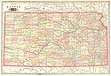
Viewing Options
Main Author:
Tunison, Henry Cuthbert
Title/Description:
Kansas
Publication Info:
New York: H.C. Tunison, 1901; from Tunison's Atlas, Encyclopædia, Gazetteer, and Portfolio of Our Universe, Globe, and Nation
Viewing Options
Main Author:
The Century Company
Title/Description:
Kansas
Publication Info:
Buffalo: The Matthews-Northrup Co., 1902; from the 1902 edition of the Century Atlas
Original Source:
From the personal collection of Dr. Robert Burckhalter
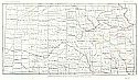
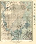
Viewing Options
Main Author:
University Geological Survey of Kansas
Title/Description:
General Map of Kansas Showing Locations of Mineral Springs and Wells
Publication Info:
Topeka: State Printing Office, 1902; Vol. VII Plate II
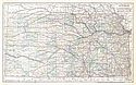
Viewing Options
Main Author:
Cram, George F.
Title/Description:
Kansas
Publication Info:
Chicago: George F. Cram, 1903
Viewing Options
Main Author:
U.S. Geological Survey
Title/Description:
Map of Southeastern Kansas Showing Lines of Outcrop of Limestone Formation
Publication Info:
Washington: Department of the Interior, U.S. Geological Survey, 1903; Bulletin 211 Plate III
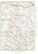
Viewing Options
Main Author:
U.S. Geological Survey
Title/Description:
Geologic Map of the Iola Quadrangle, Kansas showing Location of Oil and Gas Wells in September, 1903
Publication Info:
Washington: Department of the Interior, U.S. Geological Survey, 1903; Bulletin 238 Plate I
Viewing Options
Main Author:
The Crowell Publishing Company
Title/Description:
Kansas
Publication Info:
Springfield, Ohio: The Crowell Publishing Company, 1903; from The Twentieth Century Peerless Atlas and Pictorial Gazetteer
Viewing Options
Main Author:
Miller, J. Martin
Title/Description:
Kansas
Publication Info:
Unknown, 1904; from the Twentieth Century Atlas and Illustrated World
Viewing Options
Main Author:
Miller, J. Martin
Title/Description:
Kansas
Publication Info:
unknown publication, 1905; from the Monarch Standard Atlas
Viewing Options
Main Author:
Rand McNally and Company
Title/Description:
Kansas
Publication Info:
Chicago: Rand McNally and Co., 1905; from Unrivaled Atlas of the World

