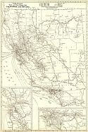
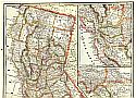
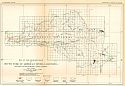
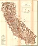
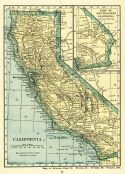
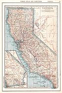
Viewing Options
Main Author:
Rand McNally and Company
Title/Description:
California and Nevada- Black and White Mileage Map
Publication Info:
Chicago: Rand McNally and Company, 1921; from the Commercial Atlas of America
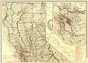
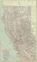
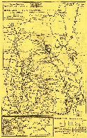
Viewing Options
Main Author:
Rand McNally and Company
Title/Description:
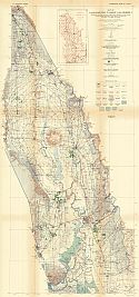
California, Northern Section
Publication Info:
Chicago: Rand McNally and Company, 1921; from the Commercial Atlas of America
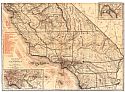
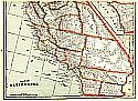
Viewing Options
Main Author:
Rand McNally and Company
Title/Description:
California, Southern Section
Publication Info:
Chicago: Rand McNally and Company, 1921; from the Commercial Atlas of America
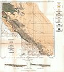
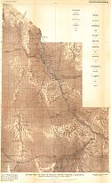
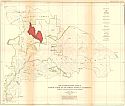
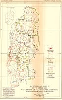
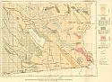
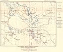
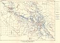
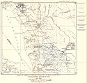
Viewing Options
Main Author:
U.S. Geological Survey
Title/Description:
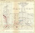
Geologic Map and Sections of Northwestern Kern County, California
Publication Info:
Washington: Department of the Interior, U.S. Geological Survey, 1921; Bulletin 721 Plate I
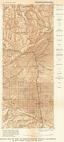
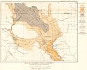
Viewing Options
Main Author:
U.S. Geological Survey
Title/Description:
Relief Map of part of Mohave Desert Region, California showing desert watering places (Sheet 1)
Publication Info:
Washington: Department of the Interior, U.S. Geological Survey, 1921; Bulletin 578 Plate 9
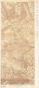
Viewing Options
Main Author:
U.S. Geological Survey
Title/Description:
Relief Map of part of Mohave Desert Region, California showing desert watering places (Sheet 2)
Publication Info:
Washington: Department of the Interior, U.S. Geological Survey, 1921; Bulletin 578 Plate 9
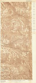
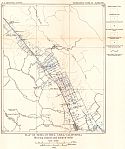
Viewing Options
Main Author:
U.S. Geological Survey
Title/Description:
Relief Map of the Mohave Desert Region, California showing desert watering places (Sheet 3)
Publication Info:
Washington: Department of the Interior, U.S. Geological Survey, 1921; Bulletin 578 Plate 2
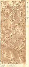
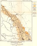
Viewing Options
Main Author:
U.S. Geological Survey
Title/Description:
Relief Map of part of Mohave Desert Region, California showing desert watering places (Sheet 4)
Publication Info:
Washington: Department of the Interior, U.S. Geological Survey, 1921; Bulletin 578 Plate 12
Viewing Options
Main Author:
U.S. Geological Survey
Title/Description:
Relief map of part of Mohave Desert Region, California, showing desert watering places (Sheet 5)
Publication Info:
Washington: Department of the Interior, U.S. Geological Survey, 1921; Bulletin 578 Plate 13
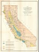
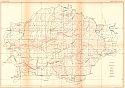
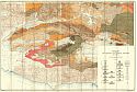
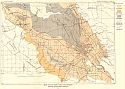
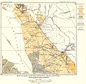
Viewing Options
Main Author:
Leck, Lawrence Vander
Title/Description:
Map of California Showing generalized classifications of land with regard to oil possibilities
Publication Info:
San Francisco: California State Mining Bureau, 1921; Bulletin No. 89
Viewing Options
Main Author:
Hamilton, Fletcher and L. Vander Leck
Title/Description:
Map of Western Imperial County
Publication Info:
San Francisco: California State Mining Bureau, 1921; Bulletin No. 89
Viewing Options
Main Author:
Hamilton, Fletcher and L. Vander Leck
Title/Description:
Reconnaissance Map - West Side of Sacramento Valley
Publication Info:
San Francisco: California State Mining Bureau, 1921; Bulletin No. 89
Viewing Options
Main Author:
Hamilton, Fletcher and L. Vander Leck
Title/Description:
Map of Southwestern Humboldt County
Publication Info:
San Francisco: California State Mining Bureau, 1921; Bulletin No. 89
Viewing Options
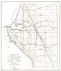
Main Author:
Hamilton, Fletcher and L. Vander Leck
Title/Description:
Geological Map of Pt. Arena District
Publication Info:
San Francisco: California State Mining Bureau, 1921; Bulletin No. 89
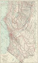
Viewing Options
Main Author:
Cram, George F.
Title/Description:
California - Northern
Publication Info:
Chicago: George F. Cram Company, 1921; from Cram's Unrivaled Atlas of the World
Viewing Options
Main Author:
Cram, George F.
Title/Description:
California - Southern
Publication Info:
Chicago: George F. Cram Company, 1921; from Cram's Unrivaled Atlas of the World
Viewing Options
Viewing Options
Main Author:
The Geographical Publishing Co.
Title/Description:
Map of California
Publication Info:
Chicago: The Geographical Publishing Co., 1922; from New International Atlas of the World
Viewing Options
Main Author:
C.S. Hammond and Company
Title/Description:
California (Northern and Central)
Publication Info:
from the New World Looseleaf Atlas, 1922
Viewing Options
Main Author:
C.S. Hammond and Company
Title/Description:
California (Southern Part)
Publication Info:
from the New World Looseleaf Atlas, 1922
Viewing Options
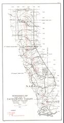
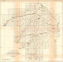
Main Author:
U.S. Geological Survey
Title/Description:
Map of Sacramento Valley, California showing contours of the water table, depths to the water table, areas irrigated with ground water and location of water analyzed
Publication Info:
Washington: Department of the Interior, U.S. Geological Survey, 1922; Bulletin 495 Plate 4

Viewing Options
Main Author:
U.S. Geological Survey
Title/Description:
Map showing the channel Ridge of Cache Creek Slough (Knights Landing Ridge) and the Division between Colusa and Yolo Basins, California
Publication Info:
Washington: Department of the Interior, U.S. Geological Survey, 1922; Bulletin 495 Plate 11

Viewing Options
Main Author:
U.S. Geological Survey
Title/Description:
Map of the Drainage Basin of Truckee River, California and Nevada showing Hydro-electic developments
Publication Info:
Washington: Department of the Interior, U.S. Geological Survey, 1922; Bulletin 493 Plate 72
Viewing Options
Main Author:
U.S. Geological Survey
Title/Description:
Map of the Drainage Basins of Kern, Kaweah, and Tule Rivers and Cottonwood Creek, California showing hydro-electric development
Publication Info:
Washington: Department of the Interior, U.S. Geological Survey, 1922; Bulletin 493 Plate 57
Viewing Options
Main Author:
U.S. Geological Survey
Title/Description:
Map of Drainage Basins of San Joaquin River, North Fork of San Joaquin River, and Big Creek, California showing hydro-electric development
Publication Info:
Washington: Department of the Interior, U.S. Geological Survey, 1922; Bulletin 493 Plate 49
Viewing Options
Main Author:
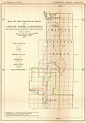
U.S. Geological Survey
Title/Description:
Map of the Drainage Basin of Canyon Creek, California showing hydro-electric developments
Publication Info:
Washington: Department of the Interior, U.S. Geological Survey, 1922; Bulletin 493 Plate 47
Viewing Options
Main Author:
U.S. Geological Survey
Title/Description:
Map of the Drainage Basin of South Form of American River California, showing hydro-electric developments
Publication Info:
Washington: Department of the Interior, U.S. Geological Survey, 1922; Bulletin 493 Plate 45
Viewing Options
Main Author:
U.S. Geological Survey
Title/Description:
Map of the Drainage Basin of Noth Fork of Feather River, California, showing hydro-electric developments
Publication Info:
Washington: Department of the Interior, U.S. Geological Survey, 1922; Bulletin 493 Plate 41
Viewing Options
Main Author:
U.S. Geological Survey
Title/Description:
Map of Basins of Tuolumne and Merced Rivers, California, showing hydro-electric developments
Publication Info:
Washington: Department of the Interior, U.S. Geological Survey, 1922; Bulletin 493 Plate 39
Viewing Options
Main Author:
U.S. Geological Survey
Title/Description:
Map of the Drainage Basins of Cow and Battle Creeks, California, showing hydro-electric developments
Publication Info:
Washington: Department of the Interior, U.S. Geological Survey, 1922; Bulletin 493 Plate 33
Viewing Options
Main Author:
U.S. Geological Survey
Title/Description:
Map of Drainage Basins of Butte Creek and West Branch of Feather River, California, showing hydro-electric developments
Publication Info:
Washington: Department of the Interior, U.S. Geological Survey, 1922; Bulletin 493 Plate 30
Viewing Options
Main Author:
U.S. Geological Survey
Title/Description:
Map of the Drainage Basins of Mokelumne, Stanislaws, and Clavey Rivers, California, showing hydro-electric developments
Publication Info:
Washington: Department of the Interior, U.S. Geological Survey, 1922; Bulletin 493 Plate 17
Viewing Options
Main Author:
U.S. Geological Survey
Title/Description:
Map of the Drainage Basins of North and South Forks of Yuba River, California, showing hydro-electric developments
Publication Info:
Washington: Department of the Interior, U.S. Geological Survey, 1922; Bulletin 493 Plate 22
Viewing Options
Main Author:
U.S. Geological Survey
Title/Description:
Map of Shasta River Basin, California showing hydro-electric developments
Publication Info:
Washington: Department of the Interior, U.S. Geological Survey, 1922; Bulletin 493 Plate 14
Viewing Options
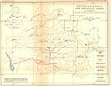
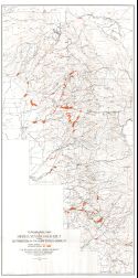
Main Author:
U.S. Geological Survey
Title/Description:
Relief Map of California showing hydro-electric transmission system
Publication Info:
Washington: Department of the Interior, U.S. Geological Survey, 1922; Bulletin 493 Plate 1
Viewing Options
Main Author:
Kimball-Upson Company
Title/Description:
1922 Free Motor Map, Sacramento Valley to Reno-Tahoe Resorts and the Sierras
Publication Info:
San Francisco: Touring Guide Publishing Company, 1922
Original Source:
Murray Hudson
Viewing Options
Main Author:
U.S. Geological Survey
Title/Description:
Reconnaissance Geologic Map of Salton Sea Region, California showing also drainage divides
Publication Info:
Washington: Department of the Interior, U.S. Geological Survey, 1923; Bulletin 497 Plate 12
Viewing Options
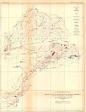
Main Author:
Haley, Charles Scott
Title/Description:
Topographic Map of Sierra Nevada Gold Belt showing Distribution of Auriferous Gravels
Publication Info:
San Francisco: California State Mining Bureau, 1923; Bulletin No. 92
Viewing Options
Main Author:
Funk and Wagnalls Company
Title/Description:
California
Publication Info:
New York: Funk and Wagnalls Company, 1923; from Atlas of the World and Gazetteer
Viewing Options
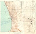
Main Author:
U.S. Department of the Interior, U.S. Geological Survey
Title/Description:
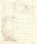
Torrance Quadrangle, Los Angles County, California
Publication Info:
Washington: U.S. Department of the Interior, U.S. Geological Survey, 1924
Viewing Options
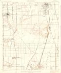
Main Author:
U.S. Department of the Interior, U.S. Geological Survey
Title/Description:
Compton Quadrangle, Los Angles County, California
Publication Info:
Washington: U.S. Department of the Interior, U.S. Geological Survey, 1924
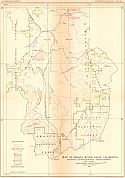
Viewing Options
Main Author:
U.S. Geological Survey
Title/Description:
Geologic Map of Parts of Los Angeles and Ventura Counties, California
Publication Info:
Washington: Department of the Interior, U.S. Geological Survey, 1924; Bulletin 753 Plate 1
Viewing Options
Main Author:
U.S. Geological Survey
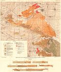
Title/Description:
Map of San Benito Area, California showing location and kinds of wells
Publication Info:
Washington: Department of the Interior, U.S. Geological Survey, 1924; Bulletin 519 Plate 19
Viewing Options
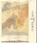
Main Author:
U.S. Geological Survey
Title/Description:
Map of San Benito Area, California showing ground-water conditions
Publication Info:
Washington: Department of the Interior, U.S. Geological Survey, 1924; Bulletin 519 Plate 18
Viewing Options
Main Author:
U.S. Geological Survey
Title/Description:
Map of Morgan Hill Area, California showing location and kinds of wells
Publication Info:
Washington: Department of the Interior, U.S. Geological Survey, 1924; Bulletin 519 Plate 17
Viewing Options
Main Author:
U.S. Geological Survey
Title/Description:
Map of Morgan Hill Area, California showing ground-water conditions
Publication Info:
Washington: Department of the Interior, U.S. Geological Survey, 1924; Bulletin 519 Plate 16
Viewing Options
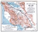
Main Author:
U.S. Geological Survey
Title/Description:
Map of San Jose Area, California showing location and kinds of wells
Publication Info:
Washington: Department of the Interior, U.S. Geological Survey, 1924; Bulletin 519 Plate 15
Viewing Options
Main Author:
U.S. Geological Survey
Title/Description:
Map of San Jose, California showing ground-water conditions
Publication Info:
Washington: Department of the Interior, U.S. Geological Survey, 1924; Bulletin 519 Plate 14
Viewing Options
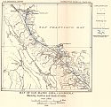
Main Author:
U.S. Geological Survey
Title/Description:
Map of San Mateo Area, California showing location and kinds of wells
Publication Info:
Washington: Department of the Interior, U.S. Geological Survey, 1924; Bulletin 519 Plate 13
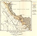
Viewing Options
Main Author:
U.S. Geological Survey
Title/Description:
Map of San Mateo Area, California showing Ground-water conditions
Publication Info:
Washington: Department of the Interior, U.S. Geological Survey, 1924; Bulletin 519 Plate 12
Viewing Options
Main Author:
U.S. Geological Survey
Title/Description:
Map of Niles Cone and adjacent areas, California showing location and kinds of wells
Publication Info:
Washington: Department of the Interior, U.S. Geological Survey, 1924; Bulletin 519 Plate 11
Viewing Options
Main Author:
U.S. Geological Survey
Title/Description:
Map of Niles Cone and adjacent areas, California showing ground-water conditions
Publication Info:
Washington: Department of the Interior, U.S. Geological Survey, 1924; Bulletin 519 Plate 10
Viewing Options
Main Author:
U.S. Geological Survey
Title/Description:
Map of the Drainage Basin of Alameda Creek and adjacent areas
Publication Info:
Washington: Department of the Interior, U.S. Geological Survey, 1924; Bulletin 519 Plate 3
Viewing Options
Main Author:
Reynolds, Francis J.
Title/Description:
California
Publication Info:
New York: P.F. Collier and Son Company, 1924; from The New World Atlas and Gazetteer
Viewing Options
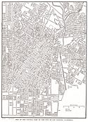
Main Author:
Reynolds, Francis J.
Title/Description:
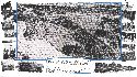
Central Los Angeles
Publication Info:
New York: P.F. Collier and Son Company, 1924; from The New World Atlas and Gazetteer
Viewing Options
Main Author:
Hill Publishing Company
Title/Description:
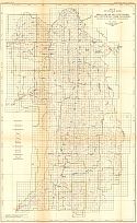
Hill's 1924 City Map, Los Angeles
Publication Info:
Los Angeles: E.F. Hill Publishing Company, 1924
Original Source:
Murray Hudson
Viewing Options
Main Author:
Borgnis, Franklin P
Title/Description:
Map of San Fernando Valley, California
Publication Info:
Los Angeles: E.F. Hill Publishing Company, 1924
Original Source:
Murray Hudson
Viewing Options
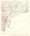
Main Author:
U.S. Department of the Interior, U.S. Geological Survey
Title/Description:
Wilmington Quadrangle, Los Angles County, California
Publication Info:
Washington: U.S. Department of the Interior, U.S. Geological Survey, 1925
Viewing Options
Main Author:
U.S. Department of the Interior, U.S. Geological Survey
Title/Description:
Clearwater Quadrangle, Los Angles County, California
Publication Info:
Washington: U.S. Department of the Interior, U.S. Geological Survey, 1925
Viewing Options
Main Author:
U.S. Geological Survey
Title/Description:
Geologic Map and Sections of the Puenta Hills Region, Southern California
Publication Info:
Washington: Department of the Interior, U.S. Geological Survey, 1925; Bulletin 768 Plate 1
Viewing Options
Main Author:
California State Mining Burea
Title/Description:
[Geology of the Randsburg Quadrangle]
Publication Info:
San Francisco: California State Mining Bureau, 1925; Bulletin No. 95
Viewing Options
Main Author:
Cooper, Frederic Taber
Title/Description:
Rider's California: A Guide-Book for Travelers
Publication Info:
New York: The Macmillan Company, 1925
Viewing Options
Main Author:
Los Angeles Chamber of Commerce
Title/Description:
Los Angeles
Publication Info:
Los Angeles: Los Angeles Chamber of Commerce, 1925
Original Source:
Murray Hudson

