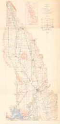
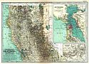
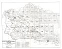
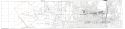
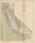
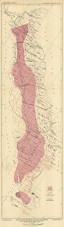
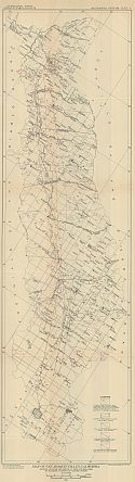
Viewing Options
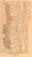
Main Author:
U.S. Geological Survey
Title/Description:
Topographic Map of the Sacramento Valley, California
Publication Info:
Washington: U.S. Department of the Interior, U.S. Geological Survey, 1911
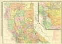
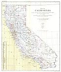
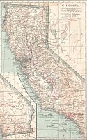
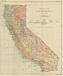
Viewing Options
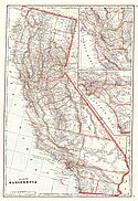
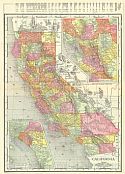
Main Author:
Rand McNally & Company
Title/Description:
California (Northern Half)
Publication Info:
Chicago: Rand McNally & Co., 1911; from Rand-McNally Indexed Atlas
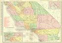
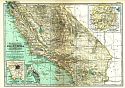
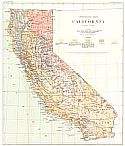
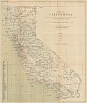
Viewing Options
Main Author:
Rand McNally & Company
Title/Description:
California (Southern Half)
Publication Info:
Chicago: Rand McNally & Co., 1911; from Rand-McNally Indexed Atlas
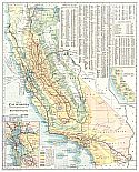
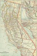
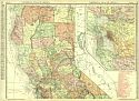
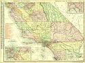
Viewing Options
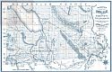
Main Author:
Southern Pacific Railroad
Title/Description:
Map of California
Publication Info:
San Francisco: Southern Pacific Railroad, 1911
Viewing Options
Main Author:
U.S. Geological Survey
Title/Description:
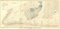
Map of the North Part of the Sierra Nevada, California and Nevada
Publication Info:
Washington: U.S. Deparment of the Interior, Geological Survey
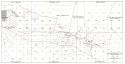
Viewing Options
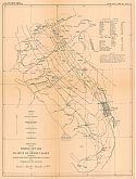
Main Author:
U.S. Geological Survey
Title/Description:
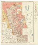
Reconnaissance Hyrdrographic Map of Antelope Valley Region, California
Publication Info:
Washington: Department of the Interior, U.S. Geological Survey, 1911; Bulletin 278 Plate 6
Viewing Options
Main Author:
Cram, George F.
Title/Description:
California
Publication Info:
Chicago: George F. Cram, 1911; from Cram's Unrivaled Atlas of the World
Viewing Options
Main Author:
Rand McNally & Company
Title/Description:
California
Publication Info:
Chicago: Rand McNally & Co., 1912; from Rand McNally's Atlas of the World
Viewing Options
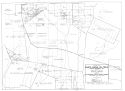
Main Author:
Pacific Improvement Company
Title/Description:
Map of the Properties of the Pacific Improvement Co. withing the Corporate Limits of the City of Pacific Grove, California
Publication Info:
San Francisco: Pacific Improvement Co., 1912; 06096; USA
Viewing Options
Main Author:
U.S. Geological Survey
Title/Description:
General Geologic and Topographic Map and Sections of the Eagle Mountain Iron-Ore District, California
Publication Info:
Washington: Department of the Interior, U.S. Geological Survey, 1912; Bulletin 503 Plate I
Viewing Options
Main Author:
U.S. Geological Survey
Title/Description:
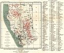
Map of Northern Counties of California, showing Location of Mining Districts
Publication Info:
Washington: Department of the Interior, U.S. Geological Survey, 1912; Bulletin 507 Plate IV
Viewing Options
Main Author:
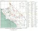
U.S. Geological Survey
Title/Description:
Map of Southern Counties of California, Showing Location of Mining Districts
Publication Info:
Washington: Department of the Interior, U.S. Geological Survey, 1912; Bulletin 507 Plate V
Viewing Options
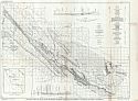
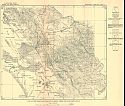
Main Author:
U.S. Geological Survey
Title/Description:
Map of Independence Region, Inyo County, California, showing drainage areas, stream channels and precipitation stations
Publication Info:
Washington: Department of the Interior, U.S. Geological Survey, 1912; Bulletin 294 Plate 1
Viewing Options
Main Author:
U.S. Geological Survey
Title/Description:
Sketch Map of the Sierra Nevada in the vicinity of Owens Valley showing isohyetose lines, precipitation stations, and stream gaging stations
Publication Info:
Washington: Department of the Interior, U.S. Geological Survey, 1912; Bulletin 294 Plate 7
Viewing Options
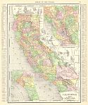
Main Author:
Rand McNally & Company
Title/Description:
Rand McNally's New Map of California
Publication Info:
Chicago: Rand McNally & Co., 1913; from Rand McNally's Banker's Directory and List of Attorneys, 76th Edition
Viewing Options
Main Author:
Denny, Edward
Title/Description:
Denny's Pocket Map of Imperial County California
Publication Info:
San Francisco: Edward Denny & Co., c.1913; compiled from latest official and private data by Edward Denny & Co. Map Publishers
Viewing Options
Main Author:
The Century Company
Title/Description:
California, Northern Part
Publication Info:
New York: The Century Company, 1913; from The Century Atlas of the World
Viewing Options
Main Author:
The Century Company
Title/Description:
California, Southern Part
Publication Info:
New York: The Century Company, 1913; from The Century Atlas of the World
Viewing Options
Main Author:
Cram, George F.
Title/Description:
California
Publication Info:
Chicago: George F. Cram, 1913; from Cram's Unrivaled Atlas of the World
Viewing Options
Main Author:
Prutzman, Paul W.
Title/Description:
Map of the Whittier-Olinda Oil Field, Los Angeles and Orange Counties
Publication Info:
San Francisco: California State Mining District, 1913; from Bulletin No. 63
Viewing Options
Main Author:
Prutzman, Paul W.
Title/Description:
Map of Santa Barbara County
Publication Info:
San Francisco: California State Mining District, 1913; from Bulletin No. 63
Viewing Options
Main Author:
Prutzman, Paul W.
Title/Description:
Map of the Ventura-Newhall Oil District, Los Angeles and Ventura Counties
Publication Info:
San Francisco: California State Mining District, 1913; from Bulletin No. 63
Viewing Options
Main Author:
Prutzman, Paul W.
Title/Description:
Map of the Santa Maria Oil Field, Santa Barbara County
Publication Info:
San Francisco: California State Mining District, 1913; from Bulletin No. 63
Viewing Options
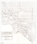
Main Author:
Prutzman, Paul W.
Title/Description:
Map of Southern California
Publication Info:
San Francisco: California State Mining District, 1913; from Bulletin No. 63
Viewing Options
Main Author:
Prutzman, Paul W.
Title/Description:
[Oil Fields of Los Angeles]
Publication Info:
San Francisco: California State Mining District, 1913; from Bulletin No. 63
Viewing Options
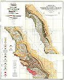
Main Author:
U.S. Geological Survey
Title/Description:
Map of California Showing Locations of Hot, Carbonated, and Sulphur Springs and the more important Faults
Publication Info:
Washington D.c: Department of the Interior, U.S. Geological Survey, 1914; Water Supply Paper 338, Plate III
Viewing Options
Main Author:
U.S. Geological Survey
Title/Description:
Lithogolic Map of California
Publication Info:
Washington D.c: Department of the Interior, U.S. Geological Survey, 1914; Water Supply Paper 338, Plate II
Viewing Options
Main Author:
Rand McNally and Company
Title/Description:
California [Northern Section]
Publication Info:
Chicago: Rand McNally and Co., 1914; from Commercial Atlas of America
Viewing Options
Main Author:
Rand McNally and Company
Title/Description:
California [Southern Section]
Publication Info:
Chicago: Rand McNally and Co., 1914; from Commercial Atlas of America
Viewing Options
Main Author:
Reynolds, Francis J.
Title/Description:
California
Publication Info:
New York: P.F. Collier and Son, 1914; from The New Encyclopedic Atlas and Gazatteer of the World
Viewing Options
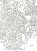
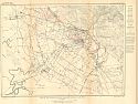
Main Author:
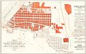
Reynolds, Francis J.
Title/Description:
Map of the Central Part of the City of Los Angeles, California
Publication Info:
New York: P.F. Collier and Son, 1914; from The New Encyclopedic Atlas and Gazatteer of the World
Viewing Options
Main Author:
U.S. Geological Survey
Title/Description:
Geologic Map of the Waltham, Priest, Bitterwater and Peachtree Valleys, in Central California
Publication Info:
Washington: Department of the Interior, U.S. Geological Survey, 1914; Bulletin 581 Plate V
Viewing Options
Main Author:
U.S. Geological Survey
Title/Description:
Topographic Map of California showing Location of Springs
Publication Info:
Washington: Department of the Interior, U.S. Geological Survey, 1914; Bulletin 338 Plate 1
Viewing Options
Main Author:
U.S. Geological Survey
Title/Description:
Lithologic Map of California
Publication Info:
Washington: Department of the Interior, U.S. Geological Survey, 1914; Bulletin 338 Plate 2
Viewing Options
Main Author:
U.S. Geological Survey
Title/Description:
Map of California showing locations of Hat, Carbonated and Sulphur springs, and the more important faults
Publication Info:
Washington: Department of the Interior, U.S. Geological Survey, 1914; Bulletin 338 Plate 3
Viewing Options
Main Author:
U.S. Geological Survey
Title/Description:
Geological Map of the Western Border of San Joaquin Valley, California between the Coalinga Oil Field and Livermore Pass
Publication Info:
Washington: Department of the Interior, U.S. Geological Survey, 1915; Bulletin 603 Plate I
Viewing Options
Main Author:
U.S. Geological Survey
Title/Description:
Map of the San Joaquin Valley, California showing artesian areas, ground-water levels and location of pumping plants
Publication Info:
Washington: Department of the Interior, U.S. Geological Survey, 1915; Bulletin 398 Plate 1
Viewing Options
Main Author:
U.S. Geological Survey
Title/Description:
Map of San Joaquin Valley, California, showing location and depth of wells in relation to sulphate content of ground water
Publication Info:
Washington: Department of the Interior, U.S. Geological Survey, 1915; Bulletin 398 Plate 2
Viewing Options
Main Author:
U.S. Geological Survey
Title/Description:
Map of the Niles Cone and Adjacent Areas, California
Publication Info:
Washington: Department of the Interior, U.S. Geological Survey, 1915; Bulletin 345 Plate 10
Viewing Options
Main Author:
U.S. Geological Survey
Title/Description:
Map of the Drainage Basin of Alameda Creek and Adjacent Areas
Publication Info:
Washington: Department of the Interior, U.S. Geological Survey, 1915; Bulletin 345 Plate 9
Viewing Options
Main Author:
Clason Map Company
Title/Description:
Guide and Map to Points of Interest...of the Los Angeles District
Publication Info:
Denver: Clason Map Company, 1915
Original Source:
Murray Hudson
Viewing Options
Main Author:
Clason Map Company
Title/Description:
The Los Angeles District
Publication Info:
Denver: Clason Map Company, 1915
Original Source:
Murray Hudson

