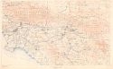
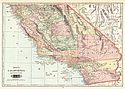
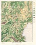
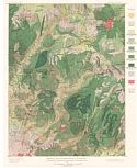
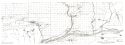
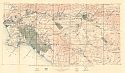
Viewing Options
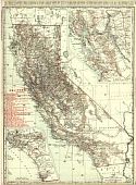
Main Author:
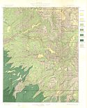
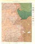
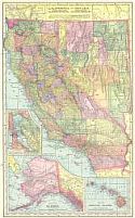
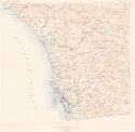
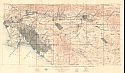
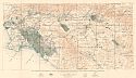
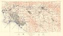
U.S. Department of the Interior, U.S. Geological Survey
Title/Description:
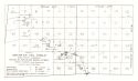
Southern California, Sheet 1
Publication Info:
Washington: U.S. Department of the Interior, U.S. Geological Survey, 1901
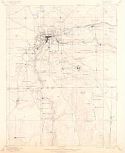
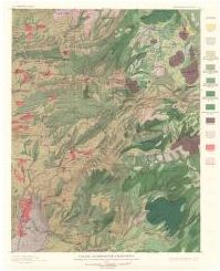
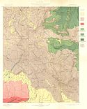
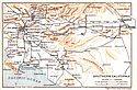
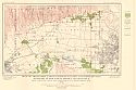
Viewing Options
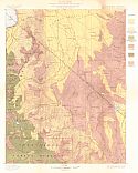
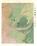
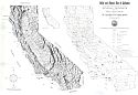
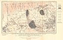
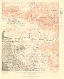
Main Author:
U.S. Department of the Interior, U.S. Geological Survey
Title/Description:
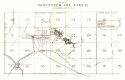
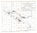
Grass Valley Special Map, Nevada County, California
Publication Info:
Washington: U.S. Department of the Interior, U.S. Geological Survey, 1901
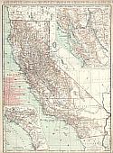
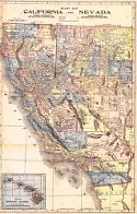
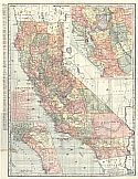
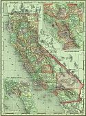
Viewing Options
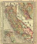
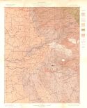
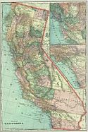
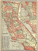
Main Author:
Rand McNally & Company
Title/Description:
Rand McNally & Co's California
Publication Info:
Chicago: Rand McNally & Co., 1901
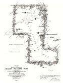
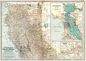
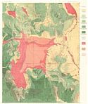
Viewing Options
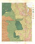
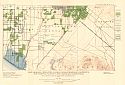
Main Author:
U.S. Surveyor General's Office
Title/Description:
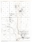
Plat of the Exterior Boundaries of Sequoia National Park, California
Publication Info:
Washington, D.C.: The Norris Peters Co., 1901
Viewing Options
Title/Description:
California
Publication Info:
Chicago: Rand McNally and Co., 1901; from Enlarged Business and Shippers Guide
Viewing Options
Main Author:
Rand McNally and Co.
Title/Description:
California
Publication Info:
Chicago: Rand McNally and Co., 1901; from the Universal Atlas of the World
Viewing Options
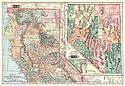
Main Author:
Cram, George F.
Title/Description:
California
Publication Info:
Chicago: The Fort Dearborn Publishing Co., 1901; from The National Standard Family and Business Atlas of the World
Viewing Options
Main Author:
Tunison, Henry Cuthbert
Title/Description:
California, Northern Half; Nevada
Publication Info:
New York: H.C. Tunison, 1901; from Tunison's Atlas, Encyclopædia, Gazetteer, and Portfolio of Our Universe, Globe, and Nation
Viewing Options
Main Author:
Tunison, Henry Cuthbert
Title/Description:
California, Southern Half
Publication Info:
New York: H.C. Tunison, 1901; from Tunison's Atlas, Encyclopædia, Gazetteer, and Portfolio of Our Universe, Globe, and Nation
Viewing Options
Main Author:
Mast, Crowell and Kirkpatrick
Title/Description:
Map of California and Nevada
Publication Info:
Chicago: Benedict and Co., 1902
Viewing Options
Main Author:
The Century Company
Title/Description:
California - Northern Part
Publication Info:
Buffalo: The Matthew-Northrup Co., 1902; from the Century Atlas of 1902
Original Source:
Courtesy of Dr. Robert Burckhalter, Santa Fe, NM
Viewing Options
Main Author:
The Century Company
Title/Description:
California - Southern Part
Publication Info:
Buffalo: The Matthew-Northrup Co., 1902; from the Century Atlas of 1902
Original Source:
Courtesy of Dr. Robert Burckhalter, Santa Fe, NM
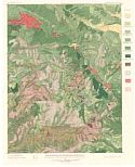
Viewing Options
Main Author:
U.S. Geological Survey
Title/Description:
Truckee Quadrangle Showing land classification and density of standing timber
Publication Info:
Washington: U.S. Deparment of the Interior, Geological Survey
Viewing Options
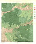
Main Author:
U.S. Geological Survey
Title/Description:
Colfax Quadrangle Showing land classification and density of standing timber
Publication Info:
Washington: U.S. Deparment of the Interior, Geological Survey
Viewing Options
Main Author:
U.S. Geological Survey
Title/Description:
Smartsville Quadrangle Showing land classification and density of standing timber
Publication Info:
Washington: U.S. Deparment of the Interior, Geological Survey
Viewing Options
Main Author:
U.S. Geological Survey
Title/Description:
Sierraville Quadrangle Showing land classification and density of standing timber
Publication Info:
Washington: U.S. Deparment of the Interior, Geological Survey
Viewing Options
Main Author:
U.S. Geological Survey
Title/Description:
Downieville Quadrangle Showing land classification and density of standing timber
Publication Info:
Washington: U.S. Deparment of the Interior, Geological Survey
Viewing Options
Main Author:
U.S. Geological Survey
Title/Description:
Bidwell Bar Quadrangle Showing land classification and density of standing timber
Publication Info:
Washington: U.S. Deparment of the Interior, Geological Survey
Viewing Options
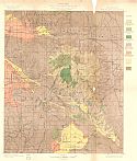
Main Author:
U.S. Geological Survey
Title/Description:
Yosemite Quadrangle, Land Classification and Density of Standing Timber
Publication Info:
Washington: U.S. Geological Survey, 1902; from the Twenty-First Annual Report Part V
Viewing Options
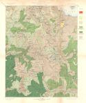
Main Author:
U.S. Geological Survey
Title/Description:
Sonora Quadrangle, Land Classification and Density of Standing Timber
Publication Info:
Washington: U.S. Geological Survey, 1902; from the Twenty-First Annual Report Part V
Viewing Options
Main Author:
U.S. Geological Survey
Title/Description:
Dardanelles Quadrangle, Land Classification and Density of Standing Timber
Publication Info:
Washington: U.S. Geological Survey, 1902; from the Twenty-First Annual Report Part V
Viewing Options
Main Author:
U.S. Geological Survey
Title/Description:
Markleeville Quadrangle, Land Classification and Density of Standing Timber
Publication Info:
Washington: U.S. Geological Survey, 1902; from the Twenty-First Annual Report Part V
Viewing Options
Main Author:
U.S. Geological Survey
Title/Description:
Jackson Quadrangle, Land Classification, and Density of Standing Timber
Publication Info:
Washington: U.S. Geological Survey, 1902; from the Twenty-First Annual Report Part V
Viewing Options
Main Author:
U.S. Geological Survey
Title/Description:
Pyramid Peak Quadrangle, Land Classification and Density of Standing Timber
Publication Info:
Washington: U.S. Geological Survey, 1902; from the Twenty-First Annual Report Part V
Viewing Options
Main Author:
U.S. Geological Survey
Title/Description:
Placerville Quadrangle, Land Classification and Density of Standing Timber
Publication Info:
Washington: U.S. Geological Survey, 1902; from the Twenty-First Annual Report Part V
Viewing Options
Main Author:
U.S. Geological Survey
Title/Description:
Big Trees Quadrangle, Land Classification and Density of Standing Timber
Publication Info:
Washington: U.S. Geological Survey, 1902; from the Twenty-First Annual Report Part V
Viewing Options
Main Author:
U.S. Geological Survey
Title/Description:
San Jacinto Quadrangle, Land Classification and Density of Stand Timber
Publication Info:
Washington: U.S. Geological Survey, 1902; from the Twenty-First Annual Report Part V
Viewing Options
Main Author:
U.S. Geological Survey
Title/Description:
Mt. Lyell Quadrangle, Land Classification and Density of Standing Timber
Publication Info:
Washington: U.S. Geological Survey, 1902; from the Twenty-First Annual Report Part V
Viewing Options
Main Author:
Matthews, James Newton
Title/Description:
California and Nevada
Publication Info:
Buffalo: J.N. Matthews Co., 1903
Viewing Options
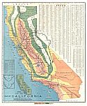
Title/Description:
Map of California Illustrating its climatology - Comparative Area - Rail Lines
Publication Info:
San Francisco: Southern Pacific Railroad, 1903
Viewing Options
Main Author:
Cram, George F.
Title/Description:
Map of California
Publication Info:
Chicago: George F. Cram, 1903
Viewing Options
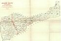
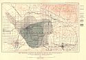
Title/Description:
Map of Amador County, California
Publication Info:
San Francisco: State Mining Bureau, 1903
Viewing Options
Title/Description:
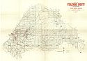
Map of Toulumne County, California
Publication Info:
San Francisco: State Mining Bureau, 1903
Viewing Options
Title/Description:
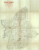
Map of Butte County, California
Publication Info:
San Francisco: State Mining Bureau, 1903
Viewing Options
Title/Description:
Map of the Southern Portion of California Showing the Saline Deposits and the Desert Section of the State
Publication Info:
San Francisco: State Mining Bureau, 1903
Viewing Options
Main Author:
Cram, George F.
Title/Description:
California
Publication Info:
Philadelphia: The Philadelphia Inquirer,1903; from Pictorial Atlas of the Greater United States and the World
Viewing Options
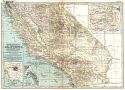
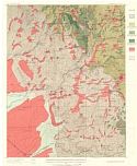
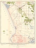
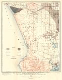
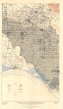
Main Author:
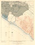
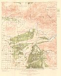
U.S. Department of the Interior, U.S. Geological Survey
Title/Description:
Southern California - Sheet 2
Publication Info:
Washington: U.S. Department of the Interior, U.S. Geological Survey, 1904
Viewing Options
Main Author:
California State Mining Bureau
Title/Description:
Relief and Mineral Map of California
Publication Info:
San Francisco: California State Mining Bureau, 1904
Viewing Options
Main Author:
Miller, J. Martin
Title/Description:
California
Publication Info:
Unknown, 1904; from the Twentieth Century Atlas and Illustrated World
Viewing Options
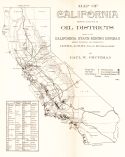
Main Author:
Prutzman, Paul W.
Title/Description:
Map of California showing location of Oil Districts
Publication Info:
San Francisco: California State Mining District, 1904; from bulletin No. 32
Viewing Options
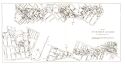
Title/Description:
City Oil Field of Los Angeles, Los Angeles County, Cal.
Publication Info:
San Francisco: California State Mining District, 1904; from Bulletin No. 32
Viewing Options
Title/Description:
Whittier Oil Field, Los Angeles County, Cal.
Publication Info:
San Francisco: California State Mining District, 1904; from Bulletin No. 32
Viewing Options
Title/Description:
Summerland Oil Field, Santa Barbara County, Cal.
Publication Info:
San Francisco: California State Mining District, 1904; from Bulletin No. 32
Viewing Options
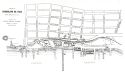
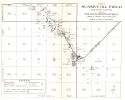
Title/Description:
The Sunset Oil Field, Kern County, Cal.
Publication Info:
San Francisco: California State Mining District, 1904; from Bulletin No. 32
Viewing Options
Title/Description:
Midway Oil Field, Kern County, Cal.
Publication Info:
San Francisco: California State Mining District, 1904; from Bulletin No. 32
Viewing Options
Title/Description:
McKittrick Oil Field, Kern County, Cal.
Publication Info:
San Francisco: California State Mining District, 1904; from Bulletin No. 32
Viewing Options
Title/Description:
Coalinga Oil Field, Fresno County, Cal.
Publication Info:
San Francisco: California State Mining District, 1904; from Bulletin No. 32
Viewing Options
Title/Description:
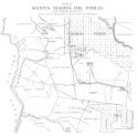
Santa Maria Oil Field, Santa Barbara County, Cal.
Publication Info:
San Francisco: California State Mining District, 1904; from Bulletin No. 32
Viewing Options
Title/Description:
Ventura County Oil Fields, Ventura County, Cal.
Publication Info:
San Francisco: California State Mining District, 1904; from Bulletin No. 32
Viewing Options
Main Author:
Baedeker, Karl
Title/Description:
Southern California
Publication Info:
Leipzig: Karl Baedeker, 1904; from The United States with an Excursion into Mexico
Viewing Options
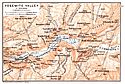
Main Author:
Baedeker, Karl
Title/Description:
Yosemite Valley
Publication Info:
Leipzig: Karl Baedeker, 1904; from The United States with an Excursion into Mexico
Viewing Options
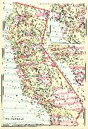
Main Author:
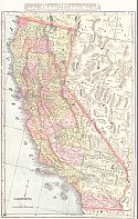
Rand McNally & Co.
Title/Description:
Rand McNally & Co's California
Publication Info:
Chicago: Rand McNally & Co., 1905
Viewing Options
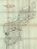
Main Author:
California State Mining Bureau
Title/Description:
Map of Yuba County, California
Publication Info:
San Francisco: State Mining Bureau, 1905
Viewing Options
Main Author:
Rand McNally and Company
Title/Description:
California
Publication Info:
Chicago: Rand McNally and Co., 1905; from Unrivaled Atlas of the World
Viewing Options
Main Author:
U.S. Geological Survey
Title/Description:
Map Showing changes in artesian areas and water levels in the San Bernardino Basin, California
Publication Info:
Washington: Department of the Interior, U.S. Geological Survey, 1905; Bulletin 142 Plate 7
Viewing Options
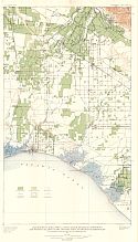
Main Author:
U.S. Geological Survey
Title/Description:
Hydrolic Map of San Bernardino, Redlands, and vicinity showing irrigated lands
Publication Info:
Washington: Department of the Interior, U.S. Geological Survey, 1905; Bulletin 142 Plate 12
Viewing Options
Main Author:
U.S. Geological Survey
Title/Description:
Map showing the atresian areas and hydrographic contours in the valley of southern California
Publication Info:
Washington: Department of the Interior, U.S. Geological Survey, 1905; Bulletin 142 Plate 8
Viewing Options
Main Author:
U.S. Geological Survey
Title/Description:
Map of the irrigated lands, pumping plants, and distributing systems in the Redondo quadrangle
Publication Info:
Washington: Department of the Interior, U.S. Geological Survey, 1905; Bulletin 139 Plate 7
Viewing Options
Main Author:
U.S. Geological Survey
Title/Description:
Map showing wells, atesian areas, and water levels in the Santa Monica quadrangle
Publication Info:
Washington: Department of the Interior, U.S. Geological Survey, 1905; Bulletin 139 Plate 6
Viewing Options
Main Author:
U.S. Geological Survey
Title/Description:
Map showing wells, artesian areas, and water levels in the Redondo quadrangle
Publication Info:
Washington: Department of the Interior, U.S. Geological Survey, 1905; Bulletin 139 Plate 5
Viewing Options
Main Author:
U.S. Geological Survey
Title/Description:
Map showing the artesian areas and hydrographic contours in the valley of Southern California
Publication Info:
Washington: Department of the Interior, U.S. Geological Survey, 1905; Bulletin 139 Plate 1
Viewing Options
Main Author:
U.S. Geological Survey
Title/Description:
Map of irrigated lands, pumping plants, and distributing systems in the Santa Monica quadrangle
Publication Info:
Washington: Department of the Interior, U.S. Geological Survey, 1905; Bulletin 139 Plate 8
Viewing Options
Main Author:
U.S. Geological Survey
Title/Description:
Map showing wells, artesian areas, and water levels in the Downey and Las Bolsas quadrangle
Publication Info:
Washington: Department of the Interior, U.S. Geological Survey, 1905; Bulletin 138 Plate 4
Viewing Options
Main Author:
U.S. Geological Survey
Title/Description:
Map Showing Irrigated Lands, Canals, Drainage Districts, and Pumping Plants, in the Downey and Las Bolsas Quadrangles
Publication Info:
Washington: Department of the Interior, U.S. Geological Survey, 1905; Water Supply Paper No. 138 Plat 2
Viewing Options
Main Author:
U.S. Geological Survey
Title/Description:
Map showing the artesian areas and hydrographic contours in the valley of Southern California
Publication Info:
Washington: Department of the Interior, U.S. Geological Survey, 1905; Bulletin 138 Plate 1
Viewing Options
Main Author:
U.S. Geological Survey
Title/Description:
Map showing wells, artesian areas, and water levels in the Santa Ana quadrangle
Publication Info:
Washington: Department of the Interior, U.S. Geological Survey, 1905; Bulletin 137 Plate 7
Viewing Options
Main Author:
U.S. Geological Survey
Title/Description:
Map showing wells, artesian areas, and water levels in the Anaheim quadrangle
Publication Info:
Washington: Department of the Interior, U.S. Geological Survey, 1905; Bulletin 137 Plate 6
Viewing Options
Main Author:
U.S. Geological Survey
Title/Description:
Map showing irrigated lands, canals, drainage districts, and pumping plants in the Santa Ana Quadrangle
Publication Info:
Washington: Department of the Interior, U.S. Geological Survey, 1905; Bulletin 137 Plate 3
Viewing Options
Main Author:
U.S. Geological Survey
Title/Description:
Map showing irrigated lands, canals, and pumping plants in the Anaheim quadrangle
Publication Info:
Washington: Department of the Interior, U.S. Geological Survey, 1905; Bulletin 137 Plate 2
Viewing Options
Main Author:
U.S. Geological Survey
Title/Description:
Map showing the artesian areas and hydrographic contours in the valley of Southern California
Publication Info:
Washington: Department of the Interior, U.S. Geological Survey, 1905; Bulletin 137 Plate 1

