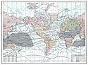
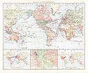
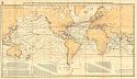
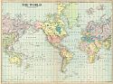
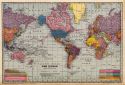
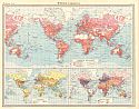
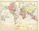
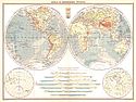
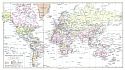
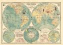
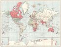
Viewing Options
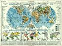
Main Author:
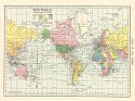
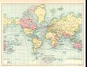
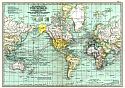
Cram, George F.
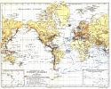
Title/Description:
The World on Mercators Projection
Publication Info:
Chicago: The Fort Dearborn Publishing Co., 1901; from The National Standard Family and Business Atlas of the World
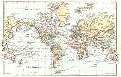
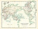
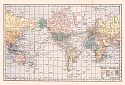
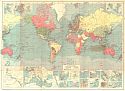
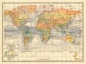
Viewing Options
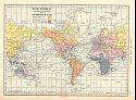
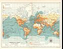
Main Author:
Tunison, Henry Cuthbert
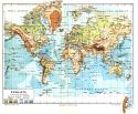
Title/Description:
World on Mercators Projection
Publication Info:
New York: H.C. Tunison, 1901; from Tunison's Atlas, Encyclopædia, Gazetteer, and Portfolio of Our Universe, Globe, and Nation
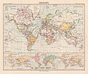
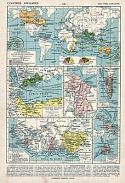
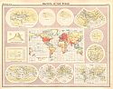
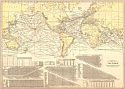
Viewing Options
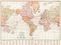
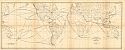
Main Author:
Tunison, Henry Cuthbert
Title/Description:
Historical Chart of the World
Publication Info:
New York: H.C. Tunison, 1901; from Tunison's Atlas, Encyclopædia, Gazetteer, and Portfolio of Our Universe, Globe, and Nation
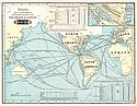
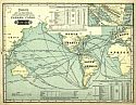
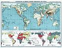
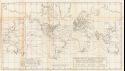
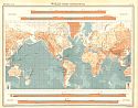
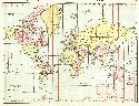
Viewing Options
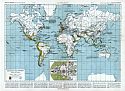
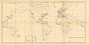
Main Author:
Tunison, Henry Cuthbert
Title/Description:
Chart of the World Showing the Distances Saved by the Nicaragua Canal
Publication Info:
New York: H.C. Tunison, 1901; from Tunison's Atlas, Encyclopædia, Gazetteer, and Portfolio of Our Universe, Globe, and Nation
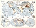
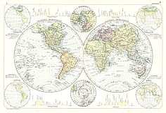
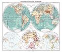
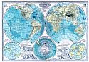
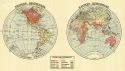
Viewing Options
Title/Description:
Westliche und Ostliche Halbkugel
Publication Info:
Leipzig: Velhagen and Klasing, 1901; from Andrees Allgemeiner Handatlas
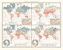
Viewing Options
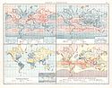
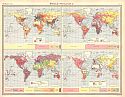
Title/Description:
Isothermen und Warmeschwankung
Publication Info:
Leipzig: Velhagen and Klasing, 1901; from Andrees Allgemeiner Handatlas
Viewing Options
Title/Description:
Isobaren und Niederschläge
Publication Info:
Leipzig: Velhagen and Klasing, 1901; from Andrees Allgemeiner Handatlas
Viewing Options
Title/Description:
Vegetationsgebiete, Meeresströmungen und Kulturpflanzen
Publication Info:
Leipzig: Velhagen and Klasing, 1901; from Andrees Allgemeiner Handatlas
Viewing Options
Title/Description:
Verbreitung der Wichtigsten Wild und Kulturtiere
Publication Info:
Leipzig: Velhagen and Klasing, 1901; from Andrees Allgemeiner Handatlas
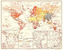
Viewing Options
Title/Description:
Völker, Religionen, Volksdichte und Handel
Publication Info:
Leipzig: Velhagen and Klasing, 1901; from Andrees Allgemeiner Handatlas
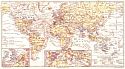
Viewing Options
Title/Description:
Kolonial und Weltverkehrskarte
Publication Info:
Leipzig: Velhagen and Klasing, 1901; from Andrees Allgemeiner Handatlas
Viewing Options
Main Author:
Tunison, H.C.
Title/Description:
Chart of the World Showing the distances saved by the Panama Canal
Publication Info:
Jacksonville, IL: H.C. Tunison, c.1902
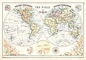
Viewing Options
Title/Description:
Western Hemisphere, Eastern Hemisphere
Publication Info:
London: G.W. Bacon and Company, 1904; from New General Atlas of the World
Viewing Options
Title/Description:
The World
Publication Info:
London: G.W. Bacon and Company, 1904; from New General Atlas of the World
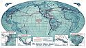
Viewing Options
Main Author:
U.S. Navy, Hydrographic Office
Title/Description:
Chart of the World on Mercator's Projection showing Submarine Cables and Connections, and also Tracks for full-powered steam vessels
Publication Info:
Washington: National Geographic Society, 1905
Viewing Options
Main Author:
Johnston, W. and A.K.
Title/Description:
Chart of the World on Mercator's Projection
Publication Info:
Edinburgh: W. and A.K. Johnston, 1905; from The Handy Royal Atlas of Modern Geography
Viewing Options
Main Author:
Habenicht, H.
Title/Description:
Westliche und Östliche Halbkugel
Publication Info:
Gotha: Justus Perthes, 1905; from Stielers Hand-Atlas
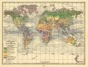
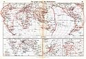
Viewing Options
Main Author:
Habenicht, H.
Title/Description:
Weltkarte in Mercators Projektion
Publication Info:
Gotha: Justus Perthes, 1905; from Stielers Hand-Atlas
Viewing Options
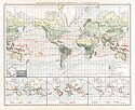
Title/Description:
Verbreitung Der Erdbeben Seebeben und Vulkane
Publication Info:
Leipzig: Bibliographisches Institut, 1906; from Meyer's Konverlations - Lexikon
Viewing Options
Title/Description:
Erdkarte in Mercators Projektion
Publication Info:
Leipzig: Bibliographisches Institut, 1906; from Meyer's Konverlations - Lexikon
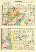
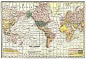
Viewing Options
Title/Description:
Entwickelung des Britischen Kolonialreiches
Publication Info:
Leipzig: Bibliographisches Institut, 1906; from Meyer's Konverlations - Lexikon
Viewing Options
Title/Description:
Karte des Welt-Telegraphen-Netzers
Publication Info:
Leipzig: Bibliographisches Institut, 1906; from Meyer's Konverlations - Lexikon
Viewing Options
Main Author:
Miller, J. Martin
Title/Description:
The World on Mercator's Projection
Publication Info:
Chicago: J. Martin Miller, 1906; 20604; W7
Viewing Options
Title/Description:
Distribution of Mission Stations Throughout the World
Publication Info:
New York: Student Volunteer Movement for Foreign Missions, 1906; Maps by John Bartholomew published in A Geography and Atlas of Protestant Missions
Viewing Options
Title/Description:
Religions und Missionskarte der Erde
Publication Info:
Leipzig: Bibliographisches Institut, 1906; from Meyer's Konveraltions-Lexikon
Viewing Options
Title/Description:
Weltverkehrs-Karte
Publication Info:
Leipzig: Bibliographisches Institut, 1906; from Meyer's Konveraltions-Lexikon
Viewing Options
Main Author:
C.S. Hammond and Company
Title/Description:
The World on Mercator's Projection
Publication Info:
New York: C.S. Hammond and Company, 1906; from Hammond's Pictorial Atlas of the World
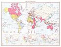
Viewing Options
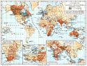
Title/Description:
The World on Mercator's Projection Showing Distribution of Races
Publication Info:
St. Paul: Pioneer Press, 1906; from Pictorial Atlas of the World
Viewing Options
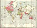
Title/Description:
Map of the World on Mercator's Projection
Publication Info:
New York: L. L. Poates Engineering Company, 1907
Viewing Options
Title/Description:
Decouvertes Des Europeens
Publication Info:
Paris: Librairie Armand Colin, 1908; from Atlas Classique Vidal-Lablache
Viewing Options
Title/Description:
Mappemonde
Publication Info:
Paris: Librairie Armand Colin, 1908; from Atlas Classique Vidal-Lablache
Viewing Options
Title/Description:
Colonies Anglaises
Publication Info:
Paris: Librairie Armand Colin, 1908; from Atlas Classique Vidal-Lablache
Viewing Options
Main Author:
Hammond, C.S.
Title/Description:
The World
Publication Info:
New York: C.S. Hammond & Co. 1908; from Hammond's Handy Atlas of the World
Viewing Options
Main Author:
Bartholomew, J.G.
Title/Description:
The World
Publication Info:
New York: Thomas Nelson and Sons, 1908; from The Globe Hand Atlas
Viewing Options
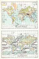
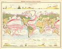
Main Author:
Bartholomew, J.G.
Title/Description:
Bathy-Orographical Map of the World, Ocean Currents and Cultivation of Land Surface
Publication Info:
New York: Thomas Nelson and Sons, 1908; from The Globe Hand Atlas
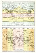
Viewing Options
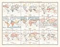
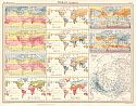
Main Author:
Bartholomew, J.G.
Title/Description:
Climate Chart, Time Chart
Publication Info:
New York: Thomas Nelson and Sons, 1908; from The Globe Hand Atlas

Viewing Options
Main Author:
Cram, George F.
Title/Description:
The World
Publication Info:
Chicago: George F. Cram, c.1909; from the Heart of our Country
Viewing Options
Viewing Options
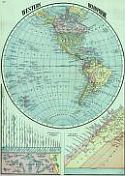
Main Author:
Cram, George F.
Title/Description:
Western Hemisphere
Publication Info:
Chicago: George F. Cram, c.1909; from the Heart of our Country
Viewing Options
Main Author:
Bartholomew, J.G.
Title/Description:
British Empire
Publication Info:
London: Cassell and Company, 1910; from Cassell's Atlas
Viewing Options
Main Author:
Bartholomew, J.G.
Title/Description:
Commercial Chart of the World
Publication Info:
London: Cassell and Company, 1910; from Cassell's Atlas
Viewing Options
Main Author:
U.S. Hydrographic Office
Title/Description:
Trade Routes and Distances by Existing Lines and by the Panama Canal Authority
Publication Info:
Washington: Office of Territories, 1912; from Panama Canal Traffic and Tolls by Emory R. Johnson
Viewing Options
Main Author:
Wansleben, Thomas O.
Title/Description:
Coaling Stations of the World
Publication Info:
Washington: Office of Territories, 1912; from Panama Canal Traffic and Tolls by Emory R. Johnson
Viewing Options
Title/Description:
The World on Mercator's Projection
Publication Info:
New York: The Century Company, 1913; from The Century Atlas of the World
Viewing Options
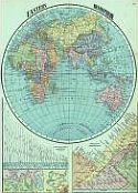
Title/Description:
Hemispheres
Publication Info:
New York: The Century Company, 1913; from The Century Atlas of the World
Viewing Options
Main Author:
Sherman, C.E.
Title/Description:
Transportation Routes of the World
Publication Info:
Columbus: Ohio State University, 1915; From The Ohio State Water Problem, Vol XX, No 10
Viewing Options
Title/Description:
Isochronic Chart
Publication Info:
New York: C.S. Hammond and Company, 1917; from the Universal Atlas of the World
Viewing Options
Main Author:
Geographical Publishing Co., Chicago, IL
Title/Description:
The World on the Mercator Projection
Publication Info:
Geographical Publishing Co., Chicago, Illinois, 1918; from World's Greatest War: Maps of Europe, Italy, and the Western Battle Front in detail with Descriptive Text fully illustrated
Viewing Options
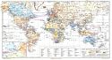
Main Author:
Bartholomew, John
Title/Description:
Route Chart of the World
Publication Info:
Edinburgh: John Bartholomew & Sion Ltd., c.1920; The British Empire is coloured red
Viewing Options
Main Author:
Bartholomew, J.G.
Title/Description:
Mapping of the World
Publication Info:
London: The Times, 1920; from the Times Survey Atlas of the World
Viewing Options
Main Author:
Bartholomew, J.G.
Title/Description:
World-Bathy-Orographical
Publication Info:
London: The Times, 1920; from the Times Survey Atlas of the World
Viewing Options
Main Author:
Bartholomew, J.G.
Title/Description:
World Climate
Publication Info:
London: The Times, 1920; from the Times Survey Atlas of the World
Viewing Options
Main Author:
Bartholomew, J.G.
Title/Description:
World Vegetation and Ocean Currents
Publication Info:
London: The Times, 1920; from the Times Survey Atlas of the World
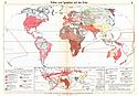
Viewing Options
Main Author:
Bartholomew, J.G.
Title/Description:
World Population, Races, Religions, Languages
Publication Info:
London: The Times, 1920; from the Times Survey Atlas of the World
Viewing Options
Main Author:
Bartholomew, J.G.
Title/Description:
World Commerical Development, occupations, means of traffic
Publication Info:
London: The Times, 1920; from the Times Survey Atlas of the World
Viewing Options
Main Author:
Bartholomew, J.G.
Title/Description:
World, Political
Publication Info:
London: The Times, 1920; from the Times Survey Atlas of the World
Viewing Options
Main Author:
Rand McNally and Company
Title/Description:
The Steamship Routes of the World
Publication Info:
Chicago: Rand McNally and Company, 1921; from the Commercial Atlas of America
Viewing Options
Main Author:
Johnston, W. and A.K.
Title/Description:
Bathy-Orographical Map of the World in Hemispheres
Publication Info:
Edinburgh: W. and A.K. Johnston, 1921; from The World-Wide Atlas of Modern Geography
Viewing Options
Main Author:
Rand McNally and Company
Title/Description:
The World on Mercator's Projection (Showing Telegraph and Cable Lines)
Publication Info:
Chicago: Rand McNally and Company, 1921; from the Commercial Atlas of America
Viewing Options
Main Author:
Philip, George
Title/Description:
World in Hemispheres: Physical
Publication Info:
London: George Philip and Son, 1921, from Philip's New Handy General Atlas and Gazetteer
Viewing Options
Main Author:
Philip, George
Title/Description:
The World: Political
Publication Info:
London: George Philip and Son, 1921, from Philip's New Handy General Atlas and Gazetteer
Viewing Options
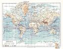
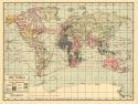
Main Author:
The Geographical Publishing Co.
Title/Description:
The World
Publication Info:
Chicago: The Geographical Publishing Co., 1922; from New International Atlas of the World
Viewing Options
Main Author:
Bibliographisches Institut
Title/Description:
Erdkarte
Publication Info:
Leipzig: Bibliographisches Institut, 1924; from Meyer's Geographischer Hadatlas, map no. 1
Viewing Options
Main Author:
Bibliographisches Institut
Title/Description:
Politische Karte der Erde
Publication Info:
Leipzig: Bibliographisches Institut, 1924; from Meyer's Geographischer Hadatlas, map no. 2
Viewing Options
Main Author:
Bibliographisches Institut
Title/Description:
Ehemalige Deutsche Kolonien
Viewing Options
Main Author:
Bibliographisches Institut
Title/Description:
Verbreitung der Deutshen im Auslande
Publication Info:
Leipzig: Bibliographisches Institut, 1924; from Meyer's Geographischer Hadatlas, map no. 92
Viewing Options
Title/Description:
The World on Mercator's Projection
Publication Info:
London: George Philip & Son, Ltd., c.1925; British Possessions are in red
Viewing Options
Main Author:
C.S. Hammond and Company
Title/Description:
The Hemispheres
Publication Info:
New York: C.S. Hammond and Company, c. 1930; from The New World Loose Leaf Atlas, Sixth Edition
Viewing Options
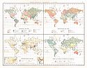
Main Author:
C.S. Hammond and Company
Title/Description:
The World Showing Annual Rainfall and Range of Temperature with July Currents
Publication Info:
New York: C.S. Hammond and Company, c. 1930; from The New World Loose Leaf Atlas, Sixth Edition
Viewing Options
Main Author:
C.S. Hammond and Company
Title/Description:
The World Showing Natural Vegetation with January Currents
Publication Info:
New York: C.S. Hammond and Company, c. 1930; from The New World Loose Leaf Atlas, Sixth Edition
Viewing Options
Main Author:
C.S. Hammond and Company
Title/Description:
Ocean Route Map of the World (with Colonial Possessions)
Publication Info:
New York: C.S. Hammond and Company, c. 1930; from The New World Loose Leaf Atlas, Sixth Edition
Viewing Options
Main Author:
C.S. Hammond and Company
Title/Description:
Colonies and Dependencies
Publication Info:
New York: C.S. Hammond and Company, c. 1930; from The New World Loose Leaf Atlas, Sixth Edition
Viewing Options
Main Author:
Rand McNally and Company
Title/Description:
Standard Map of the World
Publication Info:
Chicago: Rand McNally and Company, 1936

Viewing Options
Main Author:
Frenzel, Konrad
Title/Description:
Die politische Aufteilung der Erde
Publication Info:
Leipzig: Velhagen and Klasing, 1937; from Grosser Volks-Atlas
Viewing Options
Main Author:
Frenzel, Konrad
Title/Description:
Die grossen Linien des weltverkehrs
Publication Info:
Leipzig: Velhagen and Klasing, 1937; from Grosser Volks-Atlas
Viewing Options
Main Author:
Frenzel, Konrad
Title/Description:
Volker und Sprachen auf der Erde
Publication Info:
Leipzig: Velhagen and Klasing, 1937; from Grosser Volks-Atlas
Viewing Options
Title/Description:
The World on Mercator's Projection
Publication Info:
London: George Philip & Son, Ltd., 1938
Main Author:
McDonald, Willard F.
Title/Description
Atlas of Climatic Charts of the Oceans
Publication Info:
Washington: U.S. Department of Agriculture, Weather Bureau, 1938
Viewing Options
Title/Description:
Routes of the Flying Clipper Ships
Publication Info:
Pan America Airways, 1941
Main Author:
Hydrographic Office, U.S. Navy
Title/Description
Ice Atlas of the Northern Hemisphere
Publication Info:
U.S. Navy, 1946
Viewing Options
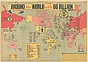
Title/Description:
Around the World with 66 Billion
Publication Info:
Sunday News, October 5, 1947
Viewing Options
Title/Description:
Pan American World Airways, The System of the Flying Clippers