Historical Maps of the World

1851 - 1875
Before 1700
1700-1750
1751-1800
1801-1825
1826-1850
pg1   pg2
1851-1875
pg1   pg2
1876-1900
After 1900

Previous Page
Next Page

  Main Author:   Martin, R. Montgomery
  Title/Description:   The World on Mercator's Projection
  Publication Info:   London: J. and F. Tallis, 1851
  Date:   1851
  Scale:   1:133,440,000
  Original Source:   Courtesy of Murray Hudson, Halls, Tennessee
Viewing options:


  Main Author:   unknown
  Title/Description:   The World on Mercator's Projection showing the Voyages of Captain Cook Round the World
  Publication Info:   London: Tallis, 1851
  Date:   1851
  Scale:   1:150,000,000
  Original Source:   Courtesy of Murray Hudson, Halls, Tennessee
Viewing options:


  Main Author:   Butler, Samuel
  Title/Description:   Orbis Veteribus Notus
  Publication Info:   Philadelphia: Blanchard and Lea,1851
  Date:   1851
  Scale:   1:48,500,000
  Original Source:   Courtesy of Murray Hudson, Halls, Tennessee
Viewing options:


  Main Author:   Levasseur, Victor
  Title/Description:   Planisphere
  Publication Info:   Paris: A. Combette, 1851; from Atlas National Illustre des 86 Departments et des Possessions de la France
  Date:   1851
  Scale:    
  Original Source:   Adams Antiques
Viewing options:


  Main Author:   Alabern, R.
  Title/Description:   Uranografia y Cosmografia
  Publication Info:   Madrid: Gaspar y Roig, 1852
  Date:   1852
  Scale:    
  Original Source:   Courtesy of Murray Hudson, Halls, Tennessee
Viewing options:


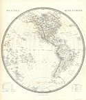
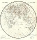
Main Author:   Society for the Diffusion of Useful Knowledge
Title/Description:   Western and Eastern Hemispheres
Publication Info:   London: Charles Knight, 1852; from the General Atlas
Date:   1852
Scale:   1:62,726,400
Original Source:   Courtesy of Murray Hudson, Halls, Tennessee
West
East
Viewing options:
Viewing options:
JPEG or Plugin
JPEG or Plugin


  Main Author:   Society for the Diffusion of Useful Knowledge
  Title/Description:   Map of the Principal Rivers Showing Their Courses, Countries and Comparitive lengths
  Publication Info:   London: Charles Knight, 1852; from the General Atlas
  Date:   1852
  Scale:   1:22,809,600
  Original Source:   Courtesy of Murray Hudson, Halls, Tennessee
Viewing options:


  Main Author:   Dufour, A.H. and T. Duvotenay
  Title/Description:   Mundo Conocido por los Anticuos
  Publication Info:   Madrid: Gaspar y Roig, 1852; from El Globo, Atlas Historico Universal de Geografica
  Date:   1852
  Scale:   1:99,280,000
  Original Source:   University of Alabama Map Library
Viewing options:


  Main Author:   Dufour, A.H. and T. Duvotenay
  Title/Description:   Mapa-Mundi
  Publication Info:   Madrid: Gaspar y Roig, 1852; from El Globo, Atlas Historico Universal de Geografica
  Date:   1852
  Scale:   1:173,712,000
  Original Source:   University of Alabama Map Library
Viewing options:


  Main Author:   Bibliographisches Institut
  Title/Description:   Welt-Charte in Mercators Projektion
  Publication Info:   Hildburghausen: Bibliographisches Institut, 1850-1860; from Atlas der Geographie
  Date:   1852
  Scale:   1:
  Original Source:   University of Alabama Map Library
Viewing options:


  Main Author:   Bibliographisches Institut
  Title/Description:   Welt-Charte in Mercators Projektion
  Publication Info:   Hildburghausen: Bibliographisches Institut, 1850-1860; from Atlas der Geographie
  Date:   1852
  Scale:  
  Original Source:   University of Alabama Map Library
Viewing options:


  Main Author:   Black, Adam and Charles
  Title/Description:   The World on Mercator's Projection
  Publication Info:   Edinburgh: A. and C. Black, 1854; from The General Atlas of the World by Hall and Hughes
  Date:   1854
  Scale:    
  Original Source:   Courtesy of Adams Antiques, Northport, Alabama
Viewing options:


  Main Author:   Black, Adam and Charles
  Title/Description:   The World
  Publication Info:   Edinburgh: A. and C. Black, 1854; from The General Atlas of the World by Hall and Hughes
  Date:   1854
  Scale:    
  Original Source:   Courtesy of Adams Antiques, Northport, Alabama
Viewing options:


  Main Author:   Black, Adam and Charles
  Title/Description:   A Chart of Magnetic Curves of Equal Variation
  Publication Info:   Edinburgh: A. and C. Black, 1854; from The General Atlas of the World by Hall and Hughes
  Date:   1854
  Scale:    
  Original Source:   Courtesy of Adams Antiques, Northport, Alabama
Viewing options:


  Main Author:   Colton, Joseph Hutchins  
  Title/Description:   Map of the World Illustrating the Principal Features of the Land and Co-Tidal Lines
  Publication Info:   New York: J.H. Colton, 1855; from The Atlas of the World
  Date:   1855
  Scale:    
  Original Source:   Birmingham Public Library Cartography Collection
Viewing options:


  Main Author:   Colton, Joseph Hutchins  
  Title/Description:   Map of the World Illustrating the Principal Features of Meteorology / Map of the World Showing the Distribution and Limits of Cultivations of the Principal Plants Useful to Mankind
  Publication Info:   New York: J.H. Colton, 1855; from The Atlas of the World
  Date:   1855
  Scale:    
  Original Source:   Birmingham Public Library Cartography Collection
Viewing options:


  Main Author:   Colton, Joseph Hutchins  
  Title/Description:   Colton's Map of the World on Mercator's Projection
  Publication Info:   New York: J.H. Colton, 1855; from The Atlas of the World
  Date:   1855
  Scale:    
  Original Source:   Birmingham Public Library Cartography Collection
Viewing options:


  Main Author:   Fleming, Carl
  Title/Description:   Geogr. Verbreitung des Christlichen Staaten Systems auf der Ganzen Erde
  Publication Info:   Glogau, Germany: Carl Fleming, c.1855
  Date:   1855
  Scale:   1:98,734,000
  Original Source:   Courtesy of Murray Hudson, Halls, Tennessee
Viewing options:


  Main Author:   unknown
  Title/Description:   Map of the World as known to the Ancients and Sacred Writers
  Publication Info:   Hartford, CT: 1855
  Date:   1855
  Scale:   1:26,294,000
  Original Source:   Courtesy of Murray Hudson, Halls, Tennessee
Viewing options:


  Main Author:   Harper and Brothers
  Title/Description:   The World on Mercator's Projection
  Publication Info:   New York: Harper and Brothers, c.1855; from Harper's Gazetteer
  Date:   1855
  Scale:   1:73,500,000
  Original Source:   Courtesy of Murray Hudson, Halls, Tennessee
Viewing options:


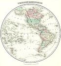
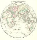
Main Author:   Colton, J.H.
Title/Description:   Western and Eastern Hemispheres
Publication Info:   New York: J.H. Colton and Company, 1855
Date:   1855
Scale:   1:62,726,000
Original Source:   Courtesy of Antique Atlas
West
East
Viewing options:
Viewing options:
JPEG or Plugin
JPEG or Plugin


  Main Author:   Colton, J.H.
  Title/Description:   Mountains and Rivers
  Publication Info:   New York: J. H. Colton and Company, 1855
  Date:   1855
  Scale:    
  Original Source:   Courtesy of Antique Atlas
Viewing options:


  Main Author:   Cornell, Sarah Sophia
  Title/Description:   The World
  Publication Info:   New York: D. Appleton and Company, 1855; from Cornell's Intermediate Geography
  Date:   1855
  Scale:   1:110,000,000
  Original Source:   Courtesy of Murray Hudson, Halls, Tennessee
Viewing options:


  Main Author:   Sydow, E. von
  Title/Description:   Erdkarte in Mercator's Projection
  Publication Info:   Gotha: Justus Perthes, 1855; from E. von Sydow's Schul-Atlas in Acht und Dreissig Karten
  Date:   1855
  Scale:   1:N/A
  Original Source:   University of Alabama Map Library
Viewing options:


  Main Author:   Sels, Edward
  Title/Description:   Chart of the World Showing the Tracks of the U.S. Steam Frigates Mississippi, Susquehanna and Powhatan, as Flagship of the Japan Squadron, under Command of Commodore M.C. Perry, U.S.N. 1853-54
  Publication Info:   unknown: c.1856
  Date:   1856
  Scale:   1:44,000,000
  Original Source:   Courtesy of Murray Hudson, Halls, Tennessee
Viewing options:


Main Author:   Stieler, Adolf
Title/Description:   Oestliche Halbkugel
Publication Info:   Gotha: Justus Perthes, 1856; from Hand-Atlas
Date:   1856
Scale:   various
Original Source:   University of Alabama Map Library
West
East
Viewing options:
Viewing options:
JPEG or Plugin
JPEG or Plugin


  Main Author:   Dussieux, Louis
  Title/Description:   Mappemonde Physique et Politique
  Publication Info:   Paris: J. Lecoffre et Comp., [1856]; from Atlas General de Geographie
  Date:   1856
  Scale:   1:98,000,000
  Original Source:   University of Alabama Map Library
Viewing options:


  Main Author:   Dussieux, Louis
  Title/Description:   Monde Connu des Anciens
  Publication Info:   Paris: J. Lecoffre et Comp., [1856]; from Atlas General de Geographie
  Date:   1856
  Scale:   1:33,898,000
  Original Source:   University of Alabama Map Library
Viewing options:


  Main Author:   Dussieux, Louis
  Title/Description:   Carte pour servir a l'histoire Des Arabes
  Publication Info:   Paris: J. Lecoffre et Comp., [1856]; from Atlas General de Geographie
  Date:   1856
  Scale:   1:45,620,000
  Original Source:   University of Alabama Map Library
Viewing options:


  Main Author:   Malte-Brun, Victor
  Title/Description:   Monde Connu des Anciens au siecle de Ptolemee
  Publication Info:   Paris: Gustave Barba, 1856; from Geographie Universelle
  Date:   1856
  Scale:   1:44,000,000
  Original Source:   University of Alabama Map Library
Viewing options:


  Main Author:   Malte-Brun, Victor
  Title/Description:   Systemes Geographiques de Ptolemee de Strabon et D'Eratosthene
  Publication Info:   Paris: Gustave Barba, 1856; from Geographie Universelle
  Date:   1856
  Scale:   1:73,400,000
  Original Source:   University of Alabama Map Library
Viewing options:


  Main Author:   Malte-Brun, Victor
  Title/Description:   Geographie D'Herodote
  Publication Info:   Paris: Gustave Barba, 1856; from Geographie Universelle
  Date:   1856
  Scale:   1:31,680,000
  Original Source:   University of Alabama Map Library
Viewing options:


  Main Author:   Malte-Brun, Victor
  Title/Description:   Geographie Primitive des Grecs, Voyage des Argonautes et D'Ulysse
  Publication Info:   Paris: Gustave Barba, 1856; from Geographie Universelle
  Date:   1856
  Scale:    
  Original Source:   University of Alabama Map Library
Viewing options:


  Main Author:   Hughes, William, edited by George Long
  Title/Description:   The World According to the Ancients
  Publication Info:   Philadelphia: Blanchard and Lea, 1856; from An Atlas of Classical Geography
  Date:   1856
  Scale:   various
  Original Source:   Courtesy of Murray Hudson, Halls, Tennessee
Viewing options:


  Main Author:   Hughes, William, edited by George Long
  Title/Description:   The World as known to the Ancients
  Publication Info:   Philadelphia: Blanchard and Lea, 1856; from An Atlas of Classical Geography
  Date:   1856
  Scale:   1:31,680,000
  Original Source:   Courtesy of Murray Hudson, Halls, Tennessee
Viewing options:


  Main Author:   Baker, S.F.
  Title/Description:   [World Hemispheres]
  Publication Info:   New Orleans: Morse and Gaston, 1857; from Diamond Miniature Atlas
  Date:   1857
  Scale:   1:183,500,000
  Original Source:   Courtesy of Murray Hudson, Halls, Tennessee
Viewing options:


  Main Author:   Morse, Charles W.
  Title/Description:   Map of the World by J. Schoener, Year 1520
  Publication Info:   New York: Samuel N. Gaston, 1857; from Morse and Gaston's Diamond Atlas, Eastern Hemisphere
  Date:   1857
  Scale:  
  Original Source:   University of Alabama Map Library
Viewing options:


  Main Author:   Morse, Charles W.
  Title/Description:   Map of the World Compiled in 1492 (Eastern Hemisphere)
  Publication Info:   New York: Samuel N. Gaston, 1857; from Morse and Gaston's Diamond Atlas, Eastern Hemisphere
  Date:   1857
  Scale:  
  Original Source:   University of Alabama Map Library
Viewing options:


  Main Author:   Morse, Charles W.
  Title/Description:   Map of the World Compiled in 1492 (Western Hemisphere)
  Publication Info:   New York: Samuel N. Gaston, 1857; from Morse and Gaston's Diamond Atlas, Eastern Hemisphere
  Date:   1857
  Scale:  
  Original Source:   University of Alabama Map Library
Viewing options:


  Main Author:   Morse, Charles W.
  Title/Description:   Map of the World by Ptolemy, 130 Years B.C.
  Publication Info:   New York: Samuel N. Gaston, 1857; from Morse and Gaston's Diamond Atlas, Eastern Hemisphere
  Date:   1857
  Scale:  
  Original Source:   University of Alabama Map Library
Viewing options:


  Main Author:   Morse, Charles W.
  Title/Description:   Map of the World According to Eratosthenes.
  Publication Info:   New York: Samuel N. Gaston, 1857; from Morse and Gaston's Diamond Atlas, Eastern Hemisphere
  Date:   1857
  Scale:  
  Original Source:   University of Alabama Map Library
Viewing options:


  Main Author:   Morse, Charles W.
  Title/Description:   Map of the World by Fra Mauro
  Publication Info:   New York: Samuel N. Gaston, 1857; from Morse and Gaston's Diamond Atlas, Eastern Hemisphere
  Date:   1857
  Scale:  
  Original Source:   University of Alabama Map Library
Viewing options:


  Main Author:   Kiepert, Enrico
  Title/Description:   Orbis Terrarum Antiquis Notus
  Publication Info:   Berlin: Dietrich Reimer, c. 1860; from Atlante Antico
  Date:   1860
  Scale:   1:25,872,620
  Original Source:   University of Alabama Map Library
Viewing options:


  Main Author:   Warren, P.M
  Title/Description:   Chart Exhibiting the Continents, Islands, Chief Mountain Ranges and other Diversities of the Land Surfaces of the Earth
  Publication Info:   Philadelphia: H. Cowperthwait and Company, 1860; from A System of Physical Geography
  Date:   1860
  Scale:   1:147,000,000
  Original Source:   Courtesy of Murray Hudson, Halls, Tennessee
Viewing options:


  Main Author:   Warren, P.M
  Title/Description:   Hydrographic Chart of the World exhibiting the Prinicipal River Basins, the Oceans and Oceanic Currents.
  Publication Info:   Philadelphia: H. Cowperthwait and Company, 1860; from A System of Physical Geography
  Date:   1860
  Scale:   1:147,000,000
  Original Source:   Courtesy of Murray Hudson, Halls, Tennessee
Viewing options:


  Main Author:   Warren, P.M
  Title/Description:   Chart Showing the Distribution of the Winds over the Surface of the Earth, also the Regions subject to Storms
  Publication Info:   Philadelphia: H. Cowperthwait and Company, 1860; from A System of Physical Geography
  Date:   1860
  Scale:   1:147,000,000
  Original Source:   Courtesy of Murray Hudson, Halls, Tennessee
Viewing options:


  Main Author:   Warren, P.M
  Title/Description:   Chart of the Distribution of Rain and Snow over the Surface of the Earth
  Publication Info:   Philadelphia: H. Cowperthwait and Company, 1860; from A System of Physical Geography
  Date:   1860
  Scale:   1:147,000,000
  Original Source:   Courtesy of Murray Hudson, Halls, Tennessee
Viewing options:


  Main Author:   Warren, P.M
  Title/Description:   Climatic Chart Showing by Isothermal Lines the Mean Annual Temperature of the Different Parts of the Earth's Surface
  Publication Info:   Philadelphia: H. Cowperthwait and Company, 1860; from A System of Physical Geography
  Date:   1860
  Scale:   1:147,000,000
  Original Source:   Courtesy of Murray Hudson, Halls, Tennessee
Viewing options:


  Main Author:   Bibliographisches Institut
  Title/Description:   Erd Karte zur Übersicht der Vertheilung des Starren und Flüssigen
  Publication Info:   Hildburghausen: Bibliographisches Institut, 1850-1860; from Atlas der Geographie
  Date:   1860
  Scale:  
  Original Source:   University of Alabama Map Library
Viewing options:


  Main Author:   Bibliographisches Institut
  Title/Description:   Vergleichen de Ubersicht bekannter Höhen und Orte der Erde über der Meeres-Fläche
  Publication Info:   Hildburghausen: Bibliographisches Institut, 1850-1860; from Atlas der Geographie
  Date:   1860
  Scale:  
  Original Source:   University of Alabama Map Library
Viewing options:


  Main Author:   Bibliographisches Institut
  Title/Description:   Vergleichende Uebersicht der Bedeutendsten Stromlängen
  Publication Info:   Hildburghausen: Bibliographisches Institut, 1850-1860; from Atlas der Geographie
  Date:   1860
  Scale:  
  Original Source:   University of Alabama Map Library
Viewing options:


  Main Author:   Bibliographisches Institut
  Title/Description:   Ubersicht der Bekannteren Gabelthilungen des Strömenden Wassers
  Publication Info:   Hildburghausen: Bibliographisches Institut, 1850-1860; from Atlas der Geographie
  Date:   1860
  Scale:   1:3,080,000
  Original Source:   University of Alabama Map Library
Viewing options:


  Main Author:   Bibliographisches Institut
  Title/Description:   Windkarte der Erde
  Publication Info:   Hildburghausen: Bibliographisches Institut, 1850-1860; from Atlas der Geographie
  Date:   1860
  Scale:  
  Original Source:   University of Alabama Map Library
Viewing options:


  Main Author:   Bibliographisches Institut
  Title/Description:   Alexander von Humboldt's System der Isotherm Kurven; in Merkator's Projection
  Publication Info:   Hildburghausen: Bibliographisches Institut, 1850-1860; from Atlas der Geographie
  Date:   1860
  Scale:  
  Original Source:   University of Alabama Map Library
Viewing options:


  Main Author:   Bibliographisches Institut
  Title/Description:   Karte der Magnetischen Meridante und Parallel-Kreise nach den Beobachtungen über die Declination der Magnetnadel
  Publication Info:   Hildburghausen: Bibliographisches Institut, 1850-1860; from Atlas der Geographie
  Date:   1860
  Scale:  
  Original Source:   University of Alabama Map Library
Viewing options:


  Main Author:   Bibliographisches Institut
  Title/Description:   Darstellung der Isodynamischen Linien
  Publication Info:   Hildburghausen: Bibliographisches Institut, 1850-1860; from Atlas der Geographie
  Date:   1860
  Scale:  
  Original Source:   University of Alabama Map Library
Viewing options:


  Main Author:   Bibliographisches Institut
  Title/Description:   Versuch Karte zur Übersicht der Fluthwellen
  Publication Info:   Hildburghausen: Bibliographisches Institut, 1850-1860; from Atlas der Geographie
  Date:   1860
  Scale:   1:114,700,450
  Original Source:   University of Alabama Map Library
Viewing options:


  Main Author:   Bibliographisches Institut
  Title/Description:   Umrisse der Pflanzengeographie
  Publication Info:   Hildburghausen: Bibliographisches Institut, 1850-1860; from Atlas der Geographie
  Date:   1860
  Scale:   1:115,350,000
  Original Source:   University of Alabama Map Library
Viewing options:


  Main Author:   Bibliographisches Institut
  Title/Description:   Verbreitungsbezirke der Wichtigsten Kulturgewächse
  Publication Info:   Hildburghausen: Bibliographisches Institut, 1850-1860; from Atlas der Geographie
  Date:   1860
  Scale:   1:107,520,000
  Original Source:   University of Alabama Map Library
Viewing options:


  Main Author:   Bibliographisches Institut
  Title/Description:   Erd Karte zur Übersicht
  Publication Info:   Hildburghausen: Bibliographisches Institut, 1850-1860; from Atlas der Geographie
  Date:   1860
  Scale:  
  Original Source:   University of Alabama Map Library
Viewing options:


  Main Author:   Weller, Edward
  Title/Description:   Map of the World Exhibiting the Chief Physical Features of the Earth
  Publication Info:   London: Longman and Company, c.1861
  Date:   1861
  Scale:   various
  Original Source:   Courtesy of Murray Hudson, Halls, Tennessee
Viewing options:


  Main Author:   Weller, Edward
  Title/Description:   The World
  Publication Info:   London: Longman and Company, c.1861
  Date:   1861
  Scale:   1:97,574,400
  Original Source:   Courtesy of Murray Hudson, Halls, Tennessee
Viewing options:


  Main Author:   Mitchell, S. Augustus, Jr.
  Title/Description:   Map of the World on Mercator Projection
  Publication Info:   Philadelphia: S. Augustus Mitchell, Jr. 1861; from The New General Atlas
  Date:   1861
  Scale:   1:97,000,000
  Original Source:   Courtesy of Murray Hudson, Halls, Tennessee
Viewing options:


  Main Author:   Vuillemin, A and Malte-Brun
  Title/Description:   Mappe - Monde
  Publication Info:   Paris: Frune, 1861; from Atlas Universal de Géographie Ancienne et Moderne
  Date:   1861
  Scale:   1:88,000,000
  Original Source:   Courtesy of Adams Antiques, Northport, Alabama
Viewing options:


  Main Author:   Pelissier
  Title/Description:   Planisphére
  Publication Info:   Paris: Lemercier, c.1861; from Atlas Illustre
  Date:   1861
  Scale:   1:115,000,000
  Original Source:   Birmingham Public Library Cartography Collection
Viewing options:


  Main Author:   Johnson, A.J.
  Title/Description:   Mountains and Rivers
  Publication Info:   New York: Johnson and Ward, 1862; from The New Illustrated Family Atlas
  Date:   1862
  Scale:   =
  Original Source:   Courtesy of Murray Hudson, Halls, Tennessee
Viewing options:


  Main Author:   Johnson, Alvin J.
  Title/Description:   Map of the World Showing the Geographical Distribution and Range of the Principal Members of the Animal Kingdom - Map of the World Illustrating the Productive Industry of Various Countries
  Publication Info:   New York: Johnson and Ward, c.1862; maps 9 and 10
  Date:   1862
  Scale:  
  Original Source:   Courtesy of Murray Hudson, Halls, Tennessee
Viewing options:


  Main Author:   Johnson, Alvin J.
  Title/Description:   Map of the World Illustrating the Principal Features of the Land and Co-Tidal Lines - Map of the World Showing the Principal Ocean Currents & Boundaries of River Systems
  Publication Info:   New York: Johnson and Ward, c.1862; maps 11 and 12
  Date:   1862
  Scale:    
  Original Source:   Courtesy of Murray Hudson, Halls, Tennessee
Viewing options:


  Main Author:   Johnson, Alvin J.
  Title/Description:   Map of the World Illustrating the Principal Features of Meteorology - Map of the World Showing the Principal Ocean Currents and Boundaries of River Systems
  Publication Info:   New York: Johnson and Ward, c.1862; maps 13 and 14
  Date:   1862
  Scale:    
  Original Source:   Courtesy of Murray Hudson, Halls, Tennessee
Viewing options:


  Main Author:   Potter, John Dennett
  Title/Description:   Track Chart of the World on Mercator's Projection
  Publication Info:   London: 1862
  Date:   1862
  Scale:   1:34,000,000
  Original Source:   Birmingham Public Library Cartography Collection
Viewing options:


  Main Author:   Bohn, Henry G.
  Title/Description:   The World
  Publication Info:   London: Henry G. Bohn, 1862; from A Pictorial Hand-Book of Modern Geography
  Date:   1862
  Scale:   1:255,000,000
  Original Source:   University of Alabama Map Library
Viewing options:


  Main Author:   Mitchell, Samuel Augustus
  Title/Description:   The World in Hemispheres with Other Projections
  Publication Info:   Philadelphia: S.A. Mitchell, 1864
  Date:   1864
  Scale:   1:135,500,000
  Original Source:   Courtesy of Murray Hudson, Halls, Tennessee
Viewing options:


  Main Author:   Johnson, Alvin J.
  Title/Description:   Johnson's Map of the World on Mercator's Projection
  Publication Info:   New York: Johnson and Ward, 1864
  Date:   1864
  Scale:   1:73,000,000
  Original Source:   Courtesy of Murray Hudson, Halls, Tennessee
Viewing options:


  Main Author:   Johnson and Ward
  Title/Description:   Western Hemisphere, Eastern Hemisphere
  Publication Info:   New York: Johnson and Ward, 1864; from The New Illustrated Family Atlas
  Date:   1864
  Scale:   1:56,073,600
  Original Source:   Courtesy of Murray Hudson, Halls, Tennessee
Viewing options:


  Main Author:   Mitchell, S. Augustus
  Title/Description:   Map of the World as known to the Ancients
  Publication Info:   Philadelphia: E.H. Butler and Company, 1864; from The Ancient Atlas, Classical and Sacred Geography
  Date:   1864
  Scale:   1:36,750,000
  Original Source:   University of Alabama Map Library
Viewing options:


  Main Author:   Cornell, Sarah Sophia
  Title/Description:   The World Showing it Great River Systems
  Publication Info:   New York: D. Appleton and Company, 1866; from A High School Geography
  Date:   1866
  Scale:   1:127,638,000
  Original Source:   Courtesy of Murray Hudson, Halls, Tennessee
Viewing options:


  Main Author:   Johnson, Alvin J.
  Title/Description:   [Various Maps of the World]
  Publication Info:   New York: A.J. Johnson, 1867
  Date:   1867
  Scale:    
  Original Source:   Courtesy of Murray Hudson, Halls, Tennessee
Viewing options:


  Main Author:   Hughes, William
  Title/Description:   The World as Known to the Ancients
  Publication Info:   New York: Sheldon and Company, 1867; from An Atlas of Classical Geography
  Date:   1867
  Scale:   1:32,000,000
  Original Source:   University of Alabama Map Library
Viewing options:


  Main Author:   Hughes, William
  Title/Description:   [The World as described by Ancient Scholars]
  Publication Info:   New York: Sheldon and Company, 1867; from An Atlas of Classical Geography
  Date:   1867
  Scale:   various
  Original Source:   University of Alabama Map Library
Viewing options:


  Main Author:   Fitch, George W.
  Title/Description:   Map of the World Illustrating the Principal Features of the Land and the Co-Tidal Lines
  Publication Info:   New York: Sheldon and Company, 1867; from Colton's Outlines of Physical Geogaphy
  Date:   1867
  Scale:   1:Not Indicated
  Original Source:   University of Alabama Map Library
Viewing options:


  Main Author:   Fitch, George W.
  Title/Description:   Map of the World Showing the Distribution of Volcanoes and Earthquakes
  Publication Info:   New York: Sheldon and Company, 1867; from Colton's Outlines of Physical Geogaphy
  Date:   1867
  Scale:   Not Indicated
  Original Source:   University of Alabama Map Library
Viewing options:


  Main Author:   Fitch, George W.
  Title/Description:   Map of the World Showing the Principal Ocean Currents and Boundaries of River Systems
  Publication Info:   New York: Sheldon and Company, 1867; from Colton's Outlines of Physical Geogaphy
  Date:   1867
  Scale:   Not Indicated
  Original Source:   University of Alabama Map Library
Viewing options:


  Main Author:   Fitch, George W.
  Title/Description:   Map of the World Illustating the Principal Features of Meteorology
  Publication Info:   New York: Sheldon and Company, 1867; from Colton's Outlines of Physical Geogaphy
  Date:   1867
  Scale:   Not Indicated
  Original Source:   University of Alabama Map Library
Viewing options:


  Main Author:   Fitch, George W.
  Title/Description:   Map of the World Illustrating the Relative Amount of Rain or Melted Snow and Ice
  Publication Info:   New York: Sheldon and Company, 1867; from Colton's Outlines of Physical Geogaphy
  Date:   1867
  Scale:   Not Indicated
  Original Source:   University of Alabama Map Library
Viewing options:


  Main Author:   Fitch, George W.
  Title/Description:   Map of the World Showing the Distribution Limits of Cultivation of the Principal Plants Used by Mankind
  Publication Info:   New York: Sheldon and Company, 1867; from Colton's Outlines of Physical Geogaphy
  Date:   1867
  Scale:   Not Indicated
  Original Source:   University of Alabama Map Library
Viewing options:


  Main Author:   Fitch, George W.
  Title/Description:   Map of the World Showing the Geographical Distribution and Range of the Principal Members of the Animal Kingdom
  Publication Info:   New York: Sheldon and Company, 1867; from Colton's Outlines of Physical Geogaphy
  Date:   1867
  Scale:   Not Indicated
  Original Source:   University of Alabama Map Library
Viewing options:


  Main Author:   Fitch, George W.
  Title/Description:   Map of the World Showing the Distribution of the Principal Races and Varieties of Mankind
  Publication Info:   New York: Sheldon and Company, 1867; from Colton's Outlines of Physical Geogaphy
  Date:   1867
  Scale:   Not Indicated
  Original Source:   University of Alabama Map Library
Viewing options:


  Main Author:   Fitch, George W.
  Title/Description:   Map of the World Illustrating the Productive Industry of Various Countries
  Publication Info:   New York: Sheldon and Company, 1867; from Colton's Outlines of Physical Geogaphy
  Date:   1867
  Scale:   Not Indicated
  Original Source:   University of Alabama Map Library
Viewing options:


  Main Author:   Colton, G.W. and C.B. Colton
  Title/Description:   [Various Thematic Maps of the World]
  Publication Info:   New York: G.W. Colton and C.B. Colton, 1869; from The Atlas of the World
  Date:   1869
  Scale:   1:200,000,000
  Original Source:   Courtesy of Murray Hudson, Halls, Tennessee
Viewing options:


  Main Author:   Johnson, Alvin J.
  Title/Description:   World on Mercator's Projection
  Publication Info:   New York: A.J. Johnson, 1869; from Johnson's New Illustrated Atlas of the World
  Date:   1869
  Scale:   1:63,000,000
  Original Source:   W. S. Hoole Special Collections Library
Viewing options:


  Main Author:   Stieler, Adolf
  Title/Description:   Welt-Karte zur Übersicht der Meers - Stömungen und des Schnellverkehrs
  Publication Info:   Gotha: Justus Perthes, 1870; No. 9 from The Hand-Atlas
  Date:   1870
  Scale:   1:110,000,000
  Original Source:   Courtesy of Murray Hudson, Halls, Tennessee
Viewing options:


  Main Author:   Bartholomew, John
  Title/Description:   The World on a Mercators Projection
  Publication Info:   Edinburgh: William Collins, Sons and Company, 1870; from The Advanced Atlas
  Date:   1870
  Scale:   1:138,000,000
  Original Source:   University of Alabama Map Library
Viewing options:


  Main Author:   Bartholomew, John
  Title/Description:   The World
  Publication Info:   Edinburgh: William Collins, Sons and Company, 1870; from The Advanced Atlas
  Date:   1870
  Scale:    
  Original Source:   University of Alabama Map Library
Viewing options:


  Main Author:   Mitchell, S. Augustus
  Title/Description:   Map of the World on the Mercator Projection
  Publication Info:   Philadelphia: S, Augutus Mitchell, 1870; from Mitchell's New General Atlas
  Date:   1870
  Scale:   1:97,000,000
  Original Source:   W. S. Hoole Special Collections Library
Viewing options:


  Main Author:   Amthor, Ed. & Wilhelm Issleib
  Title/Description:   Welt-Karte in Mercators Projection
  Publication Info:   Fort Wayne: Siemon Bro & Co., 1870; from Volks-Atlas über alle Theile der Erde für Schule und Haus
  Date:   1870
  Scale:   1:183,617,280
  Original Source:   University of Alabama Map Library
Viewing options:


Main Author:   Butler, E.H.
Title/Description:   Western and Eastern Hemispheres
Publication Info:   Philadelphia: E.H. Butler and Company, 1870
Date:   1870
Scale:   1:100,000,000
Original Source:   Courtesy of University of Alabama Map Library
West
East
Viewing options:
Viewing options:
JPEG or Plugin
JPEG or Plugin


Previous Page
Next Page


© University of Alabama
To purchase map reproductions, submit a quote request.
Download MrSID Plugin