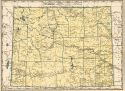
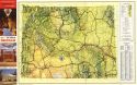
Viewing Options
Main Author:
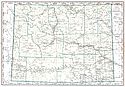
Geographical Publishing Company
Title/Description:
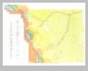
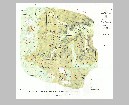
Wyoming
Publication Info:
Chicago: Geographical Publishing Company1931; from Commercial Atlas of the World
Viewing Options
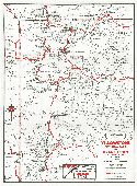
Main Author:
Continental Oil Company
Title/Description:
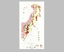
Yellowstone National Park and Grand Teton National Park, Wyoming
Publication Info:
Chicago: H.M. Gousha Company c. 1934
Original Source:
Murray Hudson
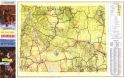
Viewing Options
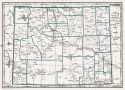
Main Author:
Branom, Frederick K. and Lloyd Edwin Smith
Title/Description:
Wyoming
Publication Info:
Chicago: Geographical Publishing Company, 1936; from Capper's 1936 Atlas of the World
Viewing Options
Main Author:
Rand McNally and Company
Title/Description:
Standard Map of Wyoming
Publication Info:
Chicago: Rand McNally and Company, 1936
Viewing Options
Main Author:
U.S. Geological Survey
Title/Description:
State of Wyoming
Publication Info:
Washington: Department of the Interior, U.S. Geological Survey, 1940; compiled 1913, revised 1924, reprinted 1944
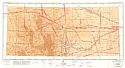
Viewing Options
Main Author:
U.S. Coast and Geodetic Survey
Title/Description:
Cheyenne Sectional Aeronautical Chart
Publication Info:
Washington: U.S. Coast and Geodetic Survey, 1940
Viewing Options
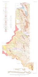
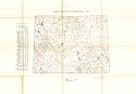
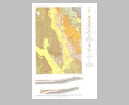
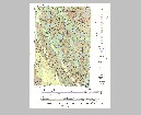
Main Author:
U.S. Geological Survey
Title/Description:
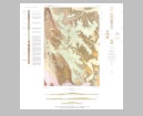
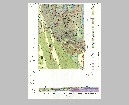
Geological map and sections of region south of Cody, Park County, Wyoming
Publication Info:
Washington: Department of the Interior, US Geological Survey, 1941; Bulletin 921, Plate 11
Viewing Options
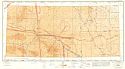
Main Author:
U.S. Coast and Geodetic Survey
Title/Description:
Casper Sectional Aeronautical Chart
Publication Info:
Washington: U.S. Coast and Geodetic Survey, 1942
Viewing Options
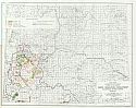
Main Author:
Bureau of the Census
Title/Description:
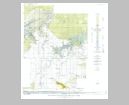
Wyoming Irrigation by Drainage Basin, 1939
Publication Info:
Washington: U.S. Governmet Printing Office, 1942
Viewing Options
Main Author:
Geographical Publishing Company
Title/Description:
Wyoming
Publication Info:
Chicago: Geographical Publishing Company, 1942; from The New International Atlas of the World, War Edition
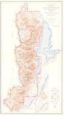
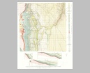
Viewing Options
Main Author:
U.S. Department of the Interior, U.S. Geological Survey
Title/Description:
Topographic Map Grand Teton National Park and Part of Jackson Hole National Monument, Teton County, Wyoming
Publication Info:
Washington: U.S. Department of the Interior, U.S. Geological Survey, 1945
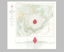
Viewing Options
Main Author:
U.S. Department of the Interior
Title/Description:
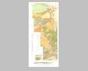
Water Resources Development, Colorado River Basin, Wyoming
Publication Info:
Washington: U.S. Department of the Interior, Bureau of Reclamation, 1946; from The Colorado River, A Natural Menace Becomes a National Resource
Viewing Options
Main Author:
Wyoming State Highway Commission
Title/Description:
Wyoming Highway Map, 1953
Publication Info:
Cheyenne: Wyoming State Highway Commission, 1953
Viewing Options
Main Author:
Wyoming State Highway Commission
Title/Description:
Wyoming Highway Map
Publication Info:
Cheyenne: Wyoming State Highway Commission, 1955
Viewing Options
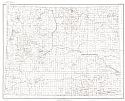
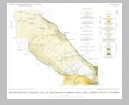
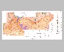
Main Author:
U.S. Geological Survey
Title/Description:
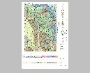
Geologic Map and Sections, Showing Structure Contours, of the Crazy Woman Creek Area, Johnson County, Wyoming
Publication Info:
Washington: Department of the Interior, U.S. Geological Survey, 1955; Bulletin 1027-B Plate 6
Viewing Options
Main Author:
U.S. Geological Survey
Title/Description:
Geologic Map and Sections of Devil's Tower National Monument, Wyoming
Publication Info:
Washington: Department of the Interior, U.S. Geological Survey, 1956; Bulletin 1021-I Plate 30
Viewing Options
Main Author:
U.S. Geological Survey
Title/Description:
Geologic Map of the Buffalo-Lake de Smet Area, Johnson and Sheridan Counties, Wyoming
Publication Info:
Washington: Department of the Interior, U.S. Geological Survey, 1959; Bulletin 1078 Plate 1
Viewing Options
Main Author:
U.S. Geological Survey
Title/Description:
Geologic Map of the Miller Hill Area, Carbon County, Wyoming
Publication Info:
Washington: Department of the Interior, U.S. Geological Survey, 1959; Bulletin 1074-F Plate 14
Viewing Options
Main Author:
U.S. Geological Survey
Title/Description:
Geologic Map of the Central Part of the Great Divide Basin, Sweetwater County, Wyoming
Publication Info:
Washington: Department of the Interior, U.S. Geological Survey, 1961; Bulletin 1099-A Plate 1
Viewing Options
Main Author:
U.S. Geological Survey
Title/Description:
Geologic and Structure Contour Map and Sections of the Carlile Quadrangle, Crook County, Wyoming
Publication Info:
Washington: Department of the Interior, U.S. Geological Survey, 1961; Bulletin 1082-J Plate 34
Viewing Options
Main Author:
U.S. Geological Survey
Title/Description:
Geologic Map and Sections of the Dewey Quadrangle, Wyoming-South Dakota
Publication Info:
Washington: Department of the Interior, U.S. Geological Survey, 1961; Bulletin 1063-B Plate 5

Viewing Options
Main Author:
U.S. Geological Survey
Title/Description:
Geologic Map of the Eastern Red Desert Area, Great Divide Basin, Sweetwater County, Wyoming
Publication Info:
Washington: Department of the Interior, U.S. Geological Survey, 1962; Bulletin 1099-B Plate 1
Viewing Options
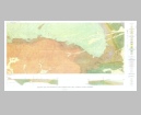
Main Author:
U.S. Geological Survey
Title/Description:
Geologic Map and Sections of the Clarkson Hill Area, Natrona County, Wyoming
Publication Info:
Washington: Department of the Interior, U.S. Geological Survey, 1962; Bulletin 1107-G Plate 7
Viewing Options
Main Author:
U.S. Geological Survey
Title/Description:
Reconnaissance Geologic Map of the Hiland-Clarkson Hill Area, Natrona County, Wyoming
Publication Info:
Washington: Department of the Interior, U.S. Geological Survey, 1962; Bulletin 1107-G Plate 6
Viewing Options
Main Author:
U.S. Geological Survey
Title/Description:
Geologic Map and Section of the Strawberry Hill Quadrangle, Wyoming
Publication Info:
Washington: Department of the Interior, U.S. Geological Survey, 1962; Bulletin 1127 Plate 1
Viewing Options
Main Author:
U.S. Geological Survey
Title/Description:
Geologic Map of Part of the Elkhorn Creek Uranium Mining Area, Crook County, Wyoming
Publication Info:
Washington: Department of the Interior, U.S. Geological Survey, 1962; Bulletin 1127 Plate 4
Viewing Options
Main Author:
U.S. Geological Survey
Title/Description:
Geologic Map and Section of Iron Deposits near Atlantic City, Freemont County, Wyoming
Publication Info:
Washington: Department of the Interior, U.S. Geological Survey, 1963; Bulletin 1142-C Plate 1
Viewing Options
Main Author:
U.S. Geological Survey
Title/Description:
Geologic Map, Electric Logs and Cross Section, Newcastle Area, Weston County, Wyoming
Publication Info:
Washington: Department of the Interior, U.S. Geological Survey, 1963; Bulletin 1141-N Plate 1
Viewing Options
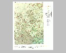
Main Author:
U.S. Geological Survey
Title/Description:
Geologic Map and Sections of the Inyan Kara Mountain Quadrangle, Crook and Weston Counties, Wyoming
Publication Info:
Washington: Department of the Interior, U.S. Geological Survey, 1963; Bulletin 1121-M Plate 1
Viewing Options
Main Author:
U.S. Geological Survey
Title/Description:
Geologic Map and Sections of the Nefsy Divide Quadrangle, Wyoming
Publication Info:
Washington: Department of the Interior, U.S. Geological Survey, 1963; Bulletin 1121-E Plate 1
Viewing Options
Main Author:
U.S. Geological Survey
Title/Description:
Geologic Map and Sections of Beaver Rim Area, Freemont and Natrona Counties, Wyoming
Publication Info:
Washington: Department of the Interior, U.S. Geological Survey, 1964; Bulletin 1164 Plate 2

