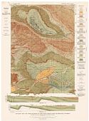
Viewing Options
Main Author:
U.S. Geological Survey
Title/Description:
Geologic Map and Cross Sections of the Grass Creek Basin Quadrangle, Wyoming
Publication Info:
Washington: Department of the Interior, U.S. Geological Survey
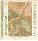
Viewing Options
Main Author:
U.S. Geological Survey
Title/Description:
Geologic Map and Cross Sections of the Meeteetse Quadrangle, Wyoming
Publication Info:
Washington: Department of the Interior, U.S. Geological Survey
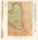
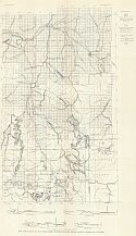
Viewing Options
Main Author:
U.S. Geological Survey
Title/Description:
Geologic Map and Cross Sections of the Oregon Basin Quadrangle, Wyoming
Publication Info:
Washington: Department of the Interior, U.S. Geological Survey
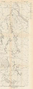
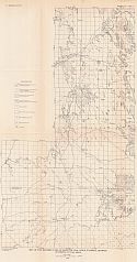
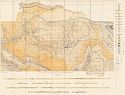
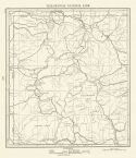
Viewing Options
Main Author:
U.S. Geological Survey
Title/Description:
Map of the Eastern Part of Gillette Coal Field, Wyoming showing outcrop of coal beds
Publication Info:
Washington: Department of the Interior, U.S. Geological Survey, 1927; Bulletin 796 Plate 9
Viewing Options
Main Author:
U.S. Geological Survey
Title/Description:
Map of the Western Part of Gillette Coal Field, Wyoming showing outcrop of coal fields
Publication Info:
Washington: Department of the Interior, U.S. Geological Survey, 1927; Bulletin 796 Plate 10
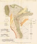
Viewing Options
Main Author:
U.S. Geological Survey
Title/Description:
Map and Sections of the Three-Forks Yellowstone Park Region, Showing Phosphate Outcrops
Publication Info:
Washington: Department of the Interior, U.S. Geological Survey, 1927; Bulletin 795 Plate 12
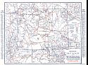
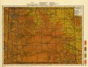
Viewing Options
Main Author:
Clason Map Company
Title/Description:
Best Roads of Wyoming
Publication Info:
Chicago: Clason Map Company, c. 1927; from Clason's Touring Atlas
Viewing Options
Main Author:
U.S. Geological Survey
Title/Description:
Geologic Map and Structure Sections of the Rock Creek Oil Field and Adjoining Areas, Wyoming
Publication Info:
Washington: Department of the Interior, U.S. Geological Survey, 1928; Bulletin 806 Plate 43
Viewing Options
Main Author:
U.S. Geological Survey
Title/Description:
Geologic Map and Sections of the Hanna and Carbon Basins, Wyoming
Publication Info:
Washington: Department of the Interior, U.S. Geological Survey, 1929; Bulletin 804 Plate 27
Viewing Options
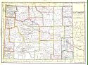
Main Author:
National Map Company
Title/Description:
Wyoming
Publication Info:
Indianapolis: National Map Company, 1930; from Official Paved Road and Commercial Survey of the United States
Viewing Options
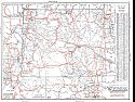
Main Author:
Clason Map Company
Title/Description:
Clason's Road Map of Wyoming
Publication Info:
Denver: The Clason Map Company, 1930; from Clason's Touring Atlas of the United States and Canada
Viewing Options
Main Author:
C.S. Hammond and Company
Title/Description:
Wyoming
Publication Info:
New York: C.S. Hammond and Company, c. 1930; from The New World Loose Leaf Atlas, Sixth Edition
Viewing Options
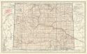
Main Author:
C.S. Hammond and Company
Title/Description:
Yellowstone National Park
Publication Info:
New York: C.S. Hammond and Company, c. 1930; from The New World Loose Leaf Atlas, Sixth Edition
Viewing Options
Main Author:
C.S. Hammond and Company
Title/Description:
Wyoming
Publication Info:
New York: C.S. Hammond and Company, c. 1930; from The New World Loose Leaf Atlas, Sixth Edition

