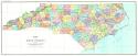
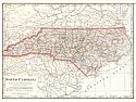
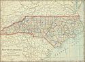
Viewing Options
Main Author:
North Carolina Geological and Economic Survey
Title/Description:
Map of North Carolina
Publication Info:
Raleigh: North Carolina Geological and Economic Survey on a base map compiled by the U.S.G.S. dated 1911
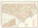
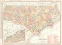
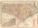
Viewing Options
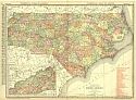
Main Author:
Rand McNally & Co.
Title/Description:
North Carolina
Publication Info:
Chicago: Rand McNally & Co., 1911; from Rand McNally's Indexed Atlas of America
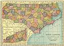
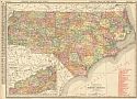
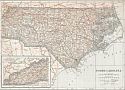
Viewing Options
Main Author:
C.S. Hammond and Company
Title/Description:
North Carolina
Publication Info:
New York: C.S. Hammond and Company, 1911; from Hammond's Modern Atlas of the World
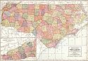
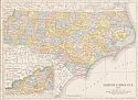
Viewing Options
Main Author:
The Geographical Publishing Company
Title/Description:
North Carolina
Publication Info:
Chicago: Geographical Publishing Company, 1911
Viewing Options
Main Author:
Cram, George F.
Title/Description:
North Carolina
Publication Info:
Chicago: George F. Cram, 1911; from Cram's Unrivaled Atlas of the World
Viewing Options
Main Author:
Rand McNally & Co.
Title/Description:
Rand McNally's New Commercial Atlas Map of North Carolina
Publication Info:
Chicago: Rand McNally & Co., 1912; from Rand McNally's Commercial Atlas of America
Viewing Options
Main Author:
Rand McNally and Co.
Title/Description:
North Carolina
Publication Info:
Chicago: Rand McNally and Co., 1912; from The Library Atlas of the World
Viewing Options
Main Author:
Rand McNally and Company
Title/Description:
North Carolina
Publication Info:
Chicago: Rand McNally and Company, 1912; from the Rand McNally Imperial Atlas of the World
Viewing Options
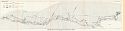
Main Author:
U.S. Geological Survey
Title/Description:
Geologic Map of the Dan River Coal Field, North Carolina
Publication Info:
Washington: Department of the Interior, U.S. Geological Survey, 1912; Bulletin 471 Plate XI
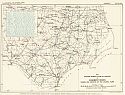
Viewing Options
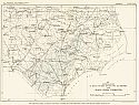
Main Author:
North Carolina Geological and Economic Survey
Title/Description:
Map showing general slope of surface of Basement Rocks underlying deposits of the Coastal Plain
Publication Info:
Raleigh: E.M. Uzzell and Company, 1912; The Coastal Plain of North Carolina, Volume 3, Plate XXIX
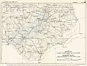
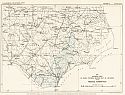
Viewing Options
Main Author:
North Carolina Geological and Economic Survey
Title/Description:
Map showing area in which Potable Waters may be obtained from the basement Rocks underlying the deposits of the Coastal Plain
Publication Info:
Raleigh: E.M. Uzzell and Company, 1912; The Coastal Plain of North Carolina, Volume 3, Plate XXXI
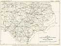
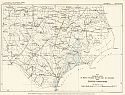
Viewing Options
Main Author:
North Carolina Geological and Economic Survey
Title/Description:
Map Showing area in which Potable waters may be obtained from the Patuxent Formation
Publication Info:
Raleigh: E.M. Uzzell and Company, 1912;The Coastal Plain of North Carolina, Volume 3, Plate XXXII
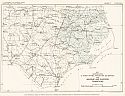
Viewing Options
Main Author:
North Carolina Geological and Economic Survey
Title/Description:
Map showing area in which potable waters may be obtained from the Black Creek Formation
Publication Info:
Raleigh: E.M. Uzzell and Company, 1912;The Coastal Plain of North Carolina, Volume 3, Plate XXXIII
Viewing Options
Main Author:
North Carolina Geological and Economic Survey
Title/Description:
Map Showing Area in which potable waters may be obtained from Peedee Formation
Publication Info:
Raleigh: E.M. Uzzell and Company, 1912;The Coastal Plain of North Carolina, Volume 3, Plate XXXIV
Viewing Options
Main Author:
North Carolina Geological and Economic Survey
Title/Description:
Map showing area in which potable waters may be obtained from Eocene Formation
Publication Info:
Raleigh: E.M. Uzzell and Company, 1912;The Coastal Plain of North Carolina, Volume 3, Plate XXXV
Viewing Options
Main Author:
North Carolina Geological and Economic Survey
Title/Description:
Map showing area in which potable waters may be obtained from Miocene and Pliocene Formations
Publication Info:
Raleigh: E.M. Uzzell and Company, 1912;The Coastal Plain of North Carolina, Volume 3, Plate XXXVI
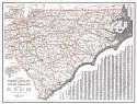
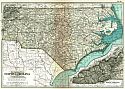
Viewing Options
Main Author:
Crocker, L.V.
Title/Description:
A Survey of the States of North Carolina and South Carolina
Publication Info:
Portland, ME: The National Survey Co., 1913
Viewing Options
Main Author:
The Century Company
Title/Description:
North Carolina
Publication Info:
New York: The Century Company, 1913; from The Century Atlas of the World
Viewing Options
Main Author:
Cram, George F.
Title/Description:
North Carolina
Publication Info:
Chicago: George F. Cram, 1913; from Cram's Unrivaled Atlas of the World
Viewing Options
Main Author:
Rand McNally and Company
Title/Description:
North Carolina
Publication Info:
Chicago: Rand McNally and Company, 1913
Viewing Options
Main Author:
Rand McNally and Company
Title/Description:
North Carolina
Publication Info:
Chicago: Rand McNally and Co., 1914; from Rand McNally's Commercial Atlas of America
Viewing Options
Main Author:
Reynolds, Francis J.
Title/Description:
North Carolina
Publication Info:
New York: P.F. Collier and Son, 1914; from The New Encyclopedic Atlas and Gazetteer of the World

