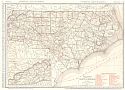
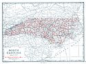
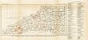
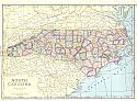
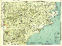
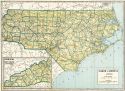
Viewing Options
Main Author:
Hassan, A.F.
Title/Description:
North Carolina
Publication Info:
Washington: Department of the Interior, U.S.Geological Survey,1916, reprinted in 1944
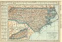
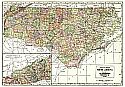
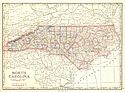
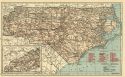
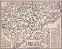
Viewing Options
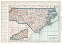
Main Author:
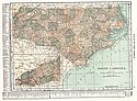
Rand McNally and Company
Title/Description:
North Carolina
Publication Info:
Chicago: Rand McNally and Co., 1916; from the Ideal Atlas of the World
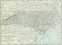
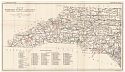
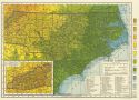
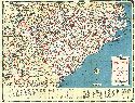
Viewing Options
Main Author:
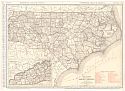
Rand McNally & Co.
Title/Description:
Rand McNally Standard Map of North Carolina
Publication Info:
Chicago: Rand McNally & Co., 1920; from Rand McNally Commercial Atlas of America
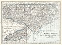
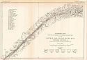
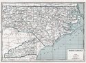
Viewing Options
Main Author:
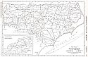
Reynolds, Francis J.
Title/Description:
North Carolina
Publication Info:
New York: P.F. Collier and Son Company, 1920; from The New World Atlas and Gazetteer
Viewing Options
Main Author:
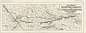
Cram, George F.
Title/Description:
North Carolina
Publication Info:
Chicago: James R. Gray and Company, 1920; from Cram's Unrivaled Atlas of the World
Viewing Options
Main Author:
C.S. Hammond and Company
Title/Description:
North Carolina
Publication Info:
New York: C.S. Hammond and Company, 1920; from The New Reference Atlas of the World
Original Source:
Courtesy of Shawn Carter
Viewing Options
Main Author:
Leslie-Judge Company
Title/Description:
North Carolina
Publication Info:
New York: Leslie-Judge Company1920; from Leslie's New World Atlas
Viewing Options
Main Author:
Rand McNally & Co.
Title/Description:
North Carolina
Publication Info:
Chicago: Rand McNally & Co., 1921; from Rand McNally & Co.'s Commercial Atlas of America
Viewing Options
Main Author:
Rand McNally & Co.
Title/Description:
Rand McNally Black and White Mileage Map of North Carolina
Publication Info:
Chicago: Rand McNally & Co., 1921; from Rand McNally's Commercial Atlas of America
Viewing Options
Main Author:
Cram, George F.
Title/Description:
North Carolina
Publication Info:
Chicago: George F. Cram Company, 1921; from Cram's Unrivaled Atlas of the World
Viewing Options
Main Author:
National Map Company
Title/Description:
North Carolina
Publication Info:
Indianapolis: National Map Company, 1921; from Auto Trails and Commercial Survey of the United States

Viewing Options
Main Author:
National Map Company
Title/Description:
North Carolina
Publication Info:
Indianapolis: National Map Company, 1921; from Auto Trails and Commercial Survey of the United States
Viewing Options
Main Author:
The Geographical Publishing Co.
Title/Description:
North Carolina
Publication Info:
Chicago: The Geographical Publishing Co., 1922; from The New International Atlas of the World
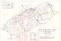
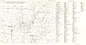
Viewing Options
Main Author:
U.S. Geological Survey
Title/Description:
Map of North Carolina showing location of Kaolin Deposits
Publication Info:
Washington: Department of the Interior, U.S. Geological Survey, 1922; Bulletin 708, Plate 1
Viewing Options
Main Author:
U.S. Geological Survey
Title/Description:
Geologic Map Showing Location of Principal Ore Deposits in the Nottely and Valley River Belt, Cherokee County, North Carolina
Publication Info:
Washington: Department of the Interior, U.S. Geological Survey, 1922; Bulletin 735 Plate 4
Viewing Options
Main Author:
U.S. Geological Survey
Title/Description:
Map of Western North Carolina Showing Location of Mica Mines and Prospects
Publication Info:
Washington: Department of the Interior, U.S. Geological Survey, 1923; Bulletin 740 Plate 19
Viewing Options
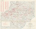
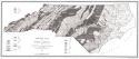
Main Author:
Campbell, Marius R. and Kent K. Kimball
Title/Description:
Map of the Deep River Coal Field in Lee, Chatham and Moore Counties, North Carolina
Publication Info:
Raleigh: North Carolina Geological and Economic Survey, 1923
Viewing Options
Main Author:
Cram, George F.
Title/Description:
North Carolina
Publication Info:
Chicago: George F. Cram Company, 1923; from Cram's Unrivaled Atlas of the World
Viewing Options
Main Author:
Funk and Wagnalls Company
Title/Description:
North Carolina
Publication Info:
New York: Funk and Wagnalls Company, 1923; from Atlas of the World and Gazetteer
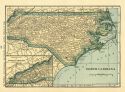
Viewing Options
Main Author:
Reynolds, Francis J.
Title/Description:
North Carolina
Publication Info:
New York: P.F. Collier and Son Company, 1924; from The New World Atlas and Gazetteer
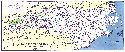
Viewing Options
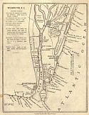
Main Author:
Sweet, Robert N.
Title/Description:
Wilmington, N.C.
Publication Info:
Robert N. Sweet, 1925; (Map Showing the location of Civil War ship wrecks)
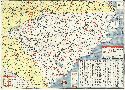
Viewing Options
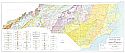
Main Author:
North Carolina Department of Conservation and Development
Title/Description:
Map of North Carolina showing location of Principal River Basins, Gaging Stations and Developed Water Power over 1,000 H.P.
Publication Info:
Raleigh: Edwards and Broughton Printing Company, 1925; Bulletin 34, Plate I

Viewing Options
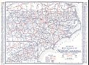
Main Author:
Rand McNally and Company
Title/Description:
North Carolina
Publication Info:
Chicago: Rand McNally and Company, 1925; from Premier Atlas of the World
Viewing Options
Main Author:
Clason Map Company
Title/Description:
Best Roads of North Carolina
Publication Info:
Chicago: Clason Map Company, c. 1927; from Clason's Touring Atlas
Viewing Options
Main Author:
National Map Company
Title/Description:
North Carolina
Publication Info:
Indianapolis: National Map Company, 1930; from Official Paved Road and Commercial Survey of the United States

Viewing Options
Main Author:
Clason Map Company
Title/Description:
Clason's Road Map of North Carolina
Publication Info:
Denver: The Clason Map Company, 1930; from Clason's Touring Atlas of the United States and Canada
Viewing Options
Main Author:
C.S. Hammond and Company
Title/Description:
North Carolina
Publication Info:
New York: C.S. Hammond and Company, c. 1930; from The New World Loose Leaf Atlas, Sixth Edition
Viewing Options
Main Author:
C.S. Hammond and Company
Title/Description:
North Carolina
Publication Info:
New York: C.S. Hammond and Company, c. 1930; from The New World Loose Leaf Atlas, Sixth Edition

Viewing Options
Main Author:
Geographical Publishing Company
Title/Description:
North Carolina
Publication Info:
Chicago: Geographical Publishing Company1931; from Commercial Atlas of the World
Viewing Options
Main Author:
Branom, Frederick K. and Lloyd Edwin Smith
Title/Description:
North Carolina
Publication Info:
Chicago: Geographical Publishing Company, 1936; from Capper's 1936 Atlas of the World
Viewing Options
Main Author:
Rand McNally and Company
Title/Description:
Standard Map of North Carolina
Publication Info:
Chicago: Rand McNally and Company, 1936
Viewing Options
Main Author:
Mid-West Map Company
Title/Description:
Sears Official Road Map, North Carolina, South Carolina
Publication Info:
Aurora, MO: Mid-West Map Company, c.1937
Viewing Options
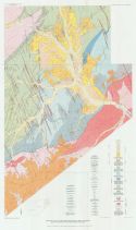
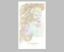
Main Author:
N.C. Department of Conservation and Development
Title/Description:
Geologic Map of North Carolina
Publication Info:
Winston-Salem: N.C. Department of Conservation and Development, 1937
Viewing Options
Main Author:
Cities Service Company
Title/Description:
North Carolina, South Carolina
Publication Info:
Chicago: H.M. Gousha Company, c. 1937
Original Source:
Murray Hudson
Viewing Options
Main Author:
Geographical Publishing Company
Title/Description:
North Carolina
Publication Info:
Chicago: Geographical Publishing Company, 1942; from The New International Atlas of the World, War Edition
Viewing Options
Main Author:
U.S. Geological Survey
Title/Description:
Map of the Central Piedmont Region of North Carolina and South Carolina, Showing locations of Mines and prospects
Publication Info:
Washington: Department of the Interior, US Geological Survey, 1948; Professional Paper 213, Plate 22
Viewing Options
Main Author:
Esso (Standard Oil of New Jersey)
Title/Description:
North Carolina, South Carolina
Publication Info:
New York: General Drafting Company, 1948
Original Source:
Murray Hudson
Viewing Options
Main Author:
North Carolina State Highway and Public Works Commission
Title/Description:
North Carolina Highways, 1948-1949
Publication Info:
Raleigh: The Commission, 1949
Original Source:
Murray Hudson
Viewing Options
Main Author:
North Carolina State Highway and Public Works Commission
Title/Description:
North Carolina Highway Map, 1949-50
Publication Info:
Raleigh: The Commission, 1950
Original Source:
Murray Hudson
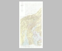
Main Author:
U.S. Geological Survey
Title/Description:
Geologic Map of the Deep River Coal Field, Chatham, Lee and Moore Counties, North Carolina (Eastern Part)
Publication Info:
Washington: Department of the Interior, U.S. Geological Survey, 1955; Professional Paper 246
Viewing Options
Main Author:
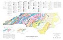
Department of Conservation and Development
Title/Description:
Geologic Map of North Carolina
Publication Info:
North Carolina Department of Conservation and Development, 1958
Viewing Options
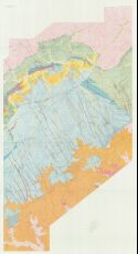
Main Author:
U.S. Geological Survey
Title/Description:
Geologic Map of the Spruce Pine Pegmatite District, Avery, Mitchell, and Yancey Counties, North Carolina (East Half)
Publication Info:
Washington: Department of the Interior, U.S. Geological Survey, 1962; Bulletin 1122-A Plate 1
Viewing Options
Main Author:
U.S. Geological Survey
Title/Description:
Geologic Map of the Spruce Pine Pegmatite District, Avery, Mitchell, and Yancey Counties, North Carolina (West Half)
Publication Info:
Washington: Department of the Interior, U.S. Geological Survey, 1962; Bulletin 1122-A Plate 1

Viewing Options
Main Author:
U.S. Geological Survey
Title/Description:
Preliminary Geologic Map and Sections of the Lineville Quadrangle, North Carolina-Tennessee
Publication Info:
Washington: Department of the Interior, U.S. Geological Survey, 1962; Bulletin 1121-D Plate 1
Viewing Options
Main Author:
North Carolina Geological Survey
Title/Description:
Geologic Survey of North Carolina
Publication Info:
Raleigh: North Carolina Geological Survey, Division of Land Resources, 1985