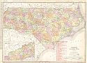
Viewing Options
Viewing Options
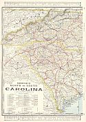
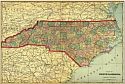
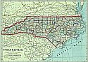
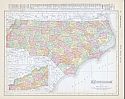
Main Author:
Cram, George F.
Title/Description:
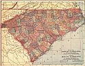
Western and Eastern Parts of North and South Carolina
Publication Info:
Chicago: George F. Cram for A. A. Grant, Toronto, Ont., 1906; from Grant's Bankers and Brokers Railroad System Atlas
Viewing Options
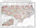
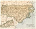
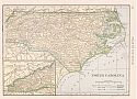
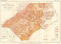
Main Author:
Rand McNally and Company
Title/Description:
North Carolina
Publication Info:
Chicago: Rand McNally and Company, 1906; from the Commercial Atlas of America
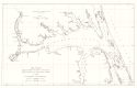
Viewing Options
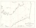
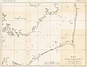
Title/Description:
Map Showing approximate location of seines and pound nets fished for shad in 1906 - North Sheet
Publication Info:
Raleigh: North Carolina Geological Survey, 1906; Economic Paper No. 12
Viewing Options
Title/Description:
Map Showing approximate location of seines and pound nets fished for shad in 1906 - South Sheet
Publication Info:
Raleigh: North Carolina Geological Survey, 1906; Economic Paper No. 12
Viewing Options
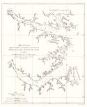
Title/Description:
Map Showing approximate location of seines and pound nets fished for shad in 1906 - West Sheet
Publication Info:
Raleigh: North Carolina Geological Survey, 1906; Economic Paper No. 12
Viewing Options
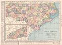
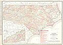
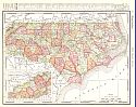
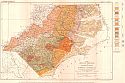
Main Author:
Rand McNally and Company
Title/Description:
North Carolina
Publication Info:
Chicago: Rand McNally and Company, 1906; from The World and its Peoples
Viewing Options
Main Author:
Hammond, C.S.
Title/Description:
North Carolina
Publication Info:
New York: C.S. Hammond & Co., 1907; from C.S. Hammond's Modern Atlas of the World
Viewing Options
Main Author:
Cram, George F.
Title/Description:
Map of North Carolina
Publication Info:
Chicago: George F. Cram, 1907; from Cram's Standard American Atlas
Viewing Options
Main Author:
P.F. Collier and Son
Title/Description:
North Carolina
Publication Info:
New York: P.F. Collier and Son, 1907; from The New Encyclopedic Atlas and Gazetteer of the World
Viewing Options
Main Author:
North Carolina Geological and Economic Survey
Title/Description:
Map of Pamlico Sound, North Carolina
Publication Info:
Raleigh: E.M. Uzzell and Company, 1907; Bulletin No. 15, Plate II
Viewing Options
Main Author:
Rand McNally & Co.
Title/Description:
North Carolina
Publication Info:
Chicago: Rand McNally & Co., 1908; from Rand McNally's Indexed Atlas of America
Viewing Options
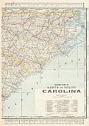
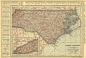
Main Author:
The Crowell Publishing Company
Title/Description:
Map of North Carolina, South Carolina
Publication Info:
New York: The Crowell Publishing Co., 1908; from The Twentieth Century Peerless Atlas
Viewing Options
Main Author:
Hammond, C.S.
Title/Description:
North Carolina
Publication Info:
New York: C.S. Hammond & Co. 1908; from Hammond's Handy Atlas of the World
Viewing Options
Main Author:
Rand McNally and Company
Title/Description:
North Carolina
Publication Info:
Chicago: Rand McNally and Company, 1908; from The New Ideal State and County Survey and Atlas
Viewing Options
Main Author:
Patten, William and J.E. Homas
Title/Description:
North Carolina
Publication Info:
New York: P.F. Collier and Son, 1909; from The New Encyclopedic Atlas and Gazetteer of the World
Viewing Options
Main Author:
Cram, George F.
Title/Description:
North Carolina
Publication Info:
Chicago: George F. Cram, c.1909; from The Heart of our Country
Viewing Options
Main Author:
Stephenson, L.W.
Title/Description:
Geologic Map showing Distribution of Surficial Formations in North Carolina
Publication Info:
Raleigh: North Carolina Geological and Economic Survey, 1909
Viewing Options
Main Author:
North Carolina Geological and Economic Survey
Title/Description:
Map showing the Distribution of Geological Formations of the Coastal Plain of North Carolina
Publication Info:
Raleigh: North Carolina Geological and Economic Survey, 1909
Viewing Options
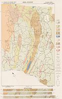
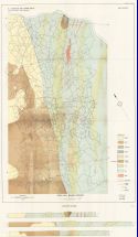
Main Author:
North Carolina Geological and Economic Survey
Title/Description:
Areal Geology, Cid Mining District, Davidson County, North Carolina
Publication Info:
Raleigh: Edwards and Broughton Printing Company, 1910; Bulletin No. 22, Plate IV
Viewing Options
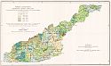
Main Author:
North Carolina Geological and Economic Survey
Title/Description:
Forest Conditions, Western North Carolina
Publication Info:
Raleigh: Edwards and Broughton Printing Company, 1910; Bulletin No. 23, Plate II
Viewing Options
Main Author:
North Carolina Geological and Economic Survey
Title/Description:
Areal Geology, Gold Hill Mining District
Publication Info:
Raleigh: Edwards and Broughton Printing Company, 1910; Bulletin No. 21, Plate III
Viewing Options
Main Author:
Rand McNally and Company
Title/Description:
North Carolina
Publication Info:
Chicago: Rand McNally and Company, 1910; from New Ideal State and County Survey

