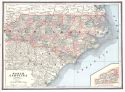
Viewing Options
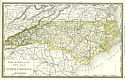
Main Author:
Watson, Gaylord
Title/Description:
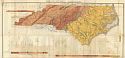
Watson's Atlas Map of North Carolina
Publication Info:
New York: Gaylord Watson, 1886
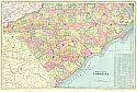
Viewing Options
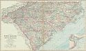
Title/Description:
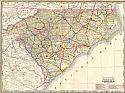
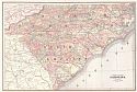
Gray's New Map of North Carolina and South Carolina
Publication Info:
Philadelphia: Stedman and Brown, 1886; from The National Atlas
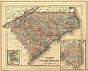
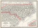
Viewing Options
Main Author:
Cram, George F.
Title/Description:
North Carolina
Publication Info:
Chicago: George F. Cram, 1887
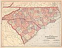
Viewing Options
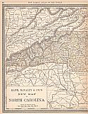
Main Author:
Rand McNally & Co.
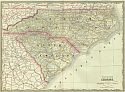
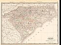
Title/Description:
North and South Carolina
Publication Info:
Chicago: Rand McNally & Co., 1887; from Rand McNally & Co.'s New Indexed Atlas of the World
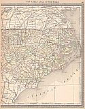
Viewing Options
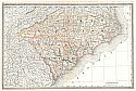
Main Author:
Mitchell Jr., S. Augustus
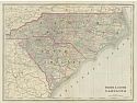
Title/Description:
North and South Carolina
Publication Info:
Philadelphia: Bradley and Bro., 1887; from Mitchell's New General Atlas
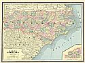
Viewing Options
Main Author:
Cram, George F
Title/Description:
New Railroad and County Map of North and South Carolina
Publication Info:
Chicago: George F Cram, 1887, from Cram's Banker and Brokers Railroad Atlas
Viewing Options
Title/Description:
Geological Map of North Carolina
Publication Info:
[Raleigh: North Carolina Geological Survey, c.1887]
Viewing Options
Main Author:
Cram, George F.
Title/Description:
North and South Carolina
Publication Info:
Chicago: George F. Cram, 1888; from Cram's Standard American Atlas
Viewing Options
Main Author:
Bradley, William M.
Title/Description:
North and South Carolina
Publication Info:
Philadelphia: William M. Bradley and Brother, 1888; from The Atlas of the World
Viewing Options
Main Author:
Cram, George F.
Title/Description:
North Carolina
Publication Info:
Kansas City: Edwin Williamson, 1888; from Cram's Unrivaled Atlas of the World
Viewing Options
Main Author:
Cram. George F.
Title/Description:
North and South Carolina
Publication Info:
Chicago: George F. Cram, 1889
Viewing Options
Main Author:
People's Publishing Company
Title/Description:
North Carolina
Publication Info:
Chicago: People's Publishing Company, 1889
Viewing Options
Main Author:
Mast, Crowell, and Kirkpatrick
Title/Description:
Map of North and South Carolina
Publication Info:
Springfield, Ohio: Mast, Crowell, & Kirkpatrick, 1889; from The Peerless Atlas of the World
Viewing Options
Main Author:
Rand McNally and Company
Title/Description:
North Carolina
Publication Info:
Chicago: Rand McNally and Co., 1889; from The Enlarged Business Atlas and Shippers Guide
West
East
Main Author:
Rand McNally and Company
Title/Description:
New Map of North Carolina
Publication Info:
Chicago: Rand McNally & Co., 1890; from Rand McNally & Co.'s Family Atlas of the World
Sheet 1
Sheet 2
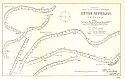
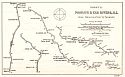
Title/Description:
Pamlico and Tar Rivers, NC from Washington to Tarboro Sheet 1
Publication Info:
Washington: Government Printing Office, 1890; from the Annual Report of the Secretary of War to 51st Congress, 2nd Session, Ex. Doc. 1, Part 2
Viewing Options
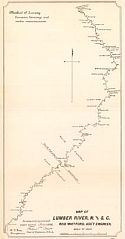
Title/Description:
Map of Lumber River N. and S.C.
Publication Info:
Washington: Government Printing Office, 1890; from the Annual Report of the Secretary of War to 51st Congress, 2nd Session, Ex. Doc. 1, Part 2
Viewing Options
Viewing Options
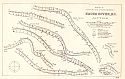
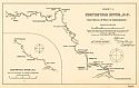
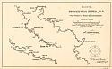
Title/Description:
Contentnia River, NC from Mouth of River to Stantonsburg, Sheet 1
Publication Info:
Washington: Government Printing Office, 1890; from the Annual Report of the Secretary of War to 51st Congress, 2nd Session, Ex. Doc. 1, Part 2
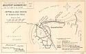
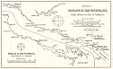
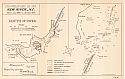
Shackleford Point
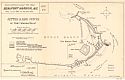
Fort Macon Point
Beaufort City Channel
Title/Description:
Progress Map for 1890, Beaufort Harbor, N.C.
Publication Info:
Washington: Government Printing Office, 1890; from the Annual Report of the Secretary of War to 51st Congress, 2nd Session, Ex. Doc. 1, Part 2
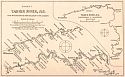
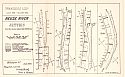
Sheet 1
Sheet 2
Title/Description:
Yadkin River, N.C. from W. N.C. R.R. Bridge near Salisbury to Wilkesboro
Publication Info:
Washington: Government Printing Office, 1890; from the Annual Report of the Secretary of War to 51st Congress, 2nd Session, Ex. Doc. 1, Part 2
Viewing Options
Main Author:
Cram, George F.
Title/Description:
North and South Carolina
Publication Info:
Rochester: W.H. Stewart, c. 1890; from Cram's Unrivaled Atlas of the World
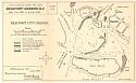
Title/Description:
Neuse River, N.C. Jetties
Publication Info:
Washington: Government Printing Office, 1890; from The Annual Report of the Secretary of War to the 51st Congress, 2nd Session, Ex. Doc. 1, Part 2
Viewing Options
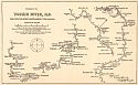
Title/Description:
New River, N.C. Mouth of the River
Publication Info:
Washington: Government Printing Office, 1890; from the Annual Report of the Secretary of War to 51st Congress, 2nd Session, Ex. Doc. 1, Part 2
Viewing Options
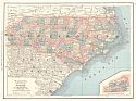
Main Author:
Walker, Henry B.
Title/Description:
North and South Carolina
Publication Info:
Philadelphia: H.B. Walker, 1890; from Walker's International Atlas