Viewing Options
Viewing Options
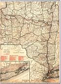
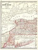
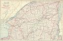
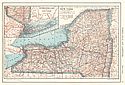
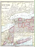
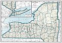
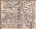
Main Author:
Rand McNally and Company
Title/Description:
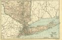
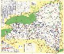
New York
Publication Info:
Chicago: Rand McNally and Company, 1921; from The Commercial Atlas of America
Viewing Options
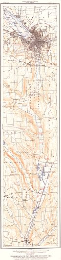
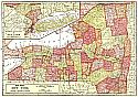
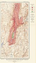
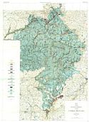
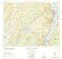
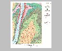
Main Author:
University of the State of New York
Title/Description:
Topographic Map of the Tully Glacial Series and Adjoining Areas
Publication Info:
Albany: University of the State of New York, 1921; New York State Museum Bulletin 227,228
Viewing Options
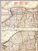
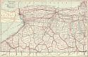
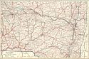
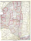
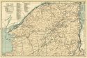
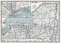
Main Author:
Cram, George F.
Title/Description:
Map of New York - Western
Publication Info:
Chicago: George F. Cram Company, 1921; from Cram's Unrivaled Atlas of the World
Viewing Options
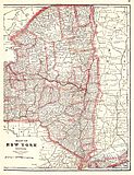
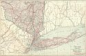
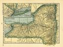
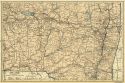
Main Author:
Cram, George F.
Title/Description:
Map of New York - Eastern
Publication Info:
Chicago: George F. Cram Company, 1921; from Cram's Unrivaled Atlas of the World
Viewing Options
Main Author:
The Geographical Publishing Co.
Title/Description:
New York
Publication Info:
Chicago: The Geographical Publishing Co., 1922; from The New International Atlas of the World
Viewing Options
Main Author:
C.S. Hammond and Company
Title/Description:
New York (Western Part)
Publication Info:
New York: C.S. Hammond and Company, 1922; from The New World Loose-leaf Atlas
Viewing Options
Main Author:
C.S. Hammond and Company
Title/Description:
New York (Southern Part)
Publication Info:
New York: C.S. Hammond and Company, 1922; from The New World Loose-leaf Atlas
Viewing Options
Main Author:
C.S. Hammond and Company
Title/Description:
New York (Northeastern Part)
Publication Info:
New York: C.S. Hammond and Company, 1922; from The New World Loose-leaf Atlas
Viewing Options
Main Author:
C.S. Hammond and Company
Title/Description:
New York (South Central Part)
Publication Info:
New York: C.S. Hammond and Company, 1922; from The New World Loose-leaf Atlas
Viewing Options
Main Author:
U.S. Geological Survey
Title/Description:
Map of Part of Clove Quadrangle, New York, Showing Areas of Calcitic and Dolomitic Limestone
Publication Info:
Washington: Department of the Interior, U.S. Geological Survey, 1923; Bulletin 744 Plate 4
Viewing Options
Main Author:
Funk and Wagnalls Company
Title/Description:
New York
Publication Info:
New York: Funk and Wagnalls Company, 1923; from Atlas of the World and Gazetteer
Viewing Options
Main Author:
Reynolds, Francis J.
Title/Description:
New York
Publication Info:
New York: P.F. Collier and Son Company, 1924; from The New World Atlas and Gazetteer
Viewing Options
Main Author:
Reynolds, Francis J.
Title/Description:
Map of Long Island, New York
Publication Info:
New York: P.F. Collier and Son Company, 1924; from The New World Atlas and Gazetteer
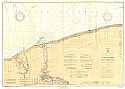
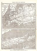
Viewing Options
Main Author:
The Chief of Engineers, U.S. Army
Title/Description:
Lake Ontario: Thirty Mile Point to Port Dalhousie, Ont., Including Niagara River to North Tonawanda, N.Y.
Publication Info:
Washington: War Department, Corps of Engineers, 1926; Lake Ontario Coast Chart No. 5
Viewing Options
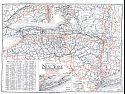
Main Author:
Clason Map Company
Title/Description:
Best Roads of New York
Publication Info:
Chicago: Clason Map Company, c. 1927; from Clason's Touring Atlas

Viewing Options
Main Author:
Standard Oil Company of New York
Title/Description:
Road Map of Long Island in Soconyland
Publication Info:
New York: General Drafting Company, 1928
Original Source:
Murray Hudson
Viewing Options
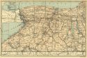
Main Author:
National Map Company
Title/Description:
New York - West
Publication Info:
Indianapolis: National Map Company, 1930; from Official Paved Road and Commercial Survey of the United States
Viewing Options
Main Author:
National Map Company
Title/Description:
New York - East
Publication Info:
Indianapolis: National Map Company, 1930; from Official Paved Road and Commercial Survey of the United States
Viewing Options
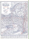
Main Author:
Clason Map Company
Title/Description:
Clason's Road Map of New York
Publication Info:
Denver: The Clason Map Company, 1930; from Clason's Touring Atlas of the United States and Canada
Viewing Options
Main Author:
C.S. Hammond and Company
Title/Description:
New York (Western Part)
Publication Info:
New York: C.S. Hammond and Company, c. 1930; from The New World Loose Leaf Atlas, Sixth Edition
Viewing Options
Main Author:
C.S. Hammond and Company
Title/Description:
New York (Southern Part)
Publication Info:
New York: C.S. Hammond and Company, c. 1930; from The New World Loose Leaf Atlas, Sixth Edition
Viewing Options
Main Author:
C.S. Hammond and Company
Title/Description:
New York (Northeastern Part)
Publication Info:
New York: C.S. Hammond and Company, c. 1930; from The New World Loose Leaf Atlas, Sixth Edition
Viewing Options
Main Author:
C.S. Hammond and Company
Title/Description:
New York (South Central Part)
Publication Info:
New York: C.S. Hammond and Company, c. 1930; from The New World Loose Leaf Atlas, Sixth Edition
Viewing Options
Main Author:
C.S. Hammond and Company
Title/Description:
New York
Publication Info:
New York: C.S. Hammond and Company, c. 1930; from The New World Loose Leaf Atlas, Sixth Edition
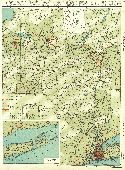
Viewing Options
Main Author:
Geographical Publishing Company
Title/Description:
New York
Publication Info:
Chicago: Geographical Publishing Company1931; from Commercial Atlas of the World
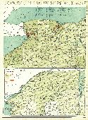
Viewing Options
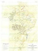
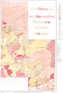
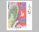
Main Author:
Rich, John Lyon
Title/Description:
Map of the Glacial Geology of the Catskill Mountains
Publication Info:
Albany: New York State Museum, University of the State of New York, 1935; Bulletin No. 299
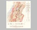
Viewing Options
Main Author:
Rich, John Lyon
Title/Description:
Map of the Catskill Mountain Region showing positions of the Ice front during the Glacial Retreat
Publication Info:
Albany: New York State Museum, University of the State of New York, 1935; Bulletin No. 299
Viewing Options
Main Author:
Branom, Frederick K. and Lloyd Edwin Smith
Title/Description:
New York
Publication Info:
Chicago: Geographical Publishing Company, 1936; from Capper's 1936 Atlas of the World
Viewing Options
Main Author:
Standard Oil of New York
Title/Description:
Motoring in New York
Publication Info:
New York: General Drafting Company, 1936
Original Source:
Murray Hudson
Viewing Options
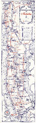
Main Author:
Standard Oil of New York
Title/Description:
A Pictorial Map of New York
Publication Info:
New York: General Drafting Company, 1936
Original Source:
Murray Hudson
Viewing Options
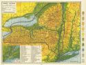
Main Author:
Rand McNally and Company
Title/Description:
Eastern New York
Publication Info:
Chicago: Rand McNally and Company, 1936
Viewing Options
Main Author:
Rand McNally and Company
Title/Description:
Western New York
Publication Info:
Chicago: Rand McNally and Company, 1936
Viewing Options
Main Author:
Mid-West Map Company
Title/Description:
Sears Official Road Map, New York
Publication Info:
Aurora, MO: Mid-West Map Company, c.1937
Viewing Options
Main Author:
Army Map Service
Title/Description:
West Point and Vicinity
Publication Info:
Washington: Army Map Service, Corps of Engineers, U.S. Army, 1950
Viewing Options
Main Author:
U.S. Geological Survey
Title/Description:
Geologic Map and Sections of the Magnetic District, Clinton County, New York
Publication Info:
Washington: Department of the Interior, U.S. Geologic Survey, 1952; Professional Paper 237, Plate 1
Viewing Options
Main Author:
U.S. Geological Survey
Title/Description:
Geologic Map and Sections of the Sterling Lake and Ringwood Area, New York- New Jersey
Publication Info:
Washington: Department of the Interior, U.S. Geological Survey, 1953; Bulletin 982-F Plate 19
Viewing Options
Main Author:
U.S. Geological Survey
Title/Description:
Geologic and Structure Contour Map of the Keuka Park Quadrangle, New York
Publication Info:
Washington: Department of the Interior, U.S. Geological Survey, 1964; Bulletin 1161-G Plate 2
Viewing Options
Main Author:
U.S. Geological Survey
Title/Description:
Geologic and Structure Contour Map of the Penn Yan Quadrangle, New York
Publication Info:
Washington: Department of the Interior, U.S. Geological Survey, 1964; Bulletin 1161-G Plate 1

