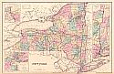
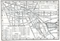
Viewing Options
Main Author:
Gray, Ormando W.
Title/Description:
New York
Publication Info:
Philadelphia: O.W. Gray, 1876
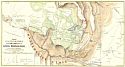
Viewing Options
Main Author:
Loan, Walton Van
Title/Description:
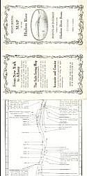
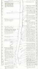
Map of all the Points of Interest within Four Miles of the Catskill Mountain House
Publication Info:
New York: Lewis E. Neuman, 1876
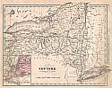
Viewing Options
Main Author:
McNally, Francis
Title/Description:
New York
Publication Info:
New York: A.S. Barnes and Company, 1876; from An Improved System of Geography
Viewing Options
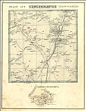
Main Author:
Everts, Ensign and Everts
Title/Description:
Map of Cincinatus Township
Publication Info:
New York: Everts, Ensign and Everts, 1876; from Combination Atlas Map of Cortland County New York
Viewing Options
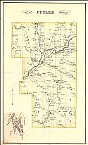
Main Author:
Everts, Ensign and Everts
Title/Description:
Map of Cuyler Township
Publication Info:
New York: Everts, Ensign and Everts, 1876; from Combination Atlas Map of Cortland County New York
Viewing Options
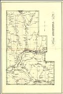
Main Author:
Evert, Ensign and Everts
Title/Description:
Map of Truxton Township
Publication Info:
New York: Everts, Ensign and Everts, 1876; from Combination Atlas Map of Cortland County New York
Viewing Options
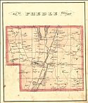
Main Author:
Everts, Ensign and Everts
Title/Description:
Map of Preble Township
Publication Info:
New York: Everts, Ensign and Everts, 1876; from Combination Atlas Map of Cortland County New York
Viewing Options
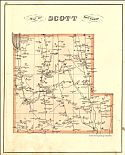
Main Author:
Everts, Ensign and Everts
Title/Description:
Map of Scott Township
Publication Info:
New York: Everts, Ensign and Everts, 1876; from Combination Atlas Map of Cortland County New York
Viewing Options
Main Author:
Everts, Ensign and Everts
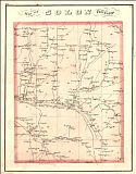
Title/Description:
Map of Solon Township
Publication Info:
New York: Everts, Ensign and Everts, 1876; from Combination Atlas Map of Cortland County New York
Viewing Options
Main Author:
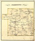
Everts, Ensign and Everts
Title/Description:
Map of Freetown Township
Publication Info:
New York: Everts, Ensign and Everts, 1876; from Combination Atlas Map of Cortland County New York
Viewing Options
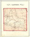
Main Author:
Everts, Ensign and Everts
Title/Description:
Map of Lapeer Township
Publication Info:
New York: Everts, Ensign and Everts, 1876; from Combination Atlas Map of Cortland County New York
Viewing Options
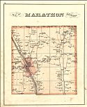
Main Author:
Everts, Ensign and Everts
Title/Description:
Map of Marathon Township
Publication Info:
New York: Everts, Ensign and Everts, 1876; from Combination Atlas Map of Cortland County New York
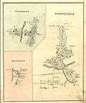
Viewing Options
Main Author:
Everts, Ensign and Everts
Title/Description:
Cincinnatus P.O., McGrawville and Texas Valley PO
Publication Info:
New York: Everts, Ensign and Everts, 1876; from "Combination Atlas of Cortland County, New York"
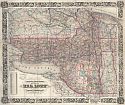
Viewing Options
Main Author:
Colton, George W.
Title/Description:
Colton's Railroad and Township Map of the State of New York with Parts of the Adjoining States and Canada
Publication Info:
New York: J.H. Colton & Co., 1879
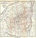
Viewing Options
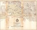
Main Author:
Colvin, Verplant
Title/Description:
Sketch Showing Region Under Survey, 1879
Publication Info:
Albany: Railroad Board of Commissioners, 1879; From the Seventh Annual Report on the Progress of the Topographical Survey of the Adirondack Region of New York
Viewing Options
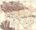
Main Author:
Colvin, Verplant
Title/Description:
Reconnaissance Map of the Upper Sable Lake
Publication Info:
Albany: Railroad Board of Commissioners, 1879; From the Seventh Annual Report on the Progress of the Topographical Survey of the Adirondack Region of New York
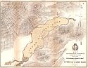
Viewing Options
Main Author:
Colvin, Verplank
Title/Description:
Reconnaissance Map of Tallow or Blue Mountain Lake
Publication Info:
Albany: Railroad Board of Commissioners, 1879; From the Seventh Annual Report on the Progress of the Topographical Survey of the Adirondack Region of New York
Viewing Options
Main Author:
Colvin, Verplank
Title/Description:
Reconnaissance Map of the Lower Saranac Lake
Publication Info:
Albany: Railroad Board of Commissioners, 1879; From the Seventh Annual Report on the Progress of the Topographical Survey of the Adirondack Region of New York

Viewing Options
Main Author:
Colvin, Verplank
Title/Description:
Beaver River Survey
Publication Info:
Albany: Railroad Board of Commissioners, 1879; From the Seventh Annual Report on the Progress of the Topographical Survey of the Adirondack Region of New York
Viewing Options
Main Author:
Osgood, James R.
Title/Description:
Niagara Falls
Publication Info:
Boston: Houghton, Osgood and Company 1879; from The Middle States: A Handbook for Travellers
Viewing Options
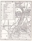
Main Author:
Osgood, James R.
Title/Description:
Rochester
Publication Info:
Boston: Houghton, Osgood and Company 1879; from The Middle States: A Handbook for Travellers
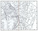
Viewing Options
Main Author:
Osgood, James R.
Title/Description:
Saratoga Springs
Publication Info:
Boston: Houghton, Osgood and Company 1879; from The Middle States: A Handbook for Travellers
Viewing Options
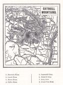
Main Author:
Osgood, James R.
Title/Description:
Catskill Mountains
Publication Info:
Boston: Houghton, Osgood and Company 1879; from The Middle States: A Handbook for Travellers
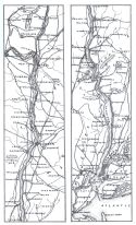
Viewing Options
Main Author:
Osgood, James R.
Title/Description:
Hudson River Valley
Publication Info:
Boston: Houghton, Osgood and Company 1879; from The Middle States: A Handbook for Travellers
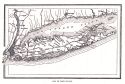
Viewing Options
Main Author:
Osgood, James R.
Title/Description:
Map of Long Island
Publication Info:
Boston: Houghton, Osgood and Company 1879; from The Middle States: A Handbook for Travellers
Viewing Options
Viewing Options
Main Author:
Radcliffe, W.H.
Title/Description:
Sight-Seeing Map of the Hudson River
Publication Info:
New York: W.H. Radcliffe, 1880
Viewing Options
Main Author:
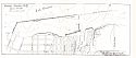
U.S. Army Corps of Engineers
Title/Description:
Oswego Harbor, N.Y., June 30, 1880
Publication Info:
Washington: U.S. Army Corps of Engineers, 1880

