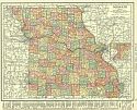
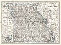
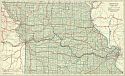
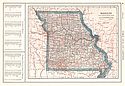
Viewing Options
Main Author:
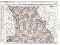
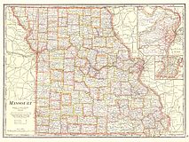
Rand McNally and Company
Title/Description:
Missouri
Publication Info:
Chicago: Rand McNally and Co., 1916; from the Ideal Atlas of the World
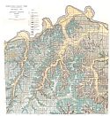
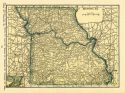
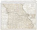
Viewing Options
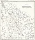
Main Author:
McCourt, W.E. and J. Bennett
Title/Description:
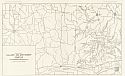
Geological Map of Jackson County, Missouri
Publication Info:
Jefferson City: Missouri Bureau of Geology and Mines, 1917; from Report Vol. XIV, Series 2
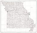
Viewing Options
Main Author:
U.S. Geological Survey
Title/Description:
State of Missouri
Publication Info:
Washington: Department of the Interior, U.S. Geological Survey, 1917; reprinted 1942
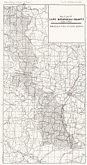
Viewing Options
Main Author:
Missouri Bureau of Geology and Mines
Title/Description:
Map of part of Cape Girardeau County
Publication Info:
Rolla: Missouri Bureau of Geology and Mines, 1918; Vol XV, 2nd Series, Plate XIV
Viewing Options
Main Author:
Missouri Bureau of Geology and Mines
Title/Description:
Map of part of Ste. Genevieve County
Publication Info:
Rolla: Missouri Bureau of Geology and Mines, 1918; Vol XV, 2nd Series, Plate XVIII
Viewing Options
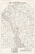
Main Author:
Missouri Bureau of Geology and Mines
Title/Description:
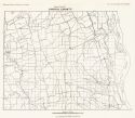
Map of parts of Perry and Bollinger County
Publication Info:
Rolla: Missouri Bureau of Geology and Mines, 1918; Vol XV, 2nd Series, Plate XVII
Viewing Options
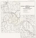
Main Author:
Missouri Bureau of Geology and Mines
Title/Description:
Map of parts of Jefferson, Franklin and St. Louis Counties
Publication Info:
Rolla: Missouri Bureau of Geology and Mines, 1918; Vol XV, 2nd Series, Plate XXIII
Viewing Options
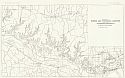
Main Author:
Missouri Bureau of Geology and Mines
Title/Description:
Map of Parts of Warren and St. Charles Counties
Publication Info:
Rolla: Missouri Bureau of Geology and Mines, 1918; Vol XV, 2nd Series, Plate XXX
Viewing Options
Main Author:
Missouri Bureau of Geology and Mines
Title/Description:
Map of Parts of Callaway and Montgomery Counties
Publication Info:
Rolla: Missouri Bureau of Geology and Mines, 1918; Vol XV, 2nd Series, Plate XXXI
Viewing Options
Main Author:
Missouri Bureau of Geology and Mines
Title/Description:
Map of Part of Lincoln County
Publication Info:
Rolla: Missouri Bureau of Geology and Mines, 1918; Vol XV, 2nd Series, Plate XXXII
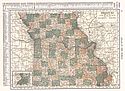
Viewing Options
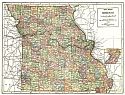
Main Author:
C.S. Hammond and Company
Title/Description:
Missouri
Publication Info:
New York: C.S. Hammond and Company, 1918; from Hammonds Pictorial Atlas of the World
Viewing Options
Main Author:
Reynolds, Francis J.
Title/Description:
Missouri
Publication Info:
New York: P.F. Collier and Son Company, 1920; from The New World Atlas and Gazetteer
Viewing Options
Main Author:
C.S. Hammond and Company
Title/Description:
Missouri
Publication Info:
New York: C.S. Hammond and Company, 1920; from The New Reference Atlas of the World
Original Source:
Courtesy of Shawn Carter
Viewing Options
Main Author:
Leslie-Judge Company
Title/Description:
Missouri
Publication Info:
New York: Leslie-Judge Company1920; from Leslie's New World Atlas
Viewing Options
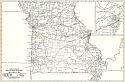
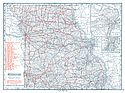
Main Author:
Rand McNally and Company
Title/Description:
Missouri- Black and White Mileage Map
Publication Info:
Chicago: Rand McNally and Company, 1921; from the Commercial Atlas of America
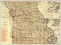
Viewing Options
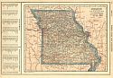
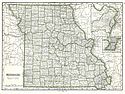
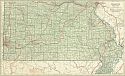
Main Author:
Rand McNally and Company
Title/Description:
Missouri
Publication Info:
Chicago: Rand McNally and Company, 1921; from the Commercial Atlas of America
Viewing Options
Main Author:
Cram, George F.
Title/Description:
Missouri
Publication Info:
Chicago: George F. Cram Company, 1921; from Cram's Unrivaled Atlas of the World
Viewing Options
Main Author:
National Map Company
Title/Description:
Missouri
Publication Info:
Indianapolis: National Map Company, 1921; from Auto Trails and Commercial Survey of the United States
Viewing Options
Main Author:
National Map Company
Title/Description:
Missouri
Publication Info:
Indianapolis: National Map Company, 1921; from Auto Trails and Commercial Survey of the United States
Viewing Options
Main Author:
The Geographical Publishing Co.
Title/Description:
Missouri
Publication Info:
Chicago: The Geographical Publishing Co., 1922; from New International Atlas of the World
Viewing Options
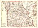
Viewing Options
Main Author:
C.S. Hammond and Company
Title/Description:
Missouri
Publication Info:
New York: C.S. Hammond and Company, 1922; from the New World Loose-leaf Atlas
Viewing Options
Main Author:
Cram, George F.
Title/Description:
Missouri
Publication Info:
Chicago: George F. Cram Company, 1923; from Cram's Unrivaled Atlas of the World
Viewing Options
Main Author:
Funk and Wagnalls Company
Title/Description:
Missouri
Publication Info:
New York: Funk and Wagnalls Company, 1923; from Atlas of the World and Gazetteer
Viewing Options
Main Author:
Reynolds, Francis J.
Title/Description:
Missouri
Publication Info:
New York: P.F. Collier and Son Company, 1924; from The New World Atlas and Gazetteer
Viewing Options
Main Author:
Rand McNally and Company
Title/Description:
Missouri
Publication Info:
Chicago: Rand McNally and Company, 1925; from Premier Atlas of the World

