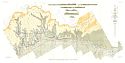
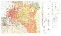
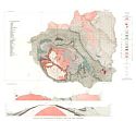
Viewing Options
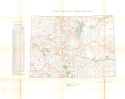
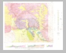
Title/Description:
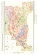
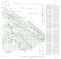
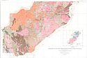
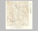
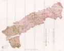
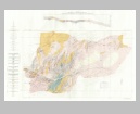
Geologic and Topographic Map Showing Surveyed Mining claims and underground development in the Bonanza District, Saguache County, Colorado
Publication Info:
Washington D.C.: Department of the Interior, US Geological Survey, 1931; Professional Paper 169, Plate 1
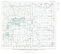
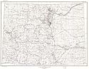
Viewing Options
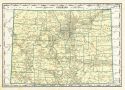
Title/Description:
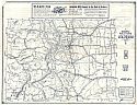
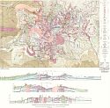
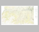
Highway Map and Guide of Colorado
Publication Info:
Aurora, Mo.: Mid-West Map Company, c. 1931
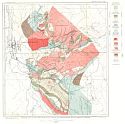
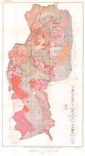
Viewing Options
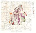
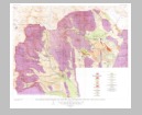
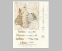
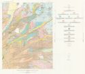
Title/Description:
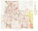
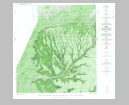
Geologic Map of the San Juan Mountains, Colorado, showing distribution of late tertiary and quarternary formations
Publication Info:
Washington D.C.: Department of the Interior, US Geological Survey, 1931; Professional Paper 166, Plate 1
Viewing Options
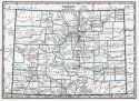
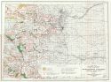
Main Author:
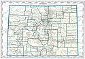
Geographical Publishing Company
Title/Description:
Colorado
Publication Info:
Chicago: Geographical Publishing Company1931; from Commercial Atlas of the World
Viewing Options
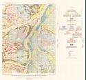
Title/Description:
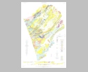
Geologic Map and Sections of Book Cliffs Coal Field, Colorado
Publication Info:
Washington D.C.: Department of the Interior, US Geological Survey, 1933; Bulletin 851, Plate 1
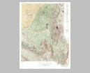
Viewing Options
Title/Description:
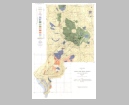
Geologic Map of the Most Productive part of the Breckenridge Mining District, Colorado
Publication Info:
Washington D.C.: Department of the Interior, US Geological Survey, 1934; Professional Paper 174, Plate 2
Viewing Options
Title/Description:
Geological Map of Colorado
Publication Info:
Washington D.C.: Department of the Interior, U.S. Geological Survey, 1935
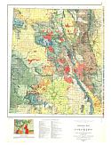
Viewing Options
Title/Description:
Geological Map of Colorado
Publication Info:
Washington D.C.: Department of the Interior, U.S. Geological Survey, 1935
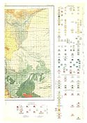
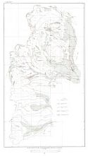
Viewing Options
Title/Description:
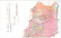
Geologic Map of the San Juan Region, Colorado
Publication Info:
Washington D.C.: Department of the Interior, US Geological Survey, 1935; Bulletin 843, Plate 1
Viewing Options
Title/Description:
Index Map Showing Mineralized and Prospectd areas, drainage, and location of hot springs in San Juan Region, Colorado
Publication Info:
Washington D.C.: Department of the Interior, US Geological Survey, 1935; Bulletin 843, Plate 3
Viewing Options
Main Author:
Branom, Frederick K. and Lloyd Edwin Smith
Title/Description:
Colorado
Publication Info:
Chicago: Geographical Publishing Company, 1936; from Capper's 1936 Atlas of the World
Viewing Options
Main Author:
Rand McNally and Company
Title/Description:
Standard Map of Colorado
Publication Info:
Chicago: Rand McNally and Company, 1936
Viewing Options
Title/Description:
Geologic Map and sections of Snowmass Mountain area, Colorado
Publication Info:
Washington D.C.: Department of the Interior, US Geological Survey, 1937; Bulletin 894, Plate 1
Viewing Options
Main Author:
U.S. Department of the Interior, U.S. Geological Survey
Title/Description:
Colorado
Publication Info:
Washington: U.S. Department of the Interior, U.S. Geological Survey, 1940
Viewing Options
Main Author:
U.S. Geological Survey
Title/Description:
Geologic map of the Alma-Horseshow District, Colorado
Publication Info:
Washington D.C.: Department of the Interior, US Geological Survey, 1940; Bulletin 911, Plate 1
Viewing Options
Main Author:
U.S. Geological Survey
Title/Description:
Glacial Map of the Alma-Horseshoe District, Colorado
Publication Info:
Washington D.C.: Department of the Interior, US Geological Survey, 1940; Bulletin 911, Plate 4
Viewing Options
Main Author:
Geographical Publishing Company
Title/Description:
Colorado
Publication Info:
Chicago: Geographical Publishing Company, 1942; from The New International Atlas of the World, War Edition
Viewing Options
Title/Description:
Geologic Map of Beaver-Tarryall area, Park county, Colorado
Publication Info:
Washington D.C.: Department of the Interior, US Geological Survey, 1942; Bulletin 928, Plate 1
Viewing Options
Main Author:
Bureau of the Census
Title/Description:
Colorado Irrigation by Drainage Basins, 1940
Publication Info:
Washington: U.S. Government Printing Office, 1942
Viewing Options
Main Author:
U.S. Department of the Interior
Title/Description:
Water Resources Development, Colorado Basin, Colorado
Publication Info:
Washington: U.S. Department of the Interior, Bureau of Reclamation, 1946; from The Colorado River, A Natural Menace Becomes a Natural Resource
Viewing Options
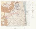
Main Author:
Stokes, W.L. and D.A. Phoenix
Title/Description:
Geology of the Egnar-Gypsum Valley Area, San Miguel and Montrose Counties, Colorado
Publication Info:
Washington: Department of the Interior, U.S. Geological Survey, 1948
Viewing Options
Main Author:
U.S. Geological SUrvey
Title/Description:
Geologic Map and Structure Sections of the La Plata District, Colorado
Publication Info:
Washington, D.C.: Department of the Interior, U.S. Geological Survey, 1949; Professional Paper 219, Plate 2
Viewing Options
Main Author:
U.S. Geological Survey
Title/Description:
Geological Map of Cripple Creek Mining District and Area to the South, Colorado
Publication Info:
Washington: Department of the Interior, US Geological Survey, 1949; Bulletin 955-B, Plate 3
Viewing Options
Main Author:
U.S. Geological Survey
Title/Description:
Geologic Map of the Front Range Mineral Belt, Colorado (North Half)
Publication Info:
Washington, D.C.: Department of the Interior, U.S. Geological Survey, 1950; Professional Paper 233, Plate 2
Viewing Options
Main Author:
U.S. Geological Survey
Title/Description:
Geologic Map of the Front Range Mineral Belt, Colorado (South Half)
Publication Info:
Washington, D.C.: Department of the Interior, U.S. Geological Survey, 1950; Professional Paper 233, Plate 2
Viewing Options
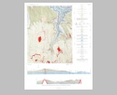
Main Author:
U.S. Geological Survey
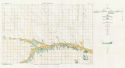
Title/Description:
Map Showing Placer Workings and the Related Physiographic Features, Park County, Colorado
Publication Info:
Washington: Department of the Interior, US Geological Survey, 1950; Bulletin 955-B, Plate 10
Viewing Options
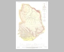
Main Author:
U.S. Geological Survey
Title/Description:
Map Showing Ice Boundaries During Wisconsin Glacial Stage, Park County, Colorado
Publication Info:
Washington: Department of the Interior, US Geological Survey, 1950; Bulletin 955-D, Plate 9
Viewing Options
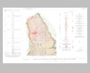
Main Author:
U.S. Geological Survey
Title/Description:
Generalized Geology Map Showing Bedrock Geologic Features Pertinent to Physiography and Placers, Park County, Colorado
Publication Info:
Washington: Department of the Interior, US Geological Survey, 1950-D; Bulletin 955, Plate 8
Viewing Options
Main Author:
U.S. Geological Survey
Title/Description:
Map Showing Major Faults, Main Veins, and General Character of Ores in Upper Blue River Area, Summit County, Ohio
Publication Info:
Washington: Department of the Interior, U.S. Geological Survey, 1951; Bulletin 970 Plate 2
Viewing Options
Main Author:
U.S. Geological Survey
Title/Description:
Geologic Map and Sections of the Upper Blue River Area, Summit County, Colorado
Publication Info:
Washington: Department of the Interior, U.S. Geological Survey, 1951; Bulletin 970 Plate 1
Viewing Options
Main Author:
U.S. Geological Survey
Title/Description:
Geologic Map and Section of the Wray Area, Colorado-Nebraska
Publication Info:
Washington: Department of the Interior, U.S. Geological Survey, 1953; Bulletin No. 1001
Viewing Options
Main Author:
U.S. Geological Survey
Title/Description:
Map Showing Geologic and Geographic Setting of the Boulder County Tungsten District and Chief Tungsten Producing Areas, Colorado
Publication Info:
Washington: Department of the Interior, U.S. Geological Survey, 1953; Professional Paper 245
Viewing Options
Main Author:
U.S. Geological Survey
Title/Description:
Geologic Map of the Boulder County Tungsten District, Colorado
Publication Info:
Washington: Department of the Interior, U.S. Geological Survey, 1953; Professional Paper 245
Viewing Options
Main Author:
U.S. Geological Survey
Title/Description:
Surficial Geologic Map of Louisville Quadrangle, Colorado
Publication Info:
Washington: Department of the Interior, U.S. Geological Survey, 1954; Bulletin No. 996
Viewing Options
Main Author:
U.S. Geological Survey
Title/Description:
Map of Pleistocene and Recent Deposits in the Denver Area, Colorado
Publication Info:
Washington: Department of the Interior, U.S. Geological Survey, 1954; Bulletin No. 996
Viewing Options
Main Author:
U.S. Geological Survey
Title/Description:
Geologic Map of Part of Routt and Moffat Counties, Colorado
Publication Info:
Washington: Department of the Interior, U.S. Geological Survey, 1955; Bulletin 1027-D Plate 19
Viewing Options
Main Author:
U.S. Geological Survey
Title/Description:
Geologic Map and Section of the Freeland-Lamartine District, Clear Creek County, Colorado
Publication Info:
Washington: Department of the Interior, U.S. Geological Survey, 1956; Bulletin 1032-B Plate 2
Viewing Options
Main Author:
U.S. Geological Survey
Title/Description:
Geologic Map of the Starkville-Weston Area, Las Animas County, Colorado
Publication Info:
Washington: Department of the Interior, U.S. Geological Survey, 1957; Bulletin 1051 Plate 2
Viewing Options
Main Author:
U.S. Geological Survey
Title/Description:
Geological Map of the Mesa Verde Area, Montezuma and Plata Counties, Colorado
Publication Info:
Washington: Department of the Interior, U.S. Geological Survey, 1959; Bulletin 1072-M Plate 49
Viewing Options
Main Author:
U.S. Geological Survey
Title/Description:
Geologic Map and Sections of the Mckinley Mountain Area, Wet Mountains, Colorado
Publication Info:
Washington: Department of the Interior, U.S. Geological Survey, 1959; Bulletin 1072-H Plate 15
Viewing Options
Main Author:
U.S. Geological Survey
Title/Description:
Geology of the Trinidad-Aguilar Area, Las Animas and Huerfano Counties, Colorado
Publication Info:
Washington: Department of the Interior, U.S. Geological Survey, 1959; Bulletin 1072-G Plate 10
Viewing Options
Main Author:
U.S. Geological Survey
Title/Description:
Geologic Map and Sections of the Placerville Quadrangle, Colorado
Publication Info:
Washington: Department of the Interior, U.S. Geological Survey, 1959; Bulletin 1072-E Plate 4
Viewing Options
Main Author:
U.S. Geological Survey
Title/Description:
Map of Colorado Showing Coal-Bearing Regions and Fields
Publication Info:
Washington: Department of the Interior, U.S. Geological Survey, 1959; Bulletin 1072-B Plate 2
Viewing Options
Main Author:
U.S. Geological Survey
Title/Description:
Geological Map of the Huerfano Park Area, Huerfano and Custer Counties, Colorado
Publication Info:
Washington: Department of the Interior, U.S. Geological Survey, 1959; Bulletin 1071-D Plate 4
Viewing Options
Main Author:
U.S. Geological Survey
Title/Description:
Geologic Map and Sections of the Northgate District, Colorado
Publication Info:
Washington: Department of the Interior, U.S. Geological Survey, 1960; Bulletin 1082-F Plate 12
Viewing Options
Main Author:
U.S. Geological Survey
Title/Description:
Geologic Map and Sections of the Little Cone Quadrangle, Colorado
Publication Info:
Washington: Department of the Interior, U.S. Geological Survey, 1960; Bulletin 1082-G Plate 19
Viewing Options
Main Author:
U.S. Geological Survey
Title/Description:
Geologic Map and Section of the Piceance Creek Basin Between the Colorado and White Rivers, Northwestern, Colorado
Publication Info:
Washington: Department of the Interior, U.S. Geological Survey, 1961; Bulletin 1082-L Plate 48
Viewing Options
Main Author:
U.S. Geological Survey
Title/Description:
Geologic Map of the Trinidad Coal Field, Huerfano and Las Animas Counties, Colorado
Publication Info:
Washington: Department of the Interior, U.S. Geological Survey, 1961; Bulletin 1112-E Plate 12
Viewing Options
Main Author:
U.S. Geological Survey
Title/Description:
Map Showing Selected Mineral Localities and Metallic Mineral Deposits of Colorado
Publication Info:
Washington: Department of the Interior, U.S. Geological Survey, 1961; Bulletin 1114 Plate 1
Viewing Options
Main Author:
U.S. Geological Survey
Title/Description:
Geology of the Area South of Telluride, Colorado
Publication Info:
Washington: Department of the Interior, U.S. Geological Survey, 1962; Bulletin 1112-G Plate 16
Viewing Options
Main Author:
U.S. Geological Survey
Title/Description:
Geologic Map of the Littleton Quadrangle, Jefferson, Douglas, and Arapahoe Counties, Colorado
Publication Info:
Washington: Department of the Interior, U.S. Geological Survey, 1962; Bulletin 1121-L Plate 1
Viewing Options
Main Author:
U.S. Geological Survey
Title/Description:
Geologic Map and Sections of the Northern Part of the Tenmile Range, Summit County, Colorado
Publication Info:
Washington: Department of the Interior, U.S. Geological Survey, 1963; Bulletin 1162-D Plate 1

