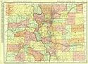
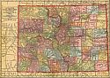
Viewing Options
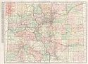
Main Author:
Rand McNally and Company
Title/Description:
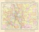
Colorado
Publication Info:
Chicago: Rand McNally and Co., 1911; from the Commercial Atlas of America
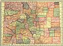
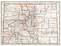
Viewing Options
Main Author:
C.S. Hammond and Company
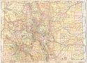
Title/Description:
Colorado
Publication Info:
New York: C.S. Hammond and Company, 1911; from Hammond's Modern Atlas of the World
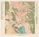
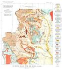
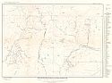
Viewing Options
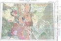
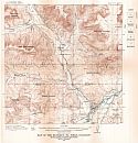
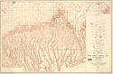
Main Author:
U.S. Geological Survey
Title/Description:
Geologic Map of the Breckenridge District, Colorado
Publication Info:
Washington: U.S. Deparment of the Interior, Geological Survey
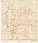
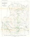
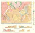
Viewing Options
Main Author:
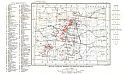
U.S. Geological Survey
Title/Description:
Map Showing Topography and Mining in the Breckenridge District, Colorado
Publication Info:
Washington: U.S. Deparment of the Interior, Geological Survey
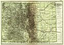
Viewing Options
Main Author:
Geographical Publishing Company
Title/Description:
Colorado
Publication Info:
Chicago: The Geographical Publishing Company, 1911
Viewing Options
Main Author:
Cram, George F.
Title/Description:
Colorado
Publication Info:
Chicago: George F. Cram, 1911; from Cram's Unrivaled Atlas of the World
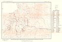
Viewing Options
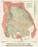
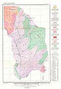
Main Author:
Colorado State Geological Survey
Title/Description:
Map Showing Topography and Mining Claims of the Alma, Colorado
Publication Info:
Colorado State Geological Survey, Bulletin 3, Plate 1, 1912
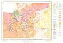
Viewing Options
Main Author:
Colorado State Geological Survey
Title/Description:
Map Showing Geology of the Alma District, Colorado
Publication Info:
Colorado State Geological Survey, Bullentin 3, Plate 2, 1912
Viewing Options
Main Author:
Colorado State Geological Survey
Title/Description:
Geological Map Reconnaissance Survey Along the Rabbit Ears Range, Routt, Grand and Jackson Counties, Colorado
Publication Info:
Colorado State Geological Survey, Bullentin , Plate 1, 1912
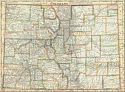
Viewing Options
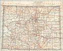
Main Author:
Rand McNally & Company
Title/Description:
Rand McNally's New Map of Colorado
Publication Info:
Chicago: Rand McNally & Co., 1912; from Rand McNally's Atlas of the World
Viewing Options
Main Author:
Rand McNally and Company
Title/Description:
Colorado
Publication Info:
Chicago: Rand McNally and Company, 1912; from The Rand McNally Imperial Atlas of the World
Viewing Options
Main Author:
U.S. Geological Survey
Title/Description:
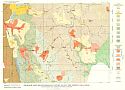
Map of Colorado, Showing Location of Mining Districts
Publication Info:
Washington: Department of the Interior, U.S. Geological Survey, 1912; Bulletin 507 Plate VI
Viewing Options
Main Author:
Colorado State Geological Survey
Title/Description:
Geologic Map of Colorado
Publication Info:
Colorado State Geological Survey, 1913
Viewing Options
Main Author:
Colorado State Geological Survey
Title/Description:
Monarch-Tomichi Special Geologic Map
Publication Info:
Colorado State Geological Survey, Bullentin 4, Plate 5, 1913
Viewing Options
Main Author:
Colorado State Geological Survey
Title/Description:
Topographic Map of the Monarchland Tomichi Mining District, Colorado
Publication Info:
Colorado State Geological Survey, Bullentin 4, Plate 1, 1913
Viewing Options
Main Author:
Colorado State Geological Survey
Title/Description:
Geologic Map of the Monarchland Tomichi Mining District, Colorado
Publication Info:
Colorado State Geological Survey, Bullentin 4, Plate 2, 1913
Viewing Options
Main Author:
Colorado State Geological Survey
Title/Description:
Monarch-Tomichi Special Topographic Map
Publication Info:
Colorado State Geological Survey, Bullentin 4, Plate 4, 1913
Viewing Options
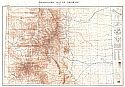
Main Author:
Colorado State Geological Survey
Title/Description:
Topographic Map of Colorado
Publication Info:
Boulder: Colorado State Geological Survey, 1913
Viewing Options
Main Author:
The Century Company
Title/Description:
Colorado
Publication Info:
New York: The Century Company, 1913; from The Century Atlas of the World
Viewing Options
Main Author:
Cram, George F.
Title/Description:
Colorado
Publication Info:
Chicago: George F. Cram, 1913; from Cram's Unrivaled Atlas of the World
Viewing Options
Main Author:
U.S. Geological Survey
Title/Description:
Map of the De Beque Oil Field, Colorado showing Geologic Formations and Structure
Publication Info:
Washington: Department of the Interior, U.S. Geological Survey, 1913; Bulletin 531 Plate VI
Viewing Options
Main Author:
Rand McNally & Co.
Title/Description:
Rand McNally & Co.'s Colorado
Publication Info:
Chicago: Rand McNally & Co., 1914
Viewing Options
Main Author:
Reynolds, Francis J.
Title/Description:
Colorado
Publication Info:
New York: P.F. Collier and Son, 1914; from The New Encyclopededic Atlas and Gazatteer of the World
Viewing Options
Main Author:
U.S. Geological Survey
Title/Description:
Geologic Map and Sections of North Park, Colorado
Publication Info:
Washington: Department of the Interior, 1914; Bulletin 596 Plate XII
Viewing Options
Main Author:
U.S. Department of the Interior, U.S. Geological Survey
Title/Description:
Topographic Map of Mesa Verde National Park, Montezuma County, Colorado
Publication Info:
Washington: U.S. Department of the Interior, U.S. Geological Survey, 1915, reprinted 1928
Viewing Options
Main Author:
Colorado State Geological Survey
Title/Description:
Map Showing the Topography of the Bonanza District, Saguache County, Colorado
Publication Info:
Colorado State Geological Survey Bulletin 9, 1915
Viewing Options
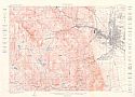
Main Author:
U.S. Geological Survey
Title/Description:
Manitou Quadrangle, Colorado
Publication Info:
U.S. Department of the Interior, U.S. Geological Survey, 1909, reprint 1915

