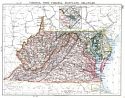
Viewing Options
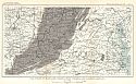
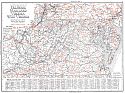
Main Author:
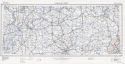
Johnston, William and Alexander Keith
Title/Description:
Virginia, West Virginia, Maryland, Delaware
Publication Info:
Edinburgh: W. and A.K. Johnston, 1901
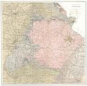
Viewing Options
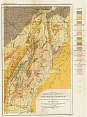
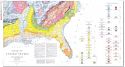
Main Author:
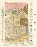
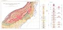
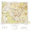
U.S. Geological Survey
Title/Description:
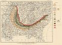
Generalized geological map of the Ozark Region
Publication Info:
Washington: Department of the Interior, US Geological Survey; 22nd Annual Report Part 2 Plate 10
Viewing Options
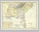
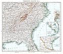
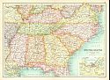
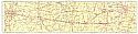
Title/Description:
Middle Atlantic States, Southern Division
Publication Info:
New York: University Publishing Company, 1901; from Maury's Manual of Geography
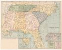
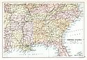
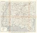
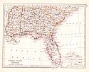
Viewing Options
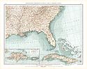
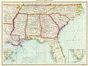
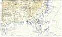
Title/Description:
Southern States, Eastern Division
Publication Info:
New York: University Publishing Company, 1901; from Maury's Manual of Geography
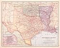
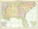
Viewing Options
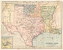
Title/Description:
Southern States, Western Division
Publication Info:
New York: University Publishing Company, 1901; from Maury's Manual of Geography
Viewing Options
Title/Description:
Südöstliche Vereinigte Staaten, Cuba und Bahama Inseln
Publication Info:
Leipzig: Velhagen and Klasing, 1901; from Andrees Allgemeiner Handatlas
Viewing Options
Main Author:
Frye, Alexis Everett
Title/Description:
Southern States, Eastern Section
Publication Info:
Boston: Ginn and Company, 1902; from Frye's Elements of Geography
Original Source:
Geological Survey of Alabama
Viewing Options
Main Author:
Frye, Alexis Everett
Title/Description:
Southern States, Western Section
Publication Info:
Boston: Ginn and Company, 1902; from Frye's Elements of Geography
Original Source:
Geological Survey of Alabama
Viewing Options
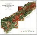
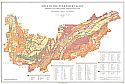
Main Author:
U.S. Geological Survey
Title/Description:
Land Classification Map of Part of the Southern Appalachian Region
Publication Info:
Washington: U.S. Deparment of the Interior, Geological Survey, 1904
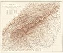
Viewing Options
Main Author:
U.S. Geological Survey
Title/Description:
Relief Map of the Southern Appalachian Region
Publication Info:
Washington: U.S. Deparment of the Interior, Geological Survey, 1904
Viewing Options
Main Author:
Habenicht, H.
Title/Description:
Vereinigte Staaten
Publication Info:
Gotha: Justus Perthes, 1905; from Stielers Hand-Atlas
Viewing Options
Main Author:
Bartholomew, J.G.
Title/Description:
United States. Section 2
Publication Info:
New York: Thomas Nelson and Sons, 1908; from The Globe Hand Atlas
Viewing Options
Main Author:
U.S. Geological Survey
Title/Description:
Geological Map of Portions of Louisiana, Texas and Arkansas including the Caddo Oil Field
Publication Info:
Washington: Department of the Interior, U.S. Geological Survey, 1909; Bulletin 429 Plate XII
Viewing Options
Main Author:
The International Text Book Company
Title/Description:
Railway Mail Service
Publication Info:
Scranton, PA: International Correspondence Schools, 1910
Viewing Options
Main Author:
U.S. Geological Survey
Title/Description:
Coal Field of Tennessee, Georgia, and Alabama
Publication Info:
Washington: Department of the Interior, U.S. Geological Survey, 1910; from Mineral Resources of the United States, 1910 Part II Plate I
Viewing Options
Main Author:
U.S. Geological Survey
Title/Description:
Coal Fields of Arkansas and Oklahoma
Publication Info:
Washington: Department of the Interior, U.S. Geological Survey, 1910; from Mineral Resources of the United States, 1910 Part II Plate II
Viewing Options
Main Author:
U.S. Geological Survey
Title/Description:
Coal Fields of Maryland, Virginia, West Virginia and Eastern Ketucky
Publication Info:
Washington: Department of the Interior, U.S. Geological Survey, 1910; from Mineral Resources of the United States, 1910 Part II Plate XIV
Viewing Options
Main Author:
Bartholomew, J.G.
Title/Description:
United States, Southern Division
Publication Info:
London: Cassell and Company, 1910; from Cassell's Atlas
Viewing Options
Main Author:
U.S. Geological Survey
Title/Description:
Map of Maryland, Delaware, Virginia, West Virginia, North Carolina, and South Carolina showing location of limekilns and quarries of limestone, sandstone, marble, slate, and granite
Publication Info:
Washington: Department of the Interior, U.S. Geological Survey, 1911; from Mineral Resources of the United States, 1911 Part II Plate VII
Viewing Options
Main Author:
U.S. Geological Survey
Title/Description:
Map of Tennessee, Mississippi, Alabama, Georgia, and Northern Florida showing location of limekilns and quarries of limestone, sandstone, marble, slate, and granite
Publication Info:
Washington: Department of the Interior, U.S. Geological Survey, 1911; from Mineral Resources of the United States, 1911 Part II Plate VIII
Viewing Options
Main Author:
American Cities Company
Title/Description:
(Street Railway Lines for Selected Cities of the Southeast U.S.)
Publication Info:
New York: L.L. Poates Engr. Co., [1912]
Viewing Options
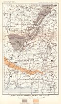
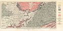
Main Author:
U.S. Geological Survey
Title/Description:
Map of Earthquake Features of the New Madrid District
Publication Info:
Washington: Department of the Interior, U.S. Geological Survey, 1912; Bulletin 494 Plate I
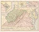
Viewing Options
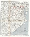
Main Author:
U.S. Geological Survey
Title/Description:
Map of Virginia, West Virginia, Maryland and part of Pennsylvania showing distribution of Limestone
Publication Info:
Washington: Department of the Interior, U.S. Geological Survey, 1912; Bulletin 522 Plate XIX
Viewing Options
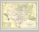
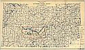
Main Author:
Redway, Jaques W. and Russell Hinman
Title/Description:
Southern States, Western Division
Publication Info:
New York: American Book Company, 1913; from Natural School Geography
Viewing Options
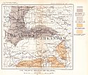
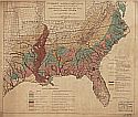
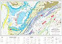
Main Author:
U.S. Geological Survey
Title/Description:
Map Showing Areal Distribution of the Cretaceous Deposits of the Eastern Gulf Coast
Publication Info:
Washington: U.S. Deparment of the Interior, Geological Survey, 1919
Viewing Options
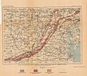
Main Author:
U.S. Geological Survey
Title/Description:
Geologic Map of parts of Kentucky, Tennessee and Virginia
Publication Info:
Washington: Department of the Interior, U.S. Geological Survey, 1919; Bulletin 688 Plate I
Viewing Options
Main Author:
Johnston, W. and A.K.
Title/Description:
United States (South-East)
Publication Info:
Edinburgh: W. and A.K. Johnston, 1921; from The World-Wide Atlas of Modern Geography, 10th edition
Viewing Options
Main Author:
Johnston, W. and A.K.
Title/Description:
United States (South-East)
Publication Info:
Edinburgh: W. and A.K. Johnston, 1921; from The World-Wide Atlas of Modern Geography, 10th edition
Viewing Options
Main Author:
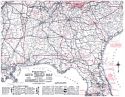
Rand McNally & Company
Title/Description:
Rand McNally Official 1922 Auto Trails Map, District 21
Publication Info:
Chicago: Rand McNally & Co., 1922
Viewing Options
Main Author:
U.S. Geological Survey
Title/Description:
Map of Southeastern States Showing Distribution of Tertiary and Cretaceous Formations, Which Carry High-Grade Clays
Publication Info:
Washington: Department of the Interior, U.S. Geological Survey, 1922; Bulletin 708 Plate V
Viewing Options
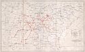
Main Author:
Southeastern Power and Light Company
Title/Description:
Map of the System of Southeastern Power and Light Company
Viewing Options
Main Author:
Demmon, E.L.
Title/Description:
Forest Associations Occurring within the Commercial Range of Southern Pines
Publication Info:
Southern Forest Experiment Station, 1927
Viewing Options
Main Author:
Clason Map Company
Title/Description:
Clason's Road Map of Delaware, Maryland, Virginia, and West Virginia
Publication Info:
Denver: The Clason Map Company, 1930; from Clason's Touring Atlas of the United States and Canada
Viewing Options
Main Author:
U.S. Department of the Interior, U.S. Geological Survey
Title/Description:
Geologic Map of the United States (Southeastern Part)
Publication Info:
Washington: U.S. Department of the Interior, Geological Survey, 1932
Viewing Options
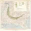
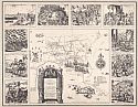
Main Author:
Ray, Kermit Roosevelt
Title/Description:
The Route of the Expedition of Hernando de Soto Through the Southern States 1539-1543
Viewing Options
Main Author:
Tennessee Valley Authority
Title/Description:
Map of the Tennessee Valley Region
Publication Info:
Tennessee Valley Authority, Engineering Service Division, 1934
Viewing Options
Main Author:
Standard Oil of Louisiana
Title/Description:
Arkansas, Louisiana and Mississippi
Publication Info:
New York: General Drafting Company, 1937
Viewing Options
Main Author:
Corps of Engineers, U.S. Army
Title/Description:
Beaumont
Publication Info:
Washington: Corps of Engineers, U.S. Army, 1940
Viewing Options
Main Author:
Corps of Engineers, U.S. Army
Title/Description:
Corpus Christi
Publication Info:
Washington: Corps of Engineers, U.S. Army, 1940
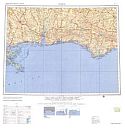
Viewing Options
Main Author:
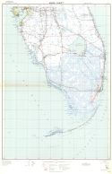
Corps of Engineers, U.S. Army
Title/Description:
Jacksonville
Publication Info:
Washington: Corps of Engineers, U.S. Army, 1940
Viewing Options
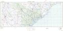
Main Author:
Corps of Engineers, U.S. Army
Publication Info:
Washington: Corps of Engineers, U.S. Army, 1940
Viewing Options
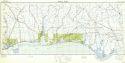
Main Author:
Corps of Engineers, U.S. Army
Title/Description:
Mobile
Publication Info:
Washington: Corps of Engineers, U.S. Army, 1940
Viewing Options
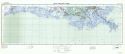
Main Author:
Corps of Engineers, U.S. Army
Title/Description:
New Orleans
Publication Info:
Washington: Corps of Engineers, U.S. Army, 1940
Viewing Options
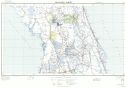
Main Author:
Corps of Engineers, U.S. Army
Title/Description:
Orlando
Publication Info:
Washington: Corps of Engineers, U.S. Army, 1940
Viewing Options
Main Author:
Corps of Engineers, U.S. Army
Title/Description:
Savannah
Publication Info:
Washington: Corps of Engineers, U.S. Army, 1940
Viewing Options
Main Author:
Corps of Engineers, U.S. Army
Title/Description:
Shreveport
Publication Info:
Washington: Corps of Engineers, U.S. Army, 1940
Viewing Options
Main Author:
Corps of Engineers, U.S. Army
Title/Description:
Winston-Salem
Publication Info:
Washington: Corps of Engineers, U.S. Army, 1940
Viewing Options
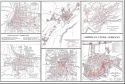
Main Author:
Corps of Engineers, U.S. Army
Title/Description:
Birmingham
Publication Info:
Washington: Corps of Engineers, U.S. Army, 1940
Viewing Options
Main Author:
Corps of Engineers, U.S. Army
Title/Description:
Norfolk
Publication Info:
Washington: Corps of Engineers, U.S. Army, 1941
Viewing Options
Main Author:
Corps of Engineers, U.S. Army
Title/Description:
Nashville
Publication Info:
Washington: Corps of Engineers, U.S. Army, 1943
Viewing Options
Main Author:
U.S. Geological Survey
Title/Description:
Geologic map of the Southern Appalachian Region
Publication Info:
Washington: Department of the Interior, US Geological Survey, 1948; Professional Paper 213, Plate 1
Viewing Options
Main Author:
U.S. Coast and Geodetic Survey
Title/Description:
Flight Chart: Atlanta to Dallas-Fort Worth, U.S.A.
Publication Info:
Washington: U.S. Coast and Geodetic Survey, 1950
Viewing Options
Main Author:
U.S. Coast and Geodetic Survey
Title/Description:
Jet Navigation Chart: United States Southeast (JN-45)
Publication Info:
Washington: U.S. Coast and Geodetic Survey, 1958; 5th Edition
Viewing Options
Main Author:
U.S. Coast and Geodetic Survey
Title/Description:
Flight Chart: Louisville to Dallas-Fort Worth, U.S.A: FC 217
Publication Info:
Washington: U.S. Coast and Geodetic Survey, 1952
Viewing Options
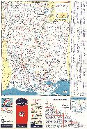
Main Author:
Standard Oil Company
Title/Description:
Arkansas, Louisiana, Mississippi, 1956-57
Publication Info:
Convent Station, N.J.: General Drafting Company, c. 1957
Original Source:
Murray Hudson
Viewing Options
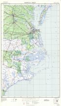
Main Author:
Army Map Service, Corps of Engineers
Title/Description:
Mobile
Publication Info:
Washington: U.S. Army Corps of Engineering, 1958
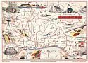
Viewing Options
Main Author:
Scott, Richard Joseph
Title/Description:
Official Map of the Greater Gulf State
Publication Info:
Mobile: Mobile Chamber of Commerce, c1960
Viewing Options
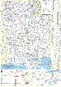
Main Author:
Tennessee Valley Authority
Title/Description:
Soils in the Tennessee Valley
Publication Info:
Chattanooga: Tennessee Valley Authority, 1968
Viewing Options
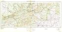
Main Author:
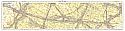
U.S. Geological Survey
Title/Description:
Lookout Mountain
Publication Info:
Washington: U.S. Geological Survey, Department of the Interior, 1968
Viewing Options
Main Author:
Tennessee Valley Authority
Title/Description:
Mineral Resources of the Tennessee Valley Region
Publication Info:
Tennessee Valley Authority, Division of Water Control Planning, 1970

